- Recent Additions
- September 1, 2001
September 1, 2001 - 1,040 New Maps Added
 |
Highlights from 1,040 New Maps added to the David Rumsey Collection. All titles may be found by searching under Search/by Publication Author using the author last names below. Or click here to view all 1,040 new maps. |
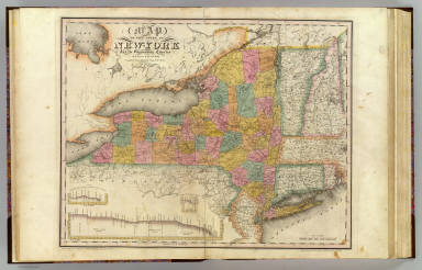
Atlas of the State of New York, 1829
David Burr
51 maps, first edition. One of the earliest State atlases in the U.S.; includes maps of all the counties and a large map of New York City.
Atlas fisico y politico de la Republica de Venezuela, 1840
Agustin Codazzi
19 maps, first edition. The first atlas of Venezuela, and the earliest atlas of a South American country listed in Phillips.
Atlas de la Republica Mexicana, 1858
Antonio Garcia Cubas
32 maps, first edition. The first comprehensive atlas of Mexico, including maps of all the provinces and two plates relating to Aztec culture.
The Illustrated Directory of San Francisco, 1895
Illustrated Directory Company
179 views, first edition. An unusual "pictorial" city directory consisting of elevation views of all the downtown San Francisco building street fronts and their business occupants, block by block. One of the few visual records remaining of the built city before the 1906 earthquake and fire.
Atlas du voyage de La Perouse, 1797
La Perouse
69 maps and views, first French edition. Atlas from the report of La Perouse's expedition to the Pacific Ocean in 1785-88.
Atlas Moderne, 1791
Jean Lattre
85 maps, later edition. Maps of the world by Bonne, Janvier, & Rizzi Zannoni; includes important maps of the United States, Canada, and Mexico.
Description geographique et statistique de la Confederation Argentine, 1873
Victor Martin de Moussy
29 maps, first edition. The first atlas of Argentina.
Atlas geografico del Peru, 1865
Paz Soldan
72 maps and views, first edition. The first atlas of Peru, including maps, plans, thematic maps, views, and statistical information.
Atlas geografico de la Republica Argentina, 1888
Paz Soldan
29 maps, second edition. Maps of all the provinces, plus maps of the railroad and telegraph lines.
Mapa de la Republica de Chile, 1875
Aime Pissis
14 maps, first edition. The maps are sectional maps that can be joined together to create a map of Chile thirteen feet long.
Indexed Atlas of the World, 1897
Rand McNally
154 maps, later edition. Large format atlas, one of Rand McNally's best 19th century world atlases, with excellent maps of U.S. cities.
Historia de Colombia, 1827
Jose Manuel Restrepo
13 maps, first edition. One of the first atlases of Colombia.
Maps of the Society for the Diffusion of Useful Knowledge, 1844
Society for the Diffusion of Useful Knowledge
215 maps, second edition. A world atlas, including excellent maps of world cities and celestial charts.