COLLECTION NAME:
David Rumsey Historical Map Collection
Record
Author:
Union Pacific Railroad Company
Date:
1890
Short Title:
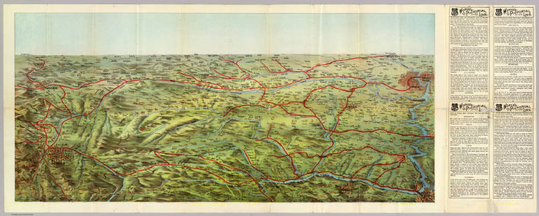
(Birdseye view Great Plains)
Publisher:
Knight, Leonard & Co.
Publisher Location:
Chicago
Type:
Timetable Map
Type:
View
Obj Height cm:
41
Obj Width cm:
90
Scale 1:
None shown
Note:
On the verso is a large full color pictorial perspective map showing the route of the Union Pacific in bright red. Covers area from Omaha and Kansas City west to Cheyenne and Denver. 4 panels of text at right entitled "World's pictorial line."
State/Province:
Kansas
State/Province:
Nebraska
State/Province:
U.S. Mid West
State/Province:
U.S. West
Full Title:
(Birdseye view of the Great Plains). Knight, Leonard & Co., Engravers and Printers, Chicago. (1890)
List No:
4117.001
Series No:
3
Engraver or Printer:
Knight, Leonard & Company
Publication Author:
Union Pacific Railroad Company
Pub Date:
1890
Pub Title:
World's pictorial line. Birdseye view of the Great Plains reached via the Union Pacific. The Overland Route ... Knight, Leonard & Co., Printers, Chicago. (untitled map on verso, birdseye view of the Great Plains). Knight, Leonard & Co., Engravers and Printers, Chicago. (1890)
Pub Note:
The text is titled "Sights and scenes in Nebraska and Kansas." Folded into self wrappers 23 x 10.
Pub List No:
4117.000
Pub Type:
Timetable Map
Pub Maps:
1
Pub Height cm:
41
Pub Width cm:
90
Image No:
4117001
Authors:
Union Pacific Railroad Company
Collection:
Rumsey Collection
