Who What Where WhenWHATShow More |
Author
Maclure, William
Full Title
(Title Page to) Observations on the Geology of the United States, explanatory of a Geological Map. By William Maclure. Read January 20th, 1809. (In) Transactions of the American Philosophical Society, Held at Philadelphia, for promoting Useful Knowledge. Volume VI. Published by C. and A. Conrad and Co. Philadelphia. ... Jane Aitken, Printer. 1809.
List No
2749A
Note
1st edition of the first geological map of U.S. A portion of a map of the U.S. by Samuel Lewis is used to make this map. The full sheet of paper was put on a larger plate and pulled, leaving the upper and right side without borders, as issued. Uncut and untrimmed, the map appears here with Maclure's original essay on the geology of the U.S. In 1817 Maclure published an expanded versus of his essay, using the small Melish Map of the U.S. as a base. Maclure was dissatisfied with the Lewis map because of its rendering of the mountains, and an errata slip is attached to the back of p 423 explaining this (and stating that originally it was intended to use a reduction of the Bradley U.S. map). See Marcou 1858 for more discussion of the Lewis map. Maclure did a Paris printing of the article and Map (using a map by Volney as a base) in 1811, in French. The Lewis map is most likely the Map of the U.S. published in the 2nd edition of Carey's American Atlas, 1809 (P-Maps p 876,Walsh). Maclure's map and essay are very rare. There is an inscription on the title page to "Mons. F.A. Michaux-Paris, from his friend..." Map bound into the back of paper covered boards with the title handwritten on the spine. Map in full color by geologic structure.
Author
Maclure, William
Full Title
(Text Page to) Observations on the Geology of the United States, explanatory of a Geological Map. By William Maclure. Read January 20th, 1809. (In) Transactions of the American Philosophical Society, Held at Philadelphia, for promoting Useful Knowledge. Volume VI. Published by C. and A. Conrad and Co. Philadelphia. ... Jane Aitken, Printer. 1809.
List No
2749B
Author
Maclure, William
Full Title
A Map of the United States of America. By Samuel G. Lewis.
List No
2749.001
Author
Humboldt, Alexander von, 1769-1859
Full Title
Tableau physique de la pente Orientale du Plateau de la Nouvelle Espagne (Chemin de Mexico a Veracruz par Puebla et Xalapa.) Dresse d'apres des mesures Barometriques et Trigonometriques, prises en 1804 par Mr. de Humboldt. 12. Dessine par A. de Humboldt, a Veracruz 1804. Termine par Wittich et Friesen 1807. Grave par Bouquet. Les Echelles et l'Ecriture gravees par Aubert.
List No
0328.012
Note
A cross section depicting the elevations from Mexico City to Veracruz. Geologic information is also included.
Author
Humboldt, Alexander von, 1769-1859
Full Title
Tableau physique de la pente Occidental du Plateau de la Nouvelle Espagne (Chemin de Mexico a Acapulco) Dresse d'apres des mesures Barometriques prises en 1803 par Mr. de Humboldt. 13. Dessine par Wittich d'apres une esquise de Mr. Humboldt 1807. Grave par Bouquet. Les Echelles et l'Ecriture gravees par Aubert.
List No
0328.013
Note
A cross section depicting the elevations from Acapulco to Mexico City. Geologic information is also included.
Author
Humboldt, Alexander von, 1769-1859
Full Title
Tableau du Plateau central des Montagnes du Mexique, entre les 19 et 21¼ de Latitude boreale (Chemin de Mexico a Guanaxuato) Dresse d'apres le Nivellement Barometrique de Mr. de Humboldt. 14. Esquise par Alex. Mr. Humboldt a Mexico 1803. Dessine par Raphael Davalos a Mexico 1804 (termine a Berlin 1807). Grave par Bouquet. Les Echelles et l'Ecriture gravees par Aubert.
List No
0328.014
Note
A cross section depicting the elevations from Mexico City to Guanaxuato. Geologic information is also included.
Author
[Cuvier, Georges, Brongniart, Alexandre]
Full Title
(Covers to) Essai sur la geographie mineralogique des environs de Paris, avec une carte, geognostique, et des coupes de terrain : Par G. Cuvier, ... Et Alexandre Brongniart ... Paris. Baudouin, Imprimeur, de l' Institute de l' Imperial de France. 1811.
List No
13382.001
Note
Covers: Black marbled paper covered boards with title "Cuvier Essai sur la geographie" on spine.
Author
[Cuvier, Georges, Brongniart, Alexandre]
Full Title
(Half Title Page to) Essai sur la geographie mineralogique des environs de Paris, avec une carte, geognostique, et des coupes de terrain : Par G. Cuvier, ... Et Alexandre Brongniart ... Paris. Baudouin, Imprimeur, de l' Institute de l' Imperial de France. 1811.
List No
13382.002
Author
[Cuvier, Georges, Brongniart, Alexandre]
Full Title
(Title Page to) Essai sur la geographie mineralogique des environs de Paris, avec une carte, geognostique, et des coupes de terrain : Par G. Cuvier, ... Et Alexandre Brongniart ... Paris. Baudouin, Imprimeur, de l' Institute de l' Imperial de France. 1811.
List No
13382.003
Author
[Cuvier, Georges, Brongniart, Alexandre]
Full Title
(Text Page to) Essai sur la geographie mineralogique des environs de Paris, avec une carte, geognostique, et des coupes de terrain : Par G. Cuvier, ... Et Alexandre Brongniart ... Paris. Baudouin, Imprimeur, de l' Institute de l' Imperial de France. 1811.
List No
13382.004
Author
[Cuvier, Georges, Brongniart, Alexandre]
Full Title
(Coupe generale et ideale des divers terreins ou formations qui composent le sol des environs de Paris). (to accompany) Essai sur la geographie mineralogique des environs de Paris ... Par G. Cuvie. 1811.
List No
13382.005
Note
Folded cross sections, 38x74 on sheet 44x77. Showing the positions of all the grounds in vicinity of Paris.
Author
[Cuvier, Georges, Brongniart, Alexandre]
Full Title
Corps organises fossiles des couches marines des environs de Paris. Lecerf, Sculpt. (to accompany) Essai sur la geographie mineralogique des environs de Paris ... Par G. Cuvie. 1811.
List No
13382.006
Note
Folded plate, 25x19 on sheet 29x23. Showing fossil bodies from the sea layers in vicinity of Paris.
Author
[Cuvier, Georges, Brongniart, Alexandre]
Full Title
Carte geognostique des environs de Paris par MM. Cuvier et Brongniart 1810. Beuvelot fils delt. Cloquet sculp. (to accompany) Essai sur la geographie mineralogique des environs de Paris ... Par G. Cuvier. 1811.
List No
13382.007
Note
Folded color map on sheet 66x76 dissected and mounted on linen. Showing geologic formations. Includes legend showing various terrains and geologic formations.
Author
[Morris, John, Reynolds, James]
Full Title
A Section of The Earth's Crust (Folded)
List No
16161.002
Note
Date estimated.
Author
[Morris, John, Reynolds, James]
Full Title
A Section of The Earth's Crust (Unfolded)
List No
16161.003
Note
Date estimated.
Author
[Morris, John, Reynolds, James]
Full Title
Forms of Stratification.
List No
16161.005
Note
Date estimated.
Author
[Morris, John, Reynolds, James]
Full Title
Section Of The London Basin.
List No
16161.006
Note
Date estimated.
Author
[Morris, John, Reynolds, James]
Full Title
The Carboniferous Group.
List No
16161.007
Note
Date estimated.
Author
[James, Edwin, Long, Stephen H.]
Full Title
Vertical Section on the Parallel of Latitude 41 degrees North intended as a continuation of Maclure's third Section from the sea-shore to the summit of the Alleghenies. (with) Vertical Section on the Parallel of Latitude 35 degrees North intended as a continuation of Maclure's fifth Section. Engrav'd by Young & Delleker.
List No
0343.003
Note
Uncolored cross sections showing geologic features.
Author
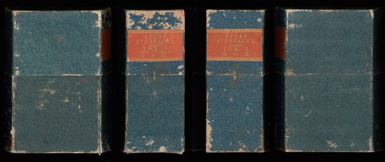
Gussefeld, Franz Ludwig
Full Title
(Covers to) Atlas von Spanien in XXVI Blättern grösstentheils mach Lopez gezeichnet, von F. L. Güssefeld... 1823.
List No
15599.001
Author
Gussefeld, Franz Ludwig
Full Title
Regnorum Hispaniae et Portugalliae tabula generalis ... per D.T. Lopez ... emendavit F.L. Gussefeld ... 1813
List No
15599.002
Author
Gussefeld, Franz Ludwig
Full Title
(Contents) Atlas von Spanien in XXVI Blättern grösstentheils mach Lopez gezeichnet, von F. L. Güssefeld... 1823.
List No
15599.003
Author
Gussefeld, Franz Ludwig
Full Title
2. Regni Portugalliae provincias tres septentrionales ... in novissimis tabulis D.T. Lopez ... 1800
List No
15599.004
Author
Gussefeld, Franz Ludwig
Full Title
3. Provincias meridionales Regni Portualliae ... ad emendatiora exemplaria D.T. Lopez curaverunt Homann Hoered. 1800
List No
15599.005
Author
Gussefeld, Franz Ludwig
Full Title
4. Hispania Benedictina ... à Ruperto Carl Monacho Weichen-stephanensi ..
List No
15599.006
Author
Gussefeld, Franz Ludwig
Full Title
5. Carte nouvelle de l'île de Cadix et du détroit de Gibraltar, levée par Jean de Petit
List No
15599.007
Author
Gussefeld, Franz Ludwig
Full Title
6. Castiliae novae pars occidentalis ... ex Dom. T. Lopez mappis ... 1781
List No
15599.008
Author
Gussefeld, Franz Ludwig
Full Title
7. Castiliae novae pars orientalis ... ex Dom. T. Lopez mappis ... 1781
List No
15599.009
Author
Gussefeld, Franz Ludwig
Full Title
8. Charta geographica provinciam Burgos. . exhibens ex illis D.T. Lopez in banc formam redegit F.L.G. 1801
List No
15599.010
Author
Gussefeld, Franz Ludwig
Full Title
9. Charta geographica provinciam Soriam ... comprehendens, ... ex illis D.T. Lopez ... 1801
List No
15599.011
Author
Gussefeld, Franz Ludwig
Full Title
10. Segoviae et Avilae provinciarum Charta geographica ex illis D. Tom. Lopez ... 1799
List No
15599.012
Author
Gussefeld, Franz Ludwig
Full Title
11. and 12. Legionis, Vallisoleti, Palenciae, Tauri et Zamorae provinciarum Charta geographica ex illis D. Tomas Lopez ... 1802
List No
15599.013
Author
Gussefeld, Franz Ludwig
Full Title
13. Charta provinciam Sala-manticam ... exhibens ... ex illis D. Tom. Lopezii ... 1801 Les nos suivants mq
List No
15599.014
Author
Gussefeld, Franz Ludwig
Full Title
14. Granadae, Cordovae, et Gienensis Regna.. 1782
List No
15599.015
Author
Gussefeld, Franz Ludwig
Full Title
15. Charta geographica Regnum Galaeciam (hispanic Galicia)... 1800
List No
15599.016
Author
Gussefeld, Franz Ludwig
Full Title
16. Sevilla Regnum in suos Archiepiscopatos Episcopatos et Praefecturas divisum...
List No
15599.017
Note
Date estimated.
Author
Gussefeld, Franz Ludwig
Full Title
17. Murcia Regnum... 1798 (with) Insularum Mailorca & Cabbera... 1798
List No
15599.018
Note
Two maps on one sheet.
Author
Gussefeld, Franz Ludwig
Full Title
18. Asturiae Principatus... 1798 (with) Plano De La Ciudad De Oviedo
List No
15599.019
Author
Gussefeld, Franz Ludwig
Full Title
19. Provincia Extremadura... 1791
List No
15599.020
Author
Gussefeld, Franz Ludwig
Full Title
20. Navarra Regnum... 1798
List No
15599.021
Author
Gussefeld, Franz Ludwig
Full Title
21. Provinciarum Guipuscoae, Alavae et Biscaye... 1800
List No
15599.022
Author
Gussefeld, Franz Ludwig
Full Title
22. Charta Regni Aragoniae... 1798
List No
15599.023
Author
Gussefeld, Franz Ludwig
Full Title
23. Regni Valenciae Tabula... 1792
List No
15599.024
Author
Gussefeld, Franz Ludwig
Full Title
24. Principatus Cataloniae... 1798
List No
15599.025
Author
Gussefeld, Franz Ludwig
Full Title
25. Carte Des Isles De Maiorque, Minorque et Yvice Par Mr. Bellin... Plan Du Port et de la Ville de Mahon.
List No
15599.026
Note
Date estimated.
Author
Gussefeld, Franz Ludwig
Full Title
26. Carte Topographique De L'Isle Minorque... 1757
List No
15599.027
Note
With a view of Mahon.
Author
Greenleaf, Moses, 1777-1834
Full Title
(Covers to) Atlas accompanying Greenleaf's map and statistical survey of Maine ... Portland -- Shirley & Hyde Publishers, (1829)
List No
3441A
Note
The third U.S. state atlas, after Mill's North Carolina and Burr's New York State. Contains six maps, one of which is a sheet of Geologic sections, and a sheet of Meteorological Diagrams. The maps are engraved by William Chapin of New York. The atlas accompanied Greenleaf's Survey of the State of Maine and his Map of Maine, all published together in 1829. The first four maps relate to the Northeastern Boundary dispute and are the only maps published in Maine that dealt with the boundary question. The fifth and sixth maps relate to grants, patterns of settlement, population, etc. The final plate gives Meteorological diagrams with information derived from Greenleaf's own observations of climate. In original half leather, marbled paper covered boards with printed title and index label. This copy has notes from Portland Bookseller Francis O'Brien written in 1954 and stating that "This copy is from the noted Maine collection of Janus G. Elder of Lewiston, Maine ... See tribute to him in the preface to Williamson's Bibliography of Maine."
Author
Greenleaf, Moses, 1777-1834
Full Title
Map of the principal rivers, mountains and highland ranges of the State of Maine, by Moses Greenleaf. 1828. Engraved by Wm. Chapin, N. York for Greenleaf's survey of Maine. Published by Shirley & Hyde, Portland, 1829.
List No
3441.001
Note
Engraved map. Boundaries in outline col. Relief shown by hachures.
Author
[Bouchette, Joseph, Greenleaf, Moses, 1777-1834]
Full Title
Sketch from Bouchette's maps of Upper & Lower Canada and the District of Gaspe. Exhibiting the true range of highlands dividing the waters of the St. Lawrence & the Atlantic, and the imaginary ranges claimed by the British for the boundary of the State of Main. (By Moses Greenleaf). W. Chapin Sc. N. York. Portland, published by Shirley & Hyde, 1829.
List No
3441.002
Note
Engraved map. Relief shown by hachures.
Author
Greenleaf, Moses, 1777-1834
Full Title
Sketch of the imaginary ranges of highlands. Reported by the British surveyors under the Treaty of Ghent, as extending across the State of Maine. (By Moses Greenleaf). W. Chapin Sculpt. N. York. (Portland, published by Shirley & Hyde, 1829)
List No
3441.003
Note
Engraved map. Boundaries hand col. Relief shown by hachures.
|