|
Author
Weigel, Christoph
Full Title
Discus Chronologicus Regum Utriusque Siciliae et Ducum Principumque Italiae Praecipuorum accurate ostendens cocevam eorum seriem ac successionem diversarum familiarum ab origine usque ad praesens tempus. ap. C. Weigelium Norimbergae. cum Priviegio Sacr. Cas. Majest.
List No
10011.000
Note
From Alex Johnson: This exceptionally attractive timewheel chronicles the reigns of the kings and dukes of 11 different jurisdictions in Italy over a period spanning from the 10th Century to the year 1720. Following the precedent set by the Eusabian Tables, the timetable permits one to cross-reference different rulers in the various regions, allowing one to make sense of the complex but interconnected dynastic politics of the Italian Peninsula and islands. The timewheel's volvelle, or turning hand, facilitates the "operation" of the piece, and the overall unusual circular arrangement of price is naturally inspired by a clock face. The peculiarity of the piece lies in the arrangement of the individual columns in the form of concentric circles. These are divided into 8 brightly-coloured segments each respectively corresponding to a century. As timetable was made in the early 1720s, the segment depicting the 18th Century is thus not even a quarter complete, such that blank space is sensibly left for one to add the names of future rulers, in their own hand. This way the timetable could be kept current, even for many years after its issue. While the present example is clean and free of notes, it appears that contemporary owners of the Weigel's timewheels took the availed themselves of opportunity to make additions. An example of a different edition of a Weigel timewheel, dated 1723, which chronicles the reigns of the rulers of the main states of Europe, found in the collections of Princeton University, features manuscript editions of subsequent rulers extending deep into the 18th Century (Rosenberg & Grafton, p. 105). Interestingly, the key to dating the present piece also represents a subtle, yet unambiguous, rhetorical message. The most recent ruler to be featured on the piece is Charles VI (1685-1740), the Austrian Habsburg who ruled as the Holy Roman Emperor and who, as labeled on the timewheel, became the King of Sicily in 1720. It is thus clear that the present piece dates from 1720 of later, but before Weigel's death in 1725. Date estimated. This chart was issued in some copies of Johann David Kohler's undated school atlas, Atlas Scholasticus et Itinerarius, and separately listed in his 1724 Anleitung zu der verbesserten Neuen Geographie.
Author
[Reynolds, James, Emslie, John]
Full Title
Popular geology. Drawn and engraved by John Emslie. London, Published by James Reynolds 174 Strand. Oct. 1st.,1849. (to accompany) Geological Diagrams.
List No
0848.009
Note
Hand colored time table chart showing the geological section of the earth's crust. The map also has notes and diagrams illustrating fossil remains, rocks, and view of section of the London Basin - artesian wells.
Author
[Warner, Higgins & Beers, Lloyd, H.H.]
Full Title
Political map of Illinois. Worthens geological and climate map of Illinois. (to accompany) Atlas of the State of Illinois To Which Is Added An Atlas Of The United States Maps of The Hemispheres &c. &c. &c. Warner, Higgins & Beers Publishers. 143 Clark St. Chicago. 1871.
List No
3749.009
Note
Two hand colored lithographed maps. Political map shows presidential vote in 1870, and Congressional districts by color. The geologic and climate map shows geological timetable and depth of rainfall in different portions of the state in inches and the average of temperature.
Author
[Central Pacific Railroad Company, Union Pacific Railroad Company]
Full Title
(Covers to) The only great through all rail route is the Union and Central Pacific R.R. line via Omaha ... Rand, McNally & Co., Printers Engravers, etc., 108 West Randolph St., Chicago ... Through time table, in effect January 1, 1872.
List No
4107A
Author
[Central Pacific Railroad Company, Union Pacific Railroad Company]
Full Title
(Text Page to) The only great through all rail route is the Union and Central Pacific R.R. line via Omaha ... Rand, McNally & Co., Printers Engravers, etc., 108 West Randolph St., Chicago ... Through time table, in effect January 1, 1872. (with) Map of rail & stage route to Big Tree Groves and Yosemite. (with) New mining map of Utah compiled from U.S. Govt. Surveys ... Nat. Railway Public Co., Philadelphia.
List No
4107.001
Note
10 p. on 1 sheet. Includes tables and text, an ad for Froiseth's new sectional and mineral map of Utah, and 2 maps. Big Tree Groves and Yosemite map at (ca. 1:1,900,000) scale. Utah map at (ca. 1:1,800,000). Relief shown by hachures. Utah map shows mining districts, etc.
Author
[Central Pacific Railroad Company, Union Pacific Railroad Company]
Full Title
(Text Page to) The only great through all rail route is the Union and Central Pacific R.R. line via Omaha ... Rand, McNally & Co., Printers Engravers, etc., 108 West Randolph St., Chicago ... Through time table, in effect January 1, 1872.
List No
4107B
Note
Contains time table and 8 views.
Author
George K. Snow & Bradlee
Full Title
(Text Page to) Pathfinder railway guide supplement. Mon. 21 ... Sun. 27, Aug., +71. Geo. K. Snow & Bradlee, Publishers, 17 Brattle Street, Boston ...
List No
5282A
Note
Timetables, postal information, advertisements. Published weekly.
Author
George K. Snow & Bradlee
Full Title
Railway map of the New England States, engraved expressly for Snow's Pathfinder railway guide. 1871 ...
List No
5282.001
Note
Relief shown by hachures. Includes advertisement "To travelers and strangers visiting Boston. Chandler's visitor's guide in and around Boston, was published June 1st, at 21 Cornhill, and is circulated free..."
Author
George K. Snow & Bradlee
Full Title
(Text Page to) Pathfinder railway guide supplement. Mon. 28 ... Sun. 3, Sept., +71. Geo. K. Snow & Bradlee, Publishers, 17 Brattle Street, Boston ...
List No
5283A
Note
Timetables, postal information, advertisements. Published weekly.
Author
George K. Snow & Bradlee
Full Title
Railway map of the New England States, engraved expressly for Snow's Pathfinder railway guide. 1871 ...
List No
5283.001
Note
Relief shown by hachures. Includes advertisement "To travelers and strangers visiting Boston. Chandler's visitor's guide in and around Boston, was published June 1st, at 21 Cornhill, and is circulated free..."
Author
Texas and Pacific Railway
Full Title
(Covers to:) The Texas and Pacific Railway. The shortest line to the great cotton grain and stock regions of Texas ... Woodward, Tiernan & Hale, Printers, St. Louis.
List No
3254A
Note
Illustrated folded title.
Author
Texas and Pacific Railway
Full Title
The Texas and Pacific Railway. The shortest line to the great cotton grain and stock regions of Texas ... Woodward, Tiernan & Hale, Printers, St. Louis.
List No
3254B
Note
Illustrated folded title, timetables and text. Uncolored. Folded to 20 x 9 cm. Timetables "in effect June 1st, 1878."
Author
Texas and Pacific Railway
Full Title
A geographically correct map of the state of Texas. Published by the Texas & Pacific Railway Company. Compiled from actual surveys and containing all changes in lines of counties up to Sept. 1st, 1876. (1878)
List No
3254.001
Note
Col. map. Relief shown by hachures. Shows the line of the railroad through Texas and its land grants. Colton did a similar map for the Texas & Pacific in 1873 (Modelski 578). This issue seems simpler and more of a land promotion. Covers also part of Indian Territory. Prime meridians: Greenwich and Washington.
Author
International & Great Northern Railroad
Full Title
(Covers to:) Texas, the short line to Texas is via the I & GN. R.R. Lone (Star) route. Austin, Tex. Rand McNally & Co., Printers 77 and 79 Madison Street, Chicago. (1878?)
List No
5050A
Note
Self folding covers are titled as above, printed in black and light blue on white paper. Includes illus.
Author
International & Great Northern Railroad
Full Title
Texas, the short line to Texas is via the I & GN. R.R. Lone (Star) route. Austin, Tex. Rand McNally & Co., Printers 77 and 79 Madison Street, Chicago. (1878?)
List No
5050B
Note
Timetables and promotional text with self folding covers 19 x 11 cm. are titled as above, printed in black and light blue on white paper. Includes illus. Timetables "in effect Jan. 6, 1878".
Author
International & Great Northern Railroad
Full Title
Colonists' and emigrants' route to Texas. Rand, McNally & Co., Engr's, Chicago. (untitled inset map of the eastern half of the United States). (1878?)
List No
5050.001
Note
A birds eye view of Texas showing the lines of the International & Great Northern Railroad. With the stamp of Henry H. Hannan, Swan Creek, Ohio. Includes 5 drawings: Pictures of productions on the International & Great Northern Railroad.
Author
[International & Great Northern Railroad, Rand McNally and Company]
Full Title
Map of the International and Great Northern Railroad. Lone (Star) route and connections. Woodward, Tiernan & Hale, Map Engravers, St. Louis. Rand, McNally & Co, Map Engr's Chicago. (1878)
List No
5051.001
Note
Black and white map covering Arkansas, Louisiana, Mississippi and parts of Texas, Indian Territory, Missouri, and adjoining states. Relief shown by hachures. The sides and verso of the folding map have timetables and promotional text: "Good news from Texas..." With the stamp of Henry H. Hannan, Swan Creek, Ohio.
Author
St. Louis, Iron Mountain, and Southern Railway Company
Full Title
(Covers to:) Texas Short Line. St. Louis, Iron Mountain & Southern Ry. from St. Louis to Arkansas and to Texas ... The company's offices, No. 513 North Fifth Street, St. Louis and at Plum Street Depot ... A.W. Soper, General Superintendent, St. Louis, Mo. Woodward, Tiernan & Hale, Printers, St. Louis.
List No
5233A
Note
Folded cover (white self wrappers printed in green with above title).
Author
St. Louis, Iron Mountain, and Southern Railway Company
Full Title
Texas Short Line. St. Louis, Iron Mountain & Southern Ry. from St. Louis to Arkansas and to Texas ... The company's offices, No. 513 North Fifth Street, St. Louis and at Plum Street Depot ... A.W. Soper, General Superintendent, St. Louis, Mo. Woodward, Tiernan & Hale, Printers, St. Louis.
List No
5233B
Note
Text, timetable, folded cover (white self wrappers 16 x 8 cm. printed in green with above title).
Author
St. Louis, Iron Mountain, and Southern Railway Company
Full Title
A geographically correct county map of states traversed by the St. Louis, Iron Mountain and Southern Railway and its connections. (with) Map of the St. Louis, Iron Mountain and Southern Railway, and connections. Maps of the new and popular St. Louis and Texas Short Line! ...
List No
5233.001
Note
This timetable map has two maps printed on one sheet. The main map is printed in outline color by county, the smaller map in full color by state. Relief shown by hachures. Includes text and distance tables. Inset map scale (ca. 1:9,390,600)
Author
[Central Pacific Railroad Company, Union Pacific Railroad Company]
Full Title
(Covers to) Union and Central Pacific Railroad Line. The Great American Over-land Route. Rand, McNally & Co., Printers, Engravers and Electrotypers, 77 and 79 Madison Street, Chicago.
List No
3256A
Note
A joint Union and Central Pacific Railway timetable and land promotion. Also has promotions for the Black Hills and Leadville Mines, Yosemite, Arizona and Montana, Pullman cars, and Pacific Mail Steamers to Japan, China and India. Plus illustrations of 24 scenes along the route. Map has printed outline color by state. Folded into light blue paper self wrappers 18x10.
Author
[Central Pacific Railroad Company, Union Pacific Railroad Company]
Full Title
(Text Page to) Union and Central Pacific Railroad Line. The Great American Over-land Route. Rand, McNally & Co., Printers, Engravers and Electrotypers, 77 and 79 Madison Street, Chicago.
List No
3256B
Note
Timetables, 24 ills. along the route, promotions for the Black Hills and Leadville Mines, Yosemite, Arizona and Montana, Pullman cars, and Pacific Mail Steamers to Japan, China and India.
Author
[Central Pacific Railroad Company, Union Pacific Railroad Company]
Full Title
New map of the American Overland Route showing its connections, and land grants of 30,000,000 acres. Rand, McNally & Co., Chicago. (1879)
List No
3256.001
Note
Relief shown by hachures. Covers most of the United States. Shows also stage routes and proposed railroads.
Author
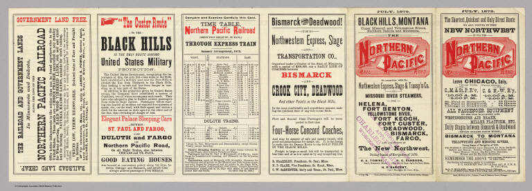
[Northern Pacific Railroad Company, Rand McNally and Company]
Full Title
(Covers to) Black Hills, Montana, Upper Missouri and Yellowstone Rivers, Northern Dakota and Minnesota, the Northern Pacific Rail Road in connection with the Northwestern Express, Stage & Transp'n Co. ... During season of navigation of 1879 ... July, 1879. Rand, McNally & Co., Printers, 77 and 79 Madison Street, Chicago.
List No
5235A
Author
[Northern Pacific Railroad Company, Rand McNally and Company]
Full Title
(Text Page to) Black Hills, Montana, Upper Missouri and Yellowstone Rivers, Northern Dakota and Minnesota, the Northern Pacific Rail Road in connection with the Northwestern Express, Stage & Transp'n Co. ... During season of navigation of 1879 ... July, 1879. Rand, McNally & Co., Printers, 77 and 79 Madison Street, Chicago.
List No
5235B
Note
Six pages on 1 sheet. Includes timetable.
Author
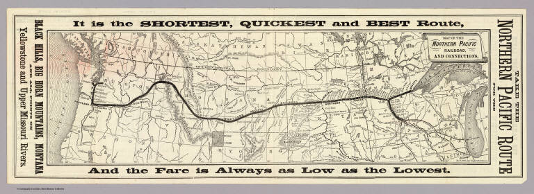
[Northern Pacific Railroad Company, Rand McNally and Company]
Full Title
Map of the Northern Pacific Railroad and connections. Rand, McNally & Co., Engr's., Chicago.
List No
5235.001
Note
Relief shown by hachures. Covers area from Lake Michigan to Oregon and Washington.
Author
St. Louis-San Francisco Railway Company
Full Title
(Covers to) St. Louis and San Francisco Railway befordert Fracht und Passagiere zu den billigsten Preisen! nach allen Punkten in Sud-West Missouri, dem Sudlichen Kansas und Texas ... Woodward, Tiernan & Hale, Printers, St. Louis.
List No
5242A
Author
St. Louis-San Francisco Railway Company
Full Title
(Text Page to) St. Louis and San Francisco Railway befordert Fracht und Passagiere zu den billigsten Preisen! nach allen Punkten in Sud-West Missouri, dem Sudlichen Kansas und Texas ... Woodward, Tiernan & Hale, Printers, St. Louis.
List No
5242B
Note
(6) p. on 1 sheet. Timetable (in English), farmland information, descriptive text, self wrapper.
Author
St. Louis-San Francisco Railway Company
Full Title
Map of Missouri, showing line and land grant of the St. Louis & San Francisco Railway, and its connections. A.L. Thornton, Map Engraver, St. Louis. Der Reichste Agricultur- und Mineralien Staat in der Union! Ausgezeichnetes, gesundes Klima, gut bewaessert und bewaldet!
List No
5242.001
Note
Does not show land grant. In English; text in upper and lower margin in German.
Author
Michigan Central Railroad Company
Full Title
(Covers to) Michigan Central Railroad. Autumn time table. The best route for Chicago, St. Louis and all western cities. Double track, steel rails. Close connections made in Chicago with all western roads ... 9-12-'79. Rand, McNally & Co., Printers, Chicago.
List No
5258A
Author
Michigan Central Railroad Company
Full Title
(Text Page to) Michigan Central Railroad. Autumn time table. The best route for Chicago, St. Louis and all western cities. Double track, steel rails. Close connections made in Chicago with all western roads ... 9-12-'79. Rand, McNally & Co., Printers, Chicago.
List No
5258B
Note
Time tables, illus., dining car menu, illus. self wrappers.
Author
Michigan Central Railroad Company
Full Title
Map of the Michigan Central Railroad principal connections. Rand, McNally & Co. Engravers, Chicago.
List No
5258.001
Note
Relief shown by hachures. Covers United States east from the Dakotas and Nebraska, excepting parts of Texas, Florida, Georgia, the Carolinas and Maine. Includes untitled inset map of the route through the Western States and timetables, text and view of Niagara Falls.
Author
Portland & Ogdensburg Railroad Company
Full Title
(Covers to) Portland & Ogdensburg Railroad. To and through the White Mountains to St. Johnsbury, Montpelier, Burlington, Montreal, Ogdensburg, Syracuse, and the West ... 7-26-79. Rand, Avery & Co., Railroad Printers, Boston.
List No
5264A
Author
Portland & Ogdensburg Railroad Company
Full Title
Map of the Portland & Ogdensburg Railroad and connections. Eng'd by Rand, Avery & Co., Boston. "7-26-79."
List No
5264.001
Note
Relief shown by hachures. Covers area from Portland to Buffalo and Ottawa to Newport, R.I. On sheet 38 x 40. Includes timetable and illus. self wrapper.
Author
Portland & Ogdensburg Railroad Company
Full Title
Topographical map of the White Mountains showing location of the Portland & Ogdensburg Railroad. (1879)
List No
5264.002
Note
Relief shown by hachures and spot heights. Includes drawing of "White Mt. Notch" in title, abbreviations and elevations for peaks in the White and Franconia mountains, chronology of the railroad, drawing of passenger car, and text.
Author
Boston and Maine Railroad
Full Title
(Covers to) Boston & Maine Railroad ... The only route from the east to Boston via Scarboro, Old Orchard, and Wells Beaches ... Geo. H. Ellis, Pr., Boston.
List No
5271A
Author
Boston and Maine Railroad
Full Title
(Text Page to) Boston & Maine Railroad ... The only route from the east to Boston via Scarboro, Old Orchard, and Wells Beaches ... Geo. H. Ellis, Pr., Boston.
List No
5271B
Note
(18) p. on 1 sheet. Includes timetables, advertisements, illus., self wrappper and map: Map of central portion of city of Boston giving locations of all the railroad stations. Scale (ca. 1:20,400). Shows wards, etc.
Author
Boston and Maine Railroad
Full Title
Map of the Boston & Maine Railroad and its connections, 1879.
List No
5271.001
Note
Covers New England and the Maritime Provinces with parts of New York and Quebec. Includes 5 views.
Author
Lake Shore & Michigan Southern Railway
Full Title
(Covers to) Time tables and map, Lake Shore and Michigan Southern Ry. Fast express trains ... reliable through connections with eastern and New England lines, and with all express trains of the New-York Central & Hudson River Railroad, and New-York, Lake Erie & Western R.R. Only route of the Fast Mail to the Western States ... Matthews, Northrup & Co., "Morning Express" Printing House, Buffalo, N.Y.
List No
5254A
Author
Lake Shore & Michigan Southern Railway
Full Title
(Text Page to) Time tables and map, Lake Shore and Michigan Southern Ry. Fast express trains ... reliable through connections with eastern and New England lines, and with all express trains of the New-York Central & Hudson River Railroad, and New-York, Lake Erie & Western R.R. Only route of the Fast Mail to the Western States ... Matthews, Northrup & Co., "Morning Express" Printing House, Buffalo, N.Y.
List No
5254B
Note
Timetables, fare chart and map: New route to Pittsburgh via Lake Shore and Pittsburgh & Lake Erie r(ailwa)ys.
Author
Lake Shore & Michigan Southern Railway
Full Title
Map of the Lake Shore and Michigan Southern Railway and its connections. Compiled from the latest sources and showing the true locations of each road. Wm. Northrup & Co., Map Engravers, Buffalo, N.Y. ...
List No
5254.001
Note
Relief shown by hachures. States in outline color. Includes 3 illus.
Author
Great Western Railway Company (Canada)
Full Title
(Covers to) Great Western Railway. Via Niagara Falls Suspension Bridge or Buffalo to the West! Great central route.-Aug. 15, 1881 ... Commercial Advertiser Print, Buffalo, N.Y.
List No
5272A
Author
Great Western Railway Company (Canada)
Full Title
(Text Page to) Great Western Railway. Via Niagara Falls Suspension Bridge or Buffalo to the West! Great central route.-Aug. 15, 1881 ... Commercial Advertiser Print, Buffalo, N.Y.
List No
5272B
Note
Timetables, passenger information, illus. self wrapper.
Author
Great Western Railway Company (Canada)
Full Title
Map of the Great Western Railway of Canada and its connecting lines. Rand, McNally & Co., Engravers, Chicago. (1881)
List No
5272.001
Note
Relief shown by hachures. Covers most of the U.S. and parts of southern Ontario and Quebec, and northern Mexico.
Author
Ohio and Mississippi Railway
Full Title
(Covers to) Ohio and Mississippi Railway. St. Louis, Louisville, Cincinnati. Direct route between the east and west ... Jan. 1st., 1883. American Bank Note Company, 142 Broadway, New York.
List No
4596A
Author
Ohio and Mississippi Railway
Full Title
(Text Page to) Ohio and Mississippi Railway. St. Louis, Louisville, Cincinnati. Direct route between the east and west ... Jan. 1st., 1883. American Bank Note Company, 142 Broadway, New York.
List No
4596B
Note
(16) p. on 1 sheet. Time tables, passenger information, illus. self wrapper.
Author
Ohio and Mississippi Railway
Full Title
Map of the Ohio and Mississippi Railway and connections. Rand, McNally & Co., Engravers, Chicago ... (1883)
List No
4596.001
Note
Relief shown by hachures. Text in margin.
Author
Southern Pacific Company
Full Title
(Covers to) "Sunset Route" The Southern Pacific Company Atlantic System. West. Poole Bros. Printers and Engravers, Chicago. (1884)
List No
5234A
Note
Folded to pocket map size. Verso has timetables. In full printed color, folding, self wrappers.
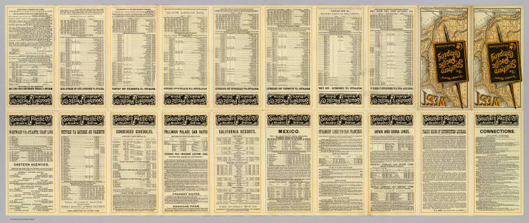
Author
Southern Pacific Company
Full Title
(Text Page to) "Sunset Route" The Southern Pacific Company Atlantic System. West. Poole Bros. Printers and Engravers, Chicago. (1884)
List No
5234B
Note
(20) p. on 1 sheet. Includes text, timetables and fare information.
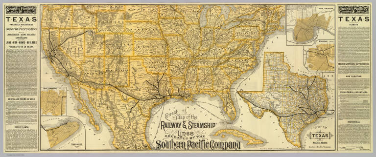
Author
Southern Pacific Company
Full Title
Correct map of the railway & steamship lines operated by the Southern Pacific Company. (with) County map of Texas showing the Atlantic System of the Southern Pacific Company. (with) New Orleans. (with) Houston, Texas. (with) San Antonio, Texas. (with) Galveston, Texas. (1884)
List No
5234.001
Note
Relief shown by hachures. Covers most of the United States and northern and central Mexico, with shipping routes to Havana. Texas map at (ca. 1:4,800,000) scale. City maps are small scale showing street patterns, railroad, stations, etc. Text in side panels.
|


