Who What Where WhenWHAT
WHERE
|
Author
Huber, Joseph Daniel von (c1730-1788)
Full Title
(Composite map to) heets A-Z Stadt Wien in Oesterreich
List No
15065.001
Author
Huber, Joseph Daniel von (c1730-1788)
Full Title
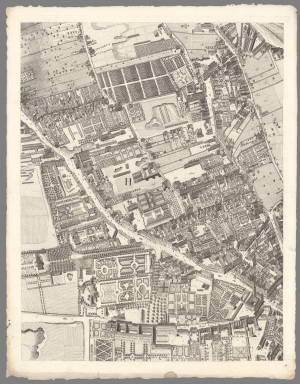
Sheet AStadt Wien in Oesterreich
List No
15065.002
Author
Huber, Joseph Daniel von (c1730-1788)
Full Title
Sheet B Stadt Wien in Oesterreich
List No
15065.003
Author
Huber, Joseph Daniel von (c1730-1788)
Full Title
Sheet C Stadt Wien in Oesterreich
List No
15065.004
Author
Huber, Joseph Daniel von (c1730-1788)
Full Title
Sheet D Stadt Wien in Oesterreich
List No
15065.005
Author
Huber, Joseph Daniel von (c1730-1788)
Full Title
Sheet E Stadt Wien in Oesterreich
List No
15065.006
Author
Huber, Joseph Daniel von (c1730-1788)
Full Title
Sheet F Stadt Wien in Oesterreich
List No
15065.007
Author
Huber, Joseph Daniel von (c1730-1788)
Full Title
Sheet G Stadt Wien in Oesterreich
List No
15065.008
Author
Huber, Joseph Daniel von (c1730-1788)
Full Title
Sheet H Stadt Wien in Oesterreich
List No
15065.009
Author
Huber, Joseph Daniel von (c1730-1788)
Full Title
Sheet I Stadt Wien in Oesterreich
List No
15065.010
Author
Huber, Joseph Daniel von (c1730-1788)
Full Title
Sheet K Stadt Wien in Oesterreich
List No
15065.011
Author
Huber, Joseph Daniel von (c1730-1788)
Full Title
Sheet L Stadt Wien in Oesterreich
List No
15065.012
Author
Huber, Joseph Daniel von (c1730-1788)
Full Title
Sheet M Stadt Wien in Oesterreich
List No
15065.013
Author
Huber, Joseph Daniel von (c1730-1788)
Full Title
Sheet N Stadt Wien in Oesterreich
List No
15065.014
Author
Huber, Joseph Daniel von (c1730-1788)
Full Title
Sheet O Stadt Wien in Oesterreich
List No
15065.015
Author
Huber, Joseph Daniel von (c1730-1788)
Full Title
Sheet P Stadt Wien in Oesterreich
List No
15065.016
Author
Huber, Joseph Daniel von (c1730-1788)
Full Title
Sheet Q Stadt Wien in Oesterreich
List No
15065.017
Author
Huber, Joseph Daniel von (c1730-1788)
Full Title
Sheet R Stadt Wien in Oesterreich
List No
15065.018
Author
Huber, Joseph Daniel von (c1730-1788)
Full Title
Sheet S Stadt Wien in Oesterreich
List No
15065.019
Author
Huber, Joseph Daniel von (c1730-1788)
Full Title
Sheet T Stadt Wien in Oesterreich
List No
15065.020
Author
Huber, Joseph Daniel von (c1730-1788)
Full Title
Sheet V Stadt Wien in Oesterreich
List No
15065.021
Author
Huber, Joseph Daniel von (c1730-1788)
Full Title
Sheet W Stadt Wien in Oesterreich
List No
15065.022
Author
Huber, Joseph Daniel von (c1730-1788)
Full Title
Sheet X Stadt Wien in Oesterreich
List No
15065.023
Author
Huber, Joseph Daniel von (c1730-1788)
Full Title
Sheet Y Stadt Wien in Oesterreich
List No
15065.024
Author
Huber, Joseph Daniel von (c1730-1788)
Full Title
Sheet Z Stadt Wien in Oesterreich
List No
15065.025
Author
Carey, Mathew
Full Title
Plat of The Seven Ranges Of Townships being Part of the Territory of the United States N.W. of the River Ohio Which by a late act of Congress are directed to be sold. Surveyed in conformity to an Ordinance of Congress of May 20th 1785. Under direction of Thos. Hutchins late Geographer to the United States.
List No
16102.033
Note
Fold out map in full color. The sections were to be sold at public auction in Pittsburg. The map shows those tracts already sold at public auction in New York.
Author
Lyon, Lucius, 1800-1851
Full Title
(Case to) (Michigan and Indiana Border Survey 1828-1835. Manuscript survey maps and notes)
List No
5125A
Note
The surveyor's copper canister or tube 8 cm. in diam. It is fitted with a buckle on the side and the remains of leather strap on a hinged lid which fed through the buckle; also 6 copper loops soldered to side of canister. The image also shows the roll of maps and notes contained therein.
Author
Lyon, Lucius, 1800-1851
Full Title
(Covers to) (Michigan and Indiana Border Survey 1828-1835. Manuscript survey maps and notes)
List No
5125B
Note
Sheepskin cover.
Author
Lyon, Lucius, 1800-1851
Full Title
(Index to) (Michigan and Indiana Border Survey 1828-1835. Manuscript survey maps and notes)
List No
5125C
Note
List of 32 township maps with survey dates, and magnetic declination in degrees and minutes east. Seven of the maps are contained in this work. Pen-and-ink.
Author
Lyon, Lucius, 1800-1851
Full Title
(Text Page to) (Michigan and Indiana Border Survey 1828-1835. Manuscript survey maps and notes)
List No
5125D
Note
Notes on interior corners of sections in Township 7 S., R. 10 W. Pen-and-ink.
Author
Lyon, Lucius, 1800-1851
Full Title
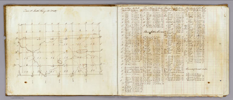
Town 8 South, Range 20 West, Town 8 South, Range 19 West (Berrien County, Michigan, 1829)
List No
5125.001
Note
Colored manuscript map. Pen-and-ink. Shows sections, quarter sections, landowners, roads, hydrography, etc.
Author
Lyon, Lucius, 1800-1851
Full Title
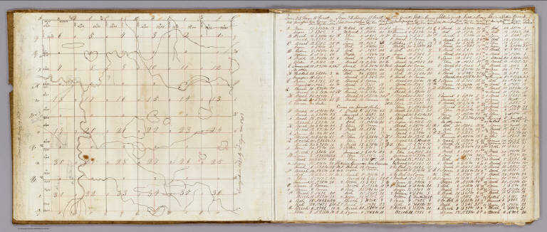
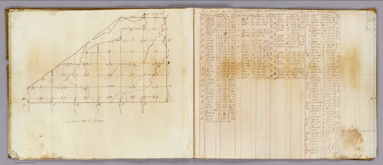
Town 7 South, Rang[e] 19 West. Surveyed in 1829 by L. Lyon, varr. 5035' E.
List No
5125.002
Note
Colored manuscript map. Pen-and-ink and pencil. Shows sections, quarter sections, smaller parcels, landowners, roads, hydrography, etc. Located in Berrien County, Michigan. Facing the map is a table of courses and distances measuring 42 x 37 cm.
Author
Lyon, Lucius, 1800-1851
Full Title
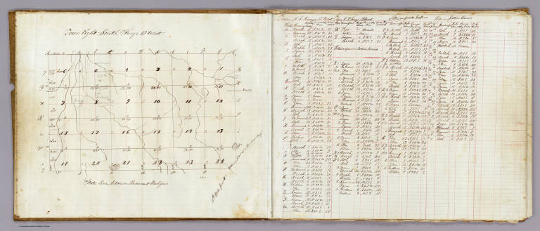
Town 8 South, Range 19 West. (Surveyed in 1829 by L. Lyon)
List No
5125.003
Note
Colored manuscript map. Pen-and-ink and pencil. Shows sections, quarter sections, smaller parcels, landowners, roads, hydrography, etc. Located in Berrien County, Michigan on the "State line between Indiana & Michigan.". Facing the map is a table of courses and distances, 31 x 30 cm.
Author
Lyon, Lucius, 1800-1851
Full Title
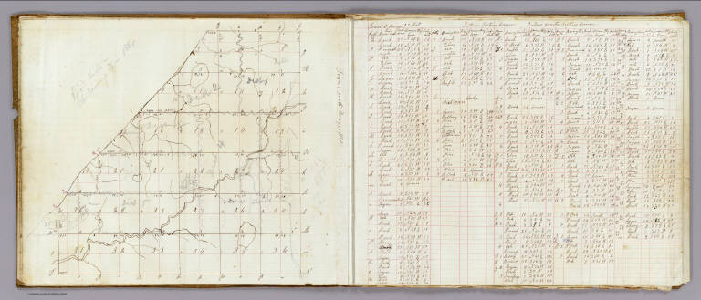
Town 7 South, Range 20 West. (Surveyed in 1829 by L. Lyon). Road dists. in Chikaming Tp. in 1861 (added in pencil)
List No
5125.004
Note
Colored manuscript map. Pen-and-ink and pencil. Shows sections, quarter sections, smaller parcels, landowners, roads, hydrography, etc. Located in Berrien County, Michigan. Facing the map is a table of courses and distances, 32 x 37 cm.
Author
Lyon, Lucius, 1800-1851
Full Title
Town 8 South, Range 20 West. (Surveyed in 1829 by L. Lyon).
List No
5125.005
Note
Colored manuscript map. Pen-and-ink and pencil. Shows sections, quarter sections, landowners, hydrography, etc. Located in Berrien County, Michigan. Facing the map is a table of courses and distances, 31 x 31 cm.
Author
Lyon, Lucius, 1800-1851
Full Title
T. 8 South, Range 21 West. (Surveyed in 1829 by L. Lyon).
List No
5125.006
Note
Colored manuscript map. Pen-and-ink and pencil. Shows sections, quarter sections, hydrography, "South Boundary of Michigan," etc. Located in Berrien County, Michigan. Facing the map is a table of courses and distances, 32 x 39 cm. Title from table.
Author
Lyon, Lucius, 1800-1851
Full Title
T. 7 South, R. 21 West. T. 8 S., Range 22 W. (Surveyed in 1829 by L. Lyon).
List No
5125.007
Note
Two colored manuscript maps on 1 sheet. Pen-and-ink. Show sections, quarter sections, hydrography, etc. Located in Berrien County, Michigan. Includes table of courses and distances.
Author
Stebbins, Henry S.
Full Title
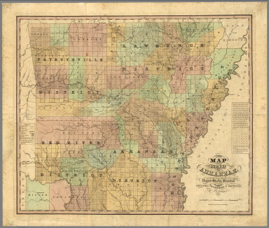
A new map of the state of Arkansas, constructed principally from the United States surveys exhibiting the counties, townships & sections by H.S. Tanner. Published by H.S. tanner, Philadelphia. Entered according to Act of Congress in ... 1839, by H.S. Tanner in ... Eastern District of Pennsylvania.
List No
7634.000
Note
An extremely rare map of Arkansas and the earliest large format map of the state, published less than 3 years after its admission to the Union on June 15, 1836. Tanner's map depicts the new state divided by the Survey of Public Lands into the "Lawrence," "Arkansas," "Fayetteville," and "Red River" Districts and further subdivided into its 30 original counties. The familiar grid of townships and sections imposed by the Survey of Public Lands dominates the mapthis closely matches a Map of Arkansas Surveying District published by the General Land Office later in 1839 and is evidence that Tanner used the most up-to-date sources. Overall, Arkansas settlement was strikingly sparse at this early date, with the total population still under 100,000 and heavily concentrated in the eastern counties. Of particular interest are Miller and Lafayette Counties in the far southwest, at the time the subject of a territorial dispute with the then-independent Republic of Texas. Here they are assigned a somewhat ambiguous status, depicted within Arkansas' borders but not included in the Arkansas Survey District. All of Miller was ceded to Texas when it became a state in 1845, but the county was later reconstituted from the western portion of Lafayette County. Hand colored map. Includes notes and legend. Shows state, county, township, and district boundaries, railroads and roads,Trails, canals, rivers, and topographical features such as prairies and swamps. Relief shown by hachures. Prime meridian is Washington.
Author
U.S. General Land Office
Full Title
A Diagram of a Portion of Oregon Territory. Surveyor General's Office, Oregon City, October 20th., 1851. John B. Preston, Surveyor General. D. McClelland Sc. Washn. D.C. (to accompany ten issues of) A Diagram of Oregon (1851,52,55,58,59,60,61,63,64).
List No
1077.001
Note
Uncolored map. Nine issues from the Annual Reports. Shows townships surveyed and proposed to be surveyed. Relief shown by hachures.
Author
U.S. General Land Office
Full Title
A Diagram of a Portion of Oregon Territory. Surveyor General's Office, Oregon City, October 21st, 1852. Surveyor General, J B Preston. Lith. by A. Hoen & Co. Balto.
List No
1077.009
Note
Nine issues from the Annual Reports. A Diagram of Oregon (1851,52,55,58,59,60,61,63,63,64) (Various Titles). Printed without color. Scale 10 mile to an inch. In upper right corner: Senate Ex. doc. No. 1, 2nd Sess., 32nd Cong. Shows townships subdivided in 1852, and proposed to be surveyed in 1853 and 1854. Relief shown by hachures.
Author
United States Coast Survey
Full Title
U.S. Coast Survey A.D. Bache, Superintendent. City Of San Francisco And Its Vicinity California. Topography by A.F. Rodgers, Sub-assistant. Hydrography by the Party under the command of Lieut. James Alden. Published in 1853. Outline and topography engraved by Max. F. O. Strobel. Lettering by E.F. Woodward.
List No
11890.000
Note
Uncolored map of city of San Francisco extends south to the Mission de Dolores and Pt. San Quentin. Shows streets, city blocks, drainage, public reservoirs, wharfs and many public buildings named and marked, Relief shown by contours and spot heights. Depth shown by bathymetric soundings. Includes explanatory text and notes. At upper right margin: Electrotype copy No. 1 by G. Mathiot. This is a slight variation on other issues of this chart.
Author
U.S. General Land Office
Full Title
Map of the Public Surveys in California ; to Accompany Report of Surveyor Genl., 1854. P.S. Duval & Co's Steam Lith. Press. Phila. Surveyor General's Office, San Francisco, Calif., Sept. 28th, 1854, Approved John C. Hays, U.S. Sur. Genl. Cal.
List No
1073.001
Note
Eleven issues from the Annual Report, (1854,55,56,57,58,59,60,61,62, 63,64). Without color. Scale 16 miles to an inch. Relief shown by hachures. In upper left corner: Sen. Ex. No. 1. 2nd Sess. 33d Cong. Shows townships, and lands surveyed and proposed to be surveyed. Includes Explanation.
Author
U.S. General Land Office
Full Title
Map of the Public Surveys in California ; to Accompany Report of Surveyor Genl., 1855. Lith. by A. Hoen & Co. Balto. Surveyor General's Office, San Francisco, Calif., Sept. 30th, 1855, Approved John C. Hays, U.S. Sur. Genl. Cal.
List No
1073.002
Note
Eleven issues from the Annual Report, (1854,55,56,57,58,59,60,61,62, 63,64). Without color. Scale 18 miles to an inch. Relief shown by hachures. In upper right corner: Sen. Ex. Doc. No. 1. , 34th. Cong. 1st. Sess. Shows townships, and lands surveyed and proposed to be surveyed. Includes Explanation. (From: Report of the Commissioner of the General Land Office).
Author
U.S. General Land Office
Full Title
Sketch of Public Surveys in New Mexico. To Accompany Report of Surveyor General 1855. Surveyor Generals Office, Santa Fe September 30th. 1855. Wm. Pelham, Surveyor General of New Mexico.
List No
1076.001
Note
Five issues (1855,57,60,61,63) from the Annual Reports.Uncolored map. Covers Arizona and New Mexico. In upper right corner: Ex.: Doc. No. 1. 34th. Cong. 1st. Sess. Relief shown by hachures. Shows Indian tribe locations. Includes notes.
Author
U.S. General Land Office
Full Title
Map of Oregon Territory West of Cascade Mountains. Surveyor General's Office, Salem, O.T., Oct. 1st., 1855. C.K. Gardiner, Sur. Genl. ; Lith. by A. Hoen & C. Balto. (to accompany ten issues of) A Diagram of Oregon (1851,52,55,58,59,60,61,63,64).
List No
1077.002
Note
Uncolored map. Nine issues from the Annual Reports. Shows townships surveyed and proposed to be surveyed, roads and pack trails. In upper right corner: Sen. ex. doc. no. 1, 34th. Cong., 1st. Sess. Relief shown by hachures.
Author
U.S. General Land Office
Full Title
Map of a Part of the Territory of Washington : to Accompany Report of Surveyor General. 1855. Surveyor General's Office, Olympia, Washington Territory, September 20th, 1855 James Tilton, Surveyor General. Lith. by A. Hoen & Co. Balto.
List No
1079.001
Note
Eleven issues, from the Annual Reports. (1855,57,57,58,59,60,61,62,63, 65,76). (Titles vary). Without color. Scale 18 miles to an inch. Relief shown by hachures. In upper right corner: Sen. Ex. Doc. No. 1, 34th Cong. 1st Sess. Shows townships, lands surveyed and proposed to be surveyed. Includes Explanation.
Author
U.S. General Land Office
Full Title
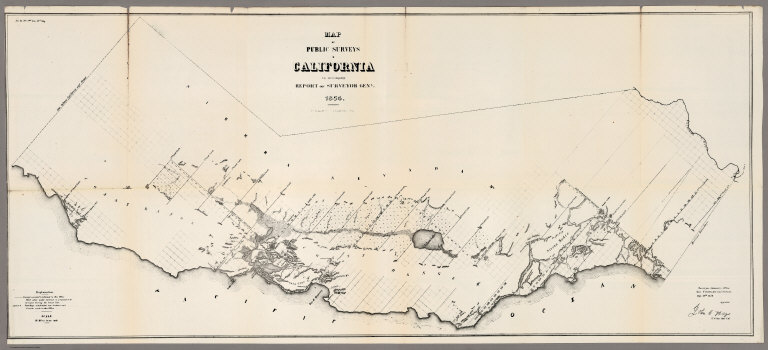
Map of the Public Surveys in California ; to Accompany Report of Surveyor Genl., 1856. Surveyor General's Office, San Francisco, Calif., Sept. 30th, 1856, Approved, U.S. Sur. Genl. Cal.
List No
1073.003
Note
Eleven issues from the Annual Report, (1854,55,56,57,58,59,60,61,62, 63,64). Without color. Scale 18 miles to an inch. Relief shown by hachures. In upper right corner: Senete Exe. Doc. No. 5, 34th Congress, 3rd Session. Shows Description of private Grants, townships, and lands surveyed and proposed to be surveyed. Includes Explanation. (From: Report of the Commissioner of the General Land Office).
Author
U.S. General Land Office
Full Title
Map of the Public Surveys in California ; to Accompany Report of Surveyor Genl., 1857. Wagner & McGuigan Lith. Phila. Surveyor Generals' Office, San Francisco, California, September 30th, 1857, Approved J.W. Mandeville, U.S. Surr. Genl. Cala.
List No
1073.004
Note
Eleven issues from the Annual Report, (1854,55,56,57,58,59,60,61,62, 63,64). Without color. Scale 18 miles to an inch. Relief shown by hachures. In upper right corner: Sen. Ex. Doc. No. 11 & Ho. Ex. Doc. No. 2, 1st Sess., 35th Cong. Shows list of private Grants finally surveyed, townships, and lands surveyed and proposed to be surveyed. Includes Explanation. (From: Report of the Commissioner of the General Land Office).
Author
U.S. General Land Office
Full Title
Sketch of Public Surveys in New Mexico. To Accompany Report of Surveyor General 1857. Surveyor Generals Office, Santa Fe September 30th. 1857. Wm. Pelham, Surveyor General of New Mexico. C.B. Graham, Lith., Washington D.C.
List No
1076.002
Note
Five issues (1855,57,60,61,63) from the Annual Reports.Uncolored map. Relief shown by hachures. In upper right corner: Sen. Ex. Doc. No. 11 & Ho. Ex. no. 2, 1st sess, 35st. Cong.
Author
U.S. General Land Office
Full Title
Map of a Part of Washington Territory Lying East of the Cascade Mountains : to Accompany Report of Surveyor General. 1857. Surveyor General's Office, Olympia, W. T. September 21st., 1857. James Tilton, Surveyor General.C.B. Graham Lith. Washington D.C.
List No
1079.002
Note
Eleven issues, from the Annual Reports. (1855,57,57,58,59,60,61,62,63, 65,76). (Titles vary). Without color. Scale 12 miles to an inch. Relief shown by hachures. In upper right corner: Sen. Ex. Doc. No. 11 & Ho. Ex. Doc. No. 2, 1st. Sess. 35th Cong.
|


