Who What Where WhenWHATShow More |
Author
Faden, William, 1750?-1836
Full Title
(Covers to) Geographical exercises; calculated to facilitate the study of geography, and, by an expeditious method, to imprint a knowledge of the science on the minds of youth. With a concise introduction, explaining the principles of geography. By William Faden. London: Printed for the proprietor (successor to the late Mr. Jefferys, Geographer to the King) at the Corner of St. Martin's Lane, Charing-Cross. MDCCLXXVII.
List No
2835A
Note
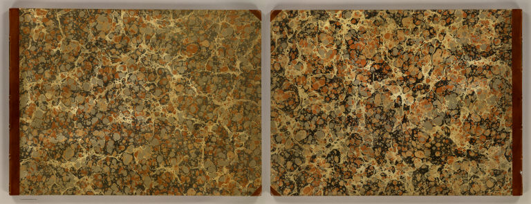
Bound in half leather marbled paper covered boards with "Faden's geography for youth" stamped in gilt on the spine.
Author
Faden, William, 1750?-1836
Full Title
(Title Page to) Geographical exercises; calculated to facilitate the study of geography, and, by an expeditious method, to imprint a knowledge of the science on the minds of youth. With a concise introduction, explaining the principles of geography. By William Faden. London: Printed for the proprietor (successor to the late Mr. Jefferys, Geographer to the King) at the Corner of St. Martin's Lane, Charing-Cross. MDCCLXXVII.
List No
2835B
Note
Includes engraved illustration of globe, telescope, anchor, building and ships. Atlas of 9 completed and 9 outline maps. The maps are beautifully executed and quite large. According to Faden in the preface, this was a project begun by Jefferys before his death in 1771 and now completed by Faden. Faden also says that Henry Peacham used outline maps for teaching in the early part of the 17th century, but that they had not been used since then, at least in England (see our copy of Courcillon de Dangeau's teaching atlas of 1693 which used outline maps). There is an introduction which explains basic geographical principals and map drawing. The maps are dated 1773-76. The World Map on Mercator's Projection includes Cook's tracks. Scarce. Not listed in Phillips, NMM, World, Tooley. Faden published an Atlas Minimus for the use of schools in 1798 (Phillips 690), but the format was much smaller and did not use outline maps -- it was an atlas with 55 maps. W.H. has a later edition with several maps dated 1783. B. McC. has a copy that a copy that is similar to ours, but Jeffrey's name has been removed from all but the America map, probably indicating a slightly later date than this one. All three copies are dated 1777 on the title page. Maps have outline color. Bound in half leather marbled paper covered boards with "Faden's geography for youth" stamped in gilt on the spine.
Author
Faden, William, 1750?-1836
Full Title
(Dedication to) Geographical exercises; calculated to facilitate the study of geography, and, by an expeditious method, to imprint a knowledge of the science on the minds of youth. With a concise introduction, explaining the principles of geography. By William Faden. London: Printed for the proprietor (successor to the late Mr. Jefferys, Geographer to the King) at the Corner of St. Martin's Lane, Charing-Cross. MDCCLXXVII.
List No
2835C
Note
"To his Royal Highness George, Prince of Wales ... Your Royal Highness's obliged, devoted, and obedient humble servant, William Faden."
Author
Faden, William, 1750?-1836
Full Title
(Preface to) Geographical exercises; calculated to facilitate the study of geography, and, by an expeditious method, to imprint a knowledge of the science on the minds of youth. With a concise introduction, explaining the principles of geography. By William Faden. London: Printed for the proprietor (successor to the late Mr. Jefferys, Geographer to the King) at the Corner of St. Martin's Lane, Charing-Cross. MDCCLXXVII.
List No
2835D
Note
"The preface." Two columns of text with illustrated initial letter.
Author
Faden, William, 1750?-1836
Full Title
(Introduction to) Geographical exercises; calculated to facilitate the study of geography, and, by an expeditious method, to imprint a knowledge of the science on the minds of youth. With a concise introduction, explaining the principles of geography. By William Faden. London: Printed for the proprietor (successor to the late Mr. Jefferys, Geographer to the King) at the Corner of St. Martin's Lane, Charing-Cross. MDCCLXXVII.
List No
2835E
Note
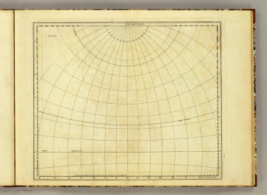
Introduction p. 1. Two columns of text.
Author
Faden, William, 1750?-1836
Full Title
(Introduction to) Geographical exercises; calculated to facilitate the study of geography, and, by an expeditious method, to imprint a knowledge of the science on the minds of youth. With a concise introduction, explaining the principles of geography. By William Faden. London: Printed for the proprietor (successor to the late Mr. Jefferys, Geographer to the King) at the Corner of St. Martin's Lane, Charing-Cross. MDCCLXXVII.
List No
2835F
Note
Introduction p. 2. Two columns of text.
Author
Faden, William, 1750?-1836
Full Title
(Introduction to) Geographical exercises; calculated to facilitate the study of geography, and, by an expeditious method, to imprint a knowledge of the science on the minds of youth. With a concise introduction, explaining the principles of geography. By William Faden. London: Printed for the proprietor (successor to the late Mr. Jefferys, Geographer to the King) at the Corner of St. Martin's Lane, Charing-Cross. MDCCLXXVII.
List No
2835G
Note
Introduction p. 3. Two columns of text.
Author
Faden, William, 1750?-1836
Full Title
(Introduction to) Geographical exercises; calculated to facilitate the study of geography, and, by an expeditious method, to imprint a knowledge of the science on the minds of youth. With a concise introduction, explaining the principles of geography. By William Faden. London: Printed for the proprietor (successor to the late Mr. Jefferys, Geographer to the King) at the Corner of St. Martin's Lane, Charing-Cross. MDCCLXXVII.
List No
2835H
Note
Introduction p. 4. Two columns of text.
Author
Faden, William, 1750?-1836
Full Title
(Introduction to) Geographical exercises; calculated to facilitate the study of geography, and, by an expeditious method, to imprint a knowledge of the science on the minds of youth. With a concise introduction, explaining the principles of geography. By William Faden. London: Printed for the proprietor (successor to the late Mr. Jefferys, Geographer to the King) at the Corner of St. Martin's Lane, Charing-Cross. MDCCLXXVII.
List No
2835I
Note
Introduction p. 5. Two columns of text.
Author
Faden, William, 1750?-1836
Full Title
(Introduction to) Geographical exercises; calculated to facilitate the study of geography, and, by an expeditious method, to imprint a knowledge of the science on the minds of youth. With a concise introduction, explaining the principles of geography. By William Faden. London: Printed for the proprietor (successor to the late Mr. Jefferys, Geographer to the King) at the Corner of St. Martin's Lane, Charing-Cross. MDCCLXXVII.
List No
2835J
Note
Introduction p. 6. Two columns of text.
Author
[Faden, William, 1750?-1836, Jefferys, Thomas]
Full Title
Europe. Engraved by Jefferys and Faden, Geographers to the King. London, publish'd according to Act of Parliament, 29th May, 1775, by Jefferys & Faden, Corner of St. Martin's Lane, Charing Cross.
List No
2835.001
Note
Engraved map. Country boundaries in outline hand coloring. Relief shown pictorially. Illustrated cartouche.
Author
[Faden, William, 1750?-1836, Jefferys, Thomas]
Full Title
Europe. London, published by Jefferys and Faden, Corner of St. Martin's Lane, Charing Cross. (1775?)
List No
2835.002
Note
Engraved map. Blank outline map to be completed students; with title, imprint and grid lines only.
Author
[Faden, William, 1750?-1836, Jefferys, Thomas]
Full Title
Asia. Engraved by Jefferys & Faden, Geographers to the King. London, published as the Act directs, 29th May, 1775, by Jefferys & Faden, St. Martin's Lane, Charing Cross.
List No
2835.003
Note
Engraved map. Country boundaries in outline hand coloring. Relief shown pictorially. Illustrated cartouche.
Author
[Faden, William, 1750?-1836, Jefferys, Thomas]
Full Title
Asia. London, publish'd by Jefferys & Faden, Corner of St. Martin's Lane, Charing Cross. (1775?)
List No
2835.004
Note
Engraved map. Blank outline map to be completed students; with title, imprint and grid lines only.
Author
[Faden, William, 1750?-1836, Jefferys, Thomas]
Full Title
Africa. Engraved by Faden and Jefferys, Geographer to the King. London: publish'd according to Act of Parliament, 29th May, 1775 by Faden & Jefferys, Corner of St. Martin's Lane, Charing Cross.
List No
2835.005
Note
Engraved map. Outline hand coloring. Relief shown pictorially. Illustrated cartouche.
Author
[Faden, William, 1750?-1836, Jefferys, Thomas]
Full Title
Africa. London, publish'd by Jefferys and Faden, Corner of St. Martin's Lane, Charing Cross. (1775?)
List No
2835.006
Note
Engraved map. Blank outline map to be completed students; with title, imprint and grid lines only.
Author
Faden, William, 1750?-1836
Full Title
America. Engraved by Willm. Faden, Charing Cross. London, published according to Act of Parliament, 27 Apr. 1776: by Wm. Faden, the Corner of St. Martin's Lane, Charing Cross.
List No
2835.007
Note
Engraved map. Outline hand color. Relief shown pictorially. Illustrated cartouche.
Author
Faden, William, 1750?-1836
Full Title
America. London, published as the Act directs, 27 Apr. 1776: by Wm. Faden, the Corner of St. Martin's Lane, Charing-Cross.
List No
2835.008
Note
Engraved map. Blank outline map to be completed students; with title, imprint and grid lines only.
Author
[Faden, William, 1750?-1836, Jefferys, Thomas]
Full Title
Eastern Hemisphere. Engraved by Faden and Jefferys, Geographer to the King. London, publish'd according to Act of Parliament, 17 Novr. 1773, by Jefferys & Faden, ye Corner of St. Martin's Lane.
List No
2835.009
Note
Engraved map. Outline hand color. Relief shown pictorially.
Author
[Faden, William, 1750?-1836, Jefferys, Thomas]
Full Title
Eastern Hemisphere. London, published by Jefferys & Faden, Corner of St. Martin's Lane, Charing Cross. (1773?)
List No
2835.010
Note
Engraved map. Blank outline map to be completed students; with title, imprint and grid lines only.
Author
[Faden, William, 1750?-1836, Jefferys, Thomas]
Full Title
Western Hemisphere. Engraved by Faden and Jefferys, Geographer to the King. London, publish'd according to Act of Parliament, 28th February 1775 by Jefferys and Faden, the Corner of St. Martin's Lane.
List No
2835.011
Note
Engraved map. Outline hand color. Relief shown pictorially.
Author
[Faden, William, 1750?-1836, Jefferys, Thomas]
Full Title
Western Hemisphere. London, publish'd by Jefferys & Faden, Corner of St. Martin's Lane, Charing Cross. (1775?)
List No
2835.012
Note
Engraved map. Blank outline map to be completed students; with title, imprint and grid lines only.
Author
[Faden, William, 1750?-1836, Jefferys, Thomas]
Full Title
Northern Hemisphere. Engraved by Faden and Jefferys, Geographer to the King. London: publish'd according to Act of Parliament, 29th May, 1775, by Jefferys & Faden, the Corner of St. Martin's Lane, Charing Cross.
List No
2835.013
Note
Engraved map. Outline hand color. Relief shown pictorially.
Author
[Faden, William, 1750?-1836, Jefferys, Thomas]
Full Title
(Nor)thern Hemisphere. London, publish'd by Jefferys & Faden, Corner of St. Martin's Lane, Charing Cross. (1775?)
List No
2835.014
Note
Engraved map. Blank outline map to be completed students; with title, imprint and grid lines only. Duplicated as blank map for Southern Hemisphere.
Author
[Faden, William, 1750?-1836, Jefferys, Thomas]
Full Title
Southern Hemisphere. Engraved by Faden & Jefferys, Geographer to the King. London, publish'd according to Act of Parliament, 29th May 1775, by Jefferys & Faden, the Corner of St. Martin's Lane, Charing Cross.
List No
2835.015
Note
Engraved map. Outline hand color. Relief shown pictorially. Illustrated cartouche.
Author
[Faden, William, 1750?-1836, Jefferys, Thomas]
Full Title
(Sou)thern Hemisphere. London, publish'd by Jefferys & Faden, Corner of St. Martin's Lane, Charing Cross. (1775?)
List No
2835.016
Note
Engraved map. Blank outline map to be completed students; with title, imprint and grid lines only. Duplicated as blank map for Northern Hemisphere. David Rumsey Collection copy imperfect: part of imprint cropped off.
Author
[Faden, William, 1750?-1836, Jefferys, Thomas]
Full Title
A chart of the World upon Mercator's projection. Describing the tracks of Capt. Cook in the year 1768, 69, 70, 71, and in 1772, 73, 74, 75, with the new discoveries. London, publish'd according to Act of Parliament by Jefferys & Faden, Corner of St. Martin's Lane, Charing Cross. 1775.
List No
2835.017
Note
Engraved map. Boundaries and routes in outline hand color. Relief shown pictorially. David Rumsey Collection copy imperfect: imprint cropped off (information in Full Title field supplied by cataloger)
Author
[Faden, William, 1750?-1836, Jefferys, Thomas]
Full Title
A chart of the World upon Mercator's projection. London, published by Jefferys & Faden, Corner of St. Martin's Lane, Charing Cross. (1775?).
List No
2835.018
Note
Engraved map. Blank outline map to be completed students; with title, imprint, grid lines and compass rose only.
Author
[Blaskowitz, Charles, Faden, William, 1750?-1836]
Full Title
(Covers to) A Topographical Chart of the Bay of Narraganset in the Province of New England, with all the Isles contained therein, among which Rhode Island and Connonicut have been particularly Surveyed, Shewing the true position & bearings of the Banks, Shoals, Rocks &c. as likewise the Soundings: To which have been added the several Works & Batteries raised by the Americans. Taken by Order of the Principal Farmers on Rhode Island, By Charles Blaskowitz. Engraved & Printed for Wm. Faden, Charing Cross, as the Act directs, July 22d 1777. To the Right Honourable Hugh Earl Percy, Baron Percy, Lucy, Poinings, Fitz-Paine, Bryan & Latimer, Lieutenant General of His Majesty's Forces in Great Britain and America. This Plan is ... most humbly Inscribed, by ... Wm. Faden. (in manuscript) Hinck S.
List No
3951A
Author
[Blaskowitz, Charles, Faden, William, 1750?-1836]
Full Title
A Topographical Chart of the Bay of Narraganset in the Province of New England, with all the Isles contained therein, among which Rhode Island and Connonicut have been particularly Surveyed, Shewing the true position & bearings of the Banks, Shoals, Rocks &c. as likewise the Soundings: To which have been added the several Works & Batteries raised by the Americans. Taken by Order of the Principal Farmers on Rhode Island, By Charles Blaskowitz. Engraved & Printed for Wm. Faden, Charing Cross, as the Act directs, July 22d 1777. To the Right Honourable Hugh Earl Percy, Baron Percy, Lucy, Poinings, Fitz-Paine, Bryan & Latimer, Lieutenant General of His Majesty's Forces in Great Britain and America. This Plan is ... most humbly Inscribed, by ... Wm. Faden. (in manuscript) Hinck S.
List No
3951.001
Note
The most important map of the area around Providence and Newport issued during the Revolution. With hand painted color. A separately issued copy dissected into 16 sections and mounted on linen. Folds into a marbled slip case 24x17 with a paper label with "Rhode Island" printed in manuscript.
Author
[Faden, William, 1750?-1836, Gerlach, P.,Deputy Quarter Master General]
Full Title
Plan of the action at Huberton under Brigadier Genl. Frazier, supported by Major Genl. Reidesel, on the 7th. July 1777. Drawn by P. Gerlach, Deputy Quarter Master General. Engraved by Wm. Faden. London, published as the Act directs Feby. 1st 1780, by W. Faden Charing Cross.
List No
4402.000
Note
A plan of a battle at Hubbardton, Vermont, the only important battle fought in Vermont during the Revolution. Nebenzahl: "This is a typical Faden battle plan. It presents clearly in color the positions and movements of the opposing units upon a topographical map, which enables the viewer to see where terrain features affected the action." The plan is normally seen on thin paper, folded, as one of six maps included in John Burgoyne's "A State of the Expedition from Canada..." London, 1780. This copy is on heavy paper, unfolded, and may have been in Faden's Atlas of Battles of the American Revolution, published in London in 1793 and again, with remaindered maps, by Bartlett & Welford in New York, circa 1845 (see P1337, #25). Relief shown by hachures. Hand col. Scale 200 paces to an in.
Author
Faden, William, 1749-1836
Full Title
(Covers to) General chart, Cook.
List No
14383.001
Note
Covers to General chart. Bound in pebbled brown board with abraded leather corners and spine. With gilt spine title.
Author
Faden, William, 1749-1836
Full Title
(Covers to) General chart, Cook. (Verso)
List No
14383.002
Note
Verso to front cover of General chart. Pink end papers. With bookplate: Liverpool Library, Lyceum, Bold Street.
Author
Faden, William, 1749-1836
Full Title
(Contents to) Contents.
List No
14383.003
Note
Table of contents to General chart. Manuscript, in ink. Lists 48 maps, in order of appearance, with associated plate numbers. With stamp: Liverpool Library.
Author
Faden, William, 1749-1836
Full Title
Western New World or Hemisphere. 3d. Edition. Engrav'd by Willm. Faden. London publish'd according to Act of Parliament, 28th October, 1790 by William Faden, Geographer to the King, Charing Cross.
List No
14383.004
Note
Map of the Western Hemisphere, or "New World" as of 1790, in circular format. Third edition. Shows continental boundaries, cities, topography, bodies of water, drainage, coastlines, islands and field ice. Features routes of exploration, with explorer names and dates of voyages, such as, "Cooks track 1774". Relief shown pictorially. Includes latitudinal and longitudinal lines. Hand-colored engraving. Map is 34 x 34 cm, on sheet 55 x 38 cm. With stamp: Liverpool Library. Followed by map, Eastern Old World or Hemisphere.
Author
Faden, William, 1749-1836
Full Title
Eastern Old World or Hemisphere. 3d. Edition. Engrav'd by Willm. Faden. London publish'd according to Act of Parliament, Decr. 1st. 1790 by William Faden, Geographer to the King, Charing Cross.
List No
14383.005
Note
Map of the Eastern Hemisphere, or "Old World" as of 1790, in circular format. Third edition. Shows continental boundaries, cities, topography, bodies of water, drainage, coastlines, islands and field ice. Features routes of exploration, with explorer names and dates of voyages, such as, "Cooks track 1773". Relief shown pictorially. Includes latitudinal and longitudinal lines. Hand-colored engraving. Map is 34 x 34 cm, on sheet 55 x 38 cm. Preceded by map, Western New World or Hemisphere.
Author
Faden, William, 1749-1836
Full Title
(Composite Map to) Western New World or Hemisphere. 3d. Edition. Engrav'd by Willm. Faden. London publish'd according to Act of Parliament, 28th October, 1790 by William Faden, Geographer to the King, Charing Cross. -- Eastern Old World or Hemisphere. 3d. Edition. Engrav'd by Willm. Faden. London publish'd according to Act of Parliament, Decr. 1st. 1790 by William Faden, Geographer to the King, Charing Cross.
List No
14383.006
Note
Composite map of the Western and Eastern Hemispheres, or "New World" and "Old World" as of 1790, in circular format. Third editions. Maps show continental boundaries, cities, topography, bodies of water, drainage, coastlines, islands and field ice. Maps feature routes of exploration, with explorer names and dates of voyages, such as, "Cooks track 1773" and "Cooks track 1774". Relief shown pictorially. Includes latitudinal and longitudinal lines. Hand-colored engraving. Together, maps are 34 x 70 cm, on double sheet 55 x 76 cm. With stamp: Liverpool Library.
Author
Faden, William, 1749-1836
Full Title
Northern Hemisphere. Engrav'd by Willm. Faden. London publish'd according to Act of Parliament, Decr. 1st. 1790 by William Faden, Geographer to the King, Charing Cross.
List No
14383.007
Note
Map of the Northern Hemisphere as of 1790, in circular format. Shows continental boundaries, cities, topography, bodies of water, drainage, coastlines, islands and field ice. Features routes of exploration, with explorer names and dates of voyages, such as, "Cooks track to America in 1778". Relief shown pictorially. Includes latitudinal and longitudinal lines. Hand-colored engraving. Map is 34 x 34 cm, on sheet 55 x 38 cm. With stamp: Liverpool Library. Followed by map, Southern Hemisphere.
Author
Faden, William, 1749-1836
Full Title
Southern Hemisphere. Engrav'd by Willm. Faden. London publish'd according to Act of Parliament, Jany. 1, 1790 by William Faden, Geographer to the King, Charing Cross.
List No
14383.008
Note
Map of the Southern Hemisphere as of 1790, in circular format. Shows continental boundaries, cities, topography, bodies of water, drainage, coastlines, islands and field ice. Features routes of exploration, with explorer names and dates of voyages, such as, "Cooks track 1773". Relief shown pictorially. Includes latitudinal and longitudinal lines. Hand-colored engraving. Map is 34 x 34 cm, on sheet 55 x 38 cm. With stamp: Liverpool Library. Preceded by map, Northern Hemisphere.
Author
Faden, William, 1749-1836
Full Title
(Composite Map to) Northern Hemisphere. Engrav'd by Willm. Faden. London publish'd according to Act of Parliament, Decr. 1st. 1790 by William Faden, Geographer to the King, Charing Cross. -- Southern Hemisphere. Engrav'd by Willm. Faden. London publish'd according to Act of Parliament, Jany. 1, 1790 by William Faden, Geographer to the King, Charing Cross.
List No
14383.009
Note
Composite map of the Northern and Southern Hemispheres as of 1790, in circular format. Maps show continental boundaries, cities, topography, bodies of water, drainage, coastlines, islands and field ice. Maps feature routes of exploration, with explorer names and dates of voyages, such as, Cooks track to America in 1778" and "Cooks track 1773". Relief shown pictorially. Includes latitudinal and longitudinal lines. Hand-colored engraving. Together, maps are 34 x 70 cm, on double sheet 55 x 76 cm. Each map with stamp: Liverpool Library.
Author
[Faden, William, 1749-1836, Roberts]
Full Title
General chart exhibiting the discoveries made by Capt. James Cook in this and his two preceeding voyages; with the tracks of the ships under his command. By Lieut. Roberts of His Majesty's Royal Navy.
List No
14383.010
Note
World map featuring routes of exploration by James Cook, as of 1794. Shows continental boundaries, cities, bodies of water, drainage, deserts, coastlines and islands. Includes latitudinal and longitudinal lines, as well as a legend. With descriptive text throughout, such as, "Turtle seen Jan. 1, 1779". Hand-colored engraving. Map is 52 x 89 cm, on fold-out sheet 60 x 96 cm. With stamp: Liverpool Library.
Author
Faden, William, 1749-1836
Full Title
Europe, exhibiting its principal states, &c. London. Published by W. Faden, Geographer to the King, Charing Cross, July 1st. 1791. W. Palmer sculpt.
List No
14383.011
Note
Map of Europe, as of 1791. Shows national boundaries, cities, topography, bodies of water, drainage, coastlines and islands. Relief shown pictorially. Includes latitudinal and longitudinal lines, as well as three bar scales. Decorative cartouche. Hand-colored engraving. Map is 52 x 65 cm, on double sheet 55 x 75 cm. With stamp: Liverpool Library.
Author
[Faden, William, 1749-1836, Jefferys, Thomas, Dunn, Samuel, -1794]
Full Title
A new and compendious map of England and Wales, wherein all the great, direct and cross roads are carefully inserted. Compiled from the Modern Surveys, by Thomas Jeffreys, Geographer to the King, and revised, corrected and improved, by Samuel Dunn, Mathematician. London : Published by Laurie & Whittle, No. 53, Fleet Street, as the Act directs, 12th May, 1794.
List No
14383.012
Note
Map of England and Wales, as of 1794. Shows political boundaries, cities, roads, topography, bodies of water, drainage, coastlines, islands and distances. Relief shown pictorially. Includes latitudinal and longitudinal lines, as well as two bar scales. Decorative cartouche. Hand-colored engraving. Map is 54 x 44 cm, on double sheet 75 x 55 cm. With stamp: Liverpool Library.
Author
[Faden, William, 1749-1836, Kitchin, Thomas, 1718-1784]
Full Title
North Britain or Scotland, divided into its counties. Corrected from the best surveys & astronomical observations by Thos. Kitchin, Hydrographer to his Majesty. London. Printed for W. Faden, Charing Cross. Published according to Act of Parliament Decr. 1st. 1778, by Wm. Faden, corner of St. Marins Lane Charing Cross.
List No
14383.013
Note
Map of Scotland, as of 1778. Shows political boundaries, cities, roads, topography, vegetation, bodies of water, drainage, coastlines, islands and anchorage. Relief shown pictorially. Includes latitudinal and longitudinal lines, as well as a legend, bar scale and compass rose with north oriented toward top of sheet. Decorative cartouche. With inset map: Shetland Isles. Hand-colored engraving. Map is 66 x 53 cm, on double sheet 75 x 55 cm. With stamp: Liverpool Library.
Author
[Faden, William, 1749-1836, Taylor, Alexander, -1828, Creed]
Full Title
A new map of Ireland, having the great features of the country described in a manner highly expressive, and the distances between the towns & stages, marked in miles and furlongs for the use of travellers. By Alexander Taylor, Lieutenant in his Majesty's Royal Engineers. Creed scrip. I. Collyer sculp. Published by Alex. Taylor, Engineer, Dublin, and by W. Faden, Geographer to his Majesty & His R. H. the Prince of Wales, Charing Cross, London, Jan. 1st. 1793.
List No
14383.014
Note
Map of Ireland, as of 1793. Shows political boundaries, cities, roads, topography, vegetation, bodies of water, drainage, coastlines, islands and distances. Relief shown with hachures. Includes latitudinal and longitudinal lines, as well as a legend and two bar scales. Decorative cartouches. With dedication, beginning: To His Excellency, John Earl of Westmorland ... Hand-colored engraving. Map is 70 x 58 cm, on fold-out sheet 75 x 63 cm. With stamp: Liverpool Library.
Author
[Faden, William, 1749-1836, Diquemare, Abbé, Delarochette, L. (Louis), 1731-1802]
Full Title
A chart of the British Channel and the Bay of Biscay with a part of the North Sea, and the entrance of St. George's Channel. By Monsr. L. Abbé Diquemare, with several emendations, and many useful additions &c. By L. S. de la Rochette. 3d. Edition MDCCXCIV. London. Engraved & published as the Act directs by W. Faden, Sucer. to the late T. Jeffreys, Geogr. to the King. Charing Cross, Sept. 17th. 1794.
List No
14383.015
Note
Nautical chart of the British [English] Channel, Bay of Biscay, North Sea and Saint George's Channel, as of 1794. Shows political boundaries, cities, roads, canals, topography, bodies of water, drainage, coastlines, islands, sand banks, depths and anchorage. Relief shown with hachures. Includes latitudinal and longitudinal lines, as well as rhumb lines and a compass rose with north oriented toward top of sheet. Indexed to indicate land characteristics, such as, "Soft, clean ground, shells and awl points." Descriptive text throughout, including notes on voyages. Hand-colored engraving. Map is 50 x 87 cm, on fold-out sheet 55 x 94 cm. With stamp: Liverpool Library.
Author
[Faden, William, 1749-1836, Delarochette, L. (Louis), 1731-1802]
Full Title
A chart of the Islands of Jersey and Guernsey, Sark, Herm and Alderney; with the adjacent coast of France. By L. S. de la Rochette. MDCCLXXXI. London. Engraved & published as the Act directs, Jany. 1st. 1781, by W. Faden, Successor to the late T. Jeffreys, Geogr. to the King. Charing Cross.
List No
14383.016
Note
Nautical chart of the Islands of Jersey and Guernsey, Sark, Herm and Alderney, as of 1781. Shows political boundaries, cities, roads, canals, topography, bodies of water, drainage, coastlines, islands, sand banks, depths and anchorage. Relief shown with hachures. Includes latitudinal and longitudinal lines, as well as a legend, rhumb lines and compass rose with north oriented toward top of sheet. Descriptive text throughout, including notes on voyages. With eleven profile views, including: Profile of Jersey, from south to north -- Profile of Guernsey, from south to north. Hand-colored engraving. Map is 69 x 50 cm, on double sheet 75 x 55 cm. With stamp: Liverpool Library.
Author
Faden, William, 1749-1836
Full Title
A map of the Seven United Provinces with the land of Drent and the generality lands. By W. Faden, Geographer to the King, MDCCLXXXIX. London, 1st of January, 1789.
List No
14383.017
Note
Map of the Netherlands, including the province of Drent [Drenthe], as of 1789. Shows political boundaries, cities, roads, topography, vegetation, bodies of water, drainage, coastlines, islands and sand banks. Relief shown pictorially and with hachures. Includes latitudinal and longitudinal lines, as well as an explanatory note and three bar scales. Decorative cartouche. Hand-colored engraving. Map is 71 x 53 cm, on double sheet 75 x 55 cm. With stamp: Liverpool Library.
Author
Faden, William, 1749-1836
Full Title
A map of the Austrian possessions in the Netherlands or Low Countries with the principalities of Liege and Stavelo, &ca. Reduced from the Trigonometric Survey made by order of H. R. H., the Prince Charles of Lorraine. Published by William Faden, Geographer to His Majesty, Jany. 1st, 1789.
List No
14383.018
Note
Map of the Austrian possessions in the Netherlands and the Low Countries, including the province of Liège (Belgium), as of 1789. Shows political boundaries, cities, roads, topography, vegetation, bodies of water, drainage, coastlines, islands and sand banks. Relief shown pictorially. Includes latitudinal and longitudinal lines, as well as an explanatory note and four bar scales. Hand-colored engraving. Map is 47 x 64 cm, on double sheet 55 x 75 cm. With stamp: Liverpool Library.
Author
Faden, William, 1749-1836
Full Title
A map of the northern part of France to facilitate the knowledge of the operations carried on by the allied armies against the French Conventional Troops. London. Published by William Faden, Geographer to the King; and to H. R. H. the Prince of Wales, Charing Cross May 1st, 1793.
List No
14383.019
Note
Military map of the northern part of France, as of 1793. Shows political boundaries, cities, roads, topography, vegetation, bodies of water, drainage and coastline. Relief shown with hachures. Includes three bar scales. Hand-colored engraving. Map is 53 x 79 cm, on fold-out sheet 55 x 84 cm.
|