Who What Where WhenWHATShow MoreWHEREShow More |
Author
[Kino, Eusebio Francisco Kino (1645–1711), Duhalde, Jean Baptiste, Picolo, Francesco Maria, Inselin]
Full Title
(Covers to) Lettres edifiantes et curieuses ecrites des missions etrangeres par quelques Missionnaires de la Compagnie de Jesus: V. Recueil. Paris, Chez Nicolas le Clerc, M. DCCv (1705). Avex approbation & privilege du Roy. (with map) Passage Par Terre A La Californie Decouvert par le Rev Pere Eusebe-Francois Kino Jesuite depuis 1698 jusqua 1701 ou l'on voit encore les Nouvelles Missions des PP. de la Compage. de Jesus. Gravee par Inseln.
List No
11561.001
Note
First printing of the 5th. volume of the Jesuit missionaries' reports in 287 page, with the first edition of the Kino's map of California published for the first time in this book. Bound in full calf with rich gold decoration and gold title on spine. Kino proved that California was not an island by leading an overland expedition there from Arizona. Map is a cartographic milestone in the mapping of California. Streeter Sale 2424 noted that: "The letters contain the first translation of Father Francisco Piccolo's "Informe del estado de la nueva cristiandad de California". Kino's map exerted a great influence on contemporary cartography, especially after the French mapmaker, Guillaume Delisle, adapted the Kino's thesis. Eusebio Francisco Kino S.J. was a Roman Catholic priest who became famous for his exploration in Northern Mexico and to present day California and Arizona. He established twenty-four missions and visitas and was known for his ability to create relationships between indigenous peoples and the religious institutions he represented. Kino also practiced other crafts and was an expert astronomer, mathematician and cartographer, who drew the first accurate maps of Pimería Alta, the Gulf of California and Baja California. Map is folding copper engraved, on sheet 24.5x21.5., with 40 +1 pages of explanatory text, extends south on the peninsula to Loreto and Cinaloa and north to Colorado River, showing Kino's discoveries, place names, settlements, rivers and mountains. Relief shown pictorially.
Author
[Kino, Eusebio Francisco Kino (1645–1711), Duhalde, Jean Baptiste, Picolo, Francesco Maria, Inselin]
Full Title
(Title Page to) Lettres edifiantes et curieuses ecrites des missions etrangeres par quelques Missionnaires de la Compagnie de Jesus: V. Recueil. Paris, Chez Nicolas le Clerc, M. DCCv (1705). Avex approbation & privilege du Roy. (with map) Passage Par Terre A La Californie Decouvert par le Rev Pere Eusebe-Francois Kino Jesuite depuis 1698 jusqua 1701 ou l'on voit encore les Nouvelles Missions des PP. de la Compage. de Jesus. Gravee par Inseln.
List No
11561.002
Note
First printing of the 5th. volume of the Jesuit missionaries' reports in 287 page, with the first edition of the Kino's map of California published for the first time in this book. Bound in full calf with rich gold decoration and gold title on spine. Kino proved that California was not an island by leading an overland expedition there from Arizona. Map is a cartographic milestone in the mapping of California. Streeter Sale 2424 noted that: "The letters contain the first translation of Father Francisco Piccolo's "Informe del estado de la nueva cristiandad de California". Kino's map exerted a great influence on contemporary cartography, especially after the French mapmaker, Guillaume Delisle, adapted the Kino's thesis. Eusebio Francisco Kino S.J. was a Roman Catholic priest who became famous for his exploration in Northern Mexico and to present day California and Arizona. He established twenty-four missions and visitas and was known for his ability to create relationships between indigenous peoples and the religious institutions he represented. Kino also practiced other crafts and was an expert astronomer, mathematician and cartographer, who drew the first accurate maps of Pimería Alta, the Gulf of California and Baja California. Map is folding copper engraved, on sheet 24.5x21.5., with 40+1 pages of explanatory text, extends south on the peninsula to Loreto and Cinaloa and north to Colorado River, showing Kino's discoveries, place names, settlements, rivers and mountains. Relief shown pictorially.
Author
[Kino, Eusebio Francisco Kino (1645–1711), Duhalde, Jean Baptiste, Picolo, Francesco Maria, Inselin]
Full Title
(Composite text) Memoire touchant l'estat des missions nouvellement establies dans la Californie par les peres de la Compagnie de Jesus; presente au conseil royal de Guadalaxara au Mexique le 10 Fevrier de l'annee 1702, par le Pere Francois Mari Picolo ... (to accompany) Lettres edifiantes et curieuses ecrites des missions etrangeres par quelques Missionnaires de la Compagnie de Jesus: V. Recueil. Paris, Chez Nicolas le Clerc, M. DCCv (1705). Avex approbation & privilege du Roy. (with map) Passage Par Terre A La Californie Decouvert par le Rev Pere Eusebe-Francois Kino Jesuite depuis 1698 jusqua 1701 ou l'on voit encore les Nouvelles Missions des PP. de la Compage. de Jesus. Gravee par Inseln.
List No
11561.003
Note
Composite of 40 pages report affecting newly establies missions to California presented to the royal council in Mexico on February 10 of the year 1702 by Father Francois Mari Picolo.
Author
[Kino, Eusebio Francisco Kino (1645–1711), Duhalde, Jean Baptiste, Picolo, Francesco Maria, Inselin]
Full Title
Passage Par Terre A La Californie Decouvert par le Rev Pere Eusebe-Francois Kino Jesuite depuis 1698 jusqua 1701 ou l'on voit encore les Nouvelles Missions des PP. de la Compage. de Jesus. Gravee par Inseln. (to accompany) Lettres edifiantes et curieuses ecrites des missions etrangeres par quelques Missionnaires de la Compagnie de Jesus: V. Recueil. Paris, Chez Nicolas le Clerc, M. DCCv (1705). Avex approbation & privilege du Roy.
List No
11561.004
Note
Folded copper engraved map, on sheet 24.5x21.5, with 40+1 pages of explanatory text, extends south on the peninsula to Loreto and Cinaloa and north to Colorado River, showing Kino's discoveries, place names, settlements, rivers and mountains. Relief shown pictorially.
Author
[Parish, Sir Woodbine (1796 - 1882), Arrowsmith, John, 1790-1873]
Full Title
(Mapa) de la Provincia de Buenos Aires. Al Excmo. Señor Brigadier Don Juan Manuel de Rosas, Gobernador y Capitan General de la Provincia de Buenos Aires, dedica esta carta topografica de ella, su antiguo amigo y muy obediente servidor, Woodbine Parish.
List No
10476.000
Note
The first edition of one of the most important maps in the history of Argentina, being the earliest obtainable general cadastral map of the Buenos Aires region, depicting all the estancias (ranches), created when the agrarian development of the Pampas and related overseas trade led the rise of modern Argentina; created by Sir Woodbine Parish, the British Consul General in Buenos Aires who was one of the main architects of the country’s economic development and chroniclers of its history; published by the leading London cartographer John Arrowsmith. This exceedingly rare, large-format, separately issued map depicts the Province of Buenos Aires and holds the distinction of being one of the most important cartographic works in the history of Argentina. It is the first edition of Sir Woodbine Parish’s grand cadastral map of the region, published in 1836, when the agrarian development of the Pampas and related overseas trade was transforming Argentina from an obscure backwater into a modern nation occupying a key role in the global economy. Beautifully printed in London by John Arrowsmith, the map was for almost 30 yeas the authoritative record of one of the world’s hottest real estate markets, consulted by mega-investors and senior diplomats and politicians on both dies of the Atlantic. Despite it tremendous influence, the map is today an outstanding rarity. The map embraces all of what was known as the Province of Buenos Aires, the heartland of the Argentinian Confederation, and extends from Montevideo, Uruguay, in the north, down to Bahía Blanca, in the south. Although traditionally a unified entity, the Province had since 1880 been divided into the Federal District of Buenos Aires, while the surrounding area remains the province. Drawn upon an impressively accurate topographic template, the map is the earliest obtainable printed map to precisely outline and label all of the province’s major estancias (ranches or estates) that cover the fertile plans of the Pampas to the south of the city of Buenos Aires, and which were the lifeblood of Argentina’s economic rise. In Arrowsmith’s clean and elegant style, the map outlines hundreds of cadastral lots, marking their owners’ names and their acreages. All towns, villages, and rural parish churches are labelled, while all major roads are delineated. All topographic features, including hills, rivers, lakes, or swamps are expressed, while the coasts are carefully charted, based upon the latest surveys. The map is a foundational work showcasing the settlements of landowners who built the Pampas into an agrarian powerhouse, indeed many of the estancias bear the names of great families that are still around today. While some of the estates remain, others have since been consumed by the urban sprawl of greater Buenos Aires. The map features a wealth of information for anyone who has an interest in Argentinian history. During the 1830s, the Province of Buenos Aires occupied an outsized role in the economy and politics of the Argentinian Confederation, home not only to the national capital, but 200,000 of the country’s 675,00 residents, and the majority of its economic capacity. The province (and Argentina as whole) was experiencing a protracted period of hyper-rapid economic expansion, driven by the development of the Pampas into a high-yield agricultural zone, producing goods for export to Europe to feed the Industrial Revolution. In particular, Argentina formed a special trading relationship with Britain that would become the cornerstone of its economic development and the source of a massive influx of investment. The Province of Buenos Aires’ wealth lay in its rural estates that produced the beef and grains that fuelled overseas trade. To realize the Pampas’ massive economic potential the existing estancias would have to be made more efficient and productive, while new estates would have be carved out of the wilderness, a process which fuelled one of the world’s hottest real estate booms, attracting investors from all across Europe and Latin America. To support the estates and bring produce to market, infrastructure would have to be improved. All this required the province and its cadastral divisions to be mapped to high scientific standard and for this purpose the provincial authorities created the Departamento Topográfico in 1824. The Departamento’s ultimate goal was to produce an authoritative map of all the province’s great estancias, the ‘Registro gràfico’, that would be continually updated, and could serve as the blueprint for civilian administration and the management of the real estate market. The hyper-development of the Pampas and the creation of the Registro gràfico received the ardent support of Brigadier General Juan Manual de Rosas (1793 - 1877), who served as the Governor of Buenos Aires Province from 1829 to 1852. A brilliant military leader and highly efficient administrator, Rosas was also a right-wing tyrant who established himself as the de facto dictator of all Argentina. He did, however, bring a about a level of stability and an ethic of organization that fostered the growth of the economy and permitted the advanced mapping of the province. Sir Woodbine Parish (1796 - 1882), who served as the British Consul in Buenos Aires from 1823 to 1832, was the architect of the all-important Anglo-Argentine economic relationship. A man of great intellectual curiosity, he was also one of the era’s most important authorities on Argentina’s geography, history and natural wonders. Born into a wealthy aristocratic family from Norfolk, Parish was educated at Eton. He served as the secretary to Lord Castlereagh, the British Foreign Minister, whereupon he played a major role in drafting the Treaty of Paris (1815) that ended the Napoleonic Wars. In Buenos Aires, he was responsible for negotiating the 1825 Anglo-Argentine Trade Treaty that jump-started Argentina’s economy. He subsequently formed a close bond with Rosas, becoming intimately involved in the administration of the country’s economy and the development of the Pampas. He took special interest in the Departamento Topográfico’s operations, making copies of their surveys and identifying new areas for development. Parish, with his friend Joseph Barclay Pentland, mapped parts of the Bolivian Andes and collected geological and animal specimens from all across Argentina. He later famously wrote Buenos Ayres and the Provinces of the Rio de la Plata (London, 1839), which is considered to be one of the seminal works on the history, politics, geography, geology and fauna of Argentina during the era. Parish also served as the Vice President of the Royal Geographical Society and was a correspondent of Charles Darwin. While Parish was impressed by the quality of the manuscript and published versions of the Registro gràfico that were created in Buenos Aires, copies of these maps were simply impossible to come by in Europe. He realized that the leading politicians, noblemen, bankers and industrialists who were pursuing vast fortunes in the Buenos Aires Province desperately needed a professionally produced and attractive version of the Registro gràfico that they could use a strategic tool. Parish painstaking copied the data from the 1830 and 1833 Registro gràfico maps onto a more accurate geographic template; on his map he described his sources as being: “La topografía de esta Carta ha sido tomada de los trabajos del Departamento Topográfico de Buenos Aires, y la configuración de las costas del Mar se ha arreglado a los últimos reconocimientos del capit.n Fitz Roy de la Marina inglesa”. This refers to the fact that he used information from the Departamento Topográfico for the cadastral information, while the coastlines were based on the fresh scientific surveys made by the Royal Navy’s Captain Robert FitzRoy, who charted the area in 1832 while accompanying Charles Darwin aboard the HMS Beagle. Parish gave his finished manuscript to John Arrowsmth (1790 - 1873), one of the world’s leading cartographic publishers, and the successor to business of his legendary uncle Aaron Arrowsmith. The Arrowsmith firm had long experience with the mapping of Latin America, and Arrowsmith ensured that the printed map was elegantly and crisply engraved, providing a level of clarity that was a considerable improvement upon its antecedents. The (present) first edition of the map was issued in January 1836, and was dedicated by Parish to General Rosas. Parish brilliantly succeeded in his design, as his map was soon regarded the authoritative cartographic record of the real estate system in Buenos Aires Province consulted by the international stakeholders in Argentina’s economic rise. It far eclipsed the less refined and practically unobtainable maps created in Buenos Aires. The Parish-Arrowsmith map was updated and reissued twice, in 1840 and 1852, and it remained the definitive map of province’s cadastral system until the 1860s, when an updated version of the Registro gràfico was published in Buenos Aires to a high technical standard, in print runs sufficient to satisfy international demand. Parish’s map is one of the most content-rich historical documents from Argentina’s early independence era. Today it is frequently consulted and cited by academics in all manner of disciplines, from history, geography, economics, agronomy and environmental sciences, although being able to handle one of the original maps remains a rare privilege. (Alexander Johnson, 2020)
Author
Griffith, Richard John (1784-1878)
Full Title
(1) A General Map of Ireland to Accompany the Report of the Railway Commissioners shewing the Principal Physical Features and Geological Structure of the Country.
List No
16105.002
Author
Griffith, Richard John (1784-1878)
Full Title
(2) A General Map of Ireland to Accompany the Report of the Railway Commissioners shewing the Principal Physical Features and Geological Structure of the Country.
List No
16105.003
Author
Griffith, Richard John (1784-1878)
Full Title
(3) A General Map of Ireland to Accompany the Report of the Railway Commissioners shewing the Principal Physical Features and Geological Structure of the Country.
List No
16105.004
Author
Griffith, Richard John (1784-1878)
Full Title
(4) A General Map of Ireland to Accompany the Report of the Railway Commissioners shewing the Principal Physical Features and Geological Structure of the Country.
List No
16105.005
Author
Griffith, Richard John (1784-1878)
Full Title
(5) A General Map of Ireland to Accompany the Report of the Railway Commissioners shewing the Principal Physical Features and Geological Structure of the Country.
List No
16105.006
Author
Griffith, Richard John (1784-1878)
Full Title
(6) A General Map of Ireland to Accompany the Report of the Railway Commissioners shewing the Principal Physical Features and Geological Structure of the Country.
List No
16105.007
Author
Griffith, Richard John (1784-1878)
Full Title
(Composite map of (1-6) A General Map of Ireland to Accompany the Report of the Railway Commissioners shewing the Principal Physical Features and Geological Structure of the Country.
List No
16105.008
Author
Bauerkeller & Cie
Full Title
La Suisse et les Pays Limitrophes Par Bauerkeller. Die Schweiz und Angrenzende Lander Von Bauerkeller.
List No
10418.000
Author
Handtke, Friedrich, 1815-1879
Full Title
Karte von Afrika.
List No
16238.000
Note
Date estimated
Author
[France. Service géographique de l'armée, Depot De La Guerre (France), Lapie, M. (Pierre), 1779-1850, Pelet, Jean-Jacques-Germain]
Full Title
263. Corte.
List No
16036.271
Note
Digital image from Yale Library.
Author
[Geographisches Institut (Weimar, Germany), Kiepert, Heinrich, 1818-1899]
Full Title
Australien. (with New South Wales). (with) Tasmania oder Van-Diemens Land. (with) Neu Seeland, New-Zealand. (with) Hawaii Archipelagus, Sandwich-Inseln. (with) Taheiti Archipelagus, Societats Inseln. Gezeichnet v. H. Kiepert. Gest. v. C. Kratz. Weimar, geographisches Institut, 1856.
List No
2077.066
Note
Engraved map. Outline hand col. Covers most of the Pacific Ocean. Scales of insets: New South Wales and Tasmania (ca. 1:5,100,000), New Zealand 1:10,000,000, Society Islands and Hawaii 1:5,000,000. Prime meridian: Ferro.
Author
[Gerold, Friedrich Karl Joseph von, 1798-1879, Heller, Karl Bartholomaus, 1824-1880, Humboldt, Alexander von, 1769-1859, Kiepert, Heinrich, 1818-1899, Smith, Martin Luther, 1819-1866, Sociedad Mexicana de Geografia y Estadistica]
Full Title
(Covers to) H. Kiepert's Karte des nordlichen tropischen America. A new map of Tropical-America north of the equator comprising the West-Indies, Central-America, Mexico, New Granada and Venezuela. Composed with the help of all cartographic and litterary (sic) materials hitherto published and dedicated by permission to His Excellency Baron Alexander von Humboldt By H. Kiepert, Ph. Dr. M.R., Acad. Berlin, F. Geogr. Soc. of. Berlin, Paris and Vienna. 1858. Published by Dietrich Reimer, Berlin. Lithogr. and printed by C. Monecke, Berlin. Lith. Inst. von C. Monecke in Berlin. (with) Central part of the Mexican Republic ... based on the surveys published by A.v. Humboldt, v. Gerolt, Heller, Smith and the Sociedad Mejicana de Geografia t Estadistica.
List No
0404A
Note
Water is hand painted in full color; countries shown with outline color. Dissected into 60 sections. Map has yellow paper end sheets and folds into a brown cloth covered slip case 21.5x15 with "Map of Tropical America" hand written in white ink on the spine, and a paper label reading "Sir ... McNeill. Tropical America" in ms and "London: Edward Stanford, Wholesale & Retail Mapseller, &c. 55, Charing Cross. Agent By Appointment. Ordnance Maps. Admiralty Charts. Maps, Guide Books, Atlases. Plans" printed in black ink. Relief shown by hachures. Scale of inset map 1:1,000,000. Prime meridians: Ferro and Greenwich.
Author
[Gerold, Friedrich Karl Joseph von, 1798-1879, Heller, Karl Bartholomaus, 1824-1880, Humboldt, Alexander von, 1769-1859, Kiepert, Heinrich, 1818-1899, Smith, Martin Luther, 1819-1866, Sociedad Mexicana de Geografia y Estadistica]
Full Title
H. Kiepert's Karte des nordlichen tropischen America. A new map of Tropical-America north of the equator comprising the West-Indies, Central-America, Mexico, New Granada and Venezuela. Composed with the help of all cartographic and litterary (sic) materials hitherto published and dedicated by permission to His Excellency Baron Alexander von Humboldt By H. Kiepert, Ph. Dr. M.R., Acad. Berlin, F. Geogr. Soc. of. Berlin, Paris and Vienna. 1858. Published by Dietrich Reimer, Berlin. Lithogr. and printed by C. Monecke, Berlin. Lith. Inst. von C. Monecke in Berlin. (with) Central part of the Mexican Republic ... based on the surveys published by A.v. Humboldt, v. Gerolt, Heller, Smith and the Sociedad Mejicana de Geografia t Estadistica.
List No
0404.001
Note
Water is hand painted in full color; countries shown with outline color. Dissected into 60 sections. Map has yellow paper end sheets and folds into a brown cloth covered slip case 21.5x15 with "Map of Tropical America" hand written in white ink on the spine, and a paper label reading "Sir ... McNeill. Tropical America" in ms and "London: Edward Stanford, Wholesale & Retail Mapseller, &c. 55, Charing Cross. Agent By Appointment. Ordnance Maps. Admiralty Charts. Maps, Guide Books, Atlases. Plans" printed in black ink. Relief shown by hachures. Scale of inset map 1:1,000,000. Prime meridians: Ferro and Greenwich.
Author
Andriveau-Goujon, E. (Eugène), 1832-1897
Full Title
(Covers to) Suisse d'après l'État-Major Fédéral et les nouvelles cartes cantonales. Paris, 1860, E. Andriveau-Goujon, éditeur, Rue du Bac, 21 . Imp. Ch. Chardon ainé; gravé: le trait par Smith; la topographie par Gérin; les ecritures par P. Rousset; les eaux par Mme. Fontaine.
List No
15652.001
Note
Hand-colored, engraved map of Switzerland, showing showing political boundaries, roads and railroads (on double plate with decorative border). Includes legend, as well as 4 bar scales and a scale statement. "No. 10" in upper right. "Atlas universel, No. 23" in upper left. See our 14008.014 for the 1880 version of this map. Manuscript additions throughout, including a red set of grid lines.
Author
Andriveau-Goujon, E. (Eugène), 1832-1897
Full Title
Suisse d'après l'État-Major Fédéral et les nouvelles cartes cantonales. Paris, 1860, E. Andriveau-Goujon, éditeur, Rue du Bac, 21 . Imp. Ch. Chardon ainé; gravé: le trait par Smith; la topographie par Gérin; les ecritures par P. Rousset; les eaux par Mme. Fontaine.
List No
15652.002
Note
Hand-colored, engraved map of Switzerland, showing showing political boundaries, roads and railroads (on double plate with decorative border). Includes legend, as well as 4 bar scales and a scale statement. "No. 10" in upper right. "Atlas universel, No. 23" in upper left. See our 14008.014 for the 1880 version of this map. Manuscript additions throughout, including a red set of grid lines.
Author
Chatelain, Anatole Julien (1817 - 1898)
Full Title
(Covers to) Carte des voies de communication établies dans le Monde entier, au moyen de la vapeur et de l'électricité; "World's Steam and Electric Map" Avec indications des Postes Consulaires de France sur le Globe dressée d’après les documents officiels très récents par Anatole Chatelain Ex-Chef du Bureau de la Statistique au Ministère des Affaires Étrangères et dédiée a S.M. l’Empereur.
List No
15798.001
Author
Chatelain, Anatole Julien (1817 - 1898)
Full Title
Carte des voies de communication établies dans le Monde entier, au moyen de la vapeur et de l'électricité; "World's Steam and Electric Map" Avec indications des Postes Consulaires de France sur le Globe dressée d’après les documents officiels très récents par Anatole Chatelain Ex-Chef du Bureau de la Statistique au Ministère des Affaires Étrangères et dédiée a S.M. l’Empereur.
List No
15798.002
Author
[Berghaus, Hermann, Stulpnagel, Fr. V.]
Full Title
Chart Of The World On Mercators Projection. Constructed By Hermann Berghaus and Fr. v. Stulpnagel.Engraved by Eberhardt and by Will. Weiler. Gotha: Justus Perthes 1863. Printed by C. Hellfarth in Gotha. (with 4 inset maps).
List No
2906.000
Note
Elaborate map showing shipping routes, etc. This wonderful map went through many editions into the 1880's (see our 1882 copy). The confederate states are shown as subtly separate from the rest of the U.S. and a large Montana territory occupies Idaho and Montana, with Idaho in Wyoming! Ocean currents are shown, relief is conveyed in great detail, and thematic inset maps abound. This issue is engraved. Apparently, later issues were lithographed (Hudson). Advertisements for Edward Stanford's maps and atlases appear on the verso, indicating that he distributed the English language version of the map. In full color, dissected into 40 sections mounted on linen. Folds into a new green cloth folding case 24x16 with "Chart Of The World Justus Perthes 1863" stamped in gold on the spine.
Author
[Reymann, Daniel Gottfried, Flemming, Carl]
Full Title
1 Wieck
List No
10605.001
Author
[Reymann, Daniel Gottfried, Flemming, Carl]
Full Title
2 Netz und Arcona
List No
10605.002
Author
[Reymann, Daniel Gottfried, Flemming, Carl]
Full Title
3 Musterblatt u. Rützenhagen
List No
10605.003
Author
[Reymann, Daniel Gottfried, Flemming, Carl]
Full Title
4 Leba
List No
10605.004
Note
Date estimated
Author
[Reymann, Daniel Gottfried, Flemming, Carl]
Full Title
5 Putzig
List No
10605.005
Author
[Reymann, Daniel Gottfried, Flemming, Carl]
Full Title
6 Hela
List No
10605.006
Author
[Reymann, Daniel Gottfried, Flemming, Carl]
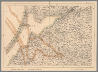
Full Title
7 Koenigsberg
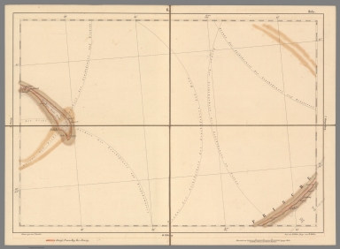
List No
10605.007
Note
Date estimated.
Author
[Reymann, Daniel Gottfried, Flemming, Carl]
Full Title
8A Helgoland
List No
10605.008
Note
Date is the latest date in the series. The range of dates of the sheets is 1822 to 1865
Author
[Reymann, Daniel Gottfried, Flemming, Carl]
Full Title
8 Toenningen
List No
10605.009
Author
[Reymann, Daniel Gottfried, Flemming, Carl]
Full Title
8b Tondern
List No
10605.010
Author
[Reymann, Daniel Gottfried, Flemming, Carl]
Full Title
8c Ripen
List No
10605.011
Author
[Reymann, Daniel Gottfried, Flemming, Carl]
Full Title
9 Rendsburg
List No
10605.012
Note
Date estimated
Author
[Reymann, Daniel Gottfried, Flemming, Carl]
Full Title
9a Flensburg
List No
10605.013
Note
Date estimated.
Author
[Reymann, Daniel Gottfried, Flemming, Carl]
Full Title
9b Apenrade
List No
10605.014
Author
[Reymann, Daniel Gottfried, Flemming, Carl]
Full Title
10 Lütjenburg
List No
10605.015
Note
Date estimated.
Author
[Reymann, Daniel Gottfried, Flemming, Carl]
Full Title
11 Warnemuende
List No
10605.016
Author
[Reymann, Daniel Gottfried, Flemming, Carl]
Full Title
12 Stralsund
List No
10605.017
Note
Digital only.
Author
[Reymann, Daniel Gottfried, Flemming, Carl]
Full Title
13 Bergen
List No
10605.018
Author
[Reymann, Daniel Gottfried, Flemming, Carl]
Full Title
14 Maasstabe u. Langenhagen
List No
10605.019
Author
[Reymann, Daniel Gottfried, Flemming, Carl]
Full Title
15 Koslin
List No
10605.020
Author
[Reymann, Daniel Gottfried, Flemming, Carl]
Full Title
16 Stolp
List No
10605.021
Author
[Reymann, Daniel Gottfried, Flemming, Carl]
Full Title
17 Behrendt
List No
10605.022
Note
Date estimated.
Author
[Reymann, Daniel Gottfried, Flemming, Carl]
Full Title
18 Elbing
List No
10605.023
Note
Date estimated.
Author
[Reymann, Daniel Gottfried, Flemming, Carl]
Full Title
19 Heilsberg
List No
10605.024
Author
[Reymann, Daniel Gottfried, Flemming, Carl]
Full Title
20 Juist
List No
10605.025
Author
[Reymann, Daniel Gottfried, Flemming, Carl]
Full Title
21 Wangeroog
List No
10605.026
Author
[Reymann, Daniel Gottfried, Flemming, Carl]
Full Title
22 Kuxhaven
List No
10605.027
|