Who What Where WhenWHEREShow More |
Author
[Munster, Sebastian, 1488-1552, Ptolemy, Claudius, Pirckheimer, Willibald, 1470-1530]
Full Title
Tabula Europae VIII. (to accompany) Geographia universalis, vetus et nozva, complectens Claudii Ptolemaei Alexandrini enarrationis libros VIII ... Basileae apud Henricum Petrum Mense Martio anno M.D. XL (1540).
List No
11623.035
Note
Woodcut uncolored 8th. map of Europe, Covers Russia, Ukraine, Baltic, and part of Scandinavia. Shows cities, towns, rivers and mountains. Relief shown pictorially. Includes legend and list town names. Text and map bound out of order.
Author
[Munster, Sebastian, 1488-1552, Ptolemy, Claudius, Pirckheimer, Willibald, 1470-1530]
Full Title
(Text Page to) Anglicanae insulae noua descriptio, complectens & Hiberniae & Scotiae propinquiores limites ... (to accompany) Geographia universalis, vetus et nozva, complectens Claudii Ptolemaei Alexandrini enarrationis libros VIII ... Basileae apud Henricum Petrum Mense Martio anno M.D. XL (1540).
List No
11623.066
Note
Descriptive text to the modern map of British Isles, covering England, Wales, southern Scotland and the eastern portion of Ireland, printed within ornamental woodcut borders.
Author
[Ptolemy, Claudius, Ruscelli, Girolamo, Giuseppe Moletti, M.]
Full Title
Tabvla Evropae VIII. D'Evropa, Ottava tavola Antica. (To accompany) La geografia di Claudio Tolomeo Alessandrino, nuouamente tradotta di Greco in Italiano, da Girolamo Ruscelli ... In Venetia, Appresso Vincenzo Valgrisi, M.D.LXI. (1561).
List No
11311.024
Note
Engraved map of the region between the Baltic and Black Seas. Relief shown pictorially.
Author
[Ptolemy, Claudius, Ruscelli, Girolamo, Giuseppe Moletti, M.]
Full Title
Tabvla Asiae IIII. Dell' Asia,Tavola Qvarta antica. (To accompany) La geografia di Claudio Tolomeo Alessandrino, nuouamente tradotta di Greco in Italiano, da Girolamo Ruscelli ... In Venetia, Appresso Vincenzo Valgrisi, M.D.LXI. (1561).
List No
11311.044
Note
Engraved map of the Eastern Mediterranean and the Middle East from Cyprus to Babylonia. Relief shown pictorially.
Author
[Ptolemy, Claudius, Ruscelli, Girolamo, Giuseppe Moletti, M.]
Full Title
Polonia et Hvngaria Nvova Tavola. Polonia, et Vngheria. Ottava tavola nvova d'Europa. (To accompany) La geografia di Claudio Tolomeo Alessandrino, nuouamente tradotta di Greco in Italiano, da Girolamo Ruscelli ... In Venetia, Appresso Vincenzo Valgrisi, M.D.LXI. (1561).
List No
11311.081
Note
Engraved map of Poland, Hungary, the Slovakia, the Czech Republic and parts of the region bounded by the Black Sea in the east. Relief shown pictorially.
Author
[Ptolemy, Claudius, Ruscelli,Girolamo, Rosaccio, Giuseppe]
Full Title
Tabvla Evropae VIII. Della Geografia di Tolomeo. Libro Terzo. (to accompany) Geographia di Clavdio Tolomeo alessandrino, tradotta di Greco nell'idioma volgare Italiano da Girolamo Ruscelli ... In Venetia, MDXCIX (1599) Appresso gli heredi di M. Sessa.
List No
11299.014
Note
Engraved map of Eastern Europe, ancient Sarmatia the region between the Baltic, Adriatic and Black Seas. Relief shown pictorially.
Author
[Ptolemy, Claudius, Ruscelli,Girolamo, Rosaccio, Giuseppe]
Full Title
Tabvla Asiae IIII. Della Geografia di Tolomeo. Libro Quinto. (to accompany) Geographia di Clavdio Tolomeo alessandrino, tradotta di Greco nell'idioma volgare Italiano da Girolamo Ruscelli ... In Venetia, MDXCIX (1599) Appresso gli heredi di M. Sessa.
List No
11299.024
Note
Engraved map of the Eastern Mediterranean and the Middle East from Cyprus to Babylonia. Relief shown pictorially.
Author
[Ptolemy, Claudius, Ruscelli,Girolamo, Rosaccio, Giuseppe]
Full Title
Polonia et Hvngaria Nvova Tavola. Descrittione della polonia. Libro Primo. (to accompany) Geographia di Clavdio Tolomeo alessandrino, tradotta di Greco nell'idioma volgare Italiano da Girolamo Ruscelli ... In Venetia, MDXCIX (1599) Appresso gli heredi di M. Sessa.
List No
11299.048
Note
Engraved map of Poland, Hungary, the Slovakia, the Czech Republic and parts of the region bounded by the Black Sea in the east. Relief shown pictorially.
Author
[Mercator, Gerhard, 1512-1594, Hondius, Iodocus, 1563-1612]
Full Title
Typus orbis terrarum : domini est terra & plenitudo, ejus, orbis terrarum, & universi qui habitant in eo : Psalmo 24. (to accompany) Atlas minor Gerardi Mercatoris.
List No
11201.010
Note
Double Hemispheres colored map, with decorative border depicting the continents. Terra Australis Incognita fills the Southern Hemisphere and connects to New Guinea in the region of Australia. Northwest Passage and interesting polar islands have been replaced with a non-descript landmass. The eastern coast of Asia has been revised to include a Korean Peninsula. South America is shown. An elongated Northwest Coast of America is shown, along with Anian.
Author
[Ortelius, Abraham, 1527-1598, Vrients, Jan Baptista]
Full Title
Aevi Veteris, Typus Geographicus. Abrah. Ortelius Regiae Mts. Geographus describ. cum Privilegijs decennalib. Imp. Reg. et Cancellariae Brabantiae. Antverpiae Ambivaritorum. 1590
List No
10001.347
Note
Part of the Parergon.
Author
[Wytfliet, Corneille, Magini, Giovanni Antonio]
Full Title
Utriusque Hemispherii Delineatio. (to accompany) Histoire universelle des Indes occidentales et orientales, et de la conversion des Indiens : divisee en trois parties par Cornille Wytfliet & Anthoine Magin & autres historiens. Premiere Partie. A Douay, Chez Francois Fabri, l'An 1611.
List No
11622.009
Note
Double page uncolored engraved double hemisphere map of the world, supported by vignette of Atlas from below, with title cartouche. Showing Terra Australis fills the Southern Hemisphere, Quivira and Anian are named on the West Coast of North America. Florida and Norimbega are shown on the Eastern Coast of North America. Includes rivers and mountains. Relief shown pictorially.
Author
[Wytfliet, Corneille, Magini, Giovanni Antonio]
Full Title
Norumbega et Virginia. (to accompany) Histoire universelle des Indes occidentales et orientales, et de la conversion des Indiens : divisee en trois parties par Cornille Wytfliet & Anthoine Magin & autres historiens. Premiere Partie. A Douay, Chez Francois Fabri, l'An 1611.
List No
11622.058
Note
Uncolored engraved double page map ofthe eastern coastline of North America, from S. Pietro" south to "Buelta de Arenas. Shows cities, towns, landmarks, rivers, forests and mountains. Relief shown pictorially. Includes decorative title cartouche.
Author
[Mercator, Gerhard, 1512-1594, Hondius, Jodocus, 1563-1612, Saltonstall, Wye]
Full Title
Typus orbis terrarum : domini est terra & plenitudo, ejus, orbis terrarum, & universi qui habitant in eo : Psalmo 24. (at head of the sheet) Of the world. (to accompany) Historia mundi : or Mercator's atlas. London Printed for Michaell Sparke, and are to be sowld in Greene Arboiure, 1637. Second edytion.
List No
11248.049
Note
Copper-engraving, uncolored double hemisphere map of the world, reduced version of Mercator`s famous world map includes several updates. The map is richly decorated in a strapwork surround with the title at top, the word ""Jehova"" in Hebrew just below. Showing Terra Australis Incognita fills the Southern Hemisphere and connects to New Guinea in the region of Australia. Northwest Passage and interesting polar islands have been replaced with a non-descript landmass. The eastern coast of Asia has been revised to include a Korean Peninsula. Several place names noted in the map, including Anian, Tolm, Norumbega, Virginia and Florida.
Author
[Briet, Philip, 1601-1668, Cramoisy, Sebastiani, Cramoisy, Gabrielis]
Full Title
Longitudo et Latitudo Orbis.
List No
12063.018
Author
[Briet, Philip, 1601-1668, Cramoisy, Sebastiani, Cramoisy, Gabrielis]
Full Title
Antiquissima Orbis Delineatio.
List No
12063.031
Author
[Briet, Philip, 1601-1668, Cramoisy, Sebastiani, Cramoisy, Gabrielis]
Full Title
Agathi - dae Monis Mechanici Alexandrini Orbis Descriptio ex Libris Geographicis Claudii Ptolemaei..
List No
12063.032
Author
[Briet, Philip, 1601-1668, Cramoisy, Sebastiani, Cramoisy, Gabrielis]
Full Title
Hoc est Punctum quod Inter Tot Gentes Ferro.
List No
12063.033
Author
[Briet, Philip, 1601-1668, Cramoisy, Sebastiani, Cramoisy, Gabrielis]
Full Title
Orbis Pars Veteribus Cognita.
List No
12063.034
Author
[Briet, Philip, 1601-1668, Cramoisy, Sebastiani, Cramoisy, Gabrielis]
Full Title
Vetus Oceani Divisio.
List No
12063.036
Author
[Briet, Philip, 1601-1668, Cramoisy, Sebastiani, Cramoisy, Gabrielis]
Full Title
La Division de Nostre Ocean.
List No
12063.039
Author
Jansson, Johannes, 1588-1664
Full Title
Orbis Terrarum Veteribus Cogniti Typus Geographicus.
List No
10056.029
Author
[Boisseau, Jean, Jollain, G.]
Full Title
Typus Orbis Terrarum, Description de la Terre Universelle.
List No
12496.005
Author
Blaeu, Joan, 1596-1673
Full Title
[Eastern Hemisphere]
List No
10151.004
Note
Description in a cartouche in the bottom right of the globe. 1 map : copperplate engraving on 12 sheets, hand colour. Dates estimated. This circular map filled the right half of Blaeu's enormous world map, which was published under the title 'Nova Totius Terrarum Orbis Tabula'. Although undated, the dedication to Gaspar de Bracamonte Guzmán, a Spanish representative at the Treaty of Westphalia, probably places the publication sometime around the conclusion of the treaty in 1648. As new information continued to arrive the map was revised multiple times, producing at least four different states. This is an impression of the first, pulled before Blaeu made major revisions to the depiction of China. As published, Blaeu's two maps were framed in a border filled with smaller terrestrial and astrological maps. Judging from the extant copies, the two hemispheres were often extracted from the map and, in this case, presented as separate sheets. In doing so, however, the compilers of the Klencke Atlas reversed the order in which the hemispheres are presented on Blaeu's sheet, presumably to give precedence to Europe.
Author
Nicolosi, Giovanni Battista, 1610-1670
Full Title
Continentem Dudum Notam Componebat. Ioa Baptista Nicolosius. S.T.D
List No
10254.011
Author
[Sanson, Nicolas, 1600-1667, Jollain, Gerhard, Berey, Nicolas, Du Val, Pierre, 1619-1683]
Full Title
(Covers to) [Composite World Atlas]
List No
15185.001
Author
[Jollain, Gerhard, Hondius, Jodocus]
Full Title
Nova Totius Terrarum Orbis Geographica Ac Hydrographica Tabula .
List No
15185.002
Author
[Berey, Nicolas, Jaillot, Hubert]
Full Title
L'Europe Corrigee, et augmentee, desus toutes les aultres cy devant faictes.
List No
15185.003
Author
Berey, Nicolas
Full Title
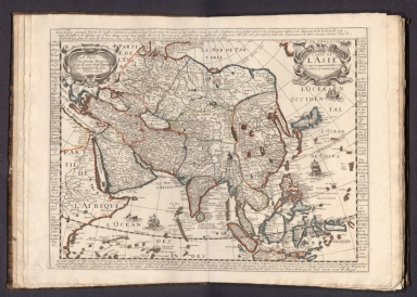
Carte L'Asie Corrigee, et augmentee, desus toutes les aultres cy devant faictes
List No
15185.004
Author
Berey, Nicolas
Full Title
Carte L'Afrique Corrigee, et augmentee, desus toutes les aultres cy devant faictes .
List No
15185.005
Author
Berey, Nicolas
Full Title
Carte L'Amerique Corrigee, et augmentee, desus toutes les aultres cy devant faictes . . .
List No
15185.006
Author
Jollain, Gerhard
Full Title
Carte General d'Hespagne
List No
15185.007
Author
Mariette, Pierre-Jean, 1603-1657
Full Title
Catalogne et Arragon .
List No
15185.008
Note
(later variant of Mariette, with changes -- "quay de l'orloge du palais aux 3 courones" address was later used by F.D. LaPointe)
Author
Jollain, Gerhard
Full Title
Galliae Regni Potentiss: Nova Descriptio Ionnae Ioliveto Auctore
List No
15185.009
Author
Sanson, Nicolas, 1600-1667
Full Title
Navarre
List No
15185.010
Author
Jollain, Gerhard
Full Title
Portugalliae Quae olim Lusitania Novissima et Exactissima Descriptio
List No
15185.011
Author
Lagniet
Full Title
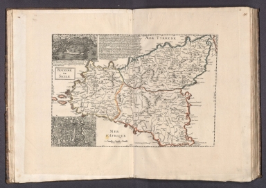
Royaume de Sicile
List No
15185.012
Author
Jollain, Gerhard
Full Title
Carte d'Italie Corsique Sardegne Et Roy Aumes Sircumuysines
List No
15185.013
Author
[Tavernier, Melchior, 1594-1665, Mariette, Pierre-Jean, 1603-1657]
Full Title
Carte Generale De l'Empire D'Allemagne et Pays Circonvoisins . . .
List No
15185.014
Author
Du Val, Pierre, 1619-1683
Full Title
Carte de L'Empire d'Alemagne par P. Duval .
List No
15185.015
Author
Mercator, Gerhard, 1512-1594
Full Title
Episcopatus Bremensis cum Adiacentibus
List No
15185.016
Note
date estimated.
Author
[Sanson, Nicolas, 1600-1667, Mariette, Pierre-Jean, 1603-1657]
Full Title
Partie Septentrionale du Royme de Hongrie tiree de divers Autheurs .
List No
15185.017
Author
[Sanson, Nicolas, 1600-1667, Mariette, Pierre-Jean, 1603-1657]
Full Title
Partie Meridionale du Royme de Hongrie tiree de divers Autheurs . . .
List No
15185.018
Author
Hondius, Hendrik, 1597-1651
Full Title
Ducatus Silesiae Wolanus
List No
15185.019
Author
[Lazius, Wolfgang, 1514-1565, Berey, Nicolas]
Full Title
Austria Archiducatgus Auctore Wolfgango Lazio
List No
15185.020
Author
Jollain, Gerhard
Full Title
Nouvelle Carte Generalle Des Dix Sept Provinces
List No
15185.021
Author
Lagniet
Full Title
Carte des Provinces Unies des Pays Bas connues soubs le nom de Hollande et pays circonvoisins ou l'on voitee qu'elles ont possede depuis leur Union a Utrecht l'an 1579 jusques a l'annee 1672 que la France a reduit en partie a son obeissace …
List No
15185.022
Author
Berey, Nicolas
Full Title
Carte De La Duche et Gouverement de Lorraine Par Blaeu
List No
15185.023
Author
[Bussemarcher, Jollain, Gerhard]
Full Title
Lotharingiae Ducatus Superioris vera delineatio
List No
15185.024
Note
This map would appear to be the original Bussemacher plate (circa 1600), re-worked by Jollain
Author
Du Val, Pierre, 1619-1683
Full Title
La Suisse Par P. Du Val
List No
15185.025
Author
Mercator, Gerhard, 1512-1594
Full Title
Tar Visina Marchia et Tirolis Comitatus
List No
15185.026
|


![[Eastern Hemisphere]](https://www.davidrumsey.com/rumsey/Size2/RUMSEY~8~1/179/10151004.jpg)

![Covers: [Composite World Atlas]](https://www.davidrumsey.com/rumsey/Size1/RUMSEY~8~1/199/15185001.jpg)


