|
Author
Zatta, Antonio, active 1757-1797
Full Title
Il Paese de' Selvaggi Outagamiani, Mascoutensi, Illinesi e Parte delle VI. Nazioni. Le Colonie Unite dell' America Settentrle. Fogl. IV. (to accompany) Atlante novissimo ... Tomo IIII. Con privilegio dell Eccelimo Senato. (tomo I-IV).
List No
11598.228
Note
Engraved hand-colored in outline, double-page map of Michigan in the north and extending south to include parts of Illinois, Indiana, Wisconsin, Minnesota and Iowa, with Missouri River, Lake Michigan on both sides. The first edition of Zatta's twelve sheet version of Mitchell's Map of North America, plus three other maps: Il Canada, La Baja D' Hudson, and Le Isole di Terra Nuova e Capo Breton. Zatta's version of Mitchell is not an exact copy: many geographical changes are introduced, and Bermuda is depicted as well as Jamaica, neither of which are shown by Mitchell. Maps showing administrative divisions, settlements, cities, towns, forts, Indian settlements, bridges, canals, mountains and rivers. Relief shown pictorially and by hacures. Includes notations.
Author
[Collot, George Henri Victor, Tardieu, P.F.]
Full Title
General Map of the Course of the Ohio from Its Source to its Junction With The Mississipi. PL. 2.
List No
4664.002
Note
The large general chart showing the entire Ohio on one sheet. Without color.
Author
Bradley, Abraham Junior
Full Title
(Covers to) Map of the United States, Exhibiting the Post-Roads, the situations, connexions and distances of the Post-Offices, Stage Roads, Counties & Principal Rivers By Abraham Bradley Junr. Entered ... 2nd day of June1804, by Abraham Bradley Junr. of the District of Columbia. (inset) Map Of North America. (1805)
List No
5812.001
Note
2nd edition or state of this map, with printed date of 1804 but with estimated date of 1805 based on the naming of Michigan Territory which was formed in 1805 The 1804 first edition (see LOC copy) does not name Michigan. Other changes from the first edition include new public surveys on the Indiana Territory and Ohio border and the addition of a Rapids between Jallot Lake and Great Falls on the Red River. Also of note is the coloring of the Lousiana Territory green all the way to the Pacific coast on the inset map of North America. Other copies we have seen show the Lousiana Territory extending only to the Rocky Mountains - the 1809 and the 1812 editions have a dotted line marking the boundary roughly at the Rocky Mountains. This 1805 edition and the 1804 edition do not have such a line north of the the 42nd parallel.
Author
Bradley, Abraham Junior
Full Title
Map of the United States, Exhibiting the Post-Roads, the situations, connexions and distances of the Post-Offices, Stage Roads, Counties & Principal Rivers By Abraham Bradley Junr. Entered ... 2nd day of June1804, by Abraham Bradley Junr. of the District of Columbia. (inset) Map Of North America. (1805)
List No
5812.002
Note
2nd edition or state of this map, with printed date of 1804 but with estimated date of 1805 based on the naming of Michigan Territory which was formed in 1805 The 1804 first edition (see LOC copy) does not name Michigan. Other changes from the first edition include new public surveys on the Indiana Territory and Ohio border and the addition of a Rapids between Jallot Lake and Great Falls on the Red River. Also of note is the coloring of the Lousiana Territory green all the way to the Pacific coast on the inset map of North America. Other copies we have seen show the Lousiana Territory extending only to the Rocky Mountains - the 1809 and the 1812 editions have a dotted line marking the boundary roughly at the Rocky Mountains. This 1805 edition and the 1804 edition do not have such a line north of the the 42nd parallel.
Author
[Arrowsmith, Aaron, Lewis, Samuel]
Full Title
Arrowsmith's Map of the World On A Globular Projection, Exhibiting Particularly The Nautical Researches of Captain James Cook...
List No
2618.000
Note
Rare U.S. edition of Arrowsmith's Globular World. Says "The whole engraved under the immediate superintendence of, corrected and improved by, Samuel Lewis, Geographer...Plan work by Harrison, Hooker, Seymour & Boyd. The writing by William Harrison." The dedication to Dalrymple that appears on the English edition is not present here, and the U.S. is somewhat redrawn, with Ohio, Indiana, Michigan (with a redrawn peninsula), Illinois, and Mississippi added. Cook's portrait remains, but in a different location with the cartouche completely redrawn. The balance of the map is almost identical to the English ed., with small exceptions such as labeling Bass Strait in New Holland (not on Eng. ed.). Compare to our 1808 English edition.
Author
Bradley, Abraham Junior
Full Title
Map of the United States, Exhibiting the Post-Roads, the situations, connexions and distances of the Post-Offices, Stage Roads, Counties & Principal Rivers By Abraham Bradley Junr. Entered ... 2nd day of June1804, by Abraham Bradley Junr. of the District of Columbia. (inset) Map Of North America. (1809)
List No
3043.000
Note
Third edition. Compared to the first edition of 1804 and the second of 1805, Illinois is added; about 25 towns are added to the western Connecticut Reserve (the Fire Lands) in northern Ohio; Township and Range lines are added in southern Indiana. Relief shown pictorially. Shows Indian tribes. Prime meridian: Washington. Without the case, dissected as issued, mounted on new linen.
Author
[Arrowsmith, Aaron, Seymour, J.H.]
Full Title
Map of America by A. Arrowsmith. Philadelphia, Published by Kimber and Conrad, and Johnson and Warner. J.H. Seymour, sculp.
List No
2315.000
Note
Very rare U.S. edition of Arrowsmith's America. The map has been totally reengraved by J.H. Seymour of Philadelphia using the latest Arrowsmith edition, 1811, as the base. Changes include the delineation of Indiana, Illinois, Ohio, Michigan, Northwest Territory, Mississippi Territory and the delineation of U.S. claims for the Western and Southern Boundary of the Louisiana Territory. The upper Mississippi River has been redrawn, as has the Michigan Peninsula (fatter), and the Great Lakes. No changes found (yet) in the Western U.S. This map is extremely scarce, with no mention of it in any of the standard map references, including Stevens and Tree. It is only listed in Shaw/Shoemaker. Conrad, the publisher of this map, was related to Arrowsmith through the Arrowsmith and Lewis Atlas. With black top and bottom rollers and brown linen edging. Outline color by country.
Author
Lewis, Samuel
Full Title
A New and correct Map of The United States Of North America; Exhibiting The Counties, Towns, Roads &c. in each State. Carefully compiled from Surveys and the most Authentic Documents, By Samuel Lewis. W. & S. Harrison sculpt. Philadelphia, Published by Emmor Kimber 1816. Copy Right secured according to Law.
List No
5047.000
Note
This is the first complete edition of this map, the largest wall map of the United States produced by Americans at that time (although Karrow 1-1418 lists an almost complete 1815 edition). Differences from the 1818 edition include Illinois and Indiana shown as Territories, a large Mississippi with no Alabama, and no Arkansas Territory. Also, there are far fewer roads shown, and fewer settlements laid down, especially in Canada. See our #432 for a proposal for publishing this map. With black top and bottom rollers and dark green linen edging. Outline color by state or territory.
Author
Melish, John
Full Title
(Covers to) Map of the United States with the contiguous British & Spanish Possessions Compiled from the latest & best Authorities By John Melish. Engraved by J. Vallance & H.S. Tanner. Entered ... 6th day of June 1816. Published by John Melish Philadelphia. (inset) West Indies.
List No
5168A
Author
Melish, John
Full Title
Map of the United States with the contiguous British & Spanish Possessions Compiled from the latest & best Authorities By John Melish. Engraved by J. Vallance & H.S. Tanner. Entered ... 6th day of June 1816. Published by John Melish Philadelphia. (inset) West Indies.
List No
5168.001
Note
With insets of the West Indies and a Statistical Table. This map has the distinction of being the first large scale detailed map made in the U.S. that showed the entire country from the Atlantic to the Pacific. This copy is an early state of the first edition -this is Martin's third state of the first edition and Ristow's fourth state (Ristow discovered a town and trail added in Ohio - Adelphi - making for a sub state of Martin's third state). The first state was an incomplete proof copy, making this the second/third state of the completed copy. The differences between this and the first complete state are small: Mansfield, Wooster, and Adelphi (and a trail from Adelphi to Athens and Chillicothe) added in Ohio, and "Vevay or" added before "Swiss Vineyards" in southeastern Indiana. Martin and Ristow identify seven states of the 1816 edition. Melish published new editions in 1818 (five states), 1819 (two states), 1820 (eight states), 1822 (two states), and 1823 (one state) for a total of twenty five different issues. Notwithstanding the many issues, the map has become extremely rare. A book accompanied the map (though issued separately) titled "A Geographical Description of the United States..." (see our #2424). Outline color by state or territory. This copy is dissected into 40 sections, backed with linen, and edged in brown cloth. It folds with marbled end sheets into new blue cloth folding boards and slip case 24.5x16.5 with leather label on spine reading "Melish. Map Of The United States. 1816" in gold.
Author
Melish, John
Full Title
Map of the United States with the contiguous British & Spanish Possessions Compiled from the latest & best Authorities By John Melish. Engraved by J. Vallance & H.S. Tanner. Entered ... 6th day of June 1816. Published by John Melish Philadelphia. (inset) West Indies.
List No
5168.002
Note
Composite of dissected map. With insets of the West Indies and a Statistical Table. This map has the distinction of being the first large scale detailed map made in the U.S. that showed the entire country from the Atlantic to the Pacific. This copy is an early state of the first edition -this is Martin's third state of the first edition and Ristow's fourth state (Ristow discovered a town and trail added in Ohio - Adelphi - making for a sub state of Martin's third state). The first state was an incomplete proof copy, making this the second/third state of the completed copy. The differences between this and the first complete state are small: Mansfield, Wooster, and Adelphi (and a trail from Adelphi to Athens and Chillicothe) added in Ohio, and "Vevay or" added before "Swiss Vineyards" in southeastern Indiana. Martin and Ristow identify seven states of the 1816 edition. Melish published new editions in 1818 (five states), 1819 (two states), 1820 (eight states), 1822 (two states), and 1823 (one state) for a total of twenty five different issues. Notwithstanding the many issues, the map has become extremely rare. A book accompanied the map (though issued separately) titled "A Geographical Description of the United States..." (see our #2424). Outline color by state or territory. This copy is dissected into 40 sections, backed with linen, and edged in brown cloth. It folds with marbled end sheets into new blue cloth folding boards and slip case 24.5x16.5 with leather label on spine reading "Melish. Map Of The United States. 1816" in gold.
Author
[Kensett, T., Shelton, W.]
Full Title
Shelton & Kensett's Map Of The State Of Indiana. Protracted from manuscript surveys communicated to the publishers By the Honorable Christopher Harrison. Lieut. Govr. of that State, to which are added the surveys of the Illinois Territory By Genl. Mansfield. Engraved by A. Doolittle, New Haven. (with) A Sketch of the existing connection of the State of Indiana and Illinois Territory, with the adjoining States. Entered ... 25th day of Decr. 1817 by Shelton & Kensett.
List No
5522.000
Note
In outline color by county. Shows townships for Indiana and Illinois.
Author
[Birkbeck, Morris, Melish, John]
Full Title
English Prairie and Adjacent Country. T.V.K & Co. Sc. J. Melish Del.
List No
2666.002
Note
An uncolored map showing the townships in Illinois and Indiana.
Author
Carey, Mathew
Full Title
The Upper Territories of the United States. Kneass & Delleker Sc.
List No
2721.030
Note
Outline color by territory. U.S. land is marked. Prime meridians Philadelphia and London. Relief shown by hachures.
Author
Tardieu, P.F.
Full Title
(Covers to) United States of Nth. America. Carte des Etats-Unis de L'Amerique Septentrionale Copiee et Gravee sur celle d'Arrowsmith Corrigee et considerablem ent augmentee d'Apres les renseignemens les plus authentiques Par P.F. Tardieu, Graveur, Editeur-proprietaire. Place de l'Estrapade No. 1. 'A Paris 1812. a Paris, Ches: Tardieu ... Dezauche, Ingenieur Geographe, Rue des Noyers. Chles. Picquet, Geographe - Graveur Quai de la Monnaie No. 17. Treuttel et Wurtz, Libraire Rue de Lille No. 17 ... J. Goujon Marchand de Cartes Geographiques, Rue du Bac No. 6. Ecrit par J.J. Pachoux. (with 1 inset map).
List No
4397A
Note
The date is estimated, the only date on the map being 1812. Compared to the 1812 edition, Alabama Territory is added (1817) and Mississippi is a state (1817). Indiana Territory has been divided into Illinois and Indiana Territories, Missouri Territory appears with Louisiana as a state (1812), and there are many additions of towns and roads in the Midwest and Southeast. Chicago appears. The only major topographical changes we can find are in the Florida/Georgia border and coast line. The next issue of this map was the 1820 dated issue. Comparing this map to the Arrowsmith "additions to 1819" issue of the Map of the United States, one is impressed that Tardieu's map is far more up to date. Even though Tardieu began by copying the Arrowsmith map, his editions are consistently more current with the political and topographical changes of the times. Map is in four sheets, each dissected into 15 sections, and backed and edged in linen. Outline color by state. Sheets folds into original brown marbled slip case 22x15 embossed in gold with "Metz. Ecole Royale D'Artillerie" on the front and "Tardieu. Etats-Unis D'Amerique" on the spine.
Author
Tardieu, P.F.
Full Title
United States of Nth. America. Carte des Etats-Unis de L'Amerique Septentrionale Copiee et Gravee sur celle d'Arrowsmith Corrigee et considerablem ent augmentee d'Apres les renseignemens les plus authentiques Par P.F. Tardieu, Graveur, Editeur-proprietaire. Place de l'Estrapade No. 1. 'A Paris 1812. a Paris, Ches: Tardieu ... Dezauche, Ingenieur Geographe, Rue des Noyers. Chles. Picquet, Geographe - Graveur Quai de la Monnaie No. 17. Treuttel et Wurtz, Libraire Rue de Lille No. 17 ... J. Goujon Marchand de Cartes Geographiques, Rue du Bac No. 6. Ecrit par J.J. Pachoux. (with 1 inset map).
List No
4397.001
Note
The date is estimated, the only date on the map being 1812. Compared to the 1812 edition, Alabama Territory is added (1817) and Mississippi is a state (1817). Indiana Territory has been divided into Illinois and Indiana Territories, Missouri Territory appears with Louisiana as a state (1812), and there are many additions of towns and roads in the Midwest and Southeast. Chicago appears. The only major topographical changes we can find are in the Florida/Georgia border and coast line. The next issue of this map was the 1820 dated issue. Comparing this map to the Arrowsmith "additions to 1819" issue of the Map of the United States, one is impressed that Tardieu's map is far more up to date. Even though Tardieu began by copying the Arrowsmith map, his editions are consistently more current with the political and topographical changes of the times. Map is in four sheets, each dissected into 15 sections, and backed and edged in linen. Outline color by state. Sheets folds into original brown marbled slip case 22x15 embossed in gold with "Metz. Ecole Royale D'Artillerie" on the front and "Tardieu. Etats-Unis D'Amerique" on the spine.
Author
Thomas, David, 1776-1859
Full Title
(Title Page to) Travels through the western country in the summer of 1816. Including notices of the natural history, antiquities, topography, agriculture, commerce and manufactures. With a map of the Wabash country, now settling. By David Thomas. Auburn, N.Y. Printed by David Rumsey. 1819.
List No
0995A
Note
Rebound in quarter leather with "Travels through the western country, David Thomas" on the spine in gold.
Author
Thomas, David, 1776-1859
Full Title
Vincennes district. Drawn by David Thomas. J. Ridley, Sc., N.Y.
List No
0995.001
Note
Engraved uncol. map. Shows rivers, counties, settlements, USPLSS townships, etc. Prime meridians: Washington and London. Covers southwesten Indiana.
Author
Arrowsmith, Aaron
Full Title
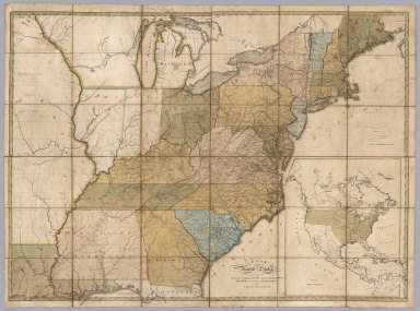
(C0vers to) A Map Of The United States of North America Drawn from a number of Critical Researches By A. Arrowsmith, Hydrographer to His Majesty. No. 10 Soho Square. Additions to 1819. London. Published as the Act Directs by A. Arrowsmith, No. 10 Soho Square. Jan 1st, 1796. Additions to 1802 ... (inset map of Florida).
List No
3445A
Note
The last edition, with the "wings" on the Mississippi and the Northwest. Adds Illinois, Indiana, Ohio, Michigan, Louisiana, Mississippi and Missouri Territory. Many changes to the topography as well. An inset of the Florida Peninsula appears. The northern wing shows the Lake of the Woods and the southern wing shows the mouths of the Mississippi in detail. The delineation of the roads indicates that Bradley's Postal Map of the U.S. may have been used as a source. Outline color by state. Map is in four sheets, each dissected into 12 sections. Sheets fold into a new slip case 26x18 with the original tan covers pasted down with a label reading "J. Le Nesuvier (645) United States" in manuscript.
Author
Arrowsmith, Aaron
Full Title
A Map Of The United States of North America Drawn from a number of Critical Researches By A. Arrowsmith, Hydrographer to His Majesty. No. 10 Soho Square. Additions to 1819. London. Published as the Act Directs by A. Arrowsmith, No. 10 Soho Square. Jan 1st, 1796. Additions to 1802 ... (inset map of Florida).
List No
3445.001
Note
The last edition, with the "wings" on the Mississippi and the Northwest. Adds Illinois, Indiana, Ohio, Michigan, Louisiana, Mississippi and Missouri Territory. Many changes to the topography as well. An inset of the Florida Peninsula appears. The northern wing shows the Lake of the Woods and the southern wing shows the mouths of the Mississippi in detail. The delineation of the roads indicates that Bradley's Postal Map of the U.S. may have been used as a source. Outline color by state. Map is in four sheets, each dissected into 12 sections. Sheets fold into a new slip case 26x18 with the original tan covers pasted down with a label reading "J. Le Nesuvier (645) United States" in manuscript.
Author
Baker, Harriet E.
Full Title
(Covers to) Harriet E. Baker's Book of Penmanship & Maps. At Mr. Dunham's School Windsor Vermont March 31, 1819.
List No
8307.001
Note
The existence of this book of penmanship throws interesting light on our other book of penmanship by Frances Henshaw, our 2501.000. This book by Harriet Baker is dated four years earlier, 1819, and from another school in Windsor, Vermont (Henshaw's school was in Middlebury, Vermont). Generally, the two books follow very similar structure, both the text and the maps, which would indicate that the production of these books of penmanship was more frequent than previously thought and also suggests that there was a common template used, even by different schools, in their construction. It can be said that Baker's maps are exquisite, perhaps a bit more so than Henshaw's, but Henshaw's text descriptions of the states are more elaborate than Baker's. For some reason, Baker omits maps of New York, Pennsylvania, South Carolina, Kentucky, Indiana, Illinois and Michigan, while including descriptions of most of them. Henshaw has no map or description of Michigan or Illinois. For the sources of the maps and text, see our entry for Henshaw's book, 2501.000. The Osher Map Library has a copy of another book of penmanship, also from Mr. Dunham's School in Windsor Vermont, titled “Catharine M. Cook’s Book of Penmanship at Mr. Dunham’s School, Windsor, Vermont, June 15th, 1818”
Author
Baker, Harriet E.
Full Title
(Title Page to) Harriet E. Baker's Book of Penmanship & Maps. At Mr. Dunham's School Windsor Vermont March 31, 1819.
List No
8307.002
Note
The existence of this book of penmanship throws interesting light on our other book of penmanship by Frances Henshaw, our 2501.000. This book by Harriet Baker is dated four years earlier, 1819, and from another school in Windsor, Vermont (Henshaw's school was in Middlebury, Vermont). Generally, the two books follow very similar structure, both the text and the maps, which would indicate that the production of these books of penmanship was more frequent than previously thought and also suggests that there was a common template used, even by different schools, in their construction. It can be said that Baker's maps are exquisite, perhaps a bit more so than Henshaw's, but Henshaw's text descriptions of the states are more elaborate than Baker's. For some reason, Baker omits maps of New York, Pennsylvania, South Carolina, Kentucky, Indiana, Illinois and Michigan, while including descriptions of most of them. Henshaw has no map or description of Michigan or Illinois. For the sources of the maps and text, see our entry for Henshaw's book, 2501.000. The Osher Map Library has a copy of another book of penmanship, also from Mr. Dunham's School in Windsor Vermont, titled “Catharine M. Cook’s Book of Penmanship at Mr. Dunham’s School, Windsor, Vermont, June 15th, 1818”
Author
Baker, Harriet E.
Full Title
(Text Page to) Astronomical Geography. (to accompany) Harriet E. Baker's Book of Penmanship & Map. At Mr. Dunham's School Windsor Vermont March 31, 1819.
List No
8307.003
Note
Hand lettered text.
Author
Baker, Harriet E.
Full Title
(Text Page to) Ptolemaic System. (to accompany) Harriet E. Baker's Book of Penmanship & Map. At Mr. Dunham's School Windsor Vermont March 31, 1819.
List No
8307.004
Note
Hand lettered text.
Author
Baker, Harriet E.
Full Title
(Text Page to) Brahean System. (to accompany) Harriet E. Baker's Book of Penmanship & Map. At Mr. Dunham's School Windsor Vermont March 31, 1819.
List No
8307.005
Note
Hand lettered text.
Author
Baker, Harriet E.
Full Title
(Text Page to) Of the several Astronomical Systems. Harriet E.aker. Windsor Vermont. (to accompany) Harriet E. Baker's Book of Penmanship & Map. At Mr. Dunham's School Windsor Vermont March 31, 1819.
List No
8307.006
Note
Hand lettered text.
Author
Baker, Harriet E.
Full Title
(Text Page to) Doctrine of the Spheres. Great Circles. Less Circles. Axis and Poles of the Earth. (to accompany) Harriet E. Baker's Book of Penmanship & Map. At Mr. Dunham's School Windsor Vermont March 31, 1819.
List No
8307.007
Note
Hand lettered text.
Author
Baker, Harriet E.
Full Title
(Text Page to) The twelve signs. Horizon. (to accompany) Harriet E. Baker's Book of Penmanship & Map. At Mr. Dunham's School Windsor Vermont March 31, 1819.
List No
8307.008
Note
Hand lettered text.
Author
Baker, Harriet E.
Full Title
(Text Page to) Torrid zone. Frigid zone. Temperate zone. (to accompany) Harriet E. Baker's Book of Penmanship & Map. At Mr. Dunham's School Windsor Vermont March 31, 1819.
List No
8307.009
Note
Hand lettered text.
Author
Baker, Harriet E.
Full Title
(Text Page to) Blank Page
List No
8307.054
Note
Hand lettered text.
Author
Baker, Harriet E.
Full Title
(Text Page to) Tropics. Polar Circles. Zones. (to accompany) Harriet E. Baker's Book of Penmanship & Map. At Mr. Dunham's School Windsor Vermont March 31, 1819.
List No
8307.010
Note
Hand lettered text.
Author
Baker, Harriet E.
Full Title
(Text Page to) Latitude. Longitude. Climate. (to accompany) Harriet E. Baker's Book of Penmanship & Map. At Mr. Dunham's School Windsor Vermont March 31, 1819.
List No
8307.011
Note
Hand lettered text.
Author
Baker, Harriet E.
Full Title
(Text Page to) America. (to accompany) Harriet E. Baker's Book of Penmanship & Map. At Mr. Dunham's School Windsor Vermont March 31, 1819.
List No
8307.012
Note
Hand lettered text.
Author
Baker, Harriet E.
Full Title
(Text Page to) America. (to accompany) Harriet E. Baker's Book of Penmanship & Map. At Mr. Dunham's School Windsor Vermont March 31, 1819.
List No
8307.013
Note
Hand lettered text.
Author
Baker, Harriet E.
Full Title
(Text Page to) America. (to accompany) Harriet E. Baker's Book of Penmanship & Map. At Mr. Dunham's School Windsor Vermont March 31, 1819.
List No
8307.014
Note
Hand lettered text.
Author
Baker, Harriet E.
Full Title
(Text Page to) America. (to accompany) Harriet E. Baker's Book of Penmanship & Map. At Mr. Dunham's School Windsor Vermont March 31, 1819.
List No
8307.015
Note
Hand lettered text.
Author
Baker, Harriet E.
Full Title
(Text Page to) America. (to accompany) Harriet E. Baker's Book of Penmanship & Map. At Mr. Dunham's School Windsor Vermont March 31, 1819.
List No
8307.016
Note
Hand lettered text.
Author
Baker, Harriet E.
Full Title
(Description of ) United States of America. (to accompany) Harriet E. Baker's Book of Penmanship & Map. At Mr. Dunham's School Windsor Vermont March 31, 1819.
List No
8307.017
Note
Geographical description of the United States. Hand lettered text.
Author
Baker, Harriet E.
Full Title
(Description of ) Vermont. (to accompany) Harriet E. Baker's Book of Penmanship & Map. At Mr. Dunham's School Windsor Vermont March 31, 1819.
List No
8307.018
Note
A short description of the state of Vermont. Hand lettered text.
Author
Baker, Harriet E.
Full Title
(Description of) New Hampshire. (to accompany) Harriet E. Baker's Book of Penmanship & Map. At Mr. Dunham's School Windsor Vermont March 31, 1819.
List No
8307.019
Note
A short description of the state of New Hampshire. Hand lettered text.
Author
Baker, Harriet E.
Full Title
New Hampshire. (to accompany) Harriet E. Baker's Book of Penmanship & Map. At Mr. Dunham's School Windsor Vermont March 31, 1819.
List No
8307.020
Note
Outline color map by county. Showing cities and towns, and rivers.
Author
Baker, Harriet E.
Full Title
(Description of) District of Maine : belonging to Massachusetts. (to accompany) Harriet E. Baker's Book of Penmanship & Map. At Mr. Dunham's School Windsor Vermont March 31, 1819.
List No
8307.021
Note
A short description of the state of District of Maine. Hand lettered text.
Author
Baker, Harriet E.
Full Title
District of Maine : belonging to Massachusetts. (to accompany) Harriet E. Baker's Book of Penmanship & Map. At Mr. Dunham's School Windsor Vermont March 31, 1819.
List No
8307.022
Note
Outline color map by county. Showing cities and towns, and rivers. Relief shown by hachures.
Author
Baker, Harriet E.
Full Title
(Description of) Massachusetts. (to accompany) Harriet E. Baker's Book of Penmanship & Map. At Mr. Dunham's School Windsor Vermont March 31, 1819.
List No
8307.023
Note
A short description of the state of Massachusetts. Hand lettered text.
Author
Baker, Harriet E.
Full Title
Massachusetts. (to accompany) Harriet E. Baker's Book of Penmanship & Map. At Mr. Dunham's School Windsor Vermont March 31, 1819.
List No
8307.024
Note
Outline color map by county. Showing cities and towns, and rivers. Relief shown by hachures.
Author
Baker, Harriet E.
Full Title
(Description of) Connecticut. (to accompany) Harriet E. Baker's Book of Penmanship & Map. At Mr. Dunham's School Windsor Vermont March 31, 1819.
List No
8307.025
Note
A short description of the state of Connecticut surrounded by vines. Hand lettered text.
Author
Baker, Harriet E.
Full Title
Connecticut. (to accompany) Harriet E. Baker's Book of Penmanship & Map. At Mr. Dunham's School Windsor Vermont March 31, 1819.
List No
8307.026
Note
Outline color map by county. Showing cities and towns, and rivers. Relief shown by hachures.
Author
Baker, Harriet E.
Full Title
(Description of) Rhode Island. (to accompany) Harriet E. Baker's Book of Penmanship & Map. At Mr. Dunham's School Windsor Vermont March 31, 1819.
List No
8307.027
Note
A short description of the state of Rhode Island. Hand lettered text.
Author
Baker, Harriet E.
Full Title
Rhode Island. (to accompany) Harriet E. Baker's Book of Penmanship & Map. At Mr. Dunham's School Windsor Vermont March 31, 1819.
List No
8307.028
Note
Outline color map by county. Showing cities and towns, and rivers. Relief shown by hachures.
Author
Baker, Harriet E.
Full Title
(Description of) New York. (to accompany) Harriet E. Baker's Book of Penmanship & Map. At Mr. Dunham's School Windsor Vermont March 31, 1819.
List No
8307.029
Note
A short description of the state of New York. Hand lettered text.
|