|
Author
[Chapin, William, Taylor, J.B.]
Full Title
Chapin's Ornamental Map Of The United States With Plans Of The World, British Possessions, West Indies & Columbia. New York, Published by W. Chapin & J.B. Taylor. 1846. Entered ... 1838 by W. Chapin & J.B. Taylor ... New York. Sold by T. & E.H. Ensign, No. 36 Ann St. N. York. Geographical Part Engraved By J.B. Taylor & H.F. Wheeler. Printed by Wm. Neale, N.Y. (above title) Steel Plates. (title engraving) Chapin del. Prudhomme sc. (portraits) Drawn & Engraved by Story & Atwood, N. York ... Painted by G. Stuart ... A. Dick sc. ... W.D. Smith sc. ... J.F.E. Prudhomme sc. Osborne sc. (with 9 inset maps).
List No
2128.000
Note
First edition listed in Karrow is 1839; all copyrights are 1838. Truly an "ornamental" map with an architecture of columns and vignettes including illustrations of the presidents at the borders that is unique. With inset maps of the Western Territory of the United States, Texas, the Canadas, the North Part of Maine, South Part of Florida, British Possessions in North America, the World, Colombia, and the West Indies. Editions from 1839 to 1853. With black top and bottom rollers. Full color by county.
Author
Wheeler, G.M.
Full Title
Map showing Detailed Topography Of The Country Traversed by the Reconnaissance Expedition through Southern & Southeastern Nevada in charge of Lieut. Geo. M. Wheeler U.S. Engineers. Assisted by Lieut. O.W. Lockwood Corps Of Engineers U.S.A. 1869. P.W. Hamel Chief Topographer And Draughtsman. Photolith. by the N.Y. Lithg. Engrg. & Prtg. Co. 16 & 18 Park Place.
List No
2739.000
Note
1st Wheeler map, done before 100th Mer. Survey. Streeter: "Since Wheeler's exploration was in part over country never before mapped, this as far as I know, is the foundation map for southern Nevada." Above the neat line reads "Reconnaissance Maps. Department Of California." Unfolded separate issue. Outline color by county.
Author
Wheeler, G.M.
Full Title
(Covers to) Report upon United States Geographical Surveys West of the One Hundredth Meridian, in charge of Capt. Geo. M. Wheeler, Corps of Engineers, U.S. Army ... In seven volumes and one supplement, accompanied by one topographic and one geologic atlas. Vol. I--Geographical report. Washington: Government Printing Office, 1889.
List No
2220A
Note
Bound in dark brown linen with title, date, volume number and topic on the spine.
Author
Wheeler, G.M.
Full Title
(Title Page to) Report upon United States Geographical Surveys West of the One Hundredth Meridian, in charge of Capt. Geo. M. Wheeler, Corps of Engineers, U.S. Army ... In seven volumes and one supplement, accompanied by one topographic and one geologic atlas. Vol. I--Geographical report. Washington: Government Printing Office, 1889.
List No
2220B
Note
Includes seal of the Engineer Department, U.S. Army.
Author
Wheeler, G.M.
Full Title
(Contents to) Report upon United States Geographical Surveys West of the One Hundredth Meridian, in charge of Capt. Geo. M. Wheeler, Corps of Engineers, U.S. Army ... In seven volumes and one supplement, accompanied by one topographic and one geologic atlas. Vol. I--Geographical report. Washington: Government Printing Office, 1889.
List No
2220C
Note
List of plates.
Author
Wheeler, G.M.
Full Title
(Contents to) Report upon United States Geographical Surveys West of the One Hundredth Meridian, in charge of Capt. Geo. M. Wheeler, Corps of Engineers, U.S. Army ... In seven volumes and one supplement, accompanied by one topographic and one geologic atlas. Vol. I--Geographical report. Washington: Government Printing Office, 1889.
List No
2220D
Note
List of plates (continued), List of maps.
Author
Hamel, P.W.
Full Title
Plan and section of cave in Cave Valley, Southeastern Nevada. Surveyed by P.W. Hamel, 1869. Drawn by Weyss & Thompson. The Graphic Co., N.Y. (1889)
List No
2220.001
Note
Lithographed map, sepia toned. Relief shown by hachures. Vertical scale of plan ca. 1:1,589.
Full Title
Alpine Lake in the Sierra Nevada, near Camp Independence, Cala. 1871. U.S. Geographical Surveys West of the 100th Meridian. (1889)
List No
2220.002
Note
Photographically based lithographed view, sepia toned. Shows peaks, lake, trees, etc.
Full Title
Kearsarge Mining Works, Kearsarge District, eastern flank of the Sierra Nevada, near Camp Independence, Cala. 1871. U.S. Geographical Surveys West of the 100th Meridian. (1889)
List No
2220.003
Note
Lithographed view, b&w. Shows buildings, trees, etc.
Full Title
Scene at mouth of Canon of the Virgin River near Shonesburg, Utah. Wriggle Trail at the right. (From a sketch made by John E. Weyss). 1872. U.S. Geographical Surveys West of the 100th Meridian. (1889)
List No
2220.004
Note
Lithographed view, sepia toned.
Full Title
Dripping Pool, Kanab Canyon, near the Colorado. 1872. U.S. Geographical Surveys West of the 100th Meridian. Sinclair & Son. (1889)
List No
2220.005
Note
Lithographed view, b&w. Shows two men, trees, etc.
Full Title
Headwaters of Paria Creek from rim of the basin--Southern Utah. U.S. Geographical Surveys West of the 100th Meridian. Sinclair & Son. (1889)
List No
2220.006
Note
Lithographed view, sepia toned.
Full Title
El Vado de Los Padres, Colorado River. (From a sketch made by John E. Weyss). 1872. U.S. Geographical Surveys West of the 100th Meridian. (1889)
List No
2220.007
Note
Lithographed view, sepia toned.
Full Title
Crossing of the Colorado River near mouth of Paria Creek. Eastern edge of the Grand Canon in the distance. (Sketched by Gilbert Thompson). 1873. U.S. Geographical Surveys West of the 100th Meridian. (1889)
List No
2220.008
Note
Lithographed view, sepia toned. Shows Indian overlooking canyons.
Full Title
Aboriginal life in the Navajo Country near Old Fort Defiance, Ariz. (From a photograph by T.H. O'Sullivan). 1873. U.S. Geographical Surveys West of the 100th Meridian. (1889)
List No
2220.009
Note
Color lithographed view. Shows two Navajos with blankets and loom.
Full Title
Sandstone walls in Canon de Chelle, N.M. Camp Beauty 1873. (Reproduction from a photograph by T.H. O'Sullivan). U.S. Geographical Surveys West of the 100th Meridian. (1889)
List No
2220.010
Note
Lithographed view, sepia toned. Shows vegetation, etc.
Full Title
Cooley's Park, Sierra Blanca Range, near Camp Apache, Arizona. 1873. (From a photograph by T.H. O'Sullivan). U.S. Geographical Surveys West of the 100th Meridian. (1889)
List No
2220.011
Note
Color lithographed view. Shows meadow, horses, trees, etc.
Full Title
Alpine Lake, summit of Cerro Blanco near Fort Garland, Colo. 1874. U.S. Geographical Surveys West of the 100th Meridian. (1889)
List No
2220.012
Note
Sepia tone lithographed view. Shows lake, trees and peaks. "The crayon lithograph plate was produced from a photograph by O'Sullivan, as an original."-- v. 1, p. 77.
Full Title
Beaver Park Valley of Conejos River, Colorado. U.S. Geographical Surveys West of the 100th Meridian. (1889)
List No
2220.013
Note
Sepia tone lithographed view. "Reproduced by crayon lithograph from a photograph by O'Sullivan"-- v. 1, p. 87.
Full Title
Lost Lakes, head of Conejos River, Colorado, Glacier Peak in the distance. U.S. Geographical Surveys West of the 100th Meridian. (1889)
List No
2220.014
Note
Sepia tone lithographed view. "The plate is prepared from a photograph by the late T.H. O'Sullivan ..."--v. 1, p. 87.
Full Title
Whitney Peak, highest of the Sierra Nevada, near head of Kern River, Cala. Called also Fisherman's Peak. 1875. U.S. Geographical Surveys West of the 100th Meridian. (1889)
List No
2220.015
Note
Sepia tone lithographed view. "... taken by Mr. William A. Cowles, September 22, 1875, from the summit of the peak ..."-- v. 1, p. 97.
Full Title
The start of the river party from Camp Mohave, Arizona. Explorations of 1871. U.S. Geographical Surveys West of the 100th Meridian. (1889)
List No
2220.016
Note
Sepia tone lithographed view. "... sketch from a photograph of the little fleet as it left the ferry dock at Camp Mohave, with officers, soldiers, citizens, and Indians, on the ferry-boat, wharf, and river bank ..."-- v. 1, p. 156.
Full Title
Black Canon, Colorado River, from Camp 8, looking above. 1871. U.S. Geographical Surveys West of the 100th Meridian. (1889)
List No
2220.017
Note
Sepia tone lithographed view. "This is from a photograph by O'Sullivan, taken near the center of Black Canon."-- v. 1, p. 158.
Full Title
Maimun--a Mohave Indian of the river party. 1871. U.S. Geographical Surveys West of the 100th Meridian. (1889)
List No
2220.018
Note
Color lithographed view. "A sketch showing Maimum (sic), a young and typical Mohave, in the foreground, is here introduced, as he was one of the characters of the trip."-- v. 1, p. 158.
Full Title
Black Canon of the Colorado River, from Mirror Bar. 1871. U.S. Geographical Surveys West of the 100th Meridian. (1889)
List No
2220.019
Note
Sepia tone lithographed view. Shows boat, canyon walls, river, etc.
Full Title
Mouth of the Lower Grand Canon of the Colorado River. 1871. U.S. Geographical Surveys West of the 100th Meridian. (1889)
List No
2220.020
Note
Color lithographed view. "Plate No. XX is an illuminated sketch made from a photograph taken in the Grand Canon near its mouth ... The sun breaking through upon the vari-colored sedimentary beds enlivens a contrast of colors that no artist can accurately copy."-- v. 1, p. 163.
Full Title
View looking south into the Grand Canon of the Colorado, from Sheavwitz Crossing. 1872. U.S. Geographical Surveys West of the 100th Meridian. (1889)
List No
2220.021
Note
Lithographed view, b&w. " ... shows a projecting rock on the right hand of the sketch called 'Devil's Anvil,' that overhangs the almost perpendicular canon. Part of the southern wall is shown, and also the river-bed. The photographic view was taken at a point a little higher up than Diamond Creek by one of the land parties of 1872."-- v. 1, p. 164.
Full Title
Grand Canon of the Colorado River, near mouth of the Kanab Wash, looking east. 1872. U.S. Geographical Surveys West of the 100th Meridian. (1889)
List No
2220.022
Note
Sepia tone lithographed view. "... redrawn from a photograph taken in 1872 ... and shows some of the pecularities of the erosion and the number of beds that make up the plateau system at this locality."-- v. 1, p. 168.
Full Title
Grand Canon of the Colorado, near Paria Creek, looking east. 1872. U.S. Geographical Surveys West of the 100th Meridian. (1889)
List No
2220.023
Note
Sepia tone lithographed view. "... gives an illustration of the verticality of the lower or first wall above the bed of the river, as also the carving of its surface at Paria Creek. A part of the summit of an irregular plateau appears in the distance."-- v. 1, p. 168.
Full Title
Colorado River party reaching mouth of Diamond Creek. 1871. U.S. Geographical Surveys West of the 100th Meridian. (1889)
List No
2220.024
Note
Sepia tone lithographed view. "Plate XXIV is a sketch redrawn from a photograph by O'Sullivan ... showing the northern wall of the canon that is here eroded into gentler profiles ... "
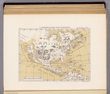
Author
[Hamel, P.W., Nell, Louis, Wheeler, G.M.]
Full Title
Map showing routes of the river and land parties engaged in exploring the Grand Canon of the Colorado. Under the command of 1st. Lieut. Geo. M. Wheeler, Corps of Engineers, U.S. Army. 1871. P.W. Hamel and L. Nell, topographers. Issued Feb. 4th 1878. The Graphic Co. Photo-Lith., 30 & 41 Park Place, N.Y. Weyss, Thompson & Lang del. By order of the Honorable the Secretary of War. Under the direction of Brig. Gen. A.A. Humphreys, Chief of Engineers, U.S. Army. (in upper margin:) United States Geographical Surveys West of the 100th Meridian. (1889)
List No
2220.025
Note
Lithographed map, sepia toned. Relief shown by hachures and spot heights. Shows drainage, roads, surveyors' routes & campsites, etc. Prime meridians: Washington and Greenwich.
Full Title
Horizontal sketch from Tallac Peak, Cal. Occupied Oct. 14, 1876 by Party No. 2, Cal. Section. Inst. No. 160, Wurdemann. Mountain stations. Form 1. Horizontal sketch. (U.S. Geographical Surveys West of the 100th Meridian. 1889)
List No
2220.026
Note
Black and white map. Relief shown by contours. Covers Tallac Peak, Devils Basin, Fallen Leaf Lake, Cascade Lake, Lake Gilmore, Emerald Bay, parts of Lake Tahoe, and Echo Lake, and surroundings. As pl. XXV in list of plates.
Full Title
Horizon sketch from Tallac Peak, Cal. Occupied Oct. 14, 1876 by Part No. 2, Cal. Section. Inst. No. 160, Wurdemann. Mountain stations. Form 2. Horizon sketch. (U.S. Geographical Surveys West of the 100th Meridian. 1889)
List No
2220.027
Note
Lithographed topographical view. Covers Lake Gilmore, Devils Basin and vicinity. "Scale: 1 inch to 4 degrees." As pl. XXVI in list of plates.
Full Title
Main-route and side meanders, and topographical stations (Tortolita and Nogal peaks region, New Mexico). Form 3. U.S. Geographical Surveys West of the 100th Meridian. (1889)
List No
2220.028
Note
Uncolored lithographed map. Relief shown by contours. As pl. XXVII in list of plates.
Author
Wheeler, G.M.
Full Title
Topography (Truckee-Donner Pass Region, California). Julius Bien, Lith. (1889)
List No
2220.029
Note
Lithographed map, sepia toned. Relief shown by contours (200 ft.) and spot heights. "Sample from plotting sheet." As pl. XXVIII in list of plates.
Author
[United States. Army. Corps of Engineers, Wheeler, G.M.]
Full Title
Sketch indicating the advancement of the surveys of the public lands and the military topographical and geographical surveys west of the Mississippi. Prepared under the direction of 1st. Lieut. Geo. M. Wheeler, Corps of Engineers U.S. Army. 1879. (1889)
List No
2220.030
Note
Color lithographed map. Relief shown by hachures and spot heights. Shows railroad surveys, Indian and military reservations, etc. Printed on 2 sheets, joined.
Author
[United States. Army. Corps of Engineers, Wheeler, G.M.]
Full Title
Sketch indicating a distribution of the territorial domain of the United States into districts favorable to the operations of parties prosecuting general government surveys. Prepared under the direction of 1st. Lieut. Geo. M. Wheeler, Corps of Engineers, U.S. Army. 1879. Originally devised January 1st 1875. U.S. Geographical Surveys West of the 100th Meridian. (1889)
List No
2220.031
Note
Color lithographed map. Shows states and territories, cities, forts, railroads, etc. Includes statistical tables and grid showing Wheeler survey map sheets.
Author
Benincasa, Andrea
Full Title
The island of Antilia by Benincasa, 1463. Reduced. Julius Bien, Photo-lith. U.S. Geographical Surveys West of the 100th Meridian. (1889)
List No
2220.032
Note
Color lithograph reproduction. As pl. XXIX in list of plates.
Author
Ptolemy, Claudius
Full Title
America from Ptolomaens, Edit: Romae, 1508. Reduced. Julius Bien, Photo-lith. U.S. Geographical Surveys West of the 100th Meridian. (1889)
List No
2220.033
Note
Color lithographed reproduction of part of world map of 1508 "Universalior cogniti Orbis Tabula ex recentibus confecta observationibus." Relief shown by pictorially. As pl. XXX in list of plates.
Author
[Ortelius, Abraham, Schoner, Johann]
Full Title
Maris Pacifici, quod vulgo Mar del Zur, cum regionibus circumiancentibus insulisque in eodem passim sparsis, novissima descriptio. From map of North America by Abrahamus Ortelius, 1589. Reduced. America from a globe in Frankfurt, about 1520. Reduced. Julius Bien, Photo-lith. U.S. Geographical Surveys West of the 100th Meridian. (1889)
List No
2220.034
Note
Color Lithograph reproductions of 2 maps on 1 sheet. Relief shown by hachures. As pl. XXXI in list of plates.
Author
Zaltieri, Bolognino
Full Title
North America by Zaltieri 1566. Reduced. Julius Bien, Photo-lith. U.S. Geographical Surveys West of the 100th Meridian. (1889)
List No
2220.035
Note
Color lithograph reproduction. Relief shown pictorially. As pl. XXXII in list of plates.
Author
[Hondius, Jodocus, 1563-1612, Mercator, Gerhard, Mercator, Michael]
Full Title
America sive India Nova, ad magnae Gerardi Mercatoris aui Universalis imitationem in compendium redacta. Per Michaelem Mercatorem Duysburgensem. From "Hondius" Ed. 1609 Amst. Reduced. U.S. Geographical Surveys West of the 100th Meridian. (1889)
List No
2220.036
Note
Lithograph reproduction. Relief shown pictorially. Includes 4 insets. As pl. XXXIII in list of plates.
Author
Briggs, Henry
Full Title
The north part of America ... R. Elstracke sculpsit. North America from Purchas, 1625. Reduced. Julius Bien, Photo-lith. U.S. Geographical Surveys West of the 100th Meridian. (1889)
List No
2220.037
Note
Color lithograph reproduction. From v. 3 of Purchas his pilgrimes, London, 1625. Shows California as an island. As pl. XXXIV in list of plates.
Author
Wit, Frederik de
Full Title
From a map of America by F. De Wit. Folio, Amsterdam, without date, about 1670. Julius Bien, Photo-lith. U.S. Geographical Surveys West of the 100th Meridian. (1889)
List No
2220.038
Note
Color lithograph reproduction. Relief shown pictorially. Shows California as an island. As pl. XXXV in list of plates.
Author
Senex, John
Full Title
From map of North America by John Senex, F.R.S. 1710. Reduced. Julius Bien, Photo-lith. U.S. Geographical Surveys West of the 100th Meridian. (1889)
List No
2220.039
Note
Color lithograph reproduction. Relief shown pictorially. Shows California as an island. As pl. XXXVI in list of plates.
Author
Wells, Edward
Full Title
From map of North America by Edward wells, M.A. 1722. Reduced. Julius Bien, Photo-lith. U.S. Geographical Surveys West of the 100th Meridian. (1889)
List No
2220.040
Note
Color lithograph reproduction. Relief shown pictorially. Shows California as an island. As pl. XXXVII in list of plates.
Author
Jefferys, Thomas
Full Title
From map of North America by Thomas Jefferys. 1782. Reduced. Julius Bien, Photo-lith. U.S. Geographical Surveys West of the 100th Meridian. (1889)
List No
2220.041
Note
Color lithograph reproduction. Relief shown pictorially. As pl. XXXVIII in list of plates.
Author
Wheeler, G.M.
Full Title
(Title Page to) Report upon United States Geographical Surveys West of the One Hundredth Meridian, in charge of Capt. Geo. M. Wheeler, Corps of Engineers, U.S. Army ... In seven volumes and one supplement, accompanied by one topographic and one geologic atlas. Vol. II--Astronomy and barometric hypsometry. Washington: Government Printing Office, 1877.
List No
2220E
Note
At heat of title: Engineer Department, U.S. Army.
Author
Wheeler, G.M.
Full Title
(Contents to) Report upon United States Geographical Surveys West of the One Hundredth Meridian, in charge of Capt. Geo. M. Wheeler, Corps of Engineers, U.S. Army ... In seven volumes and one supplement, accompanied by one topographic and one geologic atlas. Vol. II--Astronomy and barometric hypsometry. Washington: Government Printing Office, 1877.
List No
2220F
Note
List of plates.
Author
Wheeler, G.M.
Full Title
(Contents to) Report upon United States Geographical Surveys West of the One Hundredth Meridian, in charge of Capt. Geo. M. Wheeler, Corps of Engineers, U.S. Army ... In seven volumes and one supplement, accompanied by one topographic and one geologic atlas. Vol. II--Astronomy and barometric hypsometry. Washington: Government Printing Office, 1877.
List No
2220G
Note
List of plates (continued)
|