Who What Where WhenWHATShow MoreWHERE
|
Author
[Smith, George, Jefferys, Thomas]
Full Title
The Geography of the Great Solar Eclipse of July 14 MDCCXLVIII (1748). Exhibiting an accurate Map of all parts of the Earth in which it will be Visible, with the North Pole, according to the latest Discoverys By G. Smith Esqr. T. Jefferys sculp. Revised and Published according to Act of Parliament. Jan.1.1748, by E. Cave.
List No
13372.000
Author
Jefferys, Thomas
Full Title
Thomas Jefferys Engraver Geographer to His Royal Highness the Prince of Wales, at y Corner of St. Martins Lane near Charing Cross Sells great Variety of Prints English and Foreign by the most Celebrated Masters And all Sorts of Maps and Globes. Ant: Walker. Inv: del: et Sculpt. (trade card advertisement).
List No
4239A
Note
A rare advertisement for Jefferys' publications and products. The date is estimated. It is interesting that this does not emphasize the maps as much as the prints, reflecting the fact that he had a large business at this time as a general engraver. Apparently, he published this trade card to "mark his arrival in the Strand" (Harley, Imago Mundi XX), and to announce the opening of his new premises there. Card uncolored.
Author
Green, John, 1730-1753
Full Title
(Covers to) Remarks, in support of the new chart of North and South America : in six sheets. By J. Green. London : Printed for Thomas Jefferys MDCCLIII (1753).
List No
13402.001
Author
Green, John, 1730-1753
Full Title
(Title Page to) Remarks, in support of the new chart of North and South America : in six sheets. By J. Green. London : Printed for Thomas Jefferys MDCCLIII (1753).
List No
13402.002
Author
Green, John, 1730-1753
Full Title
(Text Page to) Remarks, in support of the new chart of North and South America : in six sheets. By J. Green. London : Printed for Thomas Jefferys MDCCLIII (1753).
List No
13402.003
Author
Green, John, 1730-1753
Full Title
(Text Page to) Remarks, in support of the new chart of North and South America : in six sheets. By J. Green. London : Printed for Thomas Jefferys MDCCLIII (1753).
List No
13402.004
Author
Green, John, 1730-1753
Full Title
(Text Page to) Remarks, in support of the new chart of North and South America : in six sheets. By J. Green. London : Printed for Thomas Jefferys MDCCLIII (1753).
List No
13402.005
Author
Green, John, 1730-1753
Full Title
(Text Page to) Remarks, in support of the new chart of North and South America : in six sheets. By J. Green. London : Printed for Thomas Jefferys MDCCLIII (1753).
List No
13402.006
Author
Green, John, 1730-1753
Full Title
(Text Page to) Remarks, in support of the new chart of North and South America : in six sheets. By J. Green. London : Printed for Thomas Jefferys MDCCLIII (1753).
List No
13402.007
Note
Continues Introduction. Text to Part I. North-America.
Author
Green, John, 1730-1753
Full Title
(Text Page to) Remarks, in support of the new chart of North and South America : in six sheets. By J. Green. London : Printed for Thomas Jefferys MDCCLIII (1753).
List No
13402.008
Note
Continues Part I. North-America. Second sheet
Author
Green, John, 1730-1753
Full Title
(Text Page to) Remarks, in support of the new chart of North and South America : in six sheets. By J. Green. London : Printed for Thomas Jefferys MDCCLIII (1753).
List No
13402.009
Note
Continues Part I. North-America. Second sheet
Author
Green, John, 1730-1753
Full Title
(Text Page to) Remarks, in support of the new chart of North and South America : in six sheets. By J. Green. London : Printed for Thomas Jefferys MDCCLIII (1753).
List No
13402.010
Note
Continues Part I. North-America. Second sheet
Author
Green, John, 1730-1753
Full Title
(Text Page to) Remarks, in support of the new chart of North and South America : in six sheets. By J. Green. London : Printed for Thomas Jefferys MDCCLIII (1753).
List No
13402.011
Note
Continues Part I. North-America. Second sheet. The fourth sheet.
Author
Green, John, 1730-1753
Full Title
(Text Page to) Remarks, in support of the new chart of North and South America : in six sheets. By J. Green. London : Printed for Thomas Jefferys MDCCLIII (1753).
List No
13402.012
Note
Continues Part I. North-America. The fourth sheet.
Author
Green, John, 1730-1753
Full Title
(Text Page to) Remarks, in support of the new chart of North and South America : in six sheets. By J. Green. London : Printed for Thomas Jefferys MDCCLIII (1753).
List No
13402.013
Note
Continues Part I. North-America. The fourth sheet.
Author
Green, John, 1730-1753
Full Title
(Text Page to) Remarks, in support of the new chart of North and South America : in six sheets. By J. Green. London : Printed for Thomas Jefferys MDCCLIII (1753).
List No
13402.014
Note
Continues Part I. North-America. The fourth sheet.
Author
Green, John, 1730-1753
Full Title
(Text Page to) Remarks, in support of the new chart of North and South America : in six sheets. By J. Green. London : Printed for Thomas Jefferys MDCCLIII (1753).
List No
13402.015
Note
Continues Part I. North-America. The third sheet.
Author
Green, John, 1730-1753
Full Title
(Text Page to) Remarks, in support of the new chart of North and South America : in six sheets. By J. Green. London : Printed for Thomas Jefferys MDCCLIII (1753).
List No
13402.016
Note
Continues Part I. North-America. The third sheet. The first sheet. The Island-part of North America.
Author
Green, John, 1730-1753
Full Title
(Text Page to) Remarks, in support of the new chart of North and South America : in six sheets. By J. Green. London : Printed for Thomas Jefferys MDCCLIII (1753).
List No
13402.017
Note
Continues Part I. North-America. The Island-part of North America.
Author
Green, John, 1730-1753
Full Title
(Text Page to) Remarks, in support of the new chart of North and South America : in six sheets. By J. Green. London : Printed for Thomas Jefferys MDCCLIII (1753).
List No
13402.018
Note
Part II. South-America. The sixth sheet. I. North Coast. II. East Coast.
Author
Green, John, 1730-1753
Full Title
(Text Page to) Remarks, in support of the new chart of North and South America : in six sheets. By J. Green. London : Printed for Thomas Jefferys MDCCLIII (1753).
List No
13402.019
Note
Continues: Part II. South-America. The sixth sheet. I. North Coast. II. East Coast.
Author
Green, John, 1730-1753
Full Title
(Text Page to) Remarks, in support of the new chart of North and South America : in six sheets. By J. Green. London : Printed for Thomas Jefferys MDCCLIII (1753).
List No
13402.020
Note
Continues) Part II. South-America. The sixth sheet. I. North Coast. II. East Coast.
Author
Green, John, 1730-1753
Full Title
(Text Page to) Remarks, in support of the new chart of North and South America : in six sheets. By J. Green. London : Printed for Thomas Jefferys MDCCLIII (1753).
List No
13402.021
Note
Continues) Part II. South-America. The sixth sheet. I. North Coast. II. East Coast.
Author
Green, John, 1730-1753
Full Title
(Text Page to) Remarks, in support of the new chart of North and South America : in six sheets. By J. Green. London : Printed for Thomas Jefferys MDCCLIII (1753).
List No
13402.022
Note
Continues) Part II. South-America. The sixth sheet. I. North Coast. II. East Coast.
Author
Green, John, 1730-1753
Full Title
(Text Page to) Remarks, in support of the new chart of North and South America : in six sheets. By J. Green. London : Printed for Thomas Jefferys MDCCLIII (1753).
List No
13402.023
Note
Continues) Part II. South-America. The sixth sheet. III. Islands in Southern-Ocean.
Author
Green, John, 1730-1753
Full Title
(Text Page to) Remarks, in support of the new chart of North and South America : in six sheets. By J. Green. London : Printed for Thomas Jefferys MDCCLIII (1753).
List No
13402.024
Note
Continues) Part II. South-America. The sixth sheet. West Coast of South America.
Author
Green, John, 1730-1753
Full Title
(Text Page to) Remarks, in support of the new chart of North and South America : in six sheets. By J. Green. London : Printed for Thomas Jefferys MDCCLIII (1753).
List No
13402.025
Note
Continues) Part II. South-America. West Coast of South America. The fifth sheet.
Author
Green, John, 1730-1753
Full Title
(Text Page to) Remarks, in support of the new chart of North and South America : in six sheets. By J. Green. London : Printed for Thomas Jefferys MDCCLIII (1753).
List No
13402.026
Note
Continues) Part II. South-America. The fifth sheet. Postscript.
Author
Green, John, 1730-1753
Full Title
(Text Page to) Remarks, in support of the new chart of North and South America : in six sheets. By J. Green. London : Printed for Thomas Jefferys MDCCLIII (1753).
List No
13402.027
Note
Continues) Postscript.
Author
Green, John, 1730-1753
Full Title
(Text Page to) Remarks, in support of the new chart of North and South America : in six sheets. By J. Green. London : Printed for Thomas Jefferys MDCCLIII (1753).
List No
13402.028
Note
Continues) Postscript. Includes Errata.
Author
[Green, John, d d. 1757, Jefferys, Thomas]
Full Title
(Covers to) A chart of North and South America including the Atlantic and Pacific Oceans, with the nearest coasts of Europe, Africa and Asia (by John Green]. Publish'd according to Act of Parliament Feb. 19, 1753, by T. Jefferys, Geographer to his Royal Highness the Prince of Wales at the Corner of St. Martins Lane Charing Cross ...
List No
4766A
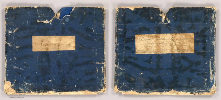
Note
Original blue slipcase with label: Bought of Thomas Jefferys Engraver ... Enclosed in a new half cloth blue marbled paper book-like case 36x31 with "Green And Jefferys. Chart of North and South America. 1753." See our 13402.000 for the 48 pages of descriptive text that were issued with the map, here bound separately.
Author
[Green, John, d d. 1757, Jefferys, Thomas]
Full Title
A chart of North and South America including the Atlantic and Pacific Oceans, with the nearest coasts of Europe, Africa and Asia (by John Green]. Publish'd according to Act of Parliament Feb. 19, 1753, by T. Jefferys, Geographer to his Royal Highness the Prince of Wales at the Corner of St. Martins Lane Charing Cross ...
List No
4766.001
Note
The 1st ed. of this map, here published as a complete chart of six sheets joined, dissected into 16 sections and folded into Jeffery's original case with a printed label: "Bought of Thomas Jefferys Engraver..." Both map and case are preserved in a new half cloth blue marbled paper book-like case 36x31 with "Green And Jefferys. Chart of North and South America. 1753." stamped in gilt on a leather label on the spine. "This is one of the most important American maps of the period, the first to label Behring's Straits, and the most accurate of the time in establishing more correct placements of the coasts of North and South America and Northeastern Asia. The map is extensively annotated by Green to show the differences of latitude and longitude between his placements on the map and other cartographers, notably Bellin, D'Anville, Brouckner, Popple, and especially DeLisle and Buache in their claims of new discoveries on the American Northwest coast. Jefferys also published Green's "Remarks, In Support of the New Chart of North and South America, in six sheets" which further detail Green's attack on DeLisle's cartography and French claims to the American Northwest. The six sheets of this map are also found bound individually with the text, as in Streeter 3453. Our copy has a printed paste down label in the lower corner of sheet six that explains the color code used to distinguish the different claims of the British, French, etc. Stevens & Tree list several later issues of this chart, including those that appear in Jeffery's American Atlas of 1775. Outline color. See our 13402.000 for the 48 pages of descriptive text that were issued with the map, here bound separately.
Author
Jefferys, Thomas
Full Title
A New and Accurate Map of the Kingdom of Ireland.
List No
12055.028
Author
Jefferys, Thomas
Full Title
(Covers to) The natural and civil history of the French dominions in North and South America. Giving a particular account of the climate, soil, minerals, animals, vegetables, manufactures, trade, commerce, and languages ... Illustrated by maps and plans of the principal places, collected from the best authorities, and engraved by T. Jefferys, Geographer to his Royal Highness the Prince of Wales. Part I. Containing a description of Canada and Louisiana. London, Printed for Thomas Jefferys at Charing-Cross. MDCCLX.
List No
4796A
Author
Jefferys, Thomas
Full Title
(Title Page to) The natural and civil history of the French dominions in North and South America. Giving a particular account of the climate, soil, minerals, animals, vegetables, manufactures, trade, commerce, and languages ... Illustrated by maps and plans of the principal places, collected from the best authorities, and engraved by T. Jefferys, Geographer to his Royal Highness the Prince of Wales. Part I. Containing a description of Canada and Louisiana. London, Printed for Thomas Jefferys at Charing-Cross. MDCCLX.
List No
4796B
Note
Printed in red and black.
Author
Jefferys, Thomas
Full Title
A map of Canada and the north part of Louisiana with the adjacent countrys. By Thos. Jefferys, Geographer to His Royal Highness the Prince of Wales. T. Jefferys sculp. (1760)
List No
4796.001
Note
Engraved map. Relief shown pictorially. Shows Indian tribes, fishing banks, etc. Includes descriptive notes. Prime meridian: Ferro.
Author
Jefferys, Thomas
Full Title
A plan of the city of Quebec, the capital of Canada, as it surrendered 18 Septembr. 1759 to the British fleet and army commanded by Vice Adml. Saunders & Brigadr. Genl. Townshend. Published according to act of Parliament Janry. 15, 1760 by Thos. Jefferys at Charing Cross. Price 2 s.
List No
4796.002
Note
Engraved map. Relief shown by hachures. Shows buildings, fortifications, "St. Laurence or the Great River called by the Indians Hoshelaga or Canada River," etc. Oriented with north toward upper right.
Author
Jefferys, Thomas
Full Title
Plan of the town and fortifications of Montreal or Ville Marie in Canada. Published by Thos. Jefferys, Geographer to His Royal Highness the Prince of Wales at Charing Cross, Jan 30, 1758. Price 2s. (1760)
List No
4796.003
Note
Engraved map. Shows buildings, fields, etc. Oriented with north toward upper right.
Author
[Jefferys, Thomas, Holland, Samuel, 1728-1801]
Full Title
A new map of Nova Scotia and Cape Britain, with the adjacent parts of New England and Canada, composed from a great number of actual surveys, and other materials regulated by many new astronomical observations of the longitude as well as latitude; with an explanation. 1755 published according to Act of Parliament by Thos. Jefferys, Geographer to His Royal Highness the Prince of Wales at the corner of St. Martins Lane, Charing Cross, London. (1760)
List No
4796.004
Note
Engraved map. Borders hand col. Relief shown pictorially. Shows Indian tribes, fishing banks, roads with distances, etc. Prime meridian: Ferro.
Author
[Gridley, Richard, Jefferys, Thomas]
Full Title
A plan of the city and fortifications of Louisburg; from a survey made by Richard Gridley, Lieut. Coll. of the Train of Artillery in 1745. ... A plan of the city and harbour of Louisburg with the French batteries that defended it and those of the English, shewing that part of Gabarus Bay in which they landed, and the ground on which they encamped during the siege in 1758. (with) A map of Gabarus Bay, adjoining Louisburg. Published by Thos. Jefferys, Geographer to the Prince of Wales at Charing Cross, Octobr. 9, 1758. Price 2s.
List No
4796.005
Note
Two engraved maps on 1 sheet, with inset. Relief shown by hachures; depths by soundings. City plan shows buildings, etc. Includes profile. "Harbour" map at (ca. 1:21,000) scale; Gabarus Bay map at (ca. 1:150,000) scale.
Author
[Gridley, Richard, Jefferys, Thomas]
Full Title
An authentic plan of the River St. Laurence from Sillery to the Fall of Montmorenci, with the operations of the Siege of Quebec under the command of Vice-Adml. Saunders & Major Genl. Wolfe down to the 5. Septr. 1759. Drawn by a captain in his majesties navy. (with) A view of the action gained by the English Sepr. 13, 1759 near Quebec, brought from thence by an officer of distinction. (with) Part of the upper river of St. Laurence.
List No
4796.006
Note
Engraved map with 2 insets. Relief shown by hachures. Oriented with north toward upper right. Includes dedication to William Pitt.
Author
[Anville, Jean Baptiste Bourguignon d, 1697-1782, Jefferys, Thomas]
Full Title
North America from the French of Mr. d'Anville, improved with the back settlements of Virginia and course of Ohio. Illustrated with geographical and historical remarks. 1755 published according to Act by Thos. Jefferys Geographer to His Royal Highness the Prince of Wales near Charing Cross. (1760)
List No
4796.007
Note
Engraved map. Relief shown pictorially. Shows Indian tribes, etc. Prime meridians: Ferro and London.
Author
[Brion de la Tour, Louis, Jefferys, Thomas]
Full Title
Plan of New Orleans the capital of Louisiana; with the disposition of its quarters and canals as they have been traced by Mr. de la Tour in the year 1720. (with) The course of Mississipi River from Bayagoulas to the sea. (with) The east mouth of the Mississipi, with the plan of Fort la Balise which defends the entrance and channel of that river. Nov: 1759, published according to Act of Parliament by T. Jefferys at Charing Cross. Price 2 s.
List No
4796.008
Note
Engraved map with 2 insets. Shows buildings, gardens, lots, magazines, vegetated areas, etc. Scales of inset maps (ca. 1:800,000) and (ca. 1:40,000).
Author
Jefferys, Thomas
Full Title
The West Indies exhibiting the English, French, Spanish, Dutch & Danish settlements. Collected from the best authorities by Thomas Jefferys, Geographer to His Royal Highness the Prince of Wales. Published according to the Act by Thos. Jefferys, Geographer to His Royal Highness the Prince of Wales near Charing Cross. (1760)
List No
4796.009
Note
Engraved map. Relief shown pictorially. Includes illustrated cartouche. Prime meridians: Ferro and London.
Author
Jefferys, Thomas
Full Title
The island of Hispaniola called by the French St. Domingo. Subject to France & Spain, from the best authorities by Thomas Jefferys, Geographer to His Royal Highness the Prince of Wales. T. Jefferys sculp. (1760)
List No
4796.010
Note
Engraved map. Relief shown pictorially.
Author
Jefferys, Thomas
Full Title
An authentic plan of the town and harbour of Cap Francois in the isle of St. Domingo. By Thomas Jefferys, Geographer to His Royal Highness, the Prince of Wales. (1760)
List No
4796.011
Note
Engraved map. Relief shown by hachures; depths by soundings. Oriented with north toward right.
Author
Jefferys, Thomas
Full Title
Guadaloupe, one of the Caribbee islands subject to France in the West Indies, from the best authorities by T. Jefferys. Published by T. Jefferys at Charing Cross. (1760)
List No
4796.012
Note
Engraved map. Relief shown pictorially and by hachures. Ornamental cartouche. Prime meridian: Ferro.
Author
Jefferys, Thomas
Full Title
Plan of the town of Basse Terre, the capital of Guadaloupe from an authentic survey. Published by Thos. Jefferys Geographer to his Royal Highness the Prince of Wales, near Charing Cross, London. T. Jefferys sculp. (1760)
List No
4796.013
Note
Engraved map. Relief shown by hachures. Shows buildings, fortifications, fields, etc. Oriented with north toward upper left.
Author
[Houel, Jean Pierre Louis Laurent, 1735-1813, Jefferys, Thomas]
Full Title
Martinico, one of the Caribbee Islands, in the West Indies; subject to the French, according to the observations of Mr. Houel, Engineer. By Thos. Jefferys, Geographer to His Royal Highness the Prince. Published by Thos. Jefferys near Charing Cross, London.
List No
4796.014
Note
Engraved map. Relief shown by hachures; depths by soundings. Shows habitation or plantations, sugar works, oxen and water mills, observations points, etc. Prime meridian: Ferro.
Author
Caylus, Anne Claude Philippe, comte de, 1692-1765
Full Title
Plan of the town and citadel of Fort Royal the capital of Martinico with the bay of Cul de Sac Royal. By Mr. de Caylus, Engineer General of the French Islands. (1760)
List No
4796.015
Note
Engraved map. Relief shown by hachures; depths by soundings. Includes inset map.
|