COLLECTION NAME:
David Rumsey Historical Map Collection
Record
Author:
Tanner, Henry S.
Date:
1849
Short Title:
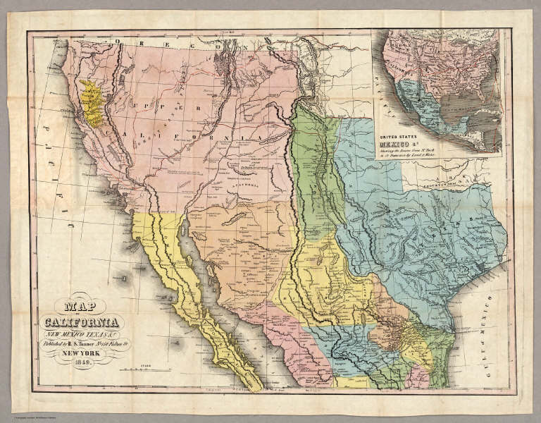
Map of California New Mexico Texas &c.
Publisher:
H.S. Tanner
Publisher Location:
Philadelphia
Type:
Pocket Map
Obj Height cm:
42
Obj Width cm:
56
Scale 1:
5,300,000
Note:
This is taken from Tanner's Map of the United States of Mexico, with the addition of the California Gold Regions colored in yellow, and an added inset map of "United States, Mexico &c. Shewing the Routes from N. York to St. Francisco by Land & Water." The map has been updated to show Fremont's route across the Great Basin and the "Boundary of 1848" with Mexico. The 14x9 cover entitled "Tanner's Travelling Map of California & c has on the inside front a "Table of Routes from New-York to California, with the Modes of Conveyance, Distances, Time and Fares." This is a very late map for Tanner, still printed from engraved plates (although the impression looks a bit tired), in the next to last year of his publishing career. He died in Brooklyn in 1858.
Reference:
Wheat 647; Wheat Gold 128.
State/Province:
California
State/Province:
New Mexico
State/Province:
Texas
Event:
California Gold Rush
Full Title:
Map of California New Mexico Texas &c. Published by H.S. Tanner No. 156 Fulton St. New York 1849.
List No:
4073.001
Series No:
2
Publication Author:
Tanner, Henry S.
Pub Date:
1849
Pub Title:
Map of California New Mexico Texas &c. Published by H.S. Tanner No. 156 Fulton St. New York 1849.
Pub Reference:
Wheat 647; Wheat Gold 128.
Pub Note:
See note field above.
Pub List No:
4073.000
Pub Type:
Pocket Map
Pub Maps:
1
Pub Height cm:
14
Pub Width cm:
9
Image No:
4073001
Authors:
Tanner, Henry S.
Collection:
Rumsey Collection
