COLLECTION NAME:
David Rumsey Historical Map Collection
Record
Author:
U.S. War Department, Topographical Engineers
Date:
1862
Short Title:
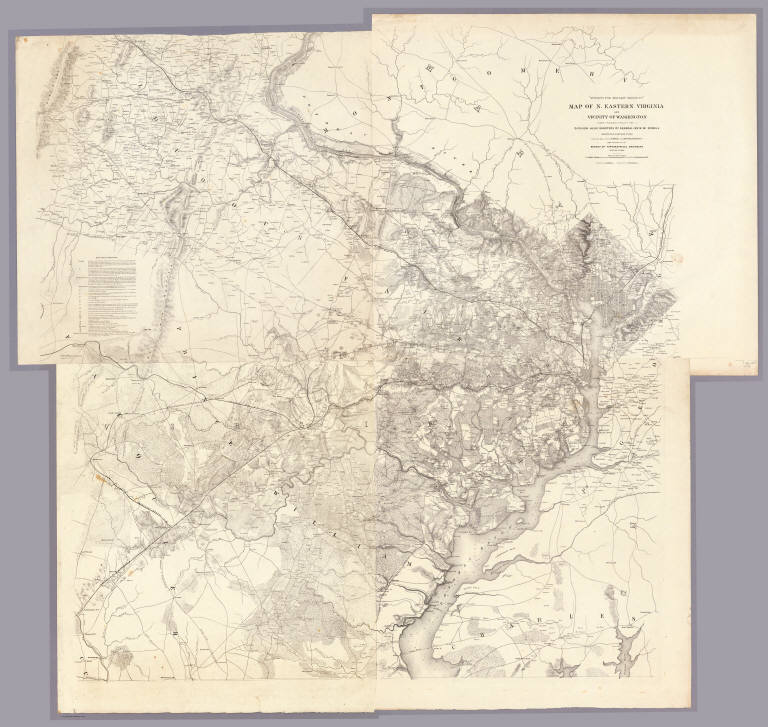
Map Of N. Eastern Virginia And Vicinity Of Washington
Publisher:
J. Schedler
Publisher Location:
New York
Type:
Separate Map
Obj Height cm:
132
Obj Width cm:
131
Scale 1:
63,360
Note:
Second edition. Four separate sheets. Very accurate and dense map showing the country around and west of Washington, which was the first detailed map of Northern Virginia for use in the Civil War. The first edition appeared in January of 1862 (Stephenson 466) and extended further south to include Fredericksburg; this second edition extends south to Morrisburg. "Data Used in Compilation" appears in the upper left sheet and shows Surveys, Reconnaissances, Informations, Maps, Manuscripts, and Additions and Corrections. The first edition is plate 7:1, 8:1 in the "Atlas to Accompany..." Illustrated in Stephenson.
Reference:
Stephenson 470. Cowell Collection.
State/Province:
District of Columbia
State/Province:
Virginia
County:
Fairfax County (Va.)
County:
Loudoun County (Va.)
City:
Washington (D.C.)
Region:
North Eastern Virginia
Region:
Potomac River
Event:
U.S. Civil War
Subject:
Military
Full Title:
"Surveys For Military Defences" Map Of N. Eastern Virginia And Vicinity Of Washington compiled in Topographical Engineers Office at Division Head Quarters Of General Irvin McDowell Arlington, January 1th 1862 corrected from recent Surveys and Reconnaissances under the direction of the Bureau Of Topographical Engineers August 1st 1862. Drawn By J.J. Young, W. Hesselbach. Engr. On Stone By J. Schedler, No. 120 Pearl St. N.Y. ...
List No:
3859.000
Series No:
1
Engraver or Printer:
Hesselbach, W.
Engraver or Printer:
Young, J.J.
Publication Author:
U.S. War Department, Topographical Engineers
Pub Date:
1862
Pub Title:
"Surveys For Military Defences" Map Of N. Eastern Virginia And Vicinity Of Washington compiled in Topographical Engineers Office at Division Head Quarters Of General Irvin McDowell Arlington, January 1th 1862 corrected from recent Surveys and Reconnaissances under the direction of the Bureau Of Topographical Engineers August 1st 1862. Drawn By J.J. Young, W. Hesselbach. Engr. On Stone By J. Schedler, No. 120 Pearl St. N.Y. ...
Pub Reference:
Stephenson 470. Cowell Collection.
Pub Note:
See note field above.
Pub List No:
3859.000
Pub Type:
Separate Map
Pub Maps:
1
Pub Height cm:
132
Pub Width cm:
131
Image No:
3859000
Authors:
U.S. War Department, Topographical Engineers
Collection:
Rumsey Collection
