COLLECTION NAME:
David Rumsey Historical Map Collection
Record
Author:
Johnston, Alexander Keith, 1804-1871
Date:
1854
Short Title:
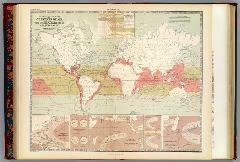
Currents of air.
Publisher:
William Blackwood & Sons
Publisher Location:
Edinburgh
Type:
Atlas Map
Obj Height cm:
53
Obj Width cm:
62
Scale 1:
70,000,000
Note:
Col. lithographed map. Inset maps: Limits of the trade winds & calms in the Atlantic Ocean between longitude 200E & 800W as determined by the wind & current charts of Lieut. Maury, U.S.N. -- The stormy regions of the West Indies showing the tracks of various hurricanes -- Tracks of the Madras Storm, 1842 and the Rodriguez Hurricane, 1843, from observations by Mr. Piddington & Mr. Thom -- Chart of the Culloden's Hurricane, 1809 and the Boyne's Gale, 1835 by Lieut. Col. W. Reid, R.E. Inset illustrations: Barometrical compass -- Thermometrical compass -- Hurricanes of the N. Hemisphere -- Hurricanes of the S. Hemisphere. "Meteorology no. 2."
World Area:
Indian Ocean
World Area:
World
Subject:
Climate
Full Title:
Geographical distribution of the currents of air, showing the regions of the trade winds, variable winds and hurricanes, with their effects in determining the different tracks of navigation by A.K. Johnston, F.R.S.E. Engraved & printed in colours by W. & A.K. Johnston, Edinburgh. William Blackwood & Sons, Edinburgh & London. 1st. March 1854. (1856)
List No:
0372.020
Page No:
Pl. 19
Series No:
74
Engraver or Printer:
Maury, Matthew Fontaine, 1806-1873
Engraver or Printer:
Piddington, Henry, 1797-1858
Engraver or Printer:
Reid, William, 1791-1858
Engraver or Printer:
Thom, Alexander, surgeon
Engraver or Printer:
W. & A.K. Johnston Limited
Publication Author:
Johnston, Alexander Keith, 1804-1871
Pub Date:
1856
Pub Title:
The physical atlas of natural phenomena by Alexander Keith Johnston, F.R.S.E., F.R.G.S., F.G.S. ... A new and enlarged edition. William Blackwood and Sons, Edinburgh and London, MDCCCLVI. [The Author reserves the right of translation]
Pub Reference:
Phillips, 229.
Pub Note:
2nd ed., enlarged. 1st ed. was 1848. Most of the maps are lithographed in color, but some are still engraved. The 1848 ed. was entirely engraved. Maps have both hand and printed color. Covers are half red leather dark teal cloth covered boards with "Atlas." embossed on the spine in gold .
Pub List No:
0372.000
Pub Type:
Physical Atlas
Pub Maps:
38
Pub Height cm:
59
Pub Width cm:
40
Image No:
0372020
Authors:
Johnston, Alexander Keith, 1804-1871
Collection:
Rumsey Collection
