COLLECTION NAME:
David Rumsey Historical Map Collection
Record
Author:
Arrowsmith, Aaron
Author:
Humboldt, Alexander von, 1769-1859
Date:
1810
Short Title:
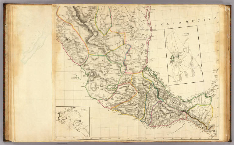
Mexico 2.
Publisher:
A. Arrowsmith
Publisher Location:
London
Type:
Atlas Map
Obj Height cm:
65
Obj Width cm:
79
Scale 1:
2,500,000
Note:
Engraved map. Outline hand col. Relief shown by hachures. Sheet 2 of 4. Shows settlements, roads, Indian tribes, rivers, etc.
Reference:
Phillips. Maps of America, p. 408; Wheat, C.I. Mapping the transmississippi West, 295; Taliaferro, H.G. Cartographic sources in the Rosenberg Library, 202; Catalogue of maps of Hispanic America, v. 1, p. 85; Torres Lanzas, P. Relacion descriptiva de los mapas, planos, & de Mexico y Floridas, 500; Mayer, R.L. Mexico illustrado, p. 235, 32; Streeter Texas 1046A.
Country:
Mexico
Subject:
Indians
Full Title:
(A new map of Mexico and adjacent provinces compiled from original documents by A. Arrowsmith, 1810. Sheet 2). (with) Veracruz. (with) Acapulco. London, Published 5th October 1810 by A. Arrowsmith, 10 Soho Square. (Engraved by E. Jones)
List No:
5699.011
Page No:
IX
Series No:
14
Engraver or Printer:
Jones, Edward
Publication Author:
Alcedo, Antonio de, 1735-1812
Publication Author:
Arrowsmith, Aaron
Publication Author:
Thompson, George Alexander
Pub Date:
1819
Pub Title:
Atlas to Thompson's Alcedo; or dictionary of America & West Indies; collated with all the most recent authorities, and composed chiefly from scarce and original documents, for that work, by A. Arrowsmith, Hydrographer to His Royal Highness the Prince Regent. London: Printed by George Smeeton, Great Saint Martin's Lane, Charing Cross. 1819.
Pub Reference:
Cf. Phillips, 1174 (1816-(1817) ed.); NMM, 292 (1816 ed.); Phillips. Maps of America, p. 112 (1816 ed.)
Pub Note:
See note field above.
Pub List No:
5699.000
Pub Type:
Regional Atlas
Pub Maps:
19
Pub Height cm:
67
Pub Width cm:
55
Image No:
5699011
Authors:
Arrowsmith, Aaron; Humboldt, Alexander von, 1769-1859
Collection:
Rumsey Collection
