COLLECTION NAME:
David Rumsey Historical Map Collection
Record
Author:
Geographisches Institut (Weimar, Germany)
Author:
Graef, C.
Date:
1879
Short Title:
Eastern United States.
Publisher:
Weimar Geographisches Institut
Publisher Location:
Weimar
Type:
Atlas Map
Obj Height cm:
64
Obj Width cm:
58
Scale 1:
4,500,000
Reference:
Espenhorst 1.1.6 48th edition.
Country:
United States
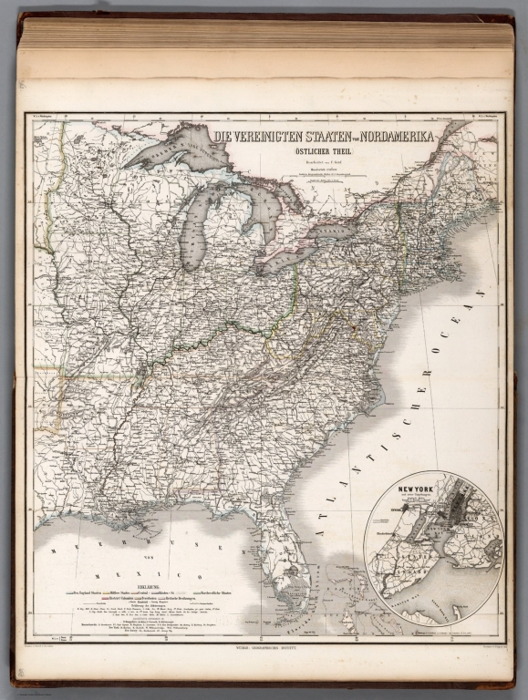
Full Title:
Die Vereinigten Staaten von Nordamerica Oestlicher Theil. (United States, Eastern Sheet.) (inset) New York (City).
List No:
9678.069
Page No:
62
Series No:
69
Engraver or Printer:
Th. Luther
Engraver or Printer:
C. Poppey jun.
Publication Author:
Geographisches Institut (Weimar, Germany)
Pub Date:
1879
Pub Title:
Grosser Hand-Atlas des Himmels und der Erde. (Great Hand-Atlas of Heaven and Earth.) Weimar. Geographisches Institut. Thueringen. 48te Auflage. 72 Blatt in Kupfestich, mit Farbendruck und Colorit. 1879. Bearbeitet von H. Kiepert, C.F. Weiland, C.u.A. Graef, C. Bruhns, O. Delitsch. Redaction: Arnd.
Pub Note:
Color. Maps often show countries color-coded to indicate the colonizing European country. Relief in hachures.
Pub List No:
9678.000
Pub Type:
World Atlas
Pub Maps:
67
Pub Height cm:
60
Pub Width cm:
38
Image No:
9678069.jp2
Authors:
Geographisches Institut (Weimar, Germany); Graef, C.