COLLECTION NAME:
David Rumsey Historical Map Collection
Record
Author:
Blaeu, Willem Janszoon, 1571-1638
Date:
1630
Short Title:
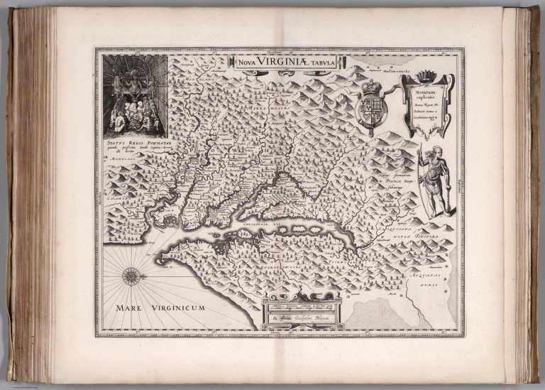
Nova Virginia Tabula.
Publisher:
Willem Janszoon Blaeu
Publisher Location:
Amsterdam
Type:
Chart Map
Obj Height cm:
38
Obj Width cm:
49
Note:
North to the right.
Reference:
Koeman Bl 1.
State/Province:
Maryland
State/Province:
Virginia
State/Province:
Delaware
Region:
Chesapeake Bay (Maryland)
Full Title:
Nova Virginia Tabula.
List No:
12202.059
Series No:
59
Publication Author:
Blaeu, Willem Janszoon, 1571-1638
Pub Date:
1630
Pub Title:
Atlantis Appendix, sive pars Altera, continens Tab: Geographicas diversarum Orbis regionum, nunc primum editas. Amsterdami, Apud Guiljelmum Blaeuw. Anno (1630).
Pub Note:
This is Willem Blaeu's first world atlas, without text on the versos of the maps. Koeman identifies 5 copies. Most of these copies have 60 maps - our copy has an additional 7 maps. The collation of all the copies identified varies considerably. Our copy does not include a map or maps of France which may indicate that it is a very early example. 37 of the maps have been printed from plates acquired from Jodocus Hondius II, substituting Willem Blaeu's name as maker. All of the plates are very strong impressions, indicating early states of all the maps. A second edition of the Appendix was published in 1631 in two states, one with 98 maps and the other with 99 maps arranged in different order (Koeman). Uncolored.
Pub List No:
12202.000
Pub Type:
World Atlas
Pub Maps:
67
Pub Height cm:
50
Pub Width cm:
34
Image No:
12202059.jp2
Authors:
Blaeu, Willem Janszoon, 1571-1638;
