COLLECTION NAME:
David Rumsey Historical Map Collection
Record
Author:
Varle, Charles P.
Date:
1832
Short Title:
United States.
Publisher:
R. Stebbins & Co.
Publisher Location:
New York
Type:
Wall Map
Obj Height cm:
110
Obj Width cm:
144
Scale 1:
1,900,800
Note:
With black top and bottom sticks, mounted on linen. Outline color on main and inset maps. Physical sections differ in scale.
Country:
United States
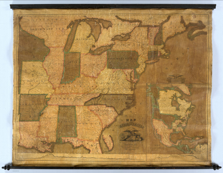
Full Title:
Map of the United States By Chas. Varle, Engineer and Geographer. New York, 1832. Revised and Republished by R. Stebbins & Co. (with) inset Map of North America. (with) inset map of South Part of Florida. (with) inset Physical Sections from "Washington City to Wheeling and from thence to the mouth of Columbia river" and from the "Pacific Ocean to the Gulf of Mexico."
List No:
5468.000
Publication Author:
Varle, Charles P.
Pub Date:
1832
Pub Title:
Map of the United States By Chas. Varle, Engineer and Geographer. New York, 1832. Revised and Republished by R. Stebbins & Co. (with) inset Map of North America. (with) inset map of South Part of Florida. (with) inset Physical Sections from "Washington City to Wheeling and from thence to the mouth of Columbia river" and from the "Pacific Ocean to the Gulf of Mexico."
Pub Note:
See note field above.
Pub List No:
5468.000
Pub Type:
Wall Map
Pub Height cm:
110
Pub Width cm:
144
Image No:
5468000
Authors:
Varle, Charles P.