COLLECTION NAME:
David Rumsey Historical Map Collection
Record
Author:
Carleton, Osgood
Date:
1806
Short Title:
A New Map of the United States.
Publisher:
John Sullivan Junr.
Publisher Location:
Boston
Type:
Wall Map
Obj Height cm:
120
Obj Width cm:
139
Scale 1:
1,520,640
Note:
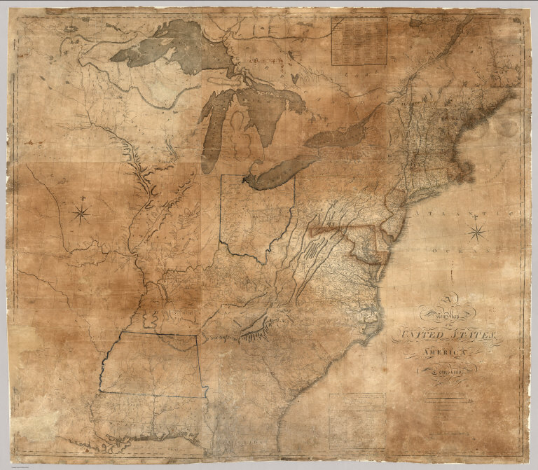
Osgood Carleton first published a map of the United States in 1791. Another edition appeared in 1797, and then this edition in 1806. This issue is a major redrawing of the 1791 and 1797 maps, and it borrows heavily from Arrowsmith's Map of the United States, 1802 (see our list no. 5699.009, from Thompson's Alcedo Atlas, our 5699.000) especially in the west. But Carleton uses other sources as well, including Bradley's postal map. There was another issue of this map, undated, and updated to some unknown period, perhaps after 1810 or even later (Chris Lane, Philadelphia Print Shop).
Reference:
Karrow 1-1398; Ristow pp 68-70.
Country:
United States
Full Title:
A New Map of the United States, of America Including part of Louisiana. Drawn from the latest Authorities. Revised and corrected by Osgood Carleton Esq. Teacher of Mathematics, Boston. Boston, Published and Sold by John Sullivan, Junr. 1806.
List No:
5801.000
Publication Author:
Carleton, Osgood
Pub Date:
1806
Pub Title:
A New Map of the United States, of America Including part of Louisiana. Drawn from the latest Authorities. Revised and corrected by Osgood Carleton Esq. Teacher of Mathematics, Boston. Boston, Published and Sold by John Sullivan, Junr. 1806.
Pub Reference:
Karrow 1-1398; Ristow pp 68-70.
Pub Note:
See note field above.
Pub List No:
5801.000
Pub Type:
Wall Map
Pub Height cm:
120
Pub Width cm:
139
Image No:
5801000
Authors:
Carleton, Osgood