COLLECTION NAME:
David Rumsey Historical Map Collection
Record
Author:
Alaskan Boundary Tribunal
Date:
1802
Short Title:
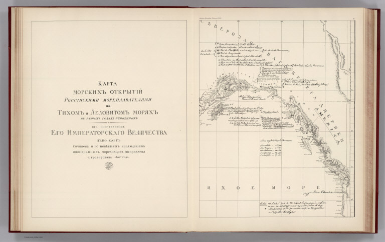
Facsimile: Russian Explorations of Pacific and Icy Seas (portion).
Publisher:
Government Printing Office
Publisher Location:
Washington
Type:
Atlas Map
Obj Height cm:
44
Obj Width cm:
70
Scale 1:
6,400,000
Note:
In Russian. Relief shown by sketches.
Reference:
P1452.
Country:
Canada
Country:
United States
State/Province:
Alaska
State/Province:
British Columbia
Subject:
Boundaries
Full Title:
(Facsimile) Russian Explorations of Pacific and Icy Seas (portion). Alaskan Boundary Tribunal, 1903. 6. Photo. Lith. by A. Hoen & Co. Baltimore, MD.
List No:
0009.049
Page No:
6
Series No:
49
Engraver or Printer:
A. Hoen & Co.
Engraver or Printer:
(U.S.) Government Printing Office
Publication Author:
Alaskan Boundary Tribunal
Pub Date:
1904
Pub Title:
(British Atlas,U.S. Atlas, Atlas of Award). Alaskan Boundary Tribunal. United States Atlas. Maps And Charts Accompanying The Case And Counter Case Of The United States. Washington, Government Printing Office, 1904 ... British Atlas. Maps And Charts Accompanying The Case Of Great Britain. U.S. Atlas. ... Atlas Of Award. Twenty-Five Sectional Maps And Index Map Showing The Line Fixed By The Tribunal ...
Pub Reference:
P1452.
Pub Note:
Three volumes, with excellent facsimiles of historic maps that support the sides in the dispute. With printed color. "Many of these maps have been reduced in scale to bring them within the limits of this atlas." Many maps also only show the portion of the original applicable to the Alaska/Canada boundary.
Pub List No:
0009.000
Pub Type:
Historical Atlas
Pub Maps:
108
Pub Height cm:
49
Pub Width cm:
40
Image No:
0009049
Authors:
Alaskan Boundary Tribunal
