COLLECTION NAME:
David Rumsey Historical Map Collection
Record
Author:
The Geological Society of America
Author:
Flint, Richard F.
Date:
1959
Short Title:
United States: East of the Rocky Mountains -- Glacial Deposits
Publisher:
The Geological Society of America
Publisher Location:
New York
Type:
Wall Map
Obj Height cm:
88
Obj Width cm:
204
Scale 1:
1,750,000
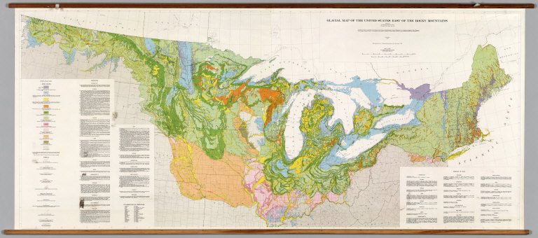
Note:
Suitable for use in a standard classroom; viewable up to 40 feet. Language(s): English. Map is paper on muslin. Mounted on wood rods. Prime Meridian is Greenwich. Projection is Lambert's conformal conic. Length of rolled wall map is 214 cm. Topics include: Pleistocene glaciation, soils associated w/ individual glacial events, internal political boundaries. Department of Geography, University of California at Berkeley, Call Number 600-B-6.
Reference:
UC Berkeley, Geography Department Call Number 600-B-6.
Country:
United States
Region:
Northern United States
Region:
Great Lakes
Subject:
Geology
Full Title:
Glacial Map of the United States East of the Rocky Mountains.
List No:
7132.000
Series No:
1
Publication Author:
The Geological Society of America
Publication Author:
Flint, Richard F.
Pub Date:
1959
Pub Title:
Glacial Map of the United States East of the Rocky Mountains.
Pub Reference:
UCBGEOG1
Pub Note:
See Note field above.
Pub List No:
7132.000
Pub Type:
Wall Map
Pub Maps:
1
Pub Height cm:
88
Pub Width cm:
204
Image No:
7132000
Authors:
Flint, Richard F.; The Geological Society of America