COLLECTION NAME:
David Rumsey Historical Map Collection
Record
Author:
California Division of Highways
Date:
1935
Short Title:
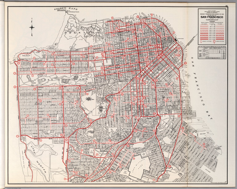
City and County of San Francisco.
Publisher:
California Division of Highways
Publisher Location:
Sacramento
Type:
Atlas Map
Obj Height cm:
60
Obj Width cm:
74
Scale 1:
21,176
Reference:
Atlas obtained from the Institute of Transportation Studies Library (Harmer E. Davis Transportation Library) at the University of California, Berkeley.
County:
San Francisco County (Calif.)
City:
San Francisco (Calif.)
Subject:
Transportation
Subject:
Roads
Full Title:
City and County of San Francisco.
List No:
6345.060
Page No:
38
Series No:
60
Engraver or Printer:
California State Printing Office
Publication Author:
California Division of Highways
Pub Date:
1935
Pub Title:
California Highway Transportation Survey, 1934.
Pub Reference:
Atlas obtained from the Institute of Transportation Studies Library (Harmer E. Davis Transportation Library) at the University of California, Berkeley.
Pub Note:
Primary report of 130 pages softbound but in rigid library binding, 29x24 cm. Appendix B in same format. Appendix B is Tabulation of Field Count by Cities and Counties. Atlas issued as Appendix A, softbound, 61x63 cm. Base maps copyright by Rand McNally & Company under title Complete Map of California.
Pub List No:
6345.000
Pub Type:
State Atlas
Pub Maps:
63
Pub Height cm:
61
Pub Width cm:
63
Image No:
6345060
Authors:
California Division of Highways
City and County of San Francisco.