COLLECTION NAME:
David Rumsey Historical Map Collection
Record
Author:
Faden, William, 1750?-1836
Author:
Roberts, Henry, Lieut.
Date:
1811
Short Title:
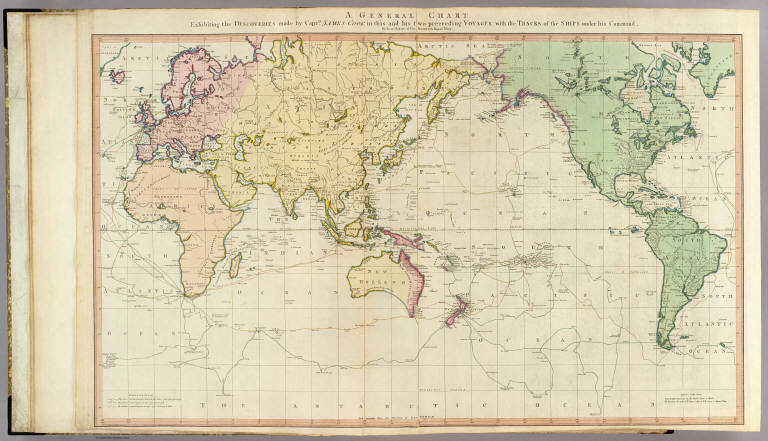
General chart.
Publisher:
William Faden
Publisher Location:
London
Type:
Atlas Map
Obj Height cm:
58
Obj Width cm:
91
Scale 1:
45,000,000
Note:
One map on 2 sheets. Full hand col. Shows tracks of the Endeavour and Resolution, 1768-1780. "5" on verso. David Rumsey Collection copy mounted as 1 sheet.
Reference:
Tooley, R.V. The mapping of Australia and Antarctica, 2nd. ed., p. 75, no. 560.
World Area:
World
Subject:
Historical
Full Title:
A general chart exhibiting the discoveries made by Captn. James Cook in this and his two preceeding voyages; with the tracks of the ships under his command, by Lieutt. Roberts of His Majesty's Royal Navy. (London, published by W. Faden, 1811)
List No:
2104.005
Page No:
5
Series No:
7
Publication Author:
Faden, William, 1750?-1836
Pub Date:
1811
Pub Title:
(General atlas. 1811)
Pub Reference:
Cf Phillips 6010, 6013, 6047.
Pub Note:
See note field above.
Pub List No:
2104.000
Pub Type:
World Atlas
Pub Maps:
56
Pub Height cm:
60
Pub Width cm:
47
Image No:
2104005
Authors:
Faden, William, 1750?-1836; Roberts, Henry, Lieut.
Collection:
Rumsey Collection
