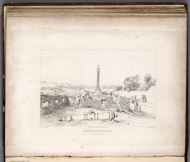
Detail View: David Rumsey Historical Map Collection: View: Londonderry from the S.W. Bastion.
|
Author:
|
Colby, Thomas
|
|
Date:
|
1837
|
|
Short Title:
|
View: Londonderry from the S.W. Bastion.
|
|
Publisher:
|
Hodges and Smith
|
|
Publisher Location:
|
Dublin
|
|
Type:
|
View
|
|
Obj Height cm:
|
21
|
|
Obj Width cm:
|
28
|
|
Full Title:
|
(View) Londonderry from the S.W. Bastion. Ordnance Survey Office. Drawn by G. Petric Esqr. from a Sketch by Lt. Dawson, R.E. Engraved by J. Duncan.
|
|
List No:
|
7853.015
|
|
Page No:
|
(118A)
|
|
Series No:
|
15
|
|
Publication Author:
|
Colby, Thomas
|
|
Pub Date:
|
1837
|
|
Pub Title:
|
Ordnance Survey of the County of Londonderry. Colonel Colby, R.E., F.R.S.L. and E., M.R.I.A., etc. Superintendent. Volume the First. Dublin: Published for Her Majesty's Government. Hodges and Smith. Dublin. 1837.
|
|
Pub Note:
|
Companion volume to Ordnance Survey maps. Includes later map bound into back of volume, Sheet 11, Londonderry, Ordnance Survey of Ireland, One Inch to a Mile, date thought to be 1879. See volume text at Internet Archive: https://archive.org/stream/ordnancesurveyc00larcgoog#page/n4/mode/2up.
|
|
Pub List No:
|
7853.000
|
|
Pub Type:
|
Gov't Report Book
|
|
Pub Maps:
|
11
|
|
Pub Height cm:
|
29
|
|
Pub Width cm:
|
24
|
|
Image No:
|
7853015.jp2
|
|
Download 1:
|
|
|
Download 2:
|
|
|
Authors:
|
Colby, Thomas
|