COLLECTION NAME:
David Rumsey Historical Map Collection
Record
Author:
Confederates States of America. Army of Northern Virginia
Author:
Koerner, P. W. O.
Date:
1895
Short Title:
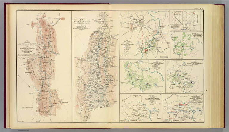
Alleghanies, Valley of Virginia.
Publisher:
U.S. Government Printing Office
Publisher Location:
Washington
Type:
Atlas Map
Obj Height cm:
43
Obj Width cm:
70
Scale 1:
Various
Note:
Two col. maps. with 7 ancillary maps. Relief shown by hachures.
State/Province:
Maryland
State/Province:
Ohio
State/Province:
Virginia
State/Province:
West Virginia
County:
Dinwiddie County (Va.)
City:
Frederick (Md.)
Region:
Salineville Region (Ohio)
Region:
Spotsylvania Courthouse Region (Va.)
Event:
U.S. Civil War
Subject:
Military
Full Title:
A map of a line of defenses in the Alleghanies compiled from Whitcomb's railroad map and original surveys by Lieut. Koerner's topographical party under direction of Capt. C.R. Howard, C.S.E. H.J. Miller, asst. and drftsmn. Chief Engr. Office, D.N.V. Maj. Gen. J.F. Gilmer, Chf. Engr. Map of the Valley of Virginia from Staunton to Winchester from surveys and reconnaissances by P.W.O. Koerner, Lt. Engr. Made under direction of Major A.H. Campbell, Chf. Topl. Bureau, D.N.V. (with) Map of the battle-field about Frederick City and the Monocacy River, Md., July 9, 1864. Sketched and drawn by Ch's. F. Von Lindenberg. (with) Skirmish at Salineville, Ohio and surrender of Brig. Gen. John H. Morgan, C.S. Army (with) Position of the Union hospitals at Cold Harbor, Va., May 31, June 12, 1864. (with) Position of the Union hospitals at the battle of the Wilderness, Va., May 5-7, 1864. (with) Position of the Union hospitals at Spotsylvania Court-House, Va., May 9-21, 1864. (with) Copy of map furnished to Maj. Gen. G.K. Warren, commanding the Fifth Army Corps, by means of which to conduct operations beginning on March 29, 1865. (with) Map of field operations of March 29, 30 and 31, 1865 of the Fifth Army Corps commanded by Maj. Gen. G.K. Warren. Julius Bien & Co., Lith., N.Y. (1891-1895)
List No:
1780.094
Page No:
pl. LXCIV
Series No:
98
Engraver or Printer:
Campbell, Albert H.
Engraver or Printer:
Gilmer, Jeremy F.
Engraver or Printer:
Howard, C. R.
Engraver or Printer:
Julius Bien & Co.
Engraver or Printer:
Lindenburg, Charles F. von
Engraver or Printer:
Miller, H. J.
Engraver or Printer:
Warren, Gouverneur Kemble, 1830-1882
Publication Author:
Cowles, Calvin D.
Publication Author:
Davis, George B.
Publication Author:
Kirkley, JAW.
Publication Author:
Perry, Leslie J.
Publication Author:
United States. War Department
Pub Date:
1895
Pub Title:
Atlas to accompany the official records of the Union and Confederate armies. Published under the direction of the Hons. Redfield Proctor, Stephen B. Elkins and Daniel S. Lamont, secretaries of war, by Maj. George B. Davis, U.S. Army, Mr. Leslie J. Perry, civilian expert, Mr. Joseph W. Kirkley, civilian expert, Board of Publication. Compiled by Capt. Calvin D. Cowles, 23d U.S. Infantry. Washington: Government Printing Office, 1891-1895.
Pub Reference:
LC Civil War maps (2nd ed.), 99; Civil War maps in the National Archives, 8; Phillips, 1353; LeGear. Atlases of the United States, 266.
Pub Note:
See note field above.
Pub List No:
1780.000
Pub Type:
Military Atlas
Pub Maps:
158
Pub Height cm:
47
Pub Width cm:
40
Image No:
1780094
Authors:
Confederates States of America. Army of Northern Virginia; Koerner, P. W. O.
Collection:
Rumsey Collection
