COLLECTION NAME:
David Rumsey Historical Map Collection
Record
Author:
Smith, Karl
Date:
1933
Short Title:
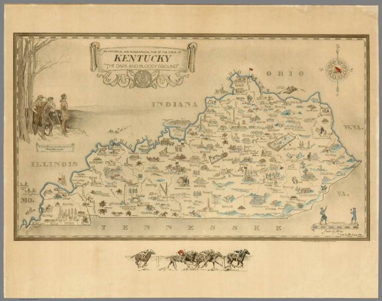
An historical and geographical map of the state of Kentucky
Publisher:
Karl Smith
Publisher Location:
Louisville, Kentucky
Type:
Separate Map
Obj Height cm:
29
Obj Width cm:
50
Scale 1:
66,597
Note:
Color pictorial map 29x49.5 on sheet 38x56. Decorative cartouche with the state seal at upper left. Compass rose on upper right oriented with north toward the upper right. With a horse racing scene on lower margin. Showing cities, landmarks, significant historical events, industry, and Native American settlements Color vignettes illustrating painting of "Daniel Boone and Companions view of Kentucky" on upper left, and "George Washington surveying Kentucky, on lower right. Relief shown pictorially. This is an earlier edition than our 1939 copy. Changes can be seen in western Kentucky on the map.
State/Province:
Kentucky
Subject:
Pictorial map
Full Title:
An historical and geographical map of the state of Kentucky "The dark and bloody group". (signed by) Karl Smith Aug. 1933. Copyrighted 1933 by Karl Smith, Louisville, Kentucky.
List No:
8694.000
Publication Author:
Smith, Karl
Pub Date:
1933
Pub Title:
An historical and geographical map of the state of Kentucky "The dark and bloody group". (signed by) Karl Smith Aug. 1933. Copyrighted 1933 by Karl Smith, Louisville, Kentucky.
Pub Note:
See note field above.
Pub List No:
8694.000
Pub Type:
Separate Map
Pub Height cm:
29
Pub Width cm:
50
Image No:
8694000.jp2
Authors:
Smith, Karl
