COLLECTION NAME:
David Rumsey Historical Map Collection
Record
Author:
Grosvenor, Melville Bell
Author:
Darley, James M.
Author:
National Geographic Society (U.S.). Cartographic Division.
Date:
1963
Short Title:
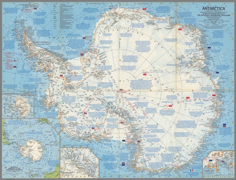
Antarctica. Atlas Plate 65, February 1963
Publisher:
National Geographic Society
Publisher Location:
Washington, D.C.
Type:
Separate Map
Obj Height cm:
49
Obj Width cm:
64
Scale 1:
9,820,000
Note:
Color map of Antarctica. Published as supplement to National Geographic Magazine, Atlas plate 65, 1963 . Relief shown hachures, spot heights and shading. Depth curves and soundings in fathoms. Azimuthal equidistant projection. Depth shown by bathymetric tints, isolines and soundings. Map showing ocean currents and wind, glaciers, ice stations. Includes many historical notes concerning the discovery and exploration of the continent.
World Area:
Antarctica
Full Title:
Antarctica. Atlas Plate 65, February 1963. Compiled and Drawn in the Cartographic Division of the National Geographic Society for the National Geographical Magazine. Melville Bell Grosvenor, Editor ; James M. Darley, Chief Cartographer. Azimuthal Equidistent Projection. Printed by R.R. Donnelley and Sons Company, Chicago. (insets) Relative size of Antarctica and the United States. (with) Relation of Antarctica to the surrounding continents. (with) Queen Maud Range. (with) McMurdo Sound.
List No:
11700.000
Engraver or Printer:
R.R. Donnelley and Sons Company
Publication Author:
Grosvenor, Melville Bell
Publication Author:
Darley, James M.
Publication Author:
National Geographic Society (U.S.). Cartographic Division.
Pub Date:
1963
Pub Title:
Antarctica. Atlas Plate 65, February 1963. Compiled and Drawn in the Cartographic Division of the National Geographic Society for the National Geographical Magazine. Melville Bell Grosvenor, Editor ; James M. Darley, Chief Cartographer. Azimuthal Equidistent Projection. Printed by R.R. Donnelley and Sons Company, Chicago. (insets) Relative size of Antarctica and the United States. (with) Relation of Antarctica to the surrounding continents. (with) Queen Maud Range. (with) McMurdo Sound.
Pub List No:
11700.000
Pub Height cm:
49
Pub Width cm:
64
Image No:
11700000.jp2
Authors:
Grosvenor, Melville Bell; Darley, James M.; National Geographic Society (U.S.). Cartographic Division.
Antarctica. Atlas Plate 65, February 1963
