COLLECTION NAME:
David Rumsey Historical Map Collection
Record
Author:
Woodbridge, William C.
Author:
Willard, Emma
Date:
1821
Short Title:
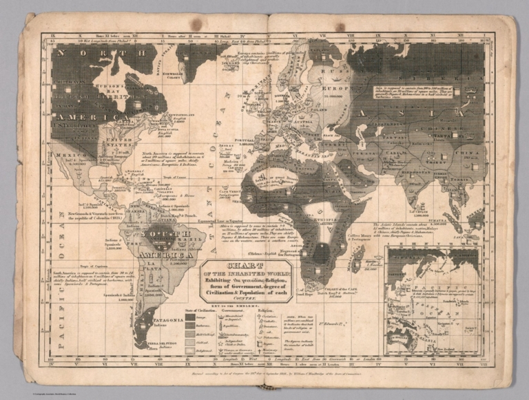
Chart of the Inhabited World.
Publisher:
Oliver D. Cooke & Sons
Publisher Location:
Hartford
Type:
Atlas Map
Obj Height cm:
24
Obj Width cm:
31
Scale 1:
90,000,000
World Area:
World
Subject:
Religions
Subject:
Population
Subject:
Data Visualization
Full Title:
Chart of the Inhabited World, Exhibiting the prevailing Religion, form of Government, degree of Civilization & Population of each Country.
List No:
12497.004
Page No:
II
Series No:
4
Publication Author:
Woodbridge, William C.
Publication Author:
Willard, Emma
Pub Date:
1823
Pub Title:
School Atlas to Accompany Woodbridge's Rudiments of Geography. Atlas on a new Plan Exhibiting the Prevailing Government, Degrees of Civilization, and the Comparative Size of Towns, Rivers and Mountains. By William C. Woodbridge. ... Third edition. ... Hartford, Oliver D. Cook & Sons, 1823.
Pub Note:
Outline color. Includes two maps not listed in the Table of Contents. The South America map shows South Georgia Islands, one of the earlier maps to do so.
Pub List No:
12497.000
Pub Type:
School Atlas
Pub Maps:
11
Pub Height cm:
25
Pub Width cm:
17
Image No:
12497004.jp2
Authors:
Woodbridge, William C.; Willard, Emma
