COLLECTION NAME:
David Rumsey Historical Map Collection
Record
Author:
Northern Pacific Rairoad company
Date:
1886
Short Title:
Text: The Northern Pacific Railroad, and the Country it Traverses
Publisher:
Rand McNally & Co.
Publisher Location:
Chicago, Ill.
Type:
Text Page
Obj Height cm:
40
Obj Width cm:
80
Note:
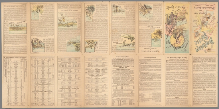
Map of the Northern Pacific Rail Road on sheet 40x81, folded into pictorial self wrappers 21x10. Map extends from Lake Superior, Chicago and St. Louis showing the route of the Northern Pacific to Portland and Tacoma in red, with rail connections to Seattle, by the Oregon and California Railroad to the Oregon state line and by the Oregon Pacific Railway Coast Steamship to San Francisco. Map shows state boundaries, provincial and some county boundaries, railroads, cities and towns, drainage, harbors, rivers and mountains. A large inset map shows extensive railway connections in the North East United States. Relief shown by hachures and form lines. On verso, eight panels tourist information, describe "The Northern Pacific Railroad, and the Country it Traverses", the other panels shows listings of rates and timetables. Railway agents stamp lightly visible on covers. Notes: Chas. B. Lamborn, Land Commissioner. Chas. S. Fee. Gen'l Pass'r. and ticket agent.
Subject:
Railroad
Full Title:
(Text Page to) Map of the Northern Pacific Rail Road and Connections. (cover title) The Northern Pacific RR. The Dining Car Route between the East and Pacific Coast. Rand McNally & Co., printers and engravers, Chicago. (on recto of cover) Northern Pacific Railroad. Between the east and Portland Ore. and Puget Sound Points. St. Paul, Minn. April-May, 1886.
List No:
11902.002
Series No:
2
Publication Author:
Northern Pacific Rairoad Compay
Pub Date:
1886
Pub Title:
Map of the Northern Pacific Rail Road and Connections. (cover title) The Northern Pacific RR. The Dining Car Route between the East and Pacific Coast. Rand McNally & Co., printers and engravers, Chicago. (on recto of cover) Northern Pacific Railroad. Between the east and Portland Ore. and Puget Sound Points. St. Paul, Minn. April-May, 1886.
Pub Note:
See note field above.
Pub List No:
11902.000
Pub Type:
Timetable Map
Pub Height cm:
21
Pub Width cm:
10
Image No:
11902002.jp2
Authors:
Northern Pacific Rairoad company