COLLECTION NAME:
David Rumsey Historical Map Collection
Record
Author:
DeSilver, Robert
Date:
1827
Short Title:
Virginia.
Publisher:
Robert DeSilver
Publisher Location:
Philadelphia
Type:
Separate Map
Obj Height cm:
33
Obj Width cm:
48
Scale 1:
1,660,000
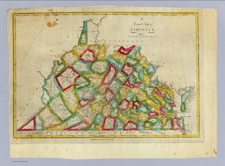
Note:
Updated from M. Carey's 1818 edition General Atlas. Many changes to the Carey plate in the western part of the state -- changes in the mountains, rivers, counties, and towns. DeSilver's imprint below map. Map has outline color by county. Relief shown by hachures. Prime meridians: Philadelphia and London.
Reference:
None found.
State/Province:
Virginia
State/Province:
West Virginia
Full Title:
A correct map of Virginia. Philadelphia: Published by Robert De Silver, 1827.
List No:
0236.000
Publication Author:
DeSilver, Robert
Pub Date:
1827
Pub Title:
A correct map of Virginia. Philadelphia: Published by Robert De Silver, 1827.
Pub Note:
See note field above.
Pub List No:
0236.000
Pub Type:
Separate Map
Pub Height cm:
33
Pub Width cm:
48
Image No:
0236000
Authors:
DeSilver, Robert
Collection:
Rumsey Collection