COLLECTION NAME:
David Rumsey Historical Map Collection
Record
Author:
Greenwood, Christopher
Author:
Greenwood, John, 1791-1867
Date:
1827
Short Title:
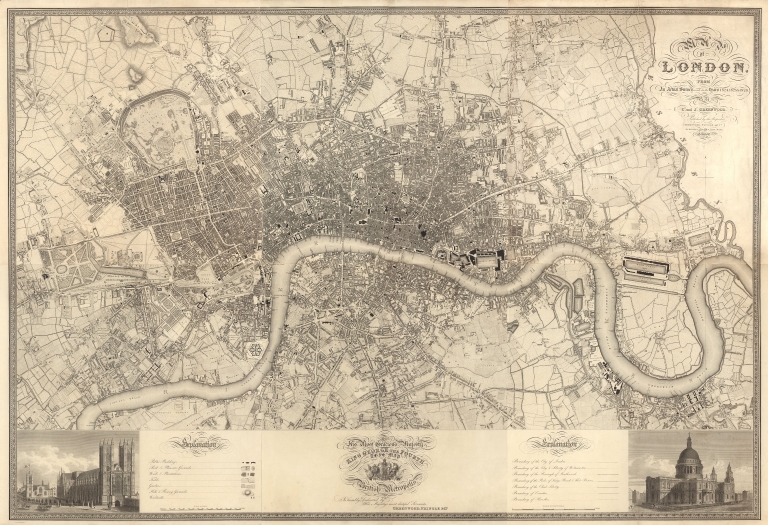
Composite: Sheets 1-6. Map of London... August 21 1827.
Publisher:
Greenwood, Pringle and Co.
Publisher Location:
London
Type:
Composite Map
Obj Height cm:
125
Obj Width cm:
186
Scale 1:
7.920
Note:
Scale 8 inches to the mile.
Reference:
Darlington and Howgego, Printed Maps of London 1553-1850, No 309 (1)
City:
London
Region:
London (England)
Full Title:
(Composite map of) (Sheets 1-6) Map of London, From an actual Survey made in the Years 1824.1825 & 1826. By C. and J. Greenwood. Published by the Proprietors... August 21 1827.
List No:
10241.001
Series No:
1
Engraver or Printer:
Neele, Josiah
Engraver or Printer:
Neele, James
Publication Author:
Greenwood, Christopher
Publication Author:
Greenwood, John, 1791-1867
Pub Date:
1827
Pub Title:
Map of London, From an actual Survey made in the Years 1824.1825 & 1826. By C. and J. Greenwood. Published by the Proprietors... August 21 1827.
Pub Note:
First edition published 1827. In six uncut, unjoined, and uncolored sheets (the map in this form, six separate sheets, is very rare). The survey was original to the Greenwoods and at a larger scale than the Ordnance Survey maps of the time. Very detailed depiction of London, showing central London and surrounding areas. See our 10242.000 for the 1835 2.5 edition in six joined and colored sheets. The map continued to be updated in six later editions to 1854.
Pub List No:
10241.000
Pub Type:
Separate Map
Pub Height cm:
62
Pub Width cm:
61
Image No:
10241001.jp2
Authors:
Greenwood, Christopher; Greenwood, John, 1791-1867
