COLLECTION NAME:
David Rumsey Historical Map Collection
Record
Author:
New York State
Date:
1883
Short Title:
Map of the State of New York Showing its Canals.
Publisher:
Weed, Parsons & Co.
Publisher Location:
Albany
Type:
Separate Map
Obj Height cm:
62
Obj Width cm:
101
Scale 1:
varies
State/Province:
New York
Subject:
Canals
Subject:
Data Visualization
Subject:
Ottoman Mapping
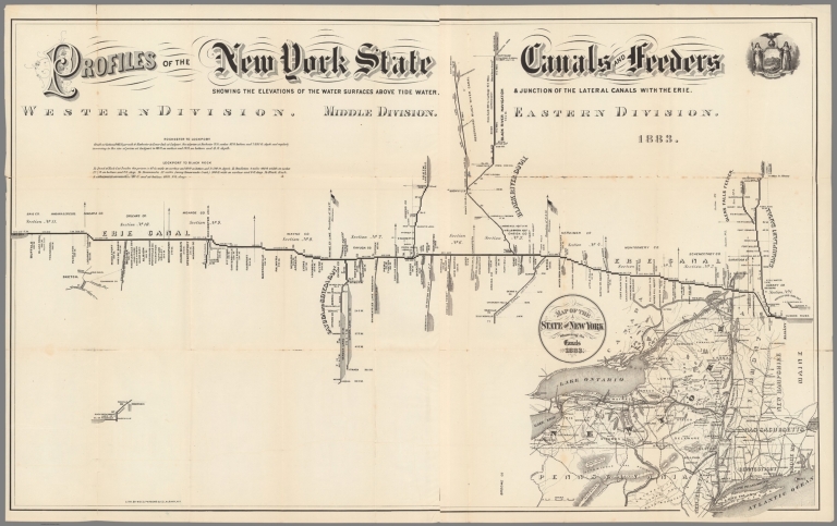
Full Title:
Map of the State of New York Showing its Canals. Profiles of the New York State Canals and Feeders. Showing the elevations of the water surfaces above tide water, & junction of the lateral canals with the Erie.
List No:
10415.000
Publication Author:
New York State
Pub Date:
1883
Pub Title:
Map of the State of New York Showing its Canals. Profiles of the New York State Canals and Feeders. Showing the elevations of the water surfaces above tide water, & junction of the lateral canals with the Erie.
Pub Note:
This map was issued in an annual report of the New York State government on the canals of the state. The report and map were issued yearly starting in the 1870's and continuing until the late 1880's. The diagram is an interesting example of data visualization.
Pub List No:
10415.000
Pub Type:
Separate Map
Pub Height cm:
62
Pub Width cm:
101
Image No:
10415000.jp2
Authors:
New York State