COLLECTION NAME:
David Rumsey Historical Map Collection
Record
Author:
Bloodgood, Don
Date:
1953
Short Title:
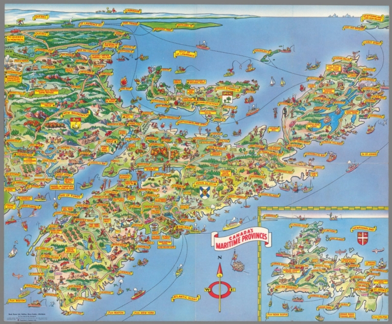
A Pic-Tour Map of Canada's Maritime Provinces.
Publisher:
H.S. Crocker Company, Inc
Publisher Location:
San Francisco
Type:
Separate Map
Obj Height cm:
46
Obj Width cm:
56
Country:
Canada
State/Province:
Nova Scotia
Subject:
Pictorial map
Full Title:
A Pic-Tour Map of Canada's Maritime Provinces.
List No:
10581.003
Series No:
3
Publication Author:
Bloodgood, Don
Pub Date:
1953
Pub Title:
A Pic-Tour Map of Canada's Maritime Provinces.
Pub Note:
An uncommon title from the series of Pic - Tour maps. Map depicts New Brunswick, Nova Scotia, Prince Edward Island, and an inset map 6 1/2 x 7 1/4 inches of Newfoundland. Verso of map features 12 color photos of Maritime Provinces scenery. Folded brochure is designed so that rear panel can be used for mailing purposes, with text in upper right corner stating "Place Stamp Here." The artist Don Bloodgood is identified in the lower left corner of the unfolded brochure. (Elisabeth Burden, 2020)
Pub List No:
10581.000
Pub Type:
Separate Map
Pub Height cm:
32
Pub Width cm:
13
Image No:
10581003.jp2
Authors:
Bloodgood, Don