COLLECTION NAME:
David Rumsey Historical Map Collection
Record
Author:
Fine, W.J.
Date:
1896
Short Title:
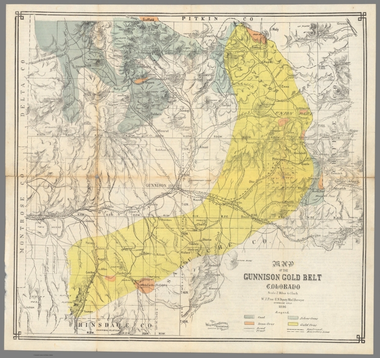
Map of the Gunnison Gold Belt Colorado.
Publisher:
Williamson-Haffner Engraving Company
Publisher Location:
Denver
Type:
Separate Map
Obj Height cm:
40
Obj Width cm:
43
Scale 1:
126,720
State/Province:
Colorado
City:
Gunnison (Colorado)
Subject:
Mining
Full Title:
Map of the Gunnison Gold Belt Colorado.
List No:
10838.001
Series No:
1
Publication Author:
Fine, W.J.
Pub Date:
1896
Pub Title:
Map of the Gunnison Gold Belt Colorado.
Pub Note:
W. J. Fine was the U. S. Deputy Mineral Surveyor, Gunnison, Colorado. Verson is text page titled The Natural Resources of Gunnison County, compiled by Thos. Tonge Denver, May 1st 1896.
Pub List No:
10838.000
Pub Type:
Separate Map
Pub Height cm:
40
Pub Width cm:
43
Image No:
10838001.jp2
Authors:
Fine, W.J.
