COLLECTION NAME:
David Rumsey Historical Map Collection
Record
Author:
California. Office of State Engineer
Author:
Hall, Wm. Ham. (William Hammond)
Date:
1880
Short Title:
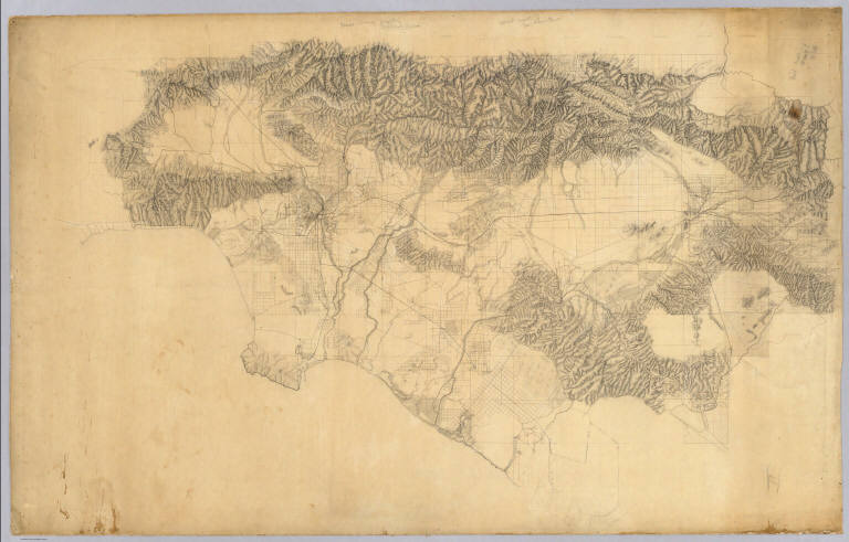
Los Angeles & San Bernardino topography.
Type:
Manuscript Map
Obj Height cm:
93
Obj Width cm:
147
Scale 1:
126,720
Note:
Beautiful hand drawn map of the Los Angles-San Bernardino Basin. Pen-and-ink and pencil. Relief shown by hachures. It appears to be a base map on a scale of two miles to an inch, probably preliminary (several of Hall's notations on the edges indicate corrections needed to the topography) and earlier than the 1888 Report titled "Irrigation in California" that had 15 maps that may have been derived from this map. It may also have served as the base for "Drainage area map to accompany report on irrigation and water supply in California" by Wm. Ham. Hall, State Engineer. (188-?). Hall was a famous engineer who was the first state engineer and was responsible for many of the early state water projects (see California Water Atlas). This map does not have any names drawn in except for a few towns, rivers, or railroads lightly penciled in. All the land divisions and city plats are indicated, with mountains, rivers, railroads, roads, arroyos and shorelines shown. Hall also published four maps of the San Joaquin Valley in 1886 (see WH's copy) separately (see Calfornia Water Atlas p.26). "VI." Title and cartographer from verso. "14" on verso.
Reference:
cf Vogdes p. 220, 226, 210; cf Cowen p. 260; California Water Atlas p. 22, 23.
State/Province:
California
County:
Los Angeles County (Calif.)
County:
San Bernardino County (Calif.)
City:
Los Angeles (Calif.)
Region:
California, Southern
Full Title:
Los Angeles & San Bernardino topography. Wm. H. Hall, State Engineer, Sacramento. (circa 1880)
List No:
3451.000
Series No:
1
Publication Author:
California. Office of State Engineer
Publication Author:
Hall, Wm. Ham. (William Hammond)
Pub Date:
1880
Pub Title:
Los Angeles & San Bernardino topography. Wm. H. Hall, State Engineer, Sacramento. (circa 1880)
Pub Reference:
cf Vogdes p. 220, 226, 210; cf Cowen p. 260; California Water Atlas p. 22, 23.
Pub Note:
See note field above.
Pub List No:
3451.000
Pub Type:
Manuscript Map
Pub Maps:
1
Pub Height cm:
93
Pub Width cm:
147
Image No:
3451000
Authors:
California. Office of State Engineer; Hall, Wm. Ham. (William Hammond)
Collection:
Rumsey Collection
