COLLECTION NAME:
David Rumsey Historical Map Collection
Record
Author:
Montana. State Highway Commission.
Date:
1941
Short Title:
Custer County Montana sheet 2
Publisher:
Montana State Highway Department
Type:
Atlas Map
Obj Height cm:
46
Obj Width cm:
56
Scale 1:
126,720
Note:
Dimensions are for full sheets.
State/Province:
Montana
County:
Custer County (Montana)
Subject:
Automobile
Subject:
Roads
Full Title:
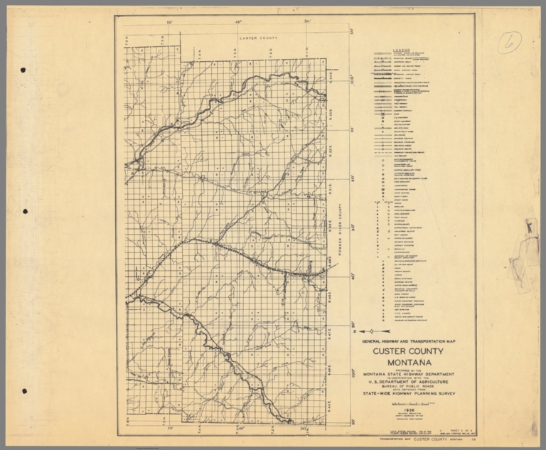
General Highway and Transportation Map Custer County Montana sheet 2
List No:
15298.008
Page No:
6
Series No:
8
Publication Author:
Montana. State Highway Commission.
Pub Date:
1941
Pub Title:
Montana Highway County Maps II
Pub Note:
Eastern half of Montana counties in 46 sheets, some counties on multiple sheets. Blueprint copies. Identified as II in manuscript title, indicating a missing part I with the western counties. Maps show extensive cultural details including all buildings. OCLC 608549233 indicates 91 maps for a full set. "'This interesting collection of county road maps covers the eastern half of the state of Montana across forty-six individually lithographed sheets. Though they were possibly originally published together as part of a spiral binder (note the hole punches on the left side of the sheets), the only covers that remain are comprised of worn brown paper to which is affixed a simple table of contents. Also of note is a small label on the front cover noting possible previous ownership by Marshall Sprague, a popular American journalist who wrote widely about the American West. Each sheet is accompanied by a comprehensive legend that identifies the various symbols used to denote the transportation network, relevant infrastructure, traveler's amenities, local businesses, and recreational opportunities. Even specialized locations of interest such as Civilian Conservation Corps Camps, beet dumps, hot springs, and country clubs are labeled, where applicable. Taken as a whole, the group of maps provides a comprehensive overview of Montana's primary economic concerns around the period of American entry into World War II. The maps were prepared by the Montana State Highway Department and originally date to 1936. The year prior, the organization underwent a major reorganization and began issuing its first highway maps under new director D. A. McKinnon. Each sheet has been revised as of December 31, 1941, the same year that Congress passed the Defense Highway Act." (Curtis Wright, 2022)
Pub List No:
15298.000
Pub Type:
State Atlas
Pub Maps:
46
Pub Height cm:
46
Pub Width cm:
56
Image No:
15298008.jp2
Authors:
Montana. State Highway Commission.
