COLLECTION NAME:
David Rumsey Historical Map Collection
Record
Author:
Ravenstein, August
Author:
Berlin Geographisch-Artistische Anstalt Ernst Schotte
Date:
1864
Short Title:
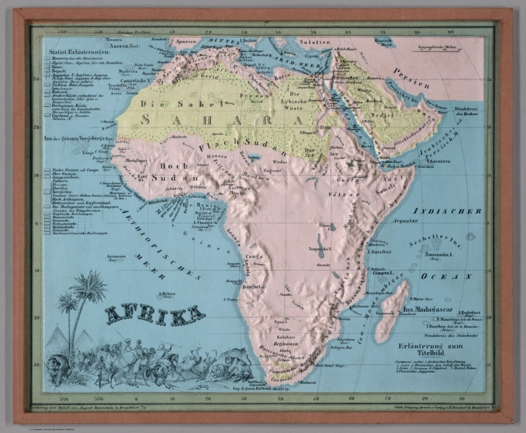
Afrika.
Publisher:
Dondorf, Bernhard, 1809-1902
Publisher Location:
Frankfurt am Main
Type:
Atlas Map
Obj Height cm:
22
Obj Width cm:
27
Scale 1:
80,000,000
Note:
Relief map of Africa. Shows geographical regions, countries, cities, railways, topography, vegetation, bodies of water, drainage, coastlines, shoals and islands. Topography shown with raised relief. Includes a legend, bar scale given in miles, latitudinal and longitudinal lines, as well as statistical and descriptive notes. Additional legend for map appears on title page. With an indexed vignette of scenery, figures, fauna and flora. Colored lithograph. Map is 22 x 27 cm, within frame 24 x 28 cm. Within a series of eight maps comprising the school atlas, Plastischer Schul-Atlas.
World Area:
Africa
Subject:
Education
Subject:
Topography
Subject:
Statistical
Full Title:
Afrika. Zeichnung u. Modell von August Ravenstein in Frankfurt a. M. Stich, Prägung, Druck u. Verlag von B. Dondorf in Frankfurt a. M.
List No:
14473.009
Series No:
9
Engraver or Printer:
Dondorf, Bernhard, 1809-1902
Publication Author:
Ravenstein, August
Publication Author:
Berlin Geographisch-Artistische Anstalt Ernst Schotte
Pub Date:
1864
Pub Title:
Plastischer Schul-Atlas für vie erste Stufe des Unterrichts in der Erdkunde. Enthaltend die Karten von Deutschland, Europa, Asien, Afrika, Nord- und Süd-Amerika und Australien, nebst einem Ideal-Bild der physisch-geographischen Verhältnisse. In Relief geprägt und nach der physisch-geographischen Beschaffenheit (in einer besonderen Beigabe auch nach der politischen Eintheilung) der Länder in Farben gedruckt. Vierte ganz umgearbeitet Auflage. Herausgegeben von Aug. Ravenstein. Frankfurt am Main, 1864. Stich, Vrägung, Druckt und Verlageben B. Dondorf.
Pub Note:
Plastischer Schul-Atlas für vie erste Stufe des Unterrichts in der Erdkunde, by August Ravenstein; published by Bernhard Dondorf in Frankfurt am Main, 1864. School atlas comprised of eight relief maps representing geography across the globe. Intended for the instruction of basic geography to children. Housed within a box, which features an illustration of figures from around the world. Verso of front cover to box provides title page, which includes a legend for the maps. Maps represent the world, Germany, the Netherlands, Belgium, Switzerland, Europe, Asia, North America, Central America, South America, Africa, Australia and Polynesia. Maps show geographical regions, countries, cities, railways, canals, topography, vegetation, bodies of water, drainage, coastlines, shoals and islands. Maps include statistical notes, as well as indexed vignettes of scenery, figures, fauna and flora. Each of the maps appears within a wooden frame. For French version of the atlas, see Pub List No. 8268.000, published in 1870.
Pub List No:
14473.000
Pub Type:
School Atlas
Pub Maps:
8
Pub Height cm:
25
Pub Width cm:
30
Image No:
14473009.jp2
Authors:
Ravenstein, August; Berlin Geographisch-Artistische Anstalt Ernst Schotte
