COLLECTION NAME:
David Rumsey Historical Map Collection
Record
Author:
Big Channel Consolidated Mining Company
Date:
1902
Short Title:
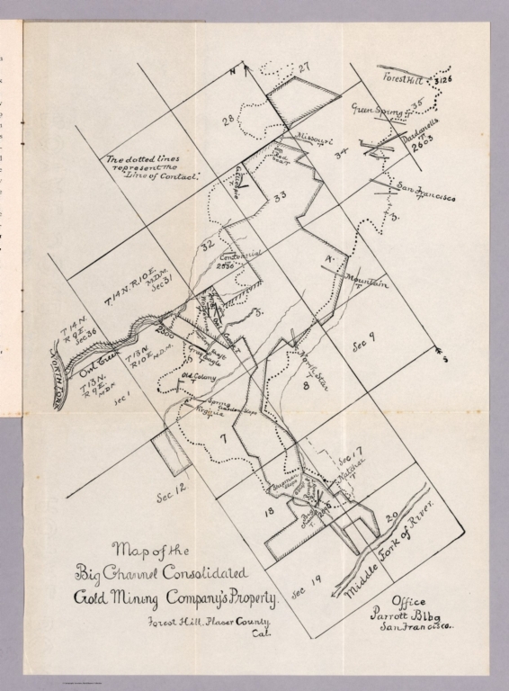
Map of the Big Channel Consolidated Gold Mining Company's property, Forest Hill, Placer County, Cal
Publisher:
Big Channel Consolidated Mining Company
Publisher Location:
San Francisco
Type:
Book Map
Obj Height cm:
36
Obj Width cm:
25
Scale 1:
None shown
Note:
Uncolored map of the Forest Hill, mining property 35.5x25, folded into booklet with gray paper covers and 8 pages of descriptive text, with title "Bid Channel Consolidated Gold Mining Company" in black ink." Published by id Channel Consolidated Gold Mining Company. "This Company is the possessor of one of the most extensive deep gravel deposits in the State of California." Map extends form the North Fork to Middle Fork of the American River, showing location of mines, gold fields. roads, rivers and creeks. Date estimated.
State/Province:
California
County:
Placer County (Calif.)
Subject:
Mining
Full Title:
Map of the Big Channel Consolidated Gold Mining Company's property, Forest Hill, Placer County, Cal. Office Parrott Bldg. San Francisco. (Cover) Bid Channel Consolidated Gold Mining Company.
List No:
11695.003
Series No:
3
Publication Author:
Big Channel Consolidated Mining Company
Pub Date:
1902
Pub Title:
Map of the Big Channel Consolidated Gold Mining Company's property, Forest Hill, Placer County, Cal. Office Parrott Bldg. San Francisco. (Cover) Bid Channel Consolidated Gold Mining Company.
Pub Note:
See note field above.
Pub List No:
11695.000
Pub Type:
Book Map
Pub Height cm:
22
Pub Width cm:
10
Image No:
11695003.jp2
Authors:
Big Channel Consolidated Mining Company
