COLLECTION NAME:
David Rumsey Historical Map Collection
Record
Author:
Arrowsmith, John, 1790-1873
Author:
Rae, John, 1813-1893
Author:
Parry, William Edward, Sir, 1790-1855
Date:
1847
Short Title:
Discoveries of the honble. Hudson's Bay Cos. Arctic expedition, to the north of Repulse Bay ...
Publisher:
Arrowsmith, John, 1790-1873
Publisher Location:
London
Type:
Atlas Map
Obj Height cm:
51
Obj Width cm:
61
Scale 1:
1,480,000
Note:
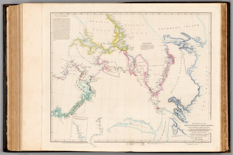
Map representing the Arctic Archipelago, also known as Nunavat and the Northwest Territories, Canada. Shows cities, topography, bodies of water, drainage, coastlines, and islands. Relief shown with hachures. Includes a legend, informational and historical text, expedition routes, latitudinal and longitudinal lines, as well as a bar scale given in English miles. With ancillary map: Continuation of the River Quoich to Chesterfield Inlet Discovered & Surveyed by Dr. Rae 1853. Hand-colored engraving. Map is 51 x 61 cm, on double sheet 56 x 68 cm.
Region:
Arctic Archipelago (Nunavut and N.W.T.)
Subject:
Exploration
Full Title:
Discoveries of the honble. Hudson's Bay Cos. Arctic expedition, to the north of Repulse Bay; conducted by John Rae Esq 1846 & 1847; also his late journey from Repulse Bay, crossing by Franklin Isthmus to Rae Strait 1853-4. Shewing in connection, the discoveries made by Parry, Ross, Back, & the honble. Company's expedition conducted by Dease & Simpson 1838-1839. Adjusted & drawn by John Arrowsmith. London, Pub Jany. 1st 1848, by John Arrowsmith, 10 Soho Square - additions to 1854.
List No:
14506.100
Series No:
100
Engraver or Printer:
Arrowsmith, John, 1790-1873
Publication Author:
Arrowsmith, John, 1790-1873
Pub Date:
1858
Pub Title:
The London atlas of universal geography, exhibiting the physical & political divisions of the various countries of the world, constructed from original materials. Is most respectfully dedicated to his venerable friends John Middleton Esqr. as a testimony of gratitude and esteem, by his much obliged & humble servant, John Arrowsmith, F.R.G.S. & R.A.S. 10, Soho Square, London. London, pubd. by J. Arrowsmith, 10 Soho Square, 1858.
Pub Note:
The London atlas of universal geography. Bound in black leather with gilt title, border, and spine title. Published by John Arrowsmith in London, 1858. In total, atlas includes 121 maps. Maps feature political boundaries, topography, cities, railways, roads, bodies of water, drainage, shorelines, coastlines, and islands. Printed primarily as hand-colored engravings, with two maps in black and white. All but one of the maps in this atlas were published by John Arrowsmith. The map of Mauritius was engraved in Edinburgh by W.H. Lizars. It is quite rare, and may be a unique survival. Examples of The London atlas of universal geography with a title page dated after 1842 are extremely rare. Most later examples have a title page date of 1842, with a list of 50 maps, often supplemented by additional maps. The Arrowsmiths were a cartographic dynasty which operated from the late-eighteenth to the mid-nineteenth century. The family business was founded by Aaron Arrowsmith (1750-1823), who was renowned for carefully prepared and meticulously updated maps, globes, and charts. He created many maps that covered multiple sheets and which were massive in total size. His spare yet exacting style was recognized around the world and mapmakers from other countries, especially the young country of the United States, sought his maps and charts as exemplars for their own work. Aaron Arrowsmith was born in County Durham in 1750. He came to London for work around 1770, where he found employment as a surveyor for the city’s mapmakers. By 1790, he had set up his own shop which specialized in general charts. Arrowsmith worked in five locations during his career, which were primarily located on or near Soho Square, a neighborhood which included the naturalist Joseph Banks, and hydrographer Matthew Flinders. Through his business ties and employment at the Hydrographic Office, Arrowsmith made other important relationships with Alexander Dalrymple, the Hudson’s Bay Company, and others entities. In 1810 he became Hydrographer to the Prince of Wales and, in 1820, Hydrographer to the King. Aaron Arrowsmith died in 1823, whereby the business and title of Hydrographer to the King passed to his sons, Aaron and Samuel, and later to his nephew, John Aaron Jr. (1802-1854), who was a founding member of the Royal Geographical Society (RGS). Samuel and John Aaron Jr. worked as partners in the business and they traded together until John Aaron Jr. left the family business in 1832 and enrolled at Oxford to become a minister. Samuel died at age 34 in 1839; his brother presided over his funeral. The remaining stock and copper plates were bought at auction by John Arrowsmith, their cousin. John Arrowsmith (1790-1873) operated his own independent business after his uncle passed away. After 1839, John moved into the Soho location of his uncle and cousins. John enjoyed considerable recognition in the geography and exploration community, and carried the title Hydrographer to Queen Victoria. Like Aaron Jr., John was a founding member of the RGS and would serve as its unofficial cartographer for 43 years. Several geographical features in Australia and Canada are named after him. He died in 1873 and the majority of his stock was eventually bought by Edward Stanford, who co-founded Stanford’s map shop, which is still open today in Covent Garden, London. ⁃ Historical notes courtesy Barry Lawrence Ruderman
Pub List No:
14506.000
Pub Type:
World Atlas
Pub Maps:
121
Pub Height cm:
58
Pub Width cm:
42
Image No:
14506100.jp2
Authors:
Arrowsmith, John, 1790-1873; Rae, John, 1813-1893; Parry, William Edward, Sir, 1790-1855