Who What Where WhenREMOVE |
REFINE
Browse All : Atlas Map of Antarctica and Pacific
1-8 of 8
Author
[Ortelius, Abraham, 1527-1598, Vrients, Jan Baptista]
Full Title
Maris Pacifici, (quod vulg�� Mar del Zur) cum regionibus circumiacentibus, insulisque in eodem passim sparsis, novissima descriptio. Cum privilegiis Imp. & Reg. Maiestatum, nec non Cancellariae Brabantiae, ad decennium. Spe Et Metv Genio Et Ingenio Nobili Dn. Nicolao Roccoxio, Patricio Antverpiensi, Eivsdemqve Vrbis Senatori, Abrahamus Ortelius Regi�� Mts. geographus sub. merito dedicabat. 1589.
List No
10001.067
Full Title
Polynesian Groups (composed of) Fiji, Viti, Islands; Sandwich, Hawaii, Islands; Samoa or Navigator Islands. South Polar Regions. (with) Kerguelen Island. (with) Victoria Land. (Published at the office of "The Times," London, 1895)
List No
1010.075
Note
Four color maps with 3 insets. Relief shown by hachures and spot heights. Show settlements, etc. Includes inset of "County of Rutland" for comparison.
Author
Monte (Monti), Urbano, 1544-1613
Full Title
Tavola XVIIII. Che Ha Sua Superiore La Tavola Nonaa. Libro Terzo.
List No
10130.021
Author
Monte (Monti), Urbano, 1544-1613
Full Title
Tavola XXXVII. Che Ha Sua Superiore La Tavola. XXI. Libro Terzo.
List No
10130.039
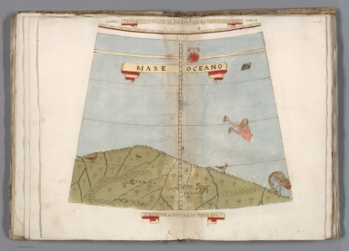
Author
Monte (Monti), Urbano, 1544-1613
Full Title
Tavola XXXVIII. Che Ha Sua Superiore La Tavola. XXI. E.XXII. Libro Terzo.
List No
10130.040
Author
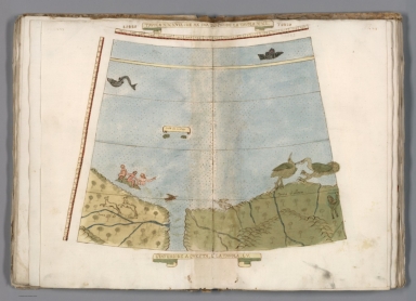
Monte (Monti), Urbano, 1544-1613
Full Title
Tavola XXXVIIII. Che Ha Sua Superiore La Tavola. XXII. Libro Terzo.
List No
10130.041
Note
The long legend describes the first circumnavigation of the globe by Magellan, 1519-1522.
Author
Tanner, Henry S.
Full Title
Oceana Or Pacific Ocean. Published by Carey & Hart, Philadelphia. (above neat line) Tanner's Universal Atlas.
List No
5363.071
Note
In full color by county of possession. Engraved. Relief shown by hachures.
Author
Buache, Philippe, 1700-1773
Full Title
Carte physique de la Grande Mer ci-devant nommee Mer du Sud ou Pacifique; ou se voient les grandes chaines de montagnes qui traversent les parties les plus orientales de l'Asie et les occidles. de l'Amerique; et leurs continuations dans le fond de la Mer, indiquees par les isles, bancs &c. Avec la representation de ce que l'on conjecture sur la Mer Glaciale Antarctique. Dressee et presentee a l'Acad. des Sc. le 5. Septbre 1744. Par Philippe Buache. Publiee sous le privilege de l'Academie du 4. Septbre. 1754. Grave par Desbruslins, Pere, 1757.
List No
5698.007
Note
Engraved hand col. map. Relief shown by hachures. Inset: Carte de la Mer Glaciale Antarctique. "45."
1-8 of 8
|