- Featured Maps
- September 5, 2009
Heights of Mountains, Lengths of Rivers
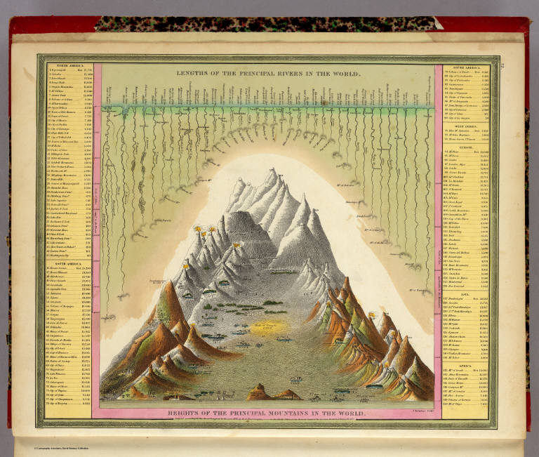
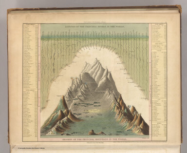
For over 100 years, atlas and map publishers in the United States and Europe published a style of map that was a visualization of the heights and lengths of the world's mountains and rivers. Some of the earliest examples appeared in Europe towards the end of the 18th century. In the United States, the form was popular throughout the 19th century and the early part of the 20th. These maps appeared in atlases, as wall maps, and as pocket maps. One of the most elegant examples was engraved originally on copper by map publisher Henry Tanner in Philadelphia in 1836 and then continued by S. Augustus Mitchell, also of Philadelphia, in lithographic versions into the 1850's. The example below was published by Mitchell in 1846.
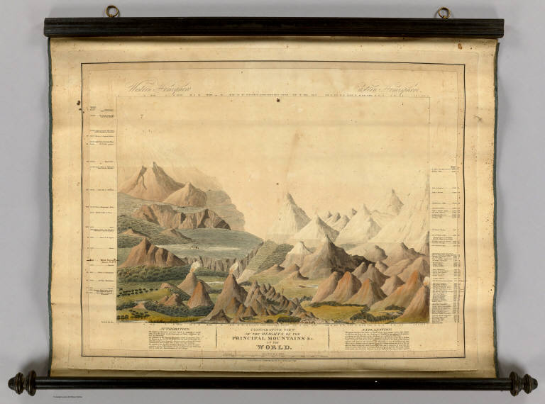
The Mountains and Rivers maps appeared in several styles and formats. One of the earliest styles was to show just mountains, piled up in a landscape, with a key of mountain heights on the left and right sides of the illustration. Also listed on the side would be the highest flights of the Condor, limits of plants and trees, elevations of lakes, elevation of certain high altitude cites, and climate zones. An early example in the Rumsey collection is Charles Smith's Comparative View of the Heights of the Principal Mountains &c. In The World, published in London in 1816:
Eight examples in this style are shown below. Each uses a different method to unpack the dense information contained in the maps: a grid system, a numbering system, elevation lines and an outline chart. (click on images to enlarge)
Another popular style combined heights of mountains and lengths of rivers in one view. The rivers are stretched out in single lines, with the longest on the left combining with the shortest mountains, while the shortest rivers combine with the highest mountains on the right. The visual result is very compelling. One of the earliest examples was W.R. Gardner's Comparative Heights of the Principal Mountains and Lengths of the Principal Rivers, published by William Darton in London in 1823:
Three examples of this style are shown below. (click on images to enlarge).
The map below is an unusual example that divides the mountains and rivers maps into five illustrations of the continents.
A third variation of the mountain and rivers designs was putting the mountains in the center of the view with the rivers extending downward on each side. One of the earliest examples of this type was published by Henry Tanner in 1836, Heights of the Principal Mountains in the World.

John Dower and Henry Teasdale published another version in London in 1844 titled Principal Mountains and Rivers of the World. It is possible that there was an earlier version of this London map that Tanner copied from - a common practice of American mapmakers in the first half of the 19th century - but Tanner's map is centered on information important to American readers and the Dower/Teasdale map is oriented to England and Europe.
Other examples of this style:
Gray's new map of the World in hemispheres, with comparative views of the heights of the principal mountains and lengths of the principal rivers on the globe, of 1885, provided a simplified view of the mountains and rivers. It appeared in George N. Colby's Atlas of the State of Maine, 1885.
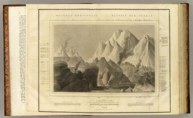
The double hemisphere style continued to the end of the 19th century, as shown by Rand McNally's Western Hemisphere, Eastern Hemisphere, of 1897 from their Indexed Atlas of the World.

There are other types of mountains and rivers maps that defy categories. Many atlas publishers issued them in pairs, such as this mountains and rivers pages from Anthony Finley's General Atlas of 1831:
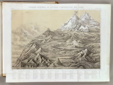
And this pair from Antonio Garcia Cubas' beautiful Atlas Pintoresco, an illustrated atlas of Mexico published in 1885:
 |
 |
| Carta Orografica. VI; Garcia Cubas, Antonio, 1832-1912; Mexico; 1885. | Carta Hydrografica. VII; Garcia Cubas, Antonio, 1832-1912; Mexico; 1885. |
School atlases often used schematic pairs of charts to indicate the heights of mountains and the lengths of rivers:
 |
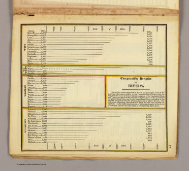 |
| Comparative heights of mountains; Worcester, Joseph E.; Boston; 1826 | Comparative lengths of rivers; Worcester, Joseph E.; Boston; 1826 |
And some examples show unique local interpretations such as Thomson's Comparative view of the lengths of the principal rivers of Scotland from 1822:
Or this example from Venezuela, Augutin Codazzi's Un cuadro de alturas que comprende las de las cordilleras de Merida... of 1840:
The Society for the Diffusion of Useful Knowledge (SDUK) had a remarkable plate in their 1844 World Atlas of A map of the principal rivers shewing their courses, countries, and comparative lengths:
 A map of the principal rivers shewing their courses, countries, and comparative lengths, Society for the Diffusion of Useful Knowledg, London, 1844
The final map in this series is from one of the last decorative 19th century atlases, the Royal Illustrated Atlas by Fullarton, 1872, Comparative Views of the Heights of the Principal Mountains and Basins of the principal Rivers... It combines an unusual showing of the basins of the major world rivers with the principal mountains of the world which also show the major geographical distributions of plant regions of the globe by altitude, a Humboldt inspired convention.
Below is a slide-show of another 23 maps that use the mountains and rivers conventions in school atlas maps, profiles, physical maps, and general maps, followed by all 33 of the various mountain and rivers maps shown above. Use the arrows to advance the slides; click on the little "i" to view the catalog record; click on "Go to Source" to see the slide-show full screen. To view the entire group in the LUNA Browser, click here
For more information on the subject of mountains and rivers maps, see the excellent post on BibliOdyssey as well as John Wolter's extensively researched article in the Quaterly Journal of the Library of Congress, The Heights of Mountains and the Lengths of Rivers.
10 Comments on Heights of Mountains, Lengths of Rivers
I have expanded upon the mountains and rivers convention in a recent blog post here:
http://www.geographicus.com/blog/rare-and-antique-maps/the-evolution-of-the-comparative-mountains-and-rivers-chart-in-the-19th-century/
great effort to write such a nice article and great collection of pictures. Nice information. Cheers
nice site man
This site is very interesting! It’s great that there are sites like this. I was really fascinated with the map collection. I love learning new things about histories, origins and even geography. I am very happy that I came across your site. I would definitely come back here to see the map collection and to read your blogs. I hope you will continue updating this site because I really love what you did to it. I would share your site with my friends because I think they’ll find it interesting to. Thanks again for this and keep up the great job!
Thank you for this marvellous site which show generaly hidden maps.
veryyyyyyyyyyyyyyyyy goooooooooooooooooodd site it is,but I want height of ountain in standard form.
wow great collection, thanks for share
You got a really useful blog I have been here reading for about an hour. I am a newbie and your success is very much an inspiration for me. Sherwani
very lovely throughout. I sometimes paint maps, fantastical maps of excursions to be made. This is very helpful and instructive.






Very good - a site very special