- Featured Maps
- September 7, 2009
Cassini Terrestrial and Celestial Globes 1790 - 1792
Giovanni Maria Cassini was a noted geographer, engraver, and publisher in Rome. He was one of the last of the fine Italian globe makers active at the end of the 18th century. Cassini made Terrestrial and Celestial Globes in 1790 and 1792. He also published the twelve terrestrial and twelve celestial globe gores that formed these globes in his atlas "Nuovo Atlante Geografico Universale" along with rules for the construction of globes and globe gores.
The full title of the Terrestrial Globe is Globo terrestre / delineato sulle ultime osservazioni con i viaggi e nuove scoperte del Cap. Cook, inglese ; Gio. Ma. Cassini C.R.S. inc. Roma : Presso la Calcograf[i]a cam[era]le, 1790. The globe shows contemporary discoveries in the Pacific as well as the routes of three of Captain James Cook's voyages.
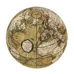
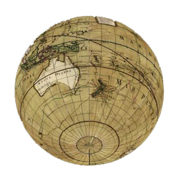
Cassini's terrestrial globe gores were used to create a physical globe about 34cm in diameter. In the virtual world, we have scanned the gores, georeferenced them and then projected and wrapped them on a three dimensional globe shown in the two images below - clicking on the globe image will open the globe in Google Earth (download app required) .
|
|
The terrestrial globe gores are shown below in their original printed form on four sheets of three gores each. The images of the sheets were downloaded from the Library of Congress, Geography and Map Division.
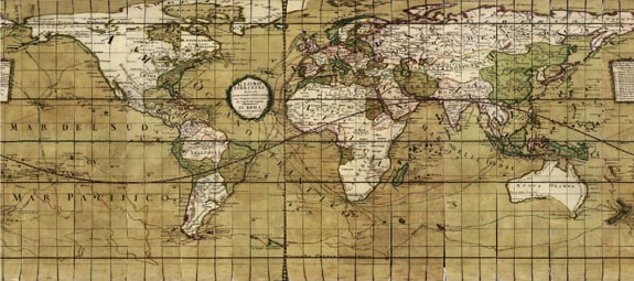
The gores were then trimmed in Photoshop and georeferenced in ArcMap to the WGS 1984 coordinate system as shown in the image below. This is the image that is used to create the virtual globe in Google Earth and ArcGlobe. Clicking on the image will open it in Rumsey Google Maps, in a Mercator Projection.
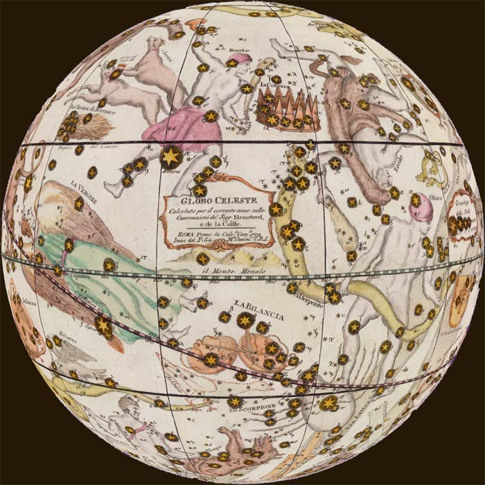
Terrestrial and Celestial globes were often paired together so in 1792 Cassini made a companion Celestial Globe, showing the Heavens and all the known stars and constellations. The Celestial Globe's full title is Globo Celeste calcolato peril corrente anno sulle osservazioni de Sigg. Flamsteed e de la Caille. Roma : Calc(ografi)a Cam(era)le, 1792. Inciso dal P. Gio. Ma. Cassini, C.R.S. Like the terrestrial globe gores, the celestial gores were scanned and georeferenced and then placed on a virtual globe as shown below. Click on the globe image below to open the globe in Google Earth (download app required).
Since the Terrestrial and Celestial Globes were typically viewed side by side in their physical instantiations, we wanted to join them together in their virtual copies. We were able to do this in Google Earth by turning the Cassini Celestial Globe inside out and placing it 64 million meters outside the Terrestrial Globe, as seen in the video below. The same space can be viewed live in Google Earth (download app required, turn off Atmosphere layer in Google Earth).
At the time we did the Cassini Globes project, the Rumsey Collection did not have copies of the Cassini globe gores. The Celestial Globe gores as well as copies of the Terrestrial Globe gores were added to the Rumsey collection in 2007. The Terrestrial gores are the same issue as the Library of Congress copies, but the coloring is different, as can be seen from the images below, in a slide-show from the Rumsey collection database, which includes the gores and the printed parts for the "ring sheet" of zodiacs and 2 polar calottes (caps). Use the arrows to advance the slides; click on the little "i" to view the catalog record; click on "Go to Source" to see the slide-show full screen.
Taking the virtualization of the Cassini globes a step further, the Cassini Globes have been placed on the Rumsey Map Islands in the virtual world, Second Life. As shown in the video below, David Rumsey's avatar, Map Darwin, explores the virtual globes which are over 100 meters in diameter and placed next to each other on the map islands, floating above an 1883 map of Yosemite Valley.
Finally, as shown in the video below, it is possible to combine the Cassini Terrestrial Globe with other GIS layers, including NASA's satellite image of the world at night, several satellite images of world topography and bathymetry, and other historical maps and globes.
Perhaps Giovanni Maria Cassini would be intrigued to see his Terrestrial and Celestial Globes take on new life in the 21st century digital world, all firmly based on the great accuracy of his geographic knowledge and the high quality of his engraving skills.
14 Comments on Cassini Terrestrial and Celestial Globes 1790 - 1792
You can download the raster files for the Celestial and Terrestrial Globes in GeoTIFF and JP2 here: http://rumseygeo.s3.amazonaws.com/CassiniWorldGlobe1790_JP2.zip (5.4MB) http://rumseygeo.s3.amazonaws.com/CassiniWorldGlobe1790_TIF.zip (141MB) http://rumseygeo.s3.amazonaws.com/CassiniCelestialGlobe1792_JP2.zip (42MB) http://rumseygeo.s3.amazonaws.com/CassiniCelestialGlobe1792_TIF.zip (911MB) Show us any interesting mashups…
Nice work. We did quite the same thing on a couple of globes for our “Virtual Globes Museum” which can be reached at http://vgm.elte.hu (A vrml plug-in is needed to enjoy all the features of the page)
Thanks for the link to your globe site, very good work. I especially like the google earth kmz versions. The vrml is also good.
Here’s an interpretation of the globe, using a developable surface (paper) and negative curvature. http://flic.kr/p/7G84dx Thanks! I love this site.
excellent work!
I printed the gores for the celestial globe and made the thing, about 12” diameter, with a rosewood mount. It’s very pretty. If you reply to this I can send a picture. And thanks for this brilliant site.
Perfect scan, superb condition! I made a hi-resolution virtual globe also from this one. http://homepage.univie.ac.at/Georg.Zotti/virtual_globes
Thank you, this site is great!
Georg Zotti globe site is very well done. Use Google Chrome browser. http://homepage.univie.ac.at/Georg.Zotti/virtual_globes
My compliments for the excellent work and the wonderful website. I am a paper model designer (www.paperpino.net) and now I am working on the fascinating subject of antique globes (re-visited as paper models). I have a question: you mentioned (and it is evident) that you Cassini’s gores have different colors in comparison of what can be found at the Library of Congress. Which is the origin of your version? Were your gores re-processed after the scan? Why? Thanks for your attention!
The world globe that we have in Google Earth is the Library of Congress version – at the time we georeferenced them we did not own a paper copy. A few months later we were able to acquire paper copies of both the world and celestial globes. So the georeferenced celestial globes are from our copy. In the Luna Browser we have both of our copies, ungeoreferenced. The gores were re-processed, or georeferenced after scanning, because that is the only way to do it.
Hi. You do great job! Maybe you can help me too. I have 26 pictures of an old map and they look like this: http://www.geog.ubc.ca/courses/geob370/notes/georeferencing/utm.gif
how can i do if i want a flat map?i want to use the texture to make my own globe.you say something about how you do but it is not really clear for me. Can you help me?
Thank you, Mr. Rumsey, for your fantastic resource-full website and especially your scans of the Cassini Celestial Globe gores. For several years I have longed to make a reproduction of an antique celestial globe, and yours are the only full set of globe gore scans I could find. After finishing a 12” globe with horizon ring, meridian ring and brass and copper fittings and accents, I am planning on giving it to my father for his 80th birthday. He got me started in astronomy and taught me many things about working with my hands, and I think he will appreciate the globe you helped make possible.
Thank you, Tom Pugsley
Why is the globe rotating backwards on "The Cassini Terrestrial Globe surrounded by the Cassini Celestial Globe -seen as the 'Heavens'?"


This is so beautiful. Are there shapefiles available for download?