- Featured Maps
- August 21, 2012
Mapping the Heavens in 1693
Ignace Gaston Pardies created a series of six beautiful star and constellation maps in the late 17th century. All six map plates join together to make a unified view of the Heavens as seen from the Earth. Pardies, a French Jesuit and professor of mathematics in Paris, corresponded with leading scientists of his day, including Newton, Leibniz and Huygens. His background in classical literature and science is evident in the complex artistry and mathematical precision of the six star maps. Pardies' use of a geocentric cartographic view of the stars was unusual for the time - most star charts and celestial globes used the God's eye perspective - looking at the entire universe from outside it. Our Cassini 1792 Celestial Globe is an example of the God's eye view - an earth-bound user had to imagine seeing the drawn constellations in the actual sky in reverse. With Pardies' maps we see the sky as it appears from earth. Pardies drew the maps on the gnomonic projection which visualized the universe as a six-sided cube instead of a globe. This method allows for accurate measurement by straight lines between any point on the map. He also showed the paths of many important comets from 1577 to 1682 moving through the constellations. In order to assist users in visualizing various aspects of these star maps, we have georeferenced the maps in GIS and then joined them together, first as a cube, then as a globe, then in other projections, and in Google Earth, and those visualizations are shown below.
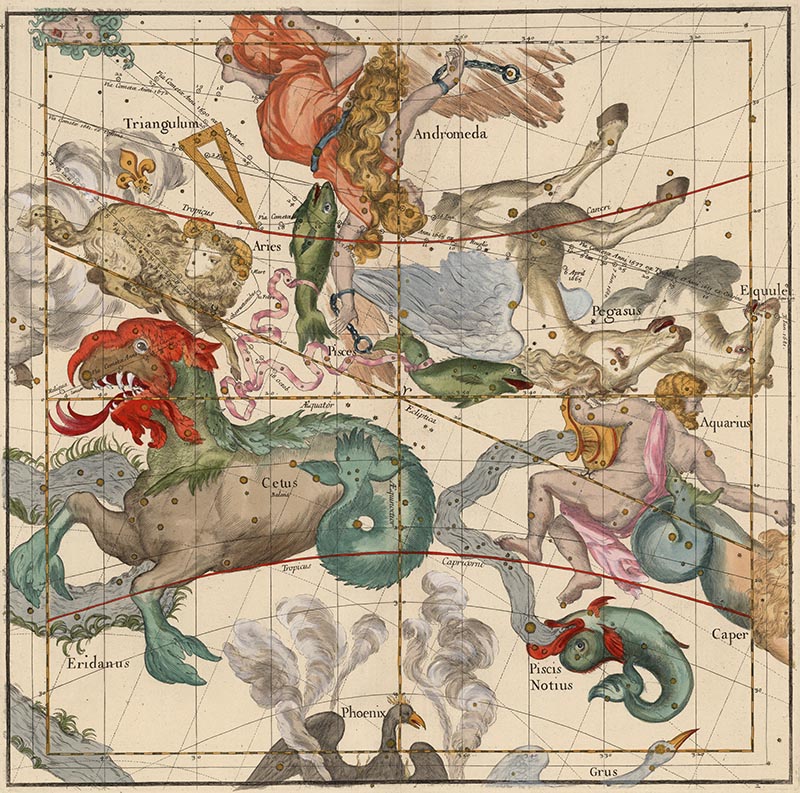
Pardies' stunning artistry can be seen in the second of the six plates, with the constellations Cetus, Aquarius, Andromeda, Pegasus and Aries:
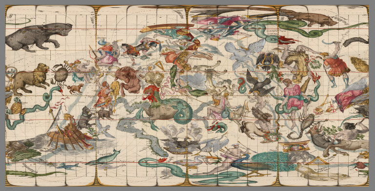
Here is the full image of Plate 2 with Latin text on the left side and French text on the right side:
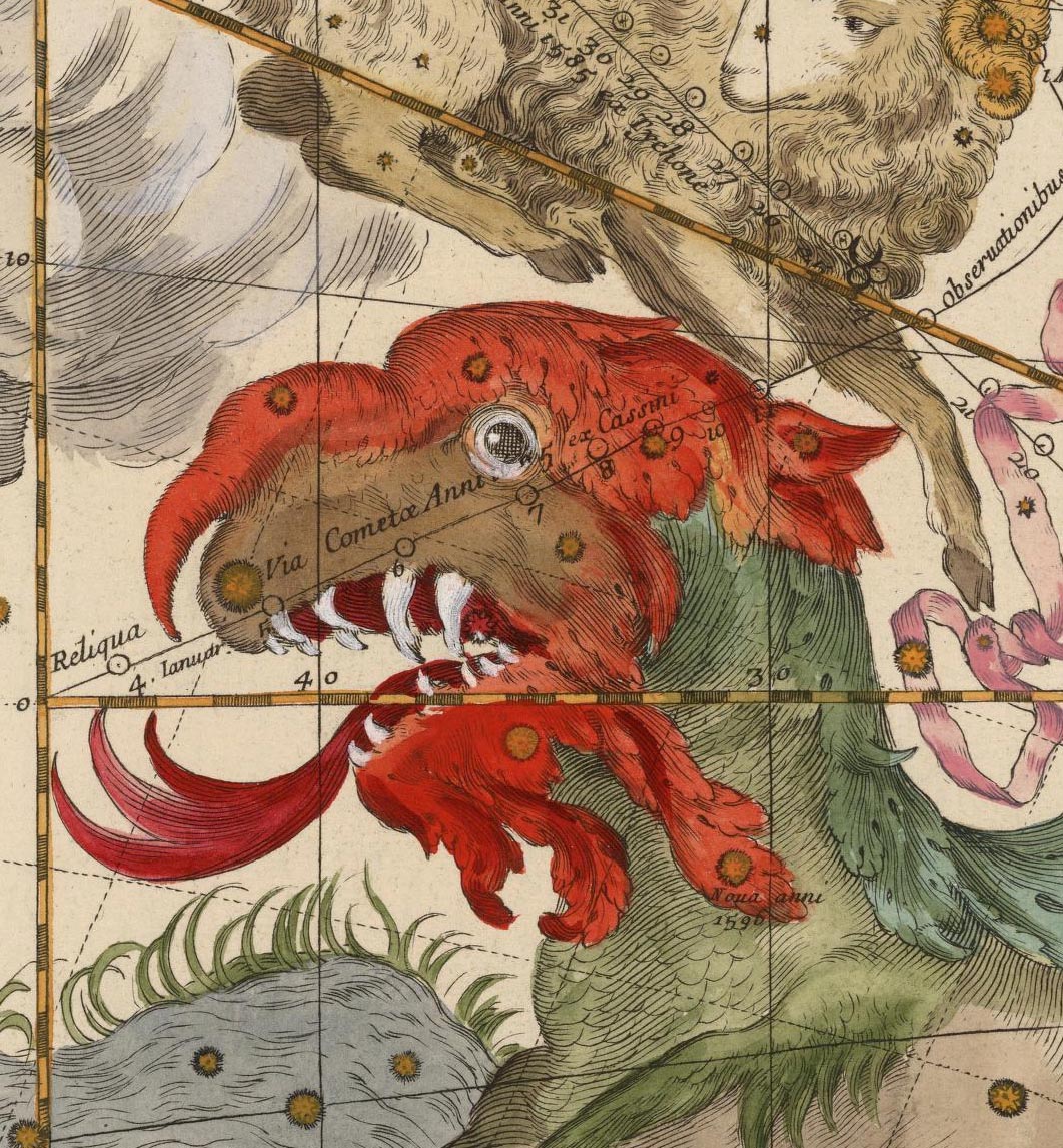
A detail of Plate 2 shows the head of Cetus and the tracks of two comets:
When Pardies' plates where published separately as an atlas, it was titled in Latin "Globi coelestis in tabulas planas redacti descriptio auctore R.P. Ignatio Gastone Pardies Societatis Jesu mathematico opus postumum." Below are all six plates, showing the explanatory text and tables on the sides of the star maps in Latin and French. First the two polar or "top and bottom" plates:
 |
 |
Then the four middle latitude or "side" plates in the order they are joined:
 |
 |
 |
 |
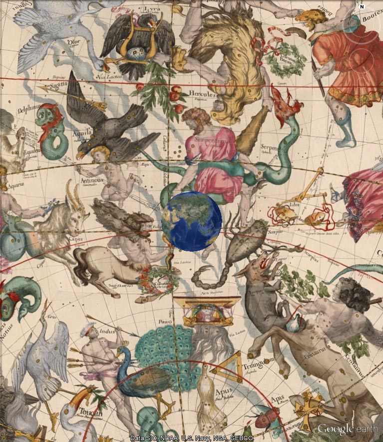
The Linda Hall Library of Science, Engineering and Technology in Kansas City, Missouri, has a notable collection of Pardies' atlases and plates and commented on his work in one of their exhibition catalogs: "Pardies' star atlas is stylistically one of the most attractive ever published. Pardies took his constellation figures primarily from Bayer's Uranometria, but since each chart covers a large section of the sky, these figures had to be carefully integrated, which was not an easy task. Pardies' engraver accomplished this task with great success.... The plate [which] shows Hercules, Ophiuchus, Scorpius, Sagittarius, Aquila, and Lyra...is one of the most stunning compositions in the history of celestial cartography." Below is that Plate 5:
The six Pardies plates can be trimmed and laid out as the six sides of a cube:
When the six sides are joined as a cube, they look like this (Plates 1, 2, and 5 visible):
Rotating the cube (Plates 1, 4, and 3 visible):
Instead of visualizing the map plates as a cube, we can still keep the gnomonic projection but show it differently in GIS, here centered on Plate 5, but showing the parts of the four plates that adjoin Plate 5 (the gnomonic projection in GIS limits our view to about 130 degrees to avoid extreme distortion at the edges):
All six plates in the same gnomonic projection in GIS:
 |
 |
 |
 |
 |
 |
In GIS, the same plates can be reprojected in orthographic projection, which allows us to see a full 180 degrees around each plate. Below is polar Plate 1 and its four adjoining plates in orthographic projection:
All six plates in the orthographic projection in GIS:
 |
 |
 |
 |
 |
 |
For a novel projection, we can use the Berghaus star projection, here centered on the North Pole. This projection allows us to see five full plates (Plates 1-5) in one projected map:
And here centered on the South Pole (Plates 2-6):
We have used the geographic projection in order to put the plates in Google Earth. This projection distorts the northern and southern parts of the sky but allows us to see the entire group of six plates in one map:
When the geographic projection map of the six plates is placed in Google Earth, it loses any distortions and gives us a complete joined view of Pardies map of the Heavens. View singly in Google Earth Application (requires download of app) or with all the Rumsey georeferenced maps in the Google Earth application (New Maps section, Celestial Globe 1693, turn off Atmosphere in View).
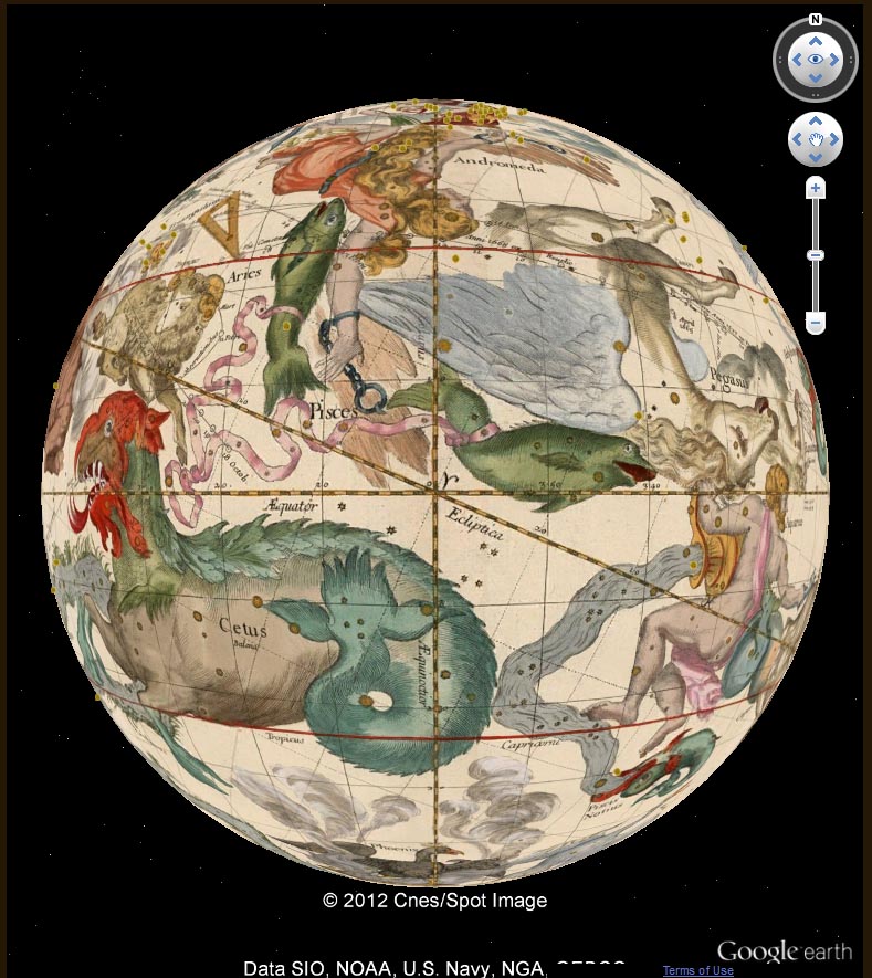
We can turn the Google Earth globe view inside out and float it 64 million meters outside the earth so that the Pardies star maps appear as we would see them in the sky. We use a mirror image of the geographic projection so that all the positions and labels of the stars and constellations are correct (rotate the earth in order to move through the sky). View singly in Google Earth Application below (requires download of app) or with all the Rumsey georeferenced maps in the Google Earth application (New Maps section, Celestial Sphere 1693, turn off Atmosphere in View).
Below is a short video of moving through the six joined Pardies plates as a globe in Google Earth:
And another video of moving through the six joined Pardies plates 64 million meters outside of the earth, much as they would be seen in the sky by earth-bound viewers:
Unfortunately, Pardies did not live to see his amazing star maps published - he died in 1673 and the first edition of his atlas of six plates was published posthumously in 1674. A second edition was published in 1693 (our copy shown here), and a third edition in 1700. But the usefulness of his work continued long after his death and his star maps took on a life of their own. Deborah Warner ("The Sky Explored") states: "The published reports of their observations indicate that Jesuit astronomers throughout the world relied heavily on Pardies' maps for obtaining coordinates of both old stars and newly discovered ones. Furthermore, while using the maps they improved them by adding new stars and correcting the positions of old ones; many of these revisions were incorporated into the second edition. Pardies' maps served as a model for the gnomonic maps of Jonas Moore, Doppelmeyer, Kordenbusch, and, in the nineteenth century, the Society for the Diffusion of Useful Knowledge, and for Grimaldi's maps of the Chinese constellations."
We can appreciate and admire Pardies genius today, over 300 years later, because a few copies of his work still survive. Putting images of them online now allows many more people to enjoy his unique mapping of the Heavens long ago.
6 Comments on Mapping the Heavens in 1693
Thank you for this information regarding the Jesuit astronomers, it is very helpful.
Just a beautiful collection of maps. Love the animation of the star placements around the earth. Thank you.
bravo, c'est vraiment super, oliiver
Really wonderful masterpiece, and interesting digital work! I finalize what David Rumsey did, designing 24 half gores suitable for a celestial paper globe construction. The project is freely available at www.paperpino.net Thank you David for making available such a number of wonderful masterpieces! PINO
The Maps of Pardies are beautiful and I think these are very important. Have you ever seen the art in the Codex Seraphinus?



I am grateful to Cartography Associates for sharing this beautiful and historically important celestial atlas with all of us. As a footnote to your blog entry, I would like to point out that Pardies built on a long tradition of Jesuit astronomers who had used the gnomonic projection for star maps, starting with Grienberger (published in 1612) and Grassi (1619). The earliest known star map in gnomonic is an illustration of Kepler’s book De stella nova…, published in 1606.