- Recent Additions
- March 6, 2009
March 6, 2009 - 1,572 New Maps Added
The following are highlights from 1,572 New Maps and Images added to the David Rumsey Collection. All titles may be found by clicking on the View links below. Or click here to view all 1,572 new maps. (This link shows 1850 maps and images because some of the new 1,572 items are text pages added to atlases and the entire atlases are shown).
|
Atlas Nouveau, 1742 |
|
 |
Carte De La Mer Mediterranee, 1764 |
 |
West-India Atlas, 1788 |
 |
Charts And Plates To La Perouse's Voyage, 1799 |
 |
Vie De George Washington, 1807 Marshall, John, Paris 19 maps, views, and pages. The is the Paris edition of Marshall's Life of Washington. The maps are perhaps the highest quality of any of the various editions. Tooley says that J.N. Buache did the maps. View Atlas |
 |
The Life of George Washington, 1807 Marshall, John, Philadelphis 12 maps, views, and pages. The Philadelphia edition of Marshall's Life of Washington. The maps are engraved by Francis Shallus, Samuel Lewis, and John Vallance - all early and importance American engravers. View Atlas |
 |
General Atlas of the United States, 1816 Lucas Jr., Fielding, Philadelphia 31 maps. This is the issue with the state maps and without the complete European maps (for 31 maps total versus 54 for the larger issue). The date is estimated. All the maps are in full color, and were engraved by Henry Tanner. Title page illustrated with engraving by G. Fairman with globe, adults, and cherubs. View Atlas |
 |
A Complete Genealogical, Historical, Chronological, And Geographical Atlas, 1820 Carey, Mathew; Lavoisne, M., Philadelphia 84 maps, diagrams, and pages. This is the first American edition which is based on the 1817 London edition published by J. Barfield. View Atlas |
 |
A General Atlas of the World, 1822 Lucas Jr., Fielding, Baltimore 67 maps. This is a very unusual Lucas atlas. It has 31 of the Tanner and Harrison engraved maps of the continents and foreign countries that appeared in the (1815) and (1816) "New And Elegant General Atlas." Of the remaining 36 maps, 8 are of South America and the West Indies and are unchanged in the 1823 atlas; the other 28 maps are in many cases early states of the new U.S. maps that appear in the 1823 atlas. View Atlas |
 |
A General Collection Of Maps, Charts, Views, &c., 1824 Melish, John, Philadelphia 27 maps. Unusual collection of maps by various makers. The Melish maps are from the second edition of the Military and Topographical Atlas. Also present are Melish's map of the U.S. to accompany Maclure's Geology, several maps of foreign countries by Carey, maps of the West Indies by Lucas, and many maps by unknown makers. This may have been published by A.T. Goodrich who acquired much of Melish's material after his death, or Robert Desilver who acquired the Carey maps. View Atlas |
 |
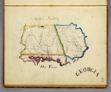
Frances A. Henshaw's Book of Penmanship, 1828 Henshaw, Frances A., Middlebury, Vermont 19 maps. Exquisite hand drawn maps of the states. Notwithstanding the title, this is a geography book hand drawn by a very promising student. It includes descriptions of Astronomical Geography, the Ptolemaic, Brahean and Copernican Systems, Comets, Great Circles, Equator, Meridian, Horizon, Colures, Tropics, Polar Circles, Zones, Climates, Latitude and Longitude, a section titled America, and 19 maps of the states with a descriptive page for each. This addition adds all the text pages to the online atlas. View Atlas |
 |
Historical atlas ... from the creation to A.D. 1828, 1830 Quin, Edward, London 21 maps. 1st edition. The unique maps show progressively receding cloud borders to indicate the expansion of geographical knowledge over time. This addition adds all the text pages to the atlas. View Atlas |
 |
New American Atlas, 1833 Tanner, Henry S., Philadelphia 18 maps on 22 sheets. Although the title page is dated 1825, many maps in the atlas are dated 1833. Several of the state maps are the latest known dates and yet this atlas has several maps of states that are very early dates - the likely explanation is that Tanner was finishing up his inventory of maps for this atlas as he prepared his new atlas, the Universal Atlas, for first issue in parts starting in 1834. View Atlas |
 |
A New Universal Atlas, 1845 Tanner, Henry S., Philadelphia 72 maps. This is the mid 1845 edition, date on title page is 1844. The Texas map by C.S. Williams appears here for the only time in the engraved form. This atlas is one of several editions of the Tanner Universal Atlas in the period 1844 to 1846 that show the transition from engraved atlases to lithographic atlases. View Atlas |
 |
New Universal Atlas, 1848 Greenleaf, Jeremiah, no place 65 maps. Rare reissue of 1842 Greenleaf Universal Atlas. Many changes from the 1842 edition: Florida a State, Michigan entirely redrawn, Mexican War results on North American map, Mexico, Texas, Oregon changes to show 1846 boundary with Canada, Missionary stations listed on the Hemispheres, and many new railroads, counties, boundaries, etc. View Atlas |
 |
A New Universal Atlas, 1848 Bourquin, Frederick; Mitchell, Samuel Augustus; Tanner, Henry S., Philadelphia 76 maps. This is a unique copy of the Mitchell/Tanner Universal Atlas. Frederick Bourquin and his employer, Peter Duval, received a Third Premium Award from the Franklin Institute in November, 1848, for their achievement in transferring the Universal Atlas from copper plates to lithographic stones. This copy of the atlas was their submission to the Franklin Institute to be considered for the award. The atlas is made up of uncolored maps from various editions by Tanner and Mitchell, between 1846 and 1848. It is a document of the important change from engraved maps to lithographic maps. View Atlas |
 |
Physical Atlas of Natural Phenomena, 1856 Johnston, Alexander Keith, 1804-1871, Edinburgh 38 maps. 2nd ed., enlarged. 1st ed. was 1848. Most of the maps are lithographed in color, but some are still engraved. The 1848 ed. was entirely engraved. Maps have both hand and printed color. This addition adds all the text pages which include some maps printed in the text. View Atlas |
 |
Colton's Advertising Atlas Of America, 1857 Colton, G.W., New York 63 maps and many pages of advertisements. Full page advertisements interspersed throughout the atlas with an Index to Advertisements bound in the front. Colton issued this atlas almost as a business directory of New York City industry in the 1850's. View Atlas |
 |
A New Universal Atlas, 1859 Mitchell, Samuel Augustus, Philadelphia 76 maps. The scarce last edition listed in Phillips of Mitchell's New Universal Atlas. It was published by Charles DeSilver of Philadelphia. This edition marks the end of the New Universal Atlas run, which started twenty three years earlier with the Tanner first edition of 1836. View Atlas |
 |
Martenet's Map of Maryland, Atlas Edition, 1866
Martenet, Simon J., Baltimore 53 maps and text pages. This is Martenet's state map in book form, by county. A description of each county accompanies the maps. Manuscript notations updating some of the political geography. List of sources of the map, most of which were Martenet's own surveys. View Atlas |
 |
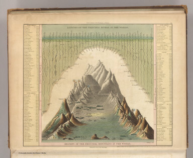
Map of the States Of California And Nevada, 1869 Holt, Warren; Gibbes, C.D., San Francisco Wall map. First issue. Lithographed in Philadelphia by S.B. Linton. The smaller 1873 Holt/Gibbes pocket map of California and Nevada was probably derived from this map. An inset profile shows "Elevation Above The Sea Of Some Of The Principal Mountains In California And Nevada." View Map |
 |
Johnson's New Illustrated Family Atlas Of The World, 1874 Johnson, A.J., New York 70 maps and text pages. The last year of continuous publication for this atlas that started in 1860. For some reason, Johnson seems to not have published atlases in 1875, 1876, and 1878 - or they were published in such small numbers that we have yet to see them. View Atlas |
 |
Rail Road Atlas and Pictorial Album of American Industry, 1875 Asher & Adams, New York 111 maps and advertising pages. This is a very unusual and wonderful atlas - it combines the most complete Asher & Adams atlas map set (the same grouping as the late 1874 issue, but updated - see our #0041) bound unfolded on edge (this is a huge book) with beautiful illustrations opposite each map of industrial establishments, products, and machinery. It has become very scarce. Its sheer size probably meant that the edition was small in number. View Atlas |
 |
A Group of 4 Geologic Atlases, 1887-1904 United States Geological Survey Washington (D.C.) Atlases of the Pacific Slope, Yellowstone Park, Aspen Colorado, and the Marquette Iron District of Michigan. Various authors. All with color lithography by Julius Bien & Co. of New York. View Atlases. |
 |
Nouvel Atlas Illustre Geographie Universelle, 1892 Desbuissons, L.E.; Migeon, J., Paris 67 maps. A late date for an atlas to have hand colored maps, as this does. With a large folding railroad map of Europe in the back. The vignette views are on every map and are very attractive. View Atlas |
 |
Atlas Of The Mexican Conflict, 1914 Rand McNally and Company; Schlitz Brewing Company, Chicago 8 maps. Presents the U.S. side of the conflict. The maps are standard Rand McNally maps of the period, except for the Mexico map which has been overprinted in red to show the war situation, dramatically showing the fleets and forts. View Atlas |
 |
Linea Divisoria Entre Mexico Y Los Estados Unidos, 1901 International Boundary Commission, New York 19 maps. Accompanies Memoria de la seccion Mexicana. Publication date approximate. U.S. and Mexican Commissioners listed with signatures. Maps in black and white and showing 20-foot contours, railroads, survey markers, landmarks, vegetation, watercourses, roads, hachures for edges of mesas, and boundary line. View Atlas |
 |
Atlas Universel de Geographie, 1937 Schrader; Vivien St Martin, L., Paris 80 maps. A fine color lithography atlas from Librairie Hachette. This copy is bound with three screw down bolts, to hold the parts as issued and to substitute new maps as they became available. The earliest map in this set is 1920. Most of the maps are dated from 1930 to 1937. View Atlas |
 |
5 Maps of Yolo County, California, 1900 - 1939 Various authors, various places (Original Not in Rumsey Collection - Original with the Yolo County Records and Archives Center). These maps show the evolution of Yolo County over a 39 year period. View Maps |
