- News
- June 7, 2011
New Geographical Search by MapRank Viewer
The new MapRank Search viewer enables geographical searching of the collection by map location and coverage, in a Google Map window. Pan and zoom the Google Map to the area of the world you want maps of, and the results will automatically appear as a scrollable list of maps with thumbnail images in the right side results window. The maps in the right side results list are ranked by coverage, with the maps that have coverage closest to your search window listed at the top. Maps lower in the list show the area of interest, but with coverage that does not match as closely. Mousing over any map in the list will show the map's coverage as a light red rectangle on top of the Google Map. Clicking on a map in the list will open it in the Luna Browser. You can filter your results with the When timeline, the What or Who keyword text window, and the Map scale windows, as well as search by place name in the Find a place window. Currently about 12,000 online maps are searchable with MapRank search; soon all the 27,000 online maps will be included. Launch MapRank Search.
Below is the MapRank Search viewer zoomed in to find maps of San Francisco, with the 1904 "San Francisco Intensity of Earthquake" map highlighted in red in the results list and with the area covered by the earthquake map shown in light red on the Google Map:
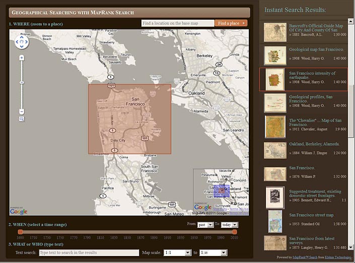
The MapRank Search viewer finding maps of San Francisco, California
Clicking on the thumbnail or title of a map in the list opens it in the Luna Browser with a zoomable image and description:
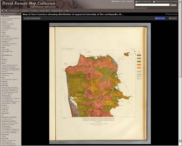
1904 "San Francisco Intensity of Earthquake" map image in the Luna Browser
Zooming out in the Google Map selection window instantly changes the search results to find maps with similar coverage, here the San Francisco Bay Area and Central California:
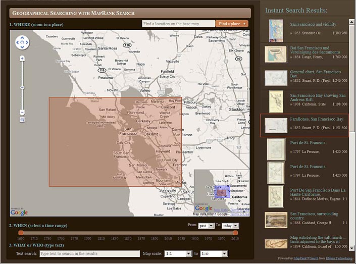
Zooming out from San Francisco changes the results list to show maps of Central California and the San Francisco Bay Area
Zooming out further in the Google Map window changes the map results again to maps of California:
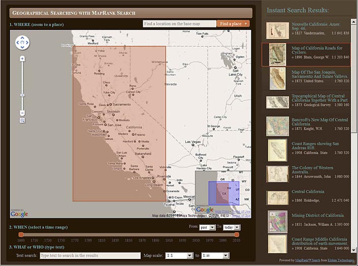
Another zoom out level finds maps of the State of California
Here the Google Map is set to find maps of the American West:
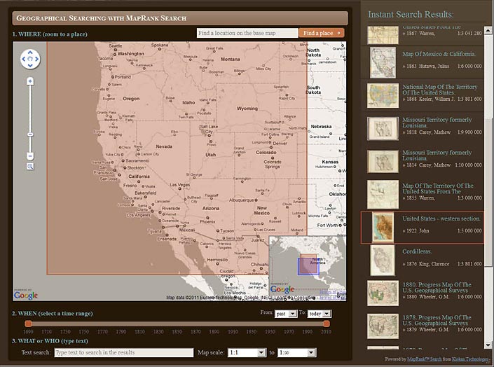
Maps of the entire American West are found with this Google Map window
Zooming out and panning east finds maps of the entire United States:
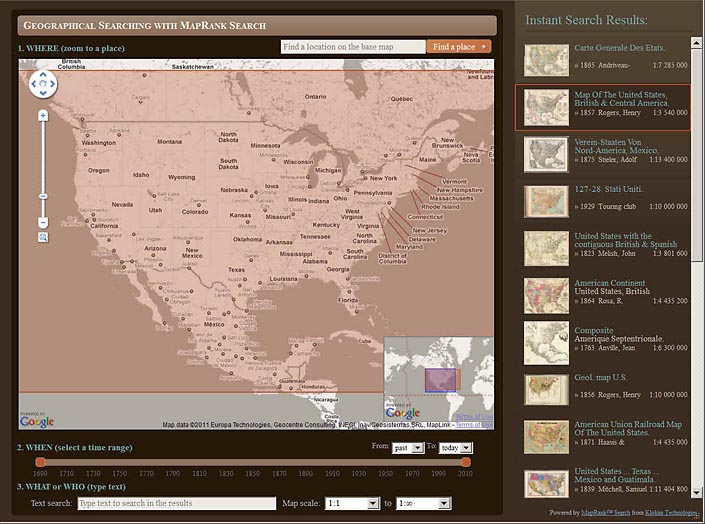
The Google Map window changed to find Unites States maps
Zooming out again finds maps of North and South America:
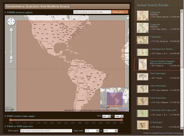
Maps of North and South America are show with this search view
Finally, zooming out to the full extent in the Google Map window finds maps of the entire World:
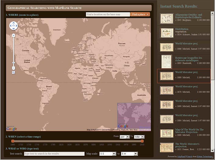
World maps shown in this zoom level
The WHEN time range line allows changing the dates of the results, here from 1690 to 1795 for the same set of World maps:
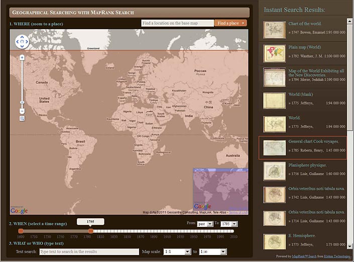
Using the WHEN time range to further filter results to World maps from the period 1690 to 1795
The Map scale boxes are used to limit the range of scales of the search, here set at 1:2,500 to 1:2.5 mil. This setting will show maps with smaller coverages that fall within the Google Map at the top of the list:
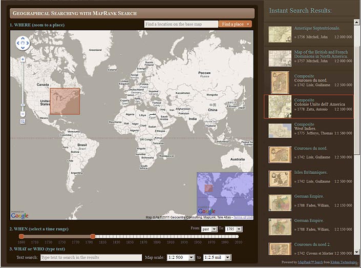
Maps of areas inside the Google Map are found by limiting Map scale at 1:2,500 to 1:2.5 mil
The Find a place box is used here to zoom the Google Map to find maps of Paris, France:
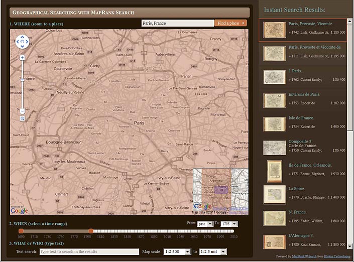
Using the Find a place box to zoom to maps of a place, here Paris, France
The WHAT or WHO box is used to further limit results to maps of Paris by Guillaume De Lisle:
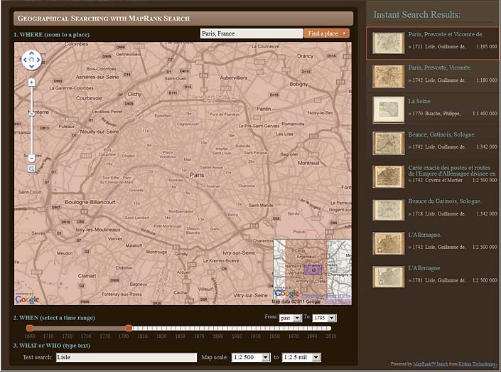
Maps of Paris before 1795 by De Lisle with scale between 1:2,500 and 1:2.5 mil
Zooming out to show all of France finds maps by De Lisle of French provinces, still limited by time and scale:
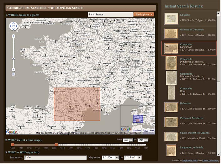
Keeping the same limits of time, scale, and De Lisle, the Google Map is zoomed out and the results are changed again
Finally, keeping the same limits but panning the map to Italy finds maps of Italy by De Lisle with the same time and scale constraints:
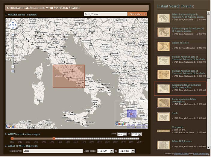
De Lisle Maps of Italy from 1690 to 1795 with scale of 1:2,500 to 1:2.5 mil are shown
This new MapRank search interface allows geographical and spatial searching of the map collection in a dynamic and fluid way. It will provide an entirely new experience of exploring our online map library, using a map to search the collection instead of relying on textual terms alone.
While the new search interface is largely complete, please let us know if you find any errors or problems. The bounding coordinates for the maps are correct in almost all cases, but there may be some maps with incorrect coordinate (coverage) data - please let us know if you find any and we will correct them. The MapRank search interface and program has been developed by Petr Pridal of Klokan Technologies.