 |
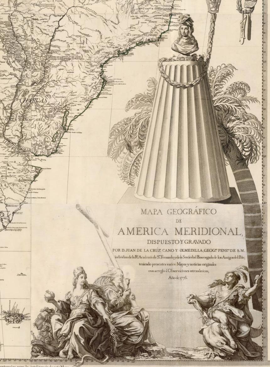
Mapa Geografico De America Meridional, 1775
Cruz Cano y Olmedilla, Juan de la; Ricarte, Hippolytus, Madrid
This is probably the most important map of South America made in the 18th century. When the eight sheets are joined together they make a huge and impressive wall map. The author, Juan de la Cruz Cano y Olmedilla, spent ten years collecting measurements and information compiled by explorers and colonists and incorporated these into the map along with valuable geographical and historical news, with some references to the sources used. This is the second edition with all the sheets from the second edition (except sheet 8, the title sheet which is first edition in all copies). The first edition was somewhat incomplete, almost like a proof. Lavishly and beautifully embellished, the map emphasizes Spanish colonial power in South America. The map went through many editions with various political implications over a period of decades. The only other copy of this complete second edition is in the Biblioteca Nacional in Madrid. Two large inset maps: Puerto de Callao (Lima) and Sitio de Angostura (site of Angostura). View Map
|
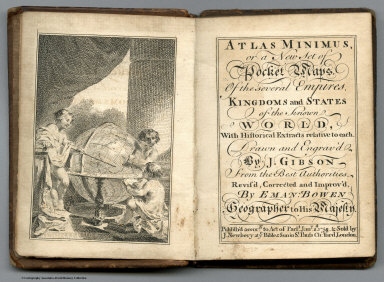 |
Atlas Minimus, 1758; Atlas Geographicus Portatilis, 1762
Gibson, John; Bowen, Emanuel , London
Lotter, Tobias Conrad; Lobeck, Tobias, Augsburg
Two important miniature pocket atlases from the 18th century. The Gibson and Bowen Atlas Minimus went through another London edition in 1792 and a Philadelphia edition by Matthew Carey in 1798. Lotter's Atlas Geographicus Portatilis consists entirely of double-page engraved plates and hand-colored maps. The maps are dense with information, given their small size.View both Miniature Atlases
|
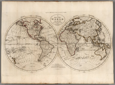 |
The General Atlas For Carey's Edition Of Guthrie's Geography Improved ... 1795
Carey, Mathew, Philadelphia
This atlas accompanies Carey's Philadelphia edition of William Guthrie's Geography, a popular world geography published in several countries in the late 18th century. The maps are similar to those published in Carey's General Atlas of 1796 (see our copy). This atlas is the first world atlas published in America - however, the 1796 edition above is also considered the first because it was issued as a separate atlas, not tied to the Guthrie Geography; it went through several editions up to 1818. View Atlas
|
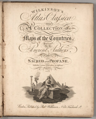 |
Two Editions of Wilkinson's General Atlas of the World, 1806 and 1808, and the 1823 Edition of Wilkinson's Atlas Classica.
Wilkinson, Robert, London
Wilkinson's General Atlas maps were copied freely by American mapmakers of the period, especially the non-American maps. American map publishers such as Lucas, Morse (S.E.), and Cummings & Hilliard (and Worcester) did this. Tooley says the last edition of Wilkinson's Genreal Atlas was 1809 (there appear to be no differences other than the title page between the 1808 and 1809 editions); Phillips has 1807; Moreland mentions 1816 as a re-issue - this also was probably used by the Americans. Wilkinson's Atlas Classica was also a source copied by American publishers for their classical atlases. The first Wilkinson Atlas Classica edition was 1797; this copy is a fairly late issue. Relief shown in various styles of hachures and sketches. Includes six "Chrono-Geneological Charts." View Atlases
|
|

|
Colombia Prima or South America, In which it has been attempted to delineate the Extent of our Knowledge of that Continent Extracted Chiefly from the Original Manuscript Maps of His Excellency the late Chevalier Pinto Likewise from those of Joao Joaquin da Rocha, Joao da Costa Ferreira, El Padre Francisco Manuel Sobrevielo &c. And From the most Authentic Edited Accounts of Those Countries, 1807
Faden, William, 1750?-1836; Delarochette, Louis Stanislas d'Arcy, London
An enormous early 19th century map of South America, rivaled only by Arrowsmith's map of 1810/1814. Shows the various colonial possessions with great detail. Scale approximate; six different scales provided. A compilation based on many reputable sources, as itemized on Sheet 8. Index on cover uses the title,"South America from the Latest Spanish and Portuguese Surveys". Each of the 8 sheets are cut into rectangles and backed with sturdy white muslin. Relief shown in hachures. Limits of the dominions of the Spanish, Portuguese, French and Dutch highlighted in color. Multiple languages per dominions, and includes English. View Map
|
|
|
13 Maps and 1 Atlas by Aaron Arrowsmith, various dates, 1799 to 1822
Arrowsmith, Aaron, London
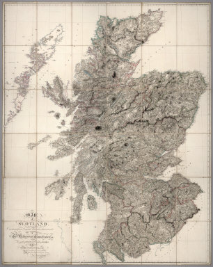
Continuing our placing online the non-American maps of Aaron Arrowsmith (see our previous group of Arrowsmith maps here), we have added maps of Egypt, Ireland, Scotland, England and Wales (2 editions), Germany (2 editions), East India Islands, Greece, Asia Minor, and Southeast Asia. Included also is a small five sheet atlas titled "Complete Neptune, to Illustrate, by Arrowsmith, The Progress of Maritime Discovery," which shows the progress of mapping the coast of Africa from Gibraltar south to the Cape of Good Hope. Typical of Arrowsmith's fine cartography, the maps are extraordinarily detailed and up-to-date for their time. View Maps View All Arrowsmith Maps
|
 |
Oddy's New General Atlas Of The World Containing Maps of Empires, Kingdoms, States Principalities &c. Engraved and Carefully Selected from the latest and most Approved Authors by James Wallis. London. Published by S.A. Oddy, No. 20 Warwick Lane & Sold by Davies & Eldridge, Exeter, Thompson & Wrightson, Birmingham & T. Sutherland, Edinburgh. 1811
Oddy, S.A.; Wallis, James, London
Obscure atlas not in Phillips. Similar to Wilkinson, but different. Important for being the source of most of the non U.S. state maps published by Lucas in his New and Elegant General Atlas of 1815 (see our copy). Most of these maps were also used in the 1823 General Atlas by Lucas, although North America was done new as well as a few others. Maps are hand painted in full color. Prime meridian London. Relief shown by sketches. View Atlas
|
 |
A Military and Topographical Atlas of the United States; including The British Possessions & Florida ... To Which Is Added, A List Of The Military Districts, A Register Of The Army, And A List Of The Navy Of The United States, 2 editions, 1813 and 1815.
Melish, John, Philadelphia
1st edition. and 2nd edition. The first edition was published during the war of 1812, and thus has the feeling of events unfolding with an uncertain outcome. The second edition was published in 1815 after the conclusion of the war, and has different text, and is more of a history. Henry Tanner engraved the five large maps that Melish drew, and J. Vallance engraved the three small maps. We believe this is the first book Melish published with the idea that it was an "Atlas." View Atlases
|
 |
372 Pocket Maps and Related Images, Various Dates, 1813 - 1969.
Various Authors and various Publishers.
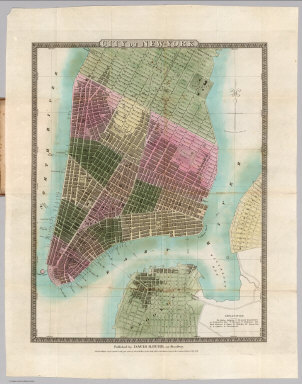
A wide ranging group of Pocket Maps from the 19th and 20th centuries. View Maps
|
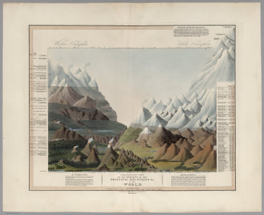 |
Comparative View of the Heights of the Principal Mountains &c. in the World, 1816
Smith, C., London
Third edition. A colorful rendering of comparative mountain heights worldwide, although separated into the Western and Eastern Hemispheres. Other aspects of the illustration (with the exception of showing volcanoes) appear to be fanciful. Substantially more taller mountains than an earlier edition (although the same date). The peaks are listed, each with a unique number which can be matched up with the numbers at the top and bottom of the illustration. By making a line between the numbers, the corresponding peak is intersected. View Map
|
|
|
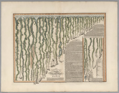
Comparative View of the Lengths of the Principal Rivers in the World, 1817
Smith, C., London
This is a companion map to the Heights of Mountains map also by Smith. The rivers have been necessarily straightened to indicate the lengths of the rivers. The compass orientation of the flowing stream is indicated by small north-pointing arrows periodically drawn adjacent to the stream. Includes table of the Length of Rivers in British Miles. A textual description of the rivers accompanies the illustration; it describes the course of the Missouri River, "recently explored by the Americans" (Lewis and Clark), as being "extremely devious." Beautiful color. View Map
|
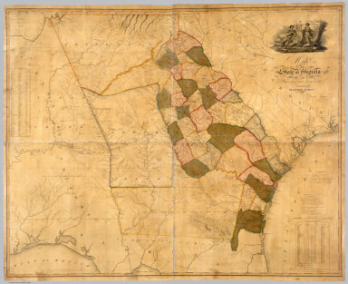 |
Map Of The State of Georgia Prepared from actual Surveys and other Documents for Eleazer Early By Daniel Sturges, 1818
Early, Eleazer; Sturges, Daniel, Savannah
This is the first large scale map of Georgia and it ranks in importance with the other large Southern State and Territory maps of the period. It was undoubtedly the most accurate Georgia map when published, It has a lovely cartouche vignette, a table of distances, a statistical table, and "Remarks, Statistical and Geological." Streeter: "All in all an important and elaborate map of Georgia in the first part of the nineteenth century." View Map
|
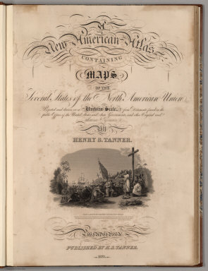 |
A New American Atlas Containing Maps Of The Several States of the North American Union, Projected and drawn on a Uniform Scale from Documents found in the public Offices of the United States and State Governments, and other Original and Authentic Information - Three Editions, 1823, 1824, 1833
Tanner, Henry, Philadelphia
Three editions of this important atlas, each with different or similar issues of the maps. After the first edition of this atlas, it is clear from looking at these and later issues that Tanner simply used maps that were available in his stock, regardless of whether they were the more recently updated copies. Nonetheless, the atlases represent an extraordinarily detailed and accurate look at the political and industrial development of the United States at the time. View Atlases
View All Six Editions of the American Atlas.
|
 |
A Group of 58 Guide Books from 1819 to 1934
Various Authors, Various Places
Includes city guides, state guides, national railroad guides, a guide to Chicago including a "history of the Great Fire," Langley's Street Guide to San Francisco with all the street listing pages, Boardman's White Mountain Guide, Guides to Canals and Railroads, Norman's Guide to New Orleans, Disturnell's Hudson River Guide, and others. Many of the guides contain interesting illustrations, views, and advertisements. View Guides
|
 |
Karte der Schweiz, von Dr. I. Woerl. Lithographie von B. Herder in Freiburg im Breisgau, 1835
Woerl, Joseph Edmund; Herder, Bartholomew, Freiburg im Breisgau
This little-known map of Switzerland by Joseph Edmund Woerl is an important record of the Swiss road network in the early 19th century. It is also an outstanding example of early lithographic map printing. Woerl seems to have pioneered a method of using color lithography to show roads and important places and towns - he used a red lithographic stone for a second overlay printing. Espenhorst speculates that Woerl may have used a unique combination of lithography and engraving to produce these maps. View Maps
|
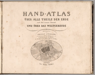 |
Hand Atlas Uber Alle Theile Der Erde nach dem neuesten Zustande Und Uber Das Weltgebaude, 1837
Stieler, Adolf, Gotha
Date estimated. 29 maps as issued thus a smaller version; 50 was the standard issue. Maps dated 1828-37. The atlas was originally issued in parts in 1816-23, totaling 50 maps. In 1832 a 63 map edition was advertised to be issued in 6 parts. See P6039 for further details. The Stieler Hand Atlas was often issued with different numbers of maps, tailored to fit the customer's specific needs. View Atlas
|
 |
Nach Angabe und auf Kosten des Verfassers der Darstellung des Erzharzofthums Osterreich unter der Ens. (The depiction of the Archduchy Austria below the Enns), 1837
Schweickhardt, Franz Xaver, Vienna
An extraordinary group of 63 birds-eye views of the Austrian countryside that all fit together into one very large image (we also have the composite image of all 63 joined). Schweickhardt intended to make 160 views but was unable to finish the project due to financial difficulties.The views show the cultural landscape of the period in great detail, with settlements, buildings, roads, trees, and other features. View Atlas View in Google Earth
|
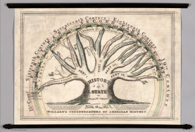 |
Willard's Chronographer of American History, 1845
Willard, Emma, New York
Willard uses the Historic Tree as a visualization of important events in American history. A smaller version of this diagram appears in one of her text books. Willard sums up her goal with this chart: "The eye is the only medium of permanent impression. The essential point in a date, is to know the relative place of an event, or how it stands in time, compared with other important events." View Map
|
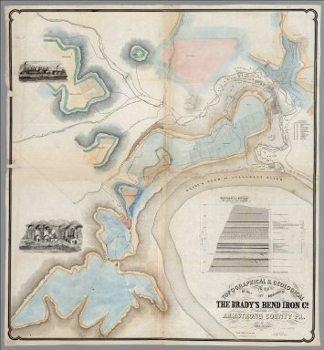 |
Topographical & Geological Map Of The Property Belonging To The Brady's Bend Iron Co. Located In Armstrong County Pa., 1850
Franks, Theo.; Brady's Bend Iron Co., Pittsburgh
This remarkable large map shows in great detail the works of the Brandy's Bend Iron Co. on the Allegheny River northeast of Pittsburgh. The scale is large and the map is subtly colored. All the buildings, tracks, roads and Collieries are delineated. There is a "Geological Section from Notes by Prof. Shepherd" showing the land on which the Iron Company is built. Two vignettes show the imposing buildings. Why this map was made is not clear, certainly not for general consumption, but perhaps for investors or others specifically interested in the Companies facilities. The date is estimated. Scale 300 feet to an inch. View Map
|
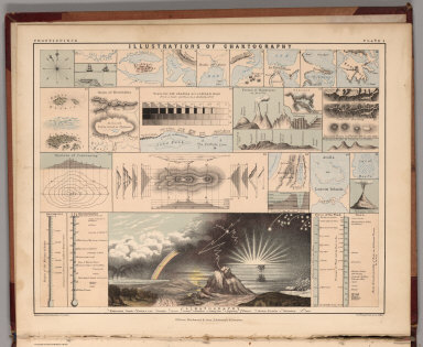 |
Atlas Of Physical Geography, Illustrating, In A Series Of Original Designs, The Elementary Facts Of Geology, Hydrology, Meteorology, And Natural History, 1852
Johnston, A. Keith, Edinburgh, London
Smaller edition of the Johnston's large physical atlas of 1856 (first issued in 1848). The thematic maps are simplified and in that process become very interesting in themselves. Printed in full color. Relief shown by hachures. View Atlas
|
 |
Department of Oregon. Map of the State of Oregon and Washington Territory, 1859
U.S. War Department, Topographical Engineers, Washington, D.C.
Wheat: "Map shows Washington Territory curving around the state of Oregon and taking in all of Idaho, although a political border is not shown. A number of "authorities" are stated in a note, and except for the unexplored portions this seems to be about the best map of Oregon, Washington and Idaho country that could have been made prior to the Civil War. It is an excellent map." This map was part of a series of maps by the U.S. Topographical Engineers - see Wheat 960 "Map of Utah Territory" 1858 and Wheat 967 "Territory and Military Department of New Mexico 1859." View Map
|
|

|
Illustrirter Handatlas fur Freunde der Erdkunde und Zum Gebrauch Beim Unterricht im verein mit Heinrich Leutemann Herausgegeben von Ehrenfried Leeder und Theodor Schade, 1863
Brockhaus, F.A.; Leeder, Ehrenfried; Leutemann, Heinrich, Leipzig.
Lavishly illustrated around margins of maps with high quality vignettes of animals, structures and people. Espenhorst: "The atlas had 22 maps, drawn under the direction of Ehrenfried Leeder (1820-1884), as well as illustrations produced by Heinrich Leutemann (1824-1905), who had been working for Brockhaus since 1837. The 32 unnumbered pages of accompanying text were prepared under the direction of Theodor Schade (1820-1882)...Leutemann produced over 200 steel-engraved illustrations, most of which were used as frames around the maps...Thus each sheet had a colored map in its center, surrounded by appropriate scenes illustrating the land and its people, the animals and plants to be found there as well as the buildings and scenery which could be seen...these atlases are so sought after today that a reprint of the 1863 edition was produced in 2005." View Atlas
|
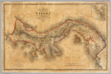 |
Carta corografica del Estado de Panama, 1865
Columbia. Comision Corografica; Ponce de Leon, Manuel, Paris, Bogota
One of the earliest printed maps of Panama based upon indigenous surveys. Published during the period when it was still one of the states of Colombia. This map was part of the mapping of Colombia undertaken by Ponce de Leon, Maria Paz, and Codazzi. With Codazzi's death, Maria Paz and Manuel Ponce de Leon were given control of the project's completion and publication of the surveying and mapping work. View Map
|
 |
Detailed Maps Of The North West Boundary From Points Roberts To The Rocky Mountains Between The United States And The British Possessions, 1866
U.S. North West Boundary Survey; Campbell, Archibald, New York
7 very large and detailed maps of the boundary. The maps are undated and not listed specifically in any sources we can locate. These maps are unusual in appearance because of the photo-lithographic enlargement - a great deal of detail is apparent. When put together the seven sheets are about forty feet long - we have made a composite. View Maps
|
|
|
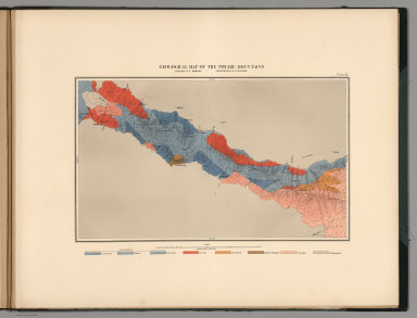
United States Geological Exploration of the Fortieth Parallel. Clarence King. Geologist in Charge. Atlas Accompanying Volume III on Mining Industry, 1870
King, Clarence, Washington, D.C.
Early geological mapping of the Comstock Lode - a later and more detailed rendering of the Comstock Lode appears in Becker's subsequent 1882 U.S. Geological Survey Atlas of the Geology of the Comstock Lode. By that time Clarence King was Director of the U.S.G.S. Excellent overview map showing the locations of mines along the route of King's 40th Parallel survey. View Atlas
|
|

|
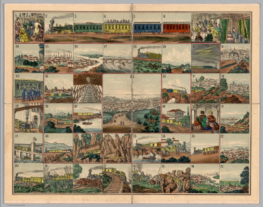
The Voyage from New York to San Francisco upon the Union Pacific Railroad. El Viage De Nueva York A San Francisco Sobre el ferro-carril pacifico de los estados unidos. Reise von New-York nach San Francisco auf der Union-Pacific Bahn. Il viaggio di Nuova York a San Francisco sulla strada ferrata pacifica degli stati uniti. De reis van New-York na San-francisco op de Pacific-ijzerbaan van de vereenigte Staaten. Le voyage de New-york a San Francisco sur le chemin de fer pacific des etats unis, 1870
Union Pacific Railroad Game, No Place of Publication
Date and author estimated, not indicated in the printed materials. An unusual board game based on the "new Union Pacific Railroad." The game board shows forty five beautifully executed views of places along the Union Pacific route, starting with "Rail road depot in New York" and ending in "San Francisco, the metropolis of California." Along the way, we have, among others, views of Pittsburgh, Omaha, "surprise by savage Indians," "wild heard of buffalloes," "railroad bridge over the Platte river," Cheyenne, Green River, Humboldt Valley, "Trukee" Valley, Sierra Nevada and Sacramento. The text is titled "Trip from New-York to San Francisco by the Union Pacific Rail Road. A new illustrated Travel-game with 45 stations, 1 dy, 12 cars and 12 numbers charts." The text is written in German and English and explains the game and the views. The cover of the game box (19x24) has a lovely colored litho view of two women joining hands across the American Continent, one representing America and the other Asia. Not in any of the standard game references - rare. View Game
|
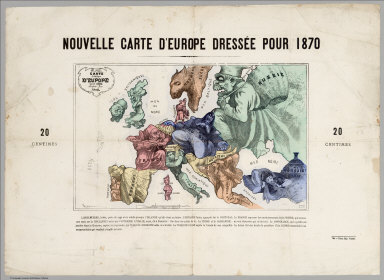 |
Carte drolatique d'Europe pour 1870
Hadol, Paul, 1835-1875, Paris
Each country is represented by human and animal form of a cartoon character that reflects the personality of each country at the onset of the Franco-Prussian war of 1870. Russia, embracing all the German states, expands in every direction with one hand placed firmly on Holland and Belgium. With one knee she crushes Austria. The map is attributed to Paul Hadol, a French caricaturist of the Napoleonic Third Empire. View Map
|
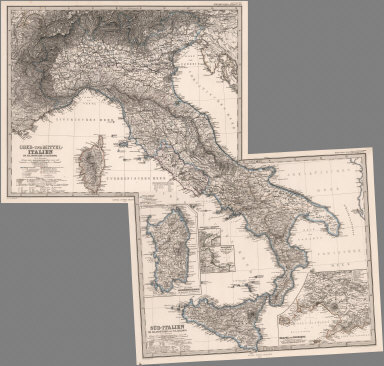 |
Hand Atlas Uber Alle Theile Der Erde Und Uber Das Weltgebaude. Erste Auscabe 1817 Jubel Auscabe 1867, 1873
Stieler, Adolf, Gotha
Date estimated. A composite atlas with title page, no index. A strange collection in original binding, indicating it was made up for a customer who seemed to want several maps of the same area, but with different publication dates. Maps are dated from early 1860's to 1873. According to the title page, 1817 was the first edition of Stieler's Atlas; Title page is dated 1867. Some of the multi-sheet map sets are incomplete, as in the United States with three sheets of six. View Atlas
|
 |
Reports upon the Survey of the Boundary Between the Territory of the United States and the Possessions of Great Britain from the Lake of the Woods to the Summit of the Rocky Mountains, 1878
U.S. Northern Boundary Commission; Campbell, Archibald; Twining, W.J., Washington
Surveys from Lake of the Woods to Rocky Mts. A separate atlas of 24 maps was published to accompany this report. See also the 1866 U.S. North West Boundary maps for the survey from the Rocky Mountains to the Pacific. View Report
|
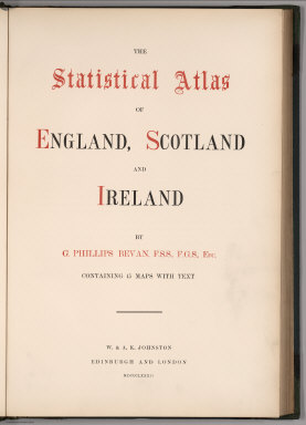 |
The Statistical Atlas of England, Scotland and Ireland, 1882
Bevan, G. Phillips, Edinburgh, London
This atlas is interesting for its visualization of statistical data of various kinds, using maps of England, Scotland, and Ireland to place data regarding crime, agriculture, education, mining, religion, and more. However the maps themselves are somewhat unimaginative in showing the data: basically, the data is placed on the maps in different colors and symbols, in a manner that conveys the spatial aspects of the information but does not go much further. Francis Walker's Statistical Atlas of the U.S. Census published in 1874 is far more path breaking in its visualizations and it is odd that Bevan seems to be unaware of it, eight years later. View Atlas
|
 |
Map of Western Palestine in 26 Sheets from surveys conducted for the Committee of the Palestine Exploration Fund by Lieutenants C.R. Conder and H.H. Kitchener, R.E. During the Years 1872 - 1877. [Bound with 4 other maps of Palestine], 1880
Conder, C.R. (Claude Reignier); Kitchener, H.R. (Horatio Herbert), London
Kitchener's Palestine survey was important because it was so accurate that it is still consulted today as a reliable record of late 19th century Palestine by archaeologists and geographers. This copy is special: it is likely the 3rd issue of the 26 sheet map and was printed by Edward Stanford instead of the Ordnance Survey which produced the first two issues earlier in 1880 and, bound with this copy are four additional maps of Palestine made by Stanford and based on the 26 sheet survey (two of the additional maps are dated 1881 and 1882 respectively, indicating that this bound volume was issued in 1882). View Atlas View 26 Sheet Palestine Map in Google Earth
|
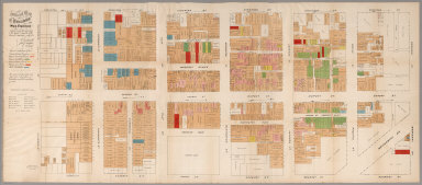 |
Official Map of Chinatown in San Francisco. Prepared under the supervision of the Special Committee of the Board of Supervisors, July, 1885
Farwell, Willard B.; Kunkler, John E.; Pond, E.B., San Francisco
First edition, first issue. Large folding map on two sheets, joined. Printed in colors. In 1885, at the height of the anti-Chinese hysteria in California, the official Report of the Special Committee of the Board of Supervisors was issued, reporting on the "Condition of the Chinese Quarter and the Chinese in San Francisco." This inflammatory report included the rare folding color map of Chinatown, but in the usual "small-scale" version (approx. 8½x19½ inches). The same small map was also issued in the San Francisco Municipal Report of 1884-85, and in Farwell's The Chinese at Home and Abroad.. However, the first issue of this map was printed in a supersized version by San Francisco's first "fine press printer," Edward Bosqui, and this is our copy shown here. It was most likely printed for the use of key city officials. The map shows San Francisco's Chinatown, bordered by California, Stockton, Broadway, and Kearney Streets. It is color-coded to show every business, gambling parlor, houses of white and Chinese prostitution, opium "Resorts," joss houses, etc. It was printed on a scale of 40 feet to the inch. The differences in this large-scale copy and the smaller version are the list of Supervisors imprinted thereon, different type fonts for streets, etc, one mistakenly identified house of white prostitution (corrected in the smaller version as a house of Chinese prostitution), and the Bosqui imprint. This large-scale version is exceedingly rare. Only a handful of copies are known, most in institutional libraries. View Map View Map in Google Earth
|
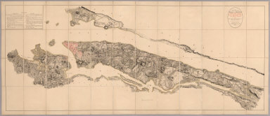 |
B.F. Steven's Facsimile of the Unpublished British Head Quarters Coloured Manuscript map of New York & Environs, 1782, Reproduced from the original drawing in the War Office, London. Issued only to subscribers at 4, Trafalgar Square, W.C., London. 1782
Great Britain. War Office; Stevens, Benjamin Franklin , London
From the printed advertisement for the map: "BF STEVENS'S Facsimile of the Unpublished British Headquarters Coloured Manuscript Map of New York and Environs 1782. Reproduced from the Original Drawing in the War Office London. 24 sheets Scale 6 1/2 inches to a mile. 10 feet by 4 feet. The successive British Commanders in Chief in America Generals Sir William Howe, Sir Henry Clinton, and Sir Guy Carleton during their respective occupations of New York and Environs in the Revolution caused this manuscript plan from time to time to be kept up. The plan extends from below Guanas Bay to the Heights of Spikendevil, a distance of about eighteen or nineteen miles. It shows the Fortifications, Defenses, Topography, Streets, Roads, etc. of the whole of the Island of New York with the Harbor Islands, Water Ways, and River Frontages on the Hudson and East Rivers, the Military Works on Long Island including Brooklyn, the Works in Paulus Hook and parts of the Jersey Shore. It has a copious Table of References to various works British and American, some of them with notes as to the time of their construction or destruction. The Original Drawing, ten feet by four feet, is on a scale of about six and a half inches to a mile. It is handsomely reproduced for subscribers only in careful facsimile on 24 sheets which can be joined up and mounted like the original as a Wall Map or mounted on linen if desired." View Map
|
 |
Andrees Allgemeiner Handatlas in 139 Haupt- und 161 Nebenkarten nebst vollstandigem alphabetischem Namenverzeichnis. Funfte, vollig neubearbeitete und vermehrte Auflage. Jubilaumsausgabe. Herausgegeben von A. Scobel. Bielefeld Und Leipzig, Verlag Von Velhagen & Klasing, 1906.
Andree, Richard; Scobel, Albert, Leipzig
Andre's atlas is know for fine engraving and extraordinary detail. He produced the early versions of the Times Atlas until Bartholomew took over in 1922. View Atlas
|
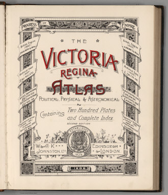 |
The Victoria Regina Atlas, Political, Physical & Astronomical. Containing Two Hundred Plates and Complete Index. Second Edition. W. & A.K. Johnston, Ltd. Established 1825. Edinburgh & London. 1906.
W. & A.K. Johnston Limited, Edinburgh, London
This atlas is small format but dense with information. Many of the maps are part of larger composites, which we have assembled as such. The regional and city maps are very well done. View Atlas
|
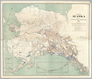 |
Map of Alaska By the Alaska Road Commission. 1909
United States. Alaska Road Commission, Washington D.C.
The map is a huge production, much larger than any other general map of Alaska published in this time period. The Board of Road Commissioners for Alaska, more commonly known as the Alaska Road Commission or ARC, was created in 1905 as a board of the U.S. War Department. It produced this map which shows roads, trails, railroads, telegraph lines, etc. Relief shown by contours. contour interval 1000 feet. At 5ft by 6ft, few maps of this period have as much detail and information. View Map
|
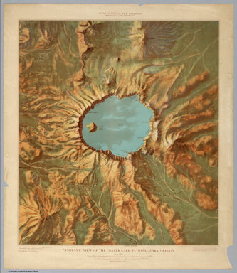 |
Six Panoramic Views of United States National Parks, 1914 - 1915
USGS (U.S. Geological Survey); John H. Renshawe , Washington D.C.
Shaded relief without contours. Full color artistic rendering of the parks which is very effective and unusual. Part of a series for the national parks. View Maps
|
 |
Official California State Highway System Maps From 1918 - 1990
California Department of Transportation (CALTRANS), Sacramento
A reversed chronological assembly (broken run) of 45 official California highway maps bound together with a custom cover. Begins in 1990 and goes back to 1918. Shows the development of the highway system over time. Color. Information included varies by date but includes regional enlargements, illustrations, descriptive text, route descriptions, and construction and funding status. Atlas obtained from the Institute of Transportation Studies Library (Harmer E. Davis Transportation Library) at the University of California, Berkeley View Maps
|
 |
California, 1945
Mora, Jo, Monterey
Jo Mora has created a delightful and beautiful map of California that is both personal and humorous. Pictorial map with vignettes and text. Mission pictures. Full color. View Map
|
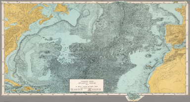 |
Physiographic Diagram, Atlantic Ocean (Sheet 1), 1957
Heezen, Bruce C.; Tharp, Marie
An early bathymetric chart of the Atlantic by Heezen and Tharp. View Map
|
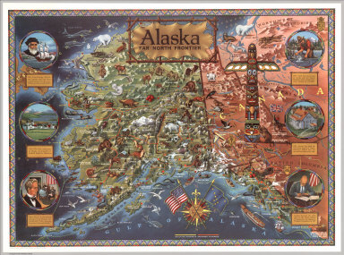 |
Alaska: Far North Frontier, 1959
Klengston Rude, Studio City, California.
Color pictorial map of Alaska, published the year Alaska officially became the 49th state of the United States of America. Showing rivers, straits, sounds, towns, mountain ranges (drawn in aerial perspective), glaciers (shaded white), and existing and proposed highways. The map is richly illustrated with naturalistic depictions of wildlife, agricultural products, historical landmarks, oil fields and fisheries. Along the left and right sides, six circular illustrations highlight important events in Alaskan history. View Map
|
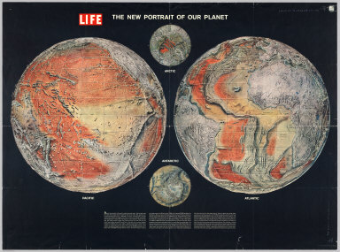 |
The New Portrait of our Planet. Life, 1960
Time Inc., New York.
A Life magazine publication. Hemispheric projection. A striking illustration of the geological and bathymetric theories at the time. View Map
|
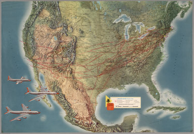 |
Six Airline Route Maps, 1960 - 1967
Various Authors, Various Places of Publication..
A group of six large, early airline route maps. Maps have shaded relief. They include illustrations and descriptions of aircraft, sights, cities, landscapes, geology, and aerial views. View Maps
|
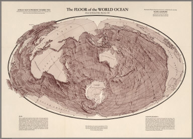 |
The Floor of the World Ocean, 1961
Harrison, Richard Edes
Modified Briesmeister Elliptical Equal-Area Projection. Map Supplement Number Two, Annals of the Association of American Geographers, Volume 51, No.3, September 1961. From the map note: "This map is a visual interpretation of the latest available bathymetric data. In the view of our incomplete knowledge, the drawing incorporates a number of surmises - especially in the inadequately surveyed portions of the Indian and Pacific Oceans." View Map
|
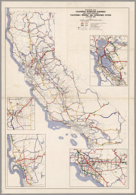 |
Eleven California Freeway and Expressway Maps, 1962 - 1975
California Department of Transportation, Division of Highways, Sacramento.
These maps show the development of the freeway and interstate highways in California over a period of 13 years, from 1962 to 1975 when the system grew exponentially. The maps include regional enlargements of San Francisco Bay Area, Sacramento, San Diego, and Los Angeles. Maps obtained from the Institute of Transportation Studies Library (Harmer E. Davis Transportation Library) at the University of California, Berkeley. View Maps
|
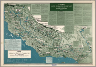 |
California Water Resources Development, including Development of the Bureau of Reclamation, U.S. Army Corps of Engineers, Major Features of the California Water Plan together with Various Projects of Districts and Municipalities, 1963
Irrigation Districts Association of California, San Francisco
Oblique view with shaded relief. Text description of water development features. Reflects the expansive dam building attitudes of the period. View Map
|
 |
Atlas Ceskoslovenske Socialisticke Republiky. (Atlas of the Czechoslovakian Socialist Republic), 1966
Götz, Antonín; Československá akademie věd.; Czechoslovakia. Ústřední správa geodézie a kartografie
A stunning atlas produced in the former Czechoslovakia, showing a great deal of thematic data in excellent cartographic design. In Russian, Czech, and English. View Atlas
|
 |
Atlas of Volcanic Phenomena, 1971
U.S. Geological Survey, Washington, D.C.
Colorful set of 20 posters of volcanic phenomena. "Original material compiled for use by the Smithsonian Institution." View Atlas
|
 |
Climatic Atlas of North and Central America. Atlas climatico de America del Norte y America Central. Altas climatique de l'Amerique de Nord et de l'Amerique Centrale. I. Maps of mean temperatures and precipitation ... 1979
World Meteorological Organization (WMO), Hungary
Maps show air temperatures by month and by year. Compiled based on international standards. Color. Isohyetal maps. View Atlas
|


