- News
- September 2, 2013
Smithsonian and ESRI use Rumsey Maps in New Time Viewer
The online Smithsonian Magazine has partnered with Allen Carroll and Bern Szukalski at ESRI's story maps to create urban history time viewers showing changes in the growth of six American cities using georeferenced maps from the Rumsey Collection (you can read the text of the Smithsonian articles but for links to the interactive maps, use the links below, the links in the articles no longer work).
In addition to the Map of New York below, five other cities are shown: Chicago in 1868, Denver in 1879, Los Angeles in 1880, Washington D.C. in 1851, and San Francisco in 1859.
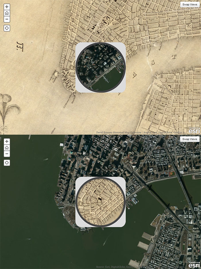
Below are two images of Colton's 1836 Map of New York City compared to a modern satellite image, using the "spyglass" map viewer created by the ESRI map story team. You can switch between the old map and the modern map as a base, using the "Swap Views" button in the upper right corner. Pan by dragging the whole map. See the live interactive viewer here.
You can see more ESRI story maps on other topics and themes here.
3 Comments on Smithsonian and ESRI use Rumsey Maps in New Time Viewer
RalfLippold
on September 2, 2013 at 8:16PM wrote:
Great work - the power of artful technology use!
yangjun
on October 30, 2017 at 2:12AM wrote:
i want to get this demo source!thanks you !
I thought you might like to see a post I did on my blog about this great project: http://crotonhistory.org/2013/09/02/the-ultimate-birds-eye-view-of-manhattan/