- Recent Additions
- February 27, 2021
Online Rumsey Maps Reach 105,000. Part Two - 2017 Additions
This is Part Two of the blog post documenting the 46,000 new maps and images that have been added online since 2015. The total online collection is now over 105,000. This post covers 50 highlights of additions made in 2017. Later posts will cover the additions made in 2018, 2019, and 2020. All titles may be found by clicking on the View links or images below.
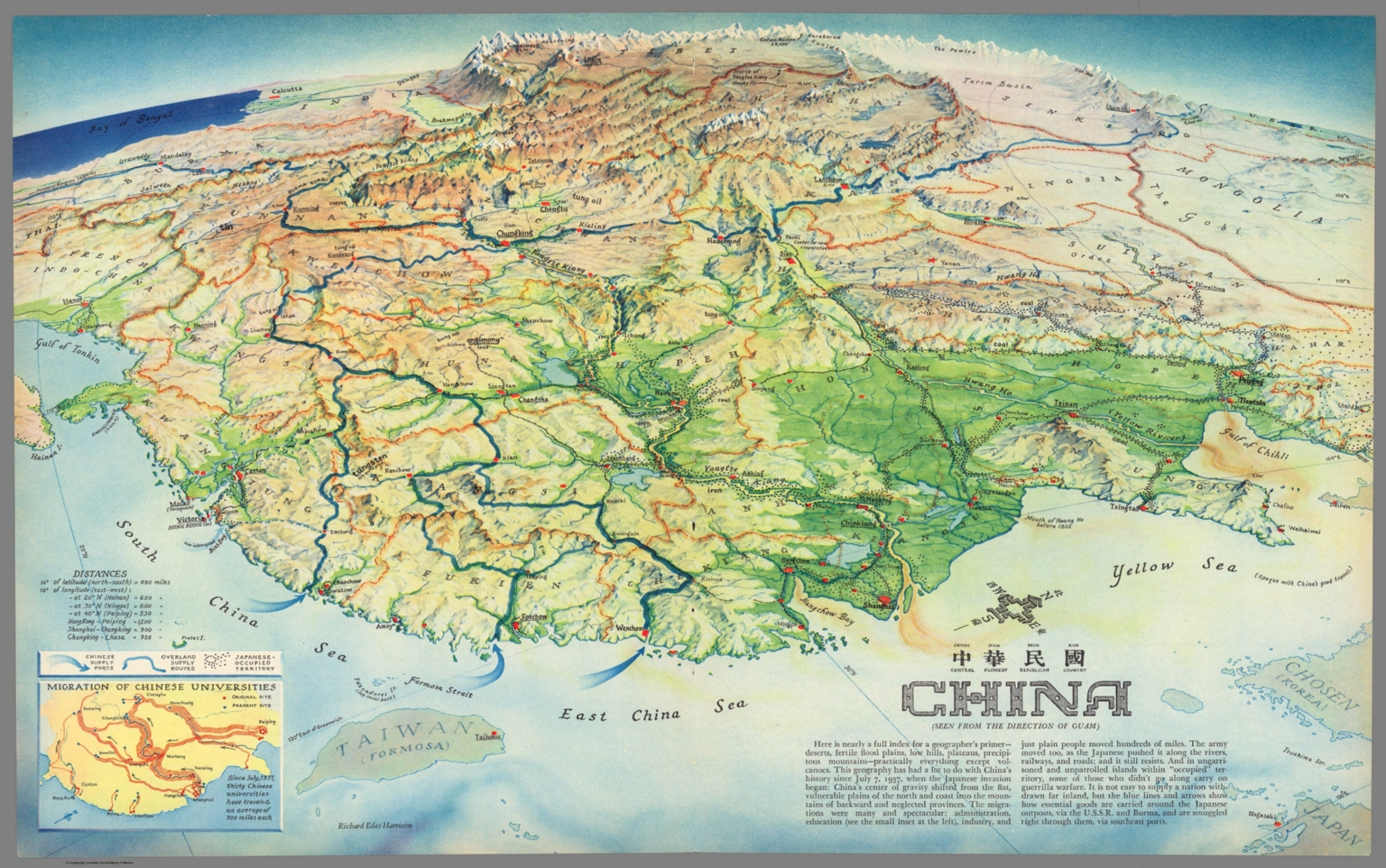 |
China : Chung Hue Min Kuo = central flowery republican country. (Seen from the direction of Guam). Richard Edes Harrison. (inset) Migration of Chinese Universities. 1941. Color map. Title in Chinese and English. Published as supplement to Fortune Magazine, April 1941. Richard Edes Harrison designed the maps to be both visually appealing and politically charged, reflecting the urgency of the war. Map shows boundaries, major cities, ports, Chinese supply ports, overland supply routes and Japanese occupied territory. Includes notes and table of distances. Relief shown pictorially and by shadings. View Map |
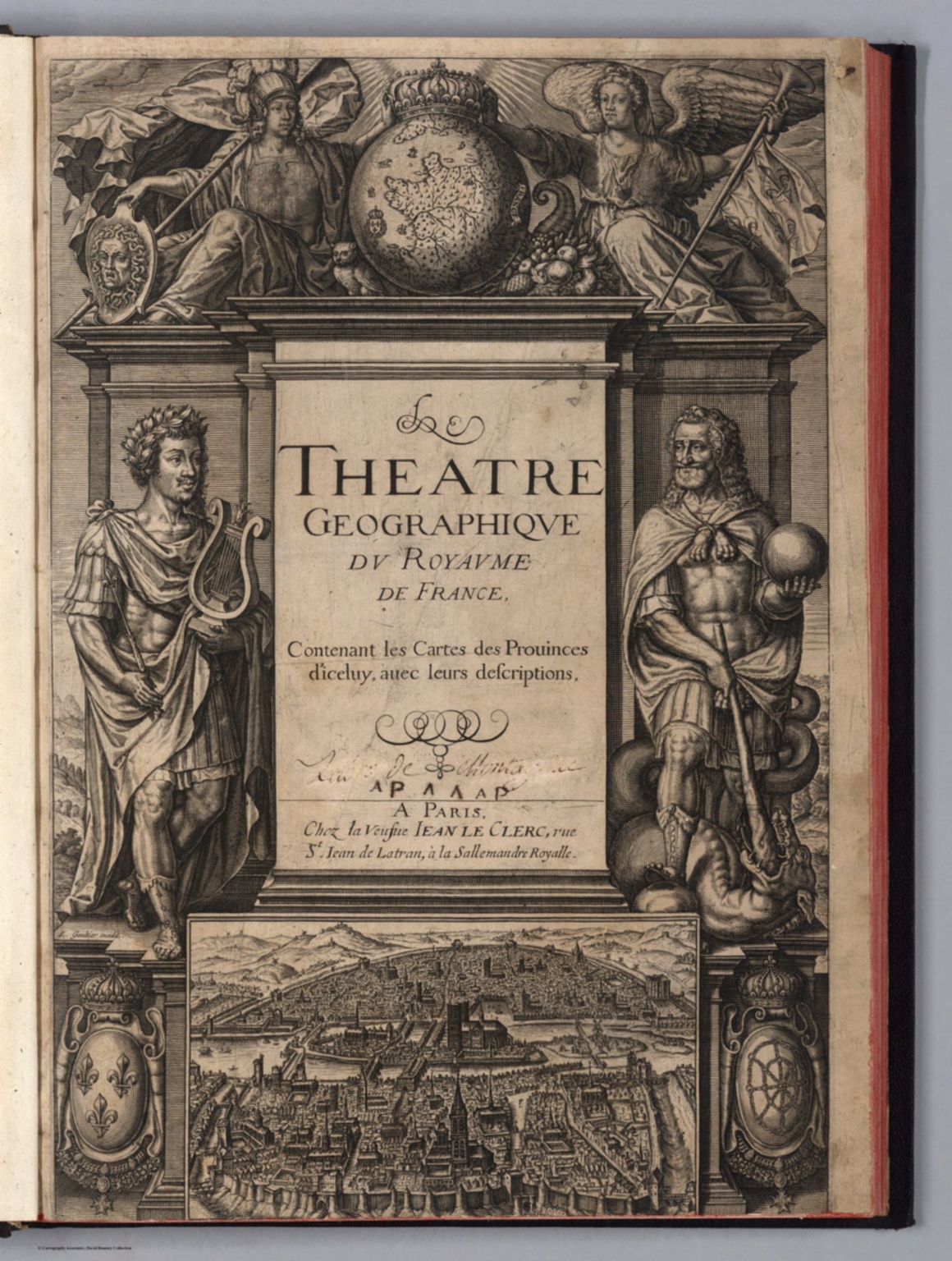 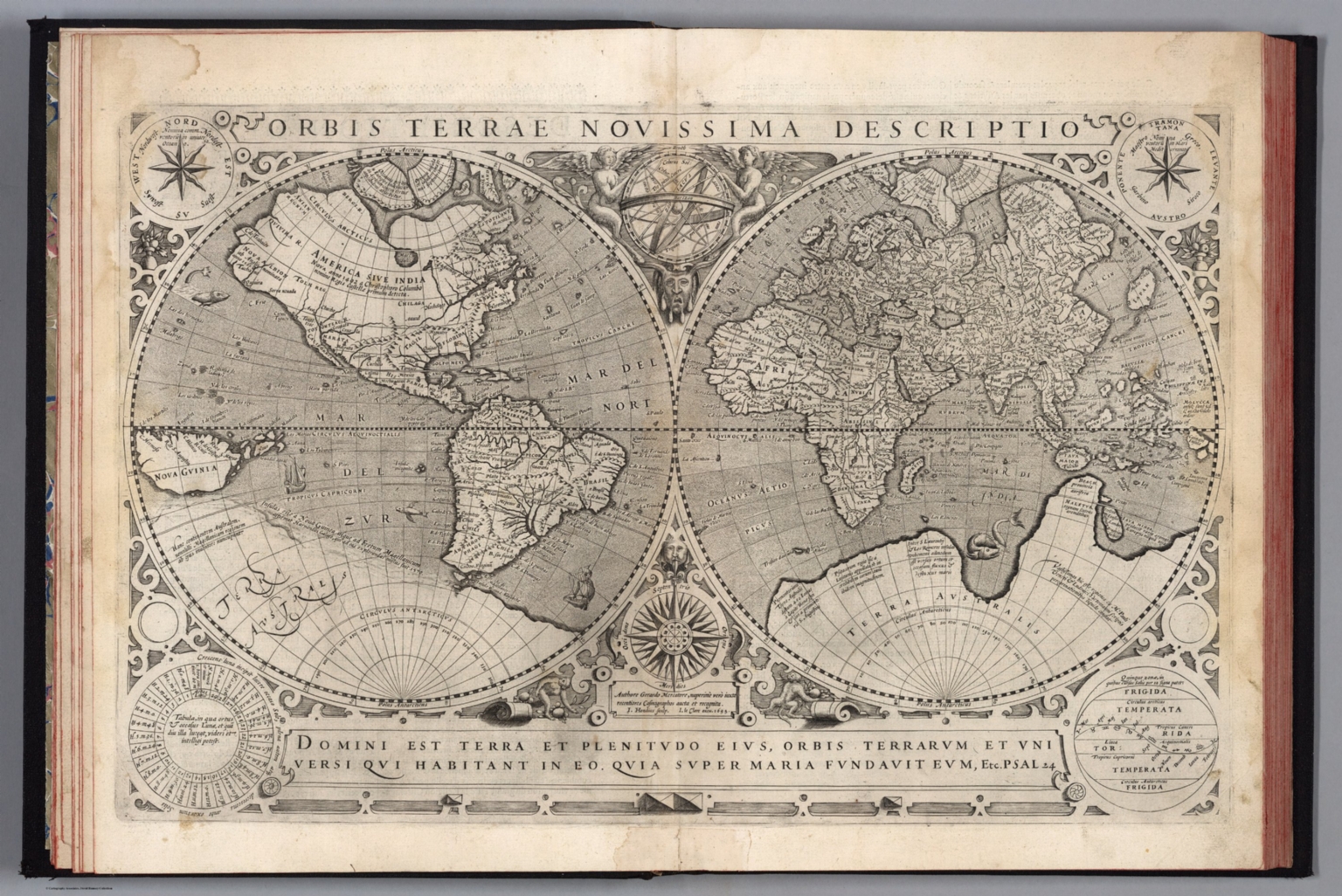 |
Theatre geographique du royaume de France. Contenant les cartes & descriptions particulieres des provinces d'iceluy. Oeuvre nouvellement mis en lumiere : avec une table, où sont les noms de toutes les cartes de chacune desdites provinces. Les descriptions par escrit ont esté recueillies & dressées par Gabriel Michel de La Roche-Maillet angevin, ancien advocat au Parlement & au conseil privé de Sa Majesté. Le tout dedié au Roy. A Paris, chez la veufve Jean Le Clerc, ruë Sainct Jean de Latran, à la Sallemandre royalle. M. DC. XXXII. Avec privilege du Roy. 1632. In 1594 Maurice Bouguereau issued the first national atlas of France with regional maps. Jean Le Clerc acquired the plates and re issued the maps with editions published by him and later his widow in 1621, 1626, and 1632 (this copy). Additional maps were added with each edition. Considered the first atlas of France to contain detailed maps of all the provinces. Sheets in French and/or Latin. Relief shown in sketches. View Atlas |
  |
Jerusalem. F. T. Treitel. Printed and published by: The Commercial Press. Jerusalem. Copyright 1942. Prop. Tewfic Habesch. Lay-out by Heller & Treitel ... Zincography by: Pikowsky. (Cover title) Jerusalem upon your palm : The new pictorial map and information guide, with compliments of the Arab Tourist Agency Ltd. Jerusalem, Jordan. Published by the Commercial Press Jerusalem. (on back cover) Map of Palestine. Copyright by Bauer, 1937. Pictorial map, 43x66, folded into pictorial cover 23x12.5. Shows roads, tracks, paths, old city, new quarter, garden, parks, public buildings, historic sites, places of interest, etc. Includes Index, abbreviations, and list of public and historic place names. On back cover: Uncolored map of Palestine. Shows boundaries, railways, roads, and airport. View Map |
 |
Carte Historique De La France Et De L'Angleterre Depuis La Naissance De Jesus-Christ Jusqu'a L'An Milseptcent, qui contient en abrege les evenements principaux de ces royaumes pendant l'empire romain. ... Avec un triple moyen d'Appendre les histoires, scavoir de succes, de siecle, en siecle, et de signeurie en seigneurie par Jer. Andre Martigonoi. 1721. Time line map, a chronological tree of French and English historical events since the birth of Christ until 1700. Prepared and published by the Italian scholar and poet Jerome Andre Martignoni. Includes in the upper left corner inset map of "modern" England, in the right upper corner "modern" France, and in lower panel coats of arms. The Channel and the Mediterranean are filled with ships and a scale. In the lower part the map continues with parts of North Africa, filled with dromedaries, elephants, etc. The title of his work translates as " Explanation of the historical map of France and Britain since the birth of Jesus Christ until the year 1700, which contains abbreviated key events of these kingdoms during the Roman Empire. Martignoni intended this work as a new means of teaching European History in an easy, comprehensible, and all-encompassing manner by means of historical maps composed in a special methodical way. View Map |
  |
NavWarMap No. 1. The Mediterranean. NavWarMap No. 2. The South China Sea Area. NavWarMap No.3. World War 2 in the North Sea area. NavWarMap No.4. The North Pacific area. NavWarMap No.5. The South Pacific. (on verso) NavWarMap No.6. We fight a Global War. Distributed by the Educational Services Division, Bureau of Naval Personnel, Navy Dept., Washington D.C. 1944. A series of 6 maps using bold graphics to show the status of the various war fronts during World War II. Full color. Relief shown by shaded relief. Also distributed by the Army Orientation Course. View Maps |
  |
Atlas. Tot Amsterdam By Frederick de Wit in de Calverstraet bij den Dam inde Witte Paskaert. 1682. This atlas marks the appearance of a less expensive atlas in the Dutch atlas market. Without text and in small folio size, it begins a move away from the expensive and elaborate atlases of Blaeu and Visscher, towards the more concise atlases that appear in the 18th century. Date estimated. Relief shown in sketches. Outline color. Hand annotations in the margins of some maps. Image No. 12220059.jp2 is a map likely prepared specially for the atlas owner for whom this was a special locale; this would account for the extensive use of gold on the sheet.. View Atlas |
  |
Geographie Mathematique, Physique et Politique de Toutes les Parties du Monde, Publiee par Edme Mentille, de l'Institute national, Malte Brun, Geographe Danois. Atlas. Compose de 45 Cartes, gravees par J.-B.-P. Tardieu aine, sur les dessins de J.-B. Poirson, ingenieur-geographe, revues et corrigees d'apres les meilliurs autorite, par Edme Mentelle ... Paris, Chez Henry Tardieum Imprimeur-Libraire ... (Chez) Laporte. An XIII. 1804. An atlas of 45 maps with numerous unusual additional maps from various sources and dates bound in (see two to the left). Additional maps have pages numbers labeled "... bis ...". Most have outline color. 1804 assigned to any undated sheet. Relief shown by sketches. View Atlas |
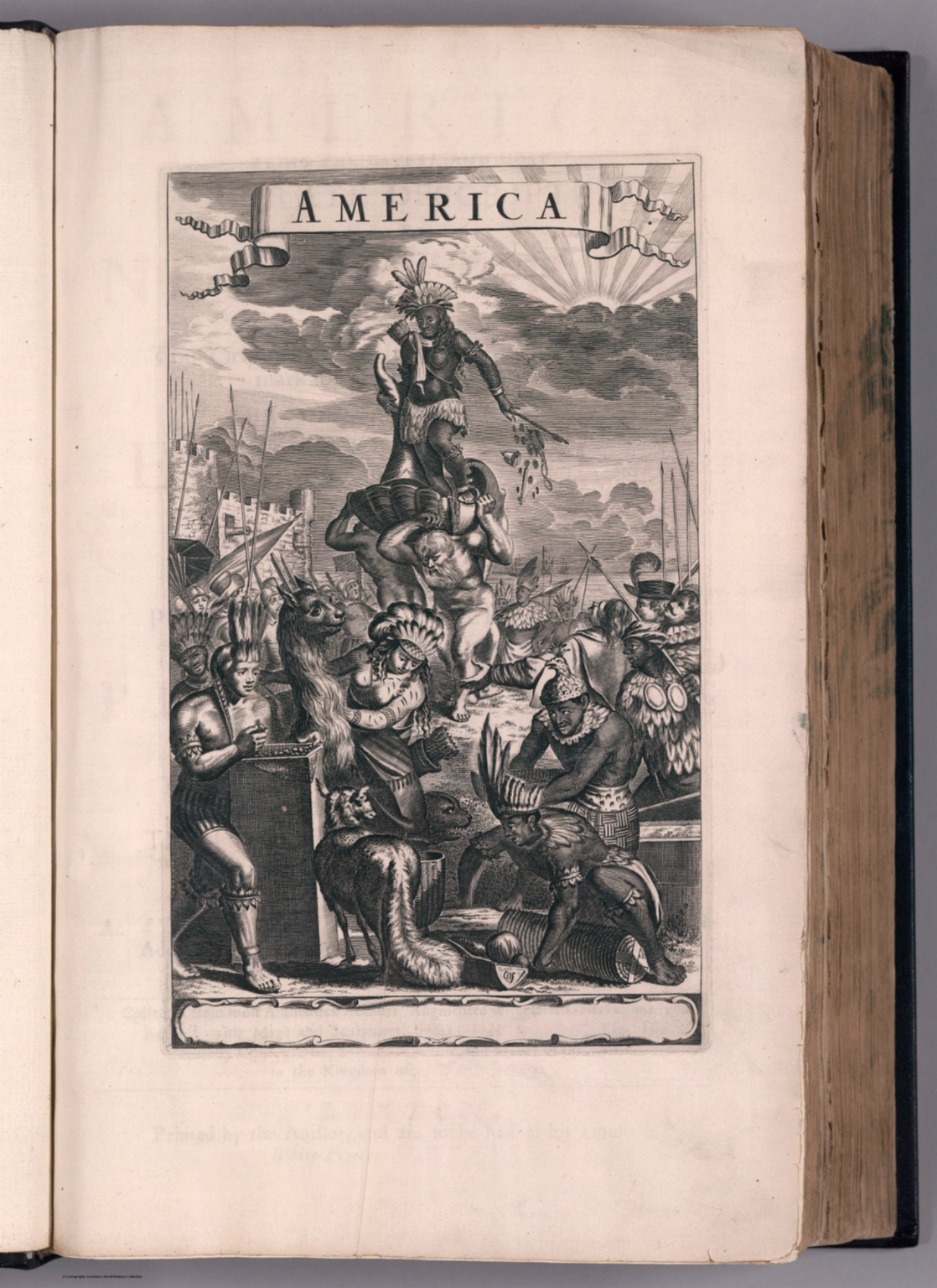  |
America: Being The Latest, And Most accurate Description Of The New World; Containing The Original of the Inhabitants, and the Remarkable Voyages thither. The Conquest of the Vast Empires of Mexico and Peru, And Other Large Provinces and Territories ... Collected from the most Authentick Authors, Augmented with later Observations, and Adorn'd with Maps and Sculptures, by John Ogilby, esq; His Majesty's Cosmographer, Geographick Printer, and Master of the Revels in the Kingdom of Ireland. London, Printed by the Author, and are to be had at his House in White Fryers, M.DC.LXXI. 1671. First edition, second issue, with the important Lord Proprietors map of Carolina by Moxon replacing the Arx Carolina plate and the Virginia pars Australis map of the first issue, with the addition of a map of Barbados, and with the plate list as in the first issue still listing Arx Carolina and Virginia pars Australis but not listing the Lords Proprietors Carolina or Barbados. This copy includes both the Arx Carolina plate and the Virginia pars Australis map, tipped in later. The work is an English translation of Arnold Montanus “De Nieuwe en Onbekende Weereld,” but with a number of additions concerning New England, New France, Maryland and Virginia. Many new maps and views were added. The Moxon map of Carolina is the first large format map of the newly established colony of Carolina. “America” was Ogilby’s finest foreign work; over 150 authors are credited although Montanus is lacking. “When it came to North America, particularly, he abandoned Montanus entirely for his own closer sources. His work used superior type and larger and finer paper than Montanus. Clearly some form of at least tacit agreement existed between Montanus and Ogilby as he acquired the same plates to illustrate his work. This is itself unusual as Ogilby was renowned for providing his own ‘sculptures’. The reasons may lie in the fact that the project clearly was already an expensive one, and that the work had been promised for some time and further delay was undesirable. The first map in the book, of the whole of America, was one of five plates provided by Ogilby himself. We may speculate that this was because Montanus did not actually own the Schagen plate, or that Ogilby wished to insert more English nomenclature” (Burden). Regarding Ogilby himself, he had a series of remarkably successful careers as a dancer, dance master, theatre manager/director, and translator of classics, and finally as author and publisher of travel and geography books. View Atlas |
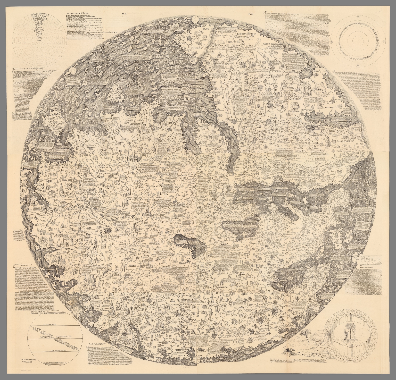 |
Mappemonde dress es en 1450, par Fra Mauro cosmographe Venetien. Par order d'Alphonse V. Roide Portugal. Publiee pour la premiere fois de la grandeur de l'original avec toutes les Legendes par Le Vicomte de Santarem, 1854. J. J. Feuquieres, lith. Schwaerzle Sculp. Pl. I-VI. 1854. |
 |
Imperia sive Monarchiae totius Mundi praecipuae - Die voornaemste rycken ofte Monarchien der gantscher werelt. Baptista a Doetechum; Franciscus Hoeus ex. 1606. Copper engraving broadside time chart, showing a diagram with the years of reign of the most important monarchs in world history, with letters and numbers to identify them, from the Assyrian rulers to the Holy Roman Emperor Rudolph II of Habsburg (1552 - 1612), with text in Latin and Dutch language. Engraved by Baptist van Doetechum and printed by Franciscus van den Hoeye. This time table was issued in Amsterdam circa.1600-1606 and is derived from the one that appeared in Michael Eytzinger's book "Pentaplus regnorum inundi." The circular table is surrounded by notes and mannerist strapwork that enclose vignettes depicting mementos of time, such as hour glasses. The dating as 1600-1606 is due to the fact that Baptist van Doetecum lived in Amsterdam only during these years. It's thought that during that time he arranged for the Printer Frans van den Hoeye to print his time chart. View Map |
 |
Rodoslovnoye Derevo Sovremennogo Sotsializma. pnt. I. Levenshteina. Knigoizdatelstvo "Utro" S. Peterburg. Ulitsa Zhukovskago, 38. (Cover title) Poiasneniia k Rodoslovnomu Derevu Sovremennago Sotsializma.. 1906. Uncolored pictorial map of the family tree of modern socialism, dated from 1889-1904. Folded into 21.5x12. With attached 15 page of explanation, notes and text on page 16. View Map |
 |
United States of America. Covarrubias. (Copyright) A.A.A. 1942. Bird's-eye view pictorial map of the United States with parts of Canada and Mexico. On verso: descriptive text: Miguel Covarrubias. Date estimated. Decorative cartouche features an American eagle shield surmounted by a ribbon banner with the title of the map. Shows natural features, mountain ranges, trees, agricultural products, industry, plane, ships and boats, fishes in the oceans, flowers and domestic animals of various regions such as a crab in Maryland, a flamingo in Florida, and cacti in the desert Southwest. Skyscrapers of the big cities and landmarks such as the Statue of Liberty are shown. A Canadian Mounty, Native Americans and cowboys are depicted in the regions they are associated with. Compass rose on lower left. Relief shown pictorially. View Map |
  |
Atlas Geographique contenant la Mappemonde et les quatre parties, avec les differents Etats, avec apprpbation & privilage du Roy MDCC.LXIII. A Paris, Chez Lattre Graveur, ordinaire de Mgr. le Dauphin, de Mgr. le Duc d'Orleans et de la Ville, rue St. Jacques, vis-a-vis celle de la Parcheminerie, a la Ville de Bordeaux. 1763. Atlas containing 51 maps; 49 folded leaves with 2 two preliminary maps inserted from other copies, 6 maps inserted at the end, table of contents and text. This is the folio version of Lattre's smaller atlas, see our 2612.000. Maps are hand-color in outline, many with additional original hand-color in part, with title cartouche, dated between 1759-1784, one map date 1816 later added to the atlas. Maps are made by De l'Isle, Buache, Janvier, Rizzi Zannoni, St. Angelo, Bonne, Jaillot, Robert de Vaugondy, and Lattre. Showing political and administrative boundaries, rivers, place names, canals, fortifications, forests, lakes, etc. Relief shown pictorially and by hachures. Bound in brown marbled half leather covers with title "Atlas Geogra" in gilt on spine. Lattre's dedication of the map to Benjamin Franklin, who as American ambassador to France, represented the United States at the peace negotiations. View Atlas |
   |
Atlas selectus von allen Konigreichen und Landern der Welt : zum bequemen Gebrauch in Schulen, auf Reisen und bey dem Lesen der Zeitungen. Verfertiget und in Kupffer gestochen von Johann George Schreibern in Leipzig. 1790. Atlas of kingdoms and countries around the world, for convenient use in schools, on trips and the reader of newspapers, prepared and engraved by Johann Georg Schreiber,1676-1750 - first cartographer in Saxony, was born 1676 and lived in Leipzig. His only work was the "Atlas Selectus" published first 1741 and reissued many times up to the end of the 18th century. Each subsequesnt edition increased the number of maps. This copy with date estimated at 1790 based on the number of maps. He died in 1745. Atlas published in 2 volumes, 149 pages, vol. 1: pages 1-76, vol 2: pages 77-149, including hand colored engraved pictorial title page, distance table with map of Germany, 2 pages of index and 148 hand colored copper engraved maps including a double hemisphere world, the continents, 26 maps of European countries, regional maps of Germany, the Russian Empire, the Black Sea and the Holy Land. The map of the Americas features the island of California. The maps on sheets 21x29, include a text panel describing the region, showing political and administrative divisions, cities, towns and villages, rivers, lakes, forests, churches, landmarks, roads, distances and canals. Include decorative cartouche and compass rose. Relief shown pictorially. Bound in brown leather cover with "Schreibers Atlas" on spine in gilt. View Atlas |
 |
Air Communications. Air Age Chart No. 5. (View) (Poster of instrument landing with vignettes of navigational aids.) 1944. Poster of instrument landing with vignettes of navigational aids. Prepared in collaboration with its Pilots and Air Transport Engineers by Aviation Research Associates. View Map |
 |
Gold Medal Flour. Washburn Crosby Flour. 1929. With unusual flour design. Color. Includes time zone clocks. View Map |
 |
World Map of the Major Tropical Diseases. 1944. From Life Magazine, May 1, 1944. View Map |
  |
Unique Media Maps. Unique Collection. 2000. Part of a series of 16 colorful, printed, watercolor, artistic, bird's eye maps of areas and cities of the United States and Canada. View Maps |
 |
San Francisco Archipelago, showing the 200 foot sea level rise. Map by Brian Sloat and Burrito Justice (copyright) 2012. High resolution topographic map of the San Francisco Archipelago, released by Northern California Coast Survey, showing the 200 foot sea level rise compared to the 2012 sea level datum, and shows what the city would like after a catastrophic disintegration of the Antarctic ice cap that caused sea levels to rise 200 feet, transforming San Francisco from a peninsula into an archipelago. Depth shown by isolines and gradient tints. View Map |
  |
12 Pictorial Maps of U.S. Cities, 1973 - 1983. Pictorial maps, filled with noted illustrations of buildings and landmarks, bridges, scenic highlights and attractions. Includes modes of transportation such as cars, airplanes, ships and boats. Shows small figures of people engaged in activities. View Maps |
  |
Geographical Fun: Being Humourous Outlines of Various Countries. With an Introduction and Descriptive Lines. By "Adelph." London: Hodder and Stoughton, 37, Paternoster Row. 1868. The plates in this volume are based on pictures drawn by Lilian Lancaster in her fifteenth year to amuse and entertain her sick brother. Lilian had a very successful stage career but eventually returned to illustration under her married name, L. Tennant. She illustrated the 1912 volume "Stories of Old" by E.L. Hoskyn, see Pub List No. 12068.000. View Atlas |
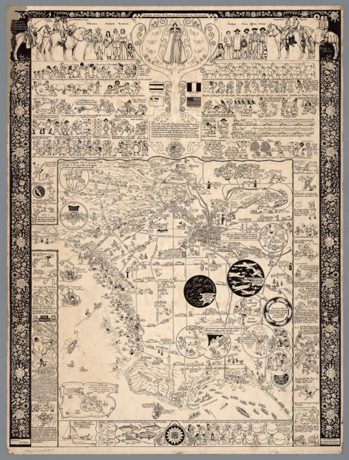 |
18 Pictorial Maps by Jo Mora, 1928-2013. 18 pictorial maps by Jo Mora, including 6 manuscript maps showing his original drawings for the printed maps. View Maps |
  |
Mercurio Geografico overo Guida Geografica in tutte le parti del Mondo, conforme le tavole geografiche del Sansone, Baudrand e Cantelli. Data in luce con direttione, e cura di Gio. Giacomo de Rossi nella sua stamperia in Roma alla Pace, all'insegna di Parigi con Priu: del S. Pont. Tomo Primo. (Half title) La guida del Mercurio geografico per tutte le parte del mondo. 1692. A fine example of De Rossi's atlas, in 2 volumes, similar to Coronelli's atlas of the same period, with engraved decorative title page. Includes 150 engraved outline hand colored maps with decorative title cartouche, on 181 sheets. Some maps having 2-4 page numbers. Index includes plates 1-95 of the first volume, and plates 96-181 in the second volume. Maps dated between 1669 and 1715, issued by Giov. Giac. de Rossi and Domenico de Rossi, they are mainly derived from Cantelli da Vignola's maps, an important seventeenth-century cartographer who pioneered the Italian style of fine bold engraving that would eventually be embraced and expanded upon by Vincenzo Coronelli, and Nicolas Sanson (20 December 1600 – 7 July 1667) a French cartographer, termed by some the creator of French geography. Maps engraved by Baudrand, Franciscus Donia, G.B. Falda, Jean Lhuilier, Vin Mariotti, Gasparo Pietro Santa, Salomon Rogiers, & Giorgio Widman, Lubin, Titi, Ameti, Magini and Mattei. Bound in blue half leather binding. Giovanni Giacomo De Rossi (1627 - 1691) was an Italian printer and publisher active in 17th century Rome. Giovanni inherited the important Rome based printing business originally founded by his father, Giuseppe de Rossi (1570-1639). By the mid-17th century the Rossi firm was considered the most active and important press in Rome.. View Atlas |
 |
Carte Tectonique Internationale de L'Europe. Carte preparee pour la publication par la Commission des cartes tectoniques internationales de la Section des sciences geologiques et geographiques de l'Academie des sciences de L'URSS. Congres Geologique International, Commission de la Carte Geologique de Monde, Sous-Commission de la Carte Tectonique du Monde. 1:2,500,000. 1962. Commission for the Geological Map of the World. Subcommission for the Tectonic Map of the World. 16 sheets which join together to form one map. Color. Lambert conic conformal projection. View Map |
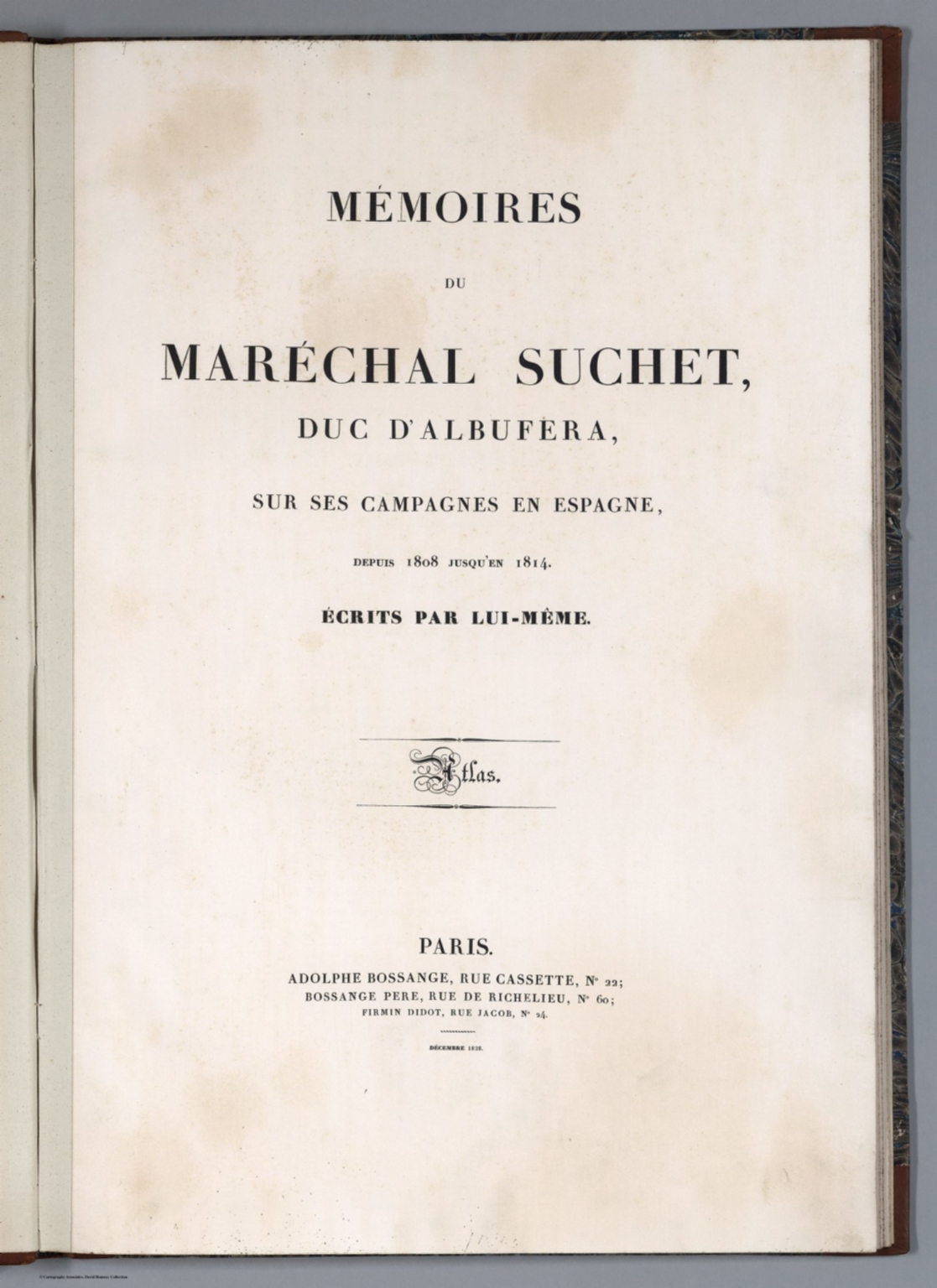 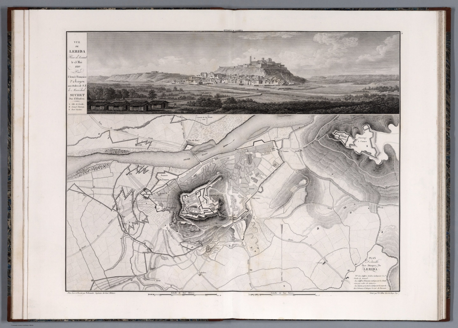 |
Memoires du Marechal Suchet, duc d'Albufera, sur ses Campagnes en Espagne, depuis 1808 jusqu'en 1814. Ecrits par lui-meme. Atlas. Paris. Adolphe Bossange, Rue Cassette, No 22; Bossange Pere, Rue de Richelieu, No 60; Firmin Didot, Rue Jacob, No 24. Decembre 1828. French Marshall Louis-Gabriel Suchet was widely considered the most successful Napoleonic general at having pacified and held areas of Spain 1808-1814. His army consisted of about 55,000 regular and reserve troop. Relief in hachures. Black and white. The combination of maps with profile views creates a very clear understanding of the battle terrain that is exceptional for battle maps of this type. View Atlas |
  |
Atlas general de la ville, des faubourgs et des monuments de Paris. Leve dessine et rapporte par Th. Jacoubet . Grave par D. Bonnet. Ecrit par Hacq. 1836. The Jacoubet atlas of the city, the suburbs and monuments of Paris was made by the architect Theodore Jacoubet. The writing and engraving were done by J. M. Hacq and D. Bonnet. Jacoubet is the last architect to have been responsible for the establishment of a map of Paris. The maps are significant because all streets and buildings are drawn to scale thereby making the maps extremely accurate for the time. The atlas is a very large map of Paris in 54 sheets, mounted on linen, on sheets 71x157 or smaller, folded to 71x51, published between 1827 and 1836, delivered in 9 parts. Maps are heavily annotated to show the evolution of the city planing, expansion of the roads and changes in the buildings. Many sheets have annotations showing proposed new streets, widening of streets, and new public spaces. It is possible that this set was used in the early planning of the Haussmann designs for new wide boulevards that were constructed in the period 1853 to 1870. The new Opera house is shown in manuscript plan. Streets and roads, canals, public buildings and monuments are represented, some roads and monuments are anticipated by the architects: churches, opera house, the City Hall, for example, is shown as it will be completed in 1848. Library lacks sheets 1 and 2 that are title sheet (image online is from Princeton University copy); 3-54 are maps, Sheets 8-9 "Plan d'Assemblage" on 2 sheets folded, including delivery table and six small plans of Paris evolution over time and a plan of major operations that were used in the triangulation of Paris. Sheets 46-48 and 52 are index sheets "Nomenclature". Sheets 53 and 54, is the smaller Plan of Paris, "Plan reduit du plan general" reduced to scale 1:10,000, with text and index, with administrative boundaries in color, street, parks, museums, major buildings and landmarks are named. This copy is with the bookplate of Paris historian and collector Paul Lacombe (1848-1921) who was librarian at the National Library, a noted bibliographer, member of the Society of Friends of the books and of the Society of French bibliophiles. View Map |
  |
Atlas geographicus omnes orbis terrarum regiones in XLI tabulis exhibens : jussu Academiae regiae scient. et eleg. litt. Boruss. ad emendatiora, quae adhuc prodiere exempla descriptus atque ad usum potissimum scholarum et institutionem juventutis editus = Atlas geographique representant en XLI cartes toutes les regions de la terre : gravé par ordre de l'Académie royale des sciences et belles lettres de Prusse d'apres les meilleurs exemplaires qui ayent paru jusqu'icy a l'usage principalement des ecoles. Berolini : Ex officina Michaelis MDCCLIII (1753). First edition of the Atlas by the famous mathematician Leonhard Euler. The Atlas was published on behalf of the Royal Prussian Academy of Sciences in Berlin by Leonhard Euler, designed specifically for the use in schools. The maps were largely based on works of Johann Christoph Rhode and were mostly engraved by Nicolaus Friedrich Sauerbrey. This edition includes a title page, a 10-page preface by Leonhard Euler in Latin and French, 41 double-page engraved maps, plus 4 additional maps. Highlights are 4 maps of the world (one in two sheets) and the 4-sheet map of America. Each map is outline hand colored and has a stamp of the Royal Prussian Academy of Sciences, most maps include decorative title cartouche, showing political and administrative divisions, cities, villages, place names, rivers, canals and mountains. Relief shown pictorially. Bound in brown leather covers with "Atlas geographicus Berolinensis" in gilt on the spine. View Atlas |
  |
Atlas of the Chinese Empire : containing separate maps of the eighteen provinces of China proper on the scale of 1:3,000,000 and of the four great dependencies on the scale of 1:7,500,000, together with an index to all the names on the maps and a list of all Protestant mission stations, &c. Specially prepared by Mr. Edward Stanford for the China Inland Mission. The China Inand Mission, London, Philadelphia, Toronto, Melbourne, Shanghai. Morgan & Scott, Ltd., 12 Paternoster Building, London, E.C. 1908. |
  |
Maps of Various European Cities with Embossed Paper Showing Buildings and Other Features in 3D. 1841 - 1849. Bauerkeller embossed his city maps and views to give a 3D effect for the buildings and some elevated features (city walls, etc.). This feature seems to be unique to Bauerkeller's maps, although he was copied in one map in our collection, the map of Cassel by Caesar (see our 12215.000). Bauerkeller also used very bright (and to our eyes very modern) printed colors to show the different districts and areas. View Maps |
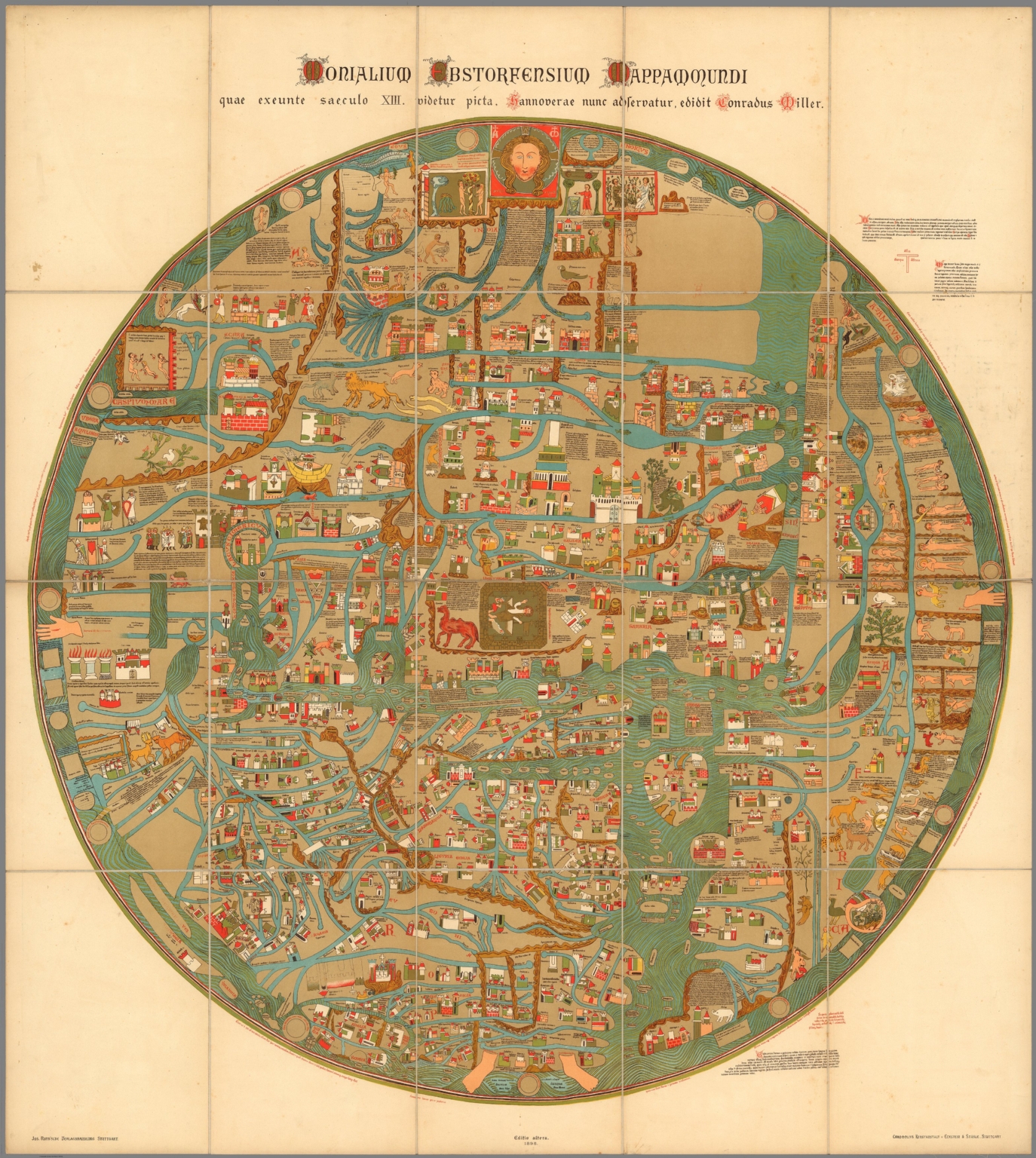 |
Monialium Ebstorfensium mappa mundi : quae exeunte saeculo XIII. videtur picta, Hannoverae nunc adservatur, edidit Conradus Miller. Jos. Roth'sche Verlagshandlung, Stuttgart. Chromolith Kunstandstalt v. Eckstein & Stahle, Stuttgart. Editio altera 1898. Circular pictorial map of the world, 101 diameter, on sheet 118x106, dissected into 20 sections 29x21, mounted on linen. The map, printed in Stuttgart, is a reproduction of the famous Ebstorf map which was destroyed in 1943. This large, circular "mappa mundi," by Gervase of Ebstorf is one of the most famous 13th Century historic maps of the world. With common medieval manuscript symbols and the medieval forms of place names, it reflects the contemporary religious ideas of the medieval map maker and represents cosmography and not cartography, which teaches the constitution of the whole order of nature, or the figure, disposition, and relation of all its parts. It visually portrays the Greek concept of the earth as flat, circular, popularized by the addition of Christian dogma. The original map, discovered in the Benedictine convent of Ebstorf, Germany, in 1830, dates from around the thirteenth century. Various dates have been given by authorities ranging from 1270 to 1350. Map showing the world is centered on Jerusalem, depicted with gold, eight-sided medieval wall, and the Tower of Babel, Bethlehem, Sodom and Gomorrah, and Mt. Sinai. Christ’s head represented in the East, at the top of the map, the direction of Paradise. His hands mark the northern and southern limits of the known world, and his feet are at Gibraltar where the Mediterranean meets the Atlantic. Europe is in the bottom left, Africa in the bottom right, and Asia at the upper half. In the East, near Christ’s head is located the Garden of Eden surrounded by mountains, the two figures bent to gather silk. Alexander the Great is consulting the Oracle of the Sun and the Moon. The map surrounded by water, depicts significant landmarks highlighted by gold, towns are shown by towers, wildlife, rivers, mountains shown pictorially and points of interest for the curious pilgrim. Also shown are the symbols for the four great rivers, the Nile, Tigris, Euphrates, and Ganges. View Map |
 |
Der Strom der Zeiten oder bildliche Darstellung der Weltgeschichte von den altesten Zeiten bis zum Ende des achtzehnden Jahrhunderts, von Friedrich Strass, Prf. der Geschichte ... 1804. Hand color timeline chart by Austrian chronologer Strass,130x70. Folds into brown marbled case 37.5x26 with a label "Der Strom der Zeiten oder bildliche Darstellung der Weltgeschichte ..." A chronological representation of world history from the oldest times until 1800, with corresponding tables on both sides of the chart. The is the second edition by Strass, see our 1803 first edition (7921.000). View Map |
  |
Palaestina - Wirtschafts - Atlas. 1926. This is a scarce atlas with statistical maps showing Jewish immigration and populations in Palestine and Israel over time. Loose leaf sheets in folio style case.. View Atlas |
  |
Mond-Atlas entworfen nach den Beobachtungen an der Pia-Sternwarte in Triest von Joh. Nep. Krieger, Mitglied der astronomischen Gesellschaft. I. Band. Mit 28 Tafein und Ansicht der Sternwarte. Triest, 1898. Im Selbstverlage des Verfassers. In Commission bei Ed. Heinr. Mayer in Leipzig. 1898. This 1898 lunar atlas was followed by a two volume sequel in 1912, Pub List No 12133.000 and 12134.000. Text is available on Internet Archive. Index map to plates in this volume are shown on List No 12134.123. View Atlas |
  |
Atlas geographique, astronomique et historique, servant a l'intelligence de l'histoire ancienne, du moyen age et moderne et a la lecture des voyages les plus recens. Dresse d'apres les meilleurs materiaux tant francais qu'etrangers conformement aus progres de la science, par J.G. Heck. - Paris, Engelmann & Compagnie, S.F. 1834. Johann Georg Heck was a German bookseller and publisher, lithographer, cartographer, geographer and author. He became known through his work the Illustrated atlas for Conversations lexicon, Iconographic Encyclopaedia of Sciences and Arts, one of the largest German view works of the 19th century (see our copy). This atlas Geographique.. is his only known atlas. In the atlas, his thematic maps are especially noteworthy. Relief shown with hachures. Outline color. View Atlas |
 |
(A fluxatlas : Spatial poem). This is the record of various directions to which people were simultaneously moving or facing around 10PM (Greenwich time) October 15th 1965. Mieko Shiomi. Event design, George Maciunas. 1965. In 1964 Japanese artist Shoimi Mieko (Chieko) was invited to New York City by George Maciunas, founder of Fluxus network of artists to collaborate with him on a number of projects. This Fluxus map is the 1st. edition uncolored broadside issued in 1966, in 3 folds, with title on the cover "A fluxatlas. Mieko Shiomi. Event design, George Maciunas", now flattened. Includes outline maps of Japan, North America and Europe with notations indicating the locations of artists describing what they were doing at the time. In 1965 Shiomi conducted a series of nine events that she called "Spatial Poems" Each began with invitation to friends and colleagues to respond to a simple instruction, which took the form an intimate action poem, the accumulated responses she received constitute the work and give a glimpse of the network of artists who were connected through Fluxus activities. For Spatial Poem No. 2. Mieko contacted people around the world to record what they were doing and the direction they were facing in the morning Greenwich time on October 15, 1965. View Map |
 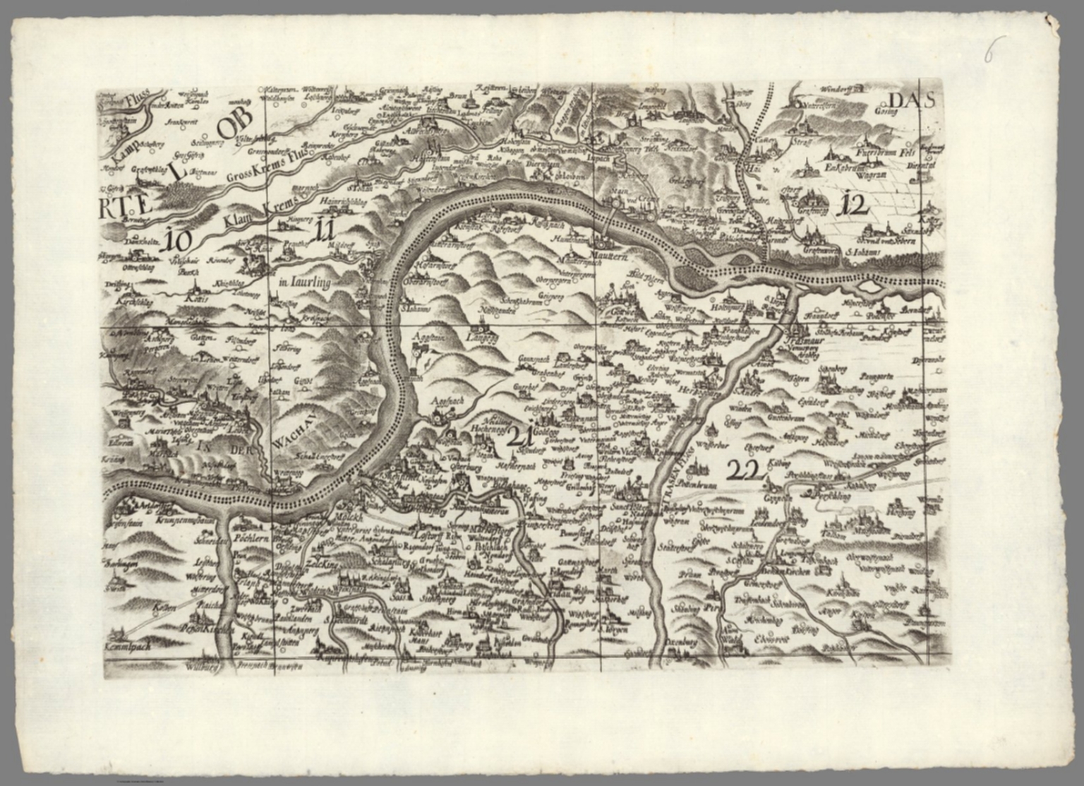 |
Archiducatus Austriae inferioris geographica et noviter emendata accuratissima descriptio : Iussu et Sumptibus Inclytorum, Archiducat; Austriae Inferioris Dominorum Statuum Provincialium tabula haec Geographica nouiter emendata in Lucem data est. Anno ... MDC XCVII (1697). (inset views) Larpa Ceres spicas fragrantia vina ministrat Incopia Bachus, dat quo que terra Crocum. (with) Austria Cæsaribus foelix et patria regum archiducumque domus regno populis qz beata.. 1697. 1 map on 20 sheets 156x216, 16 sheets of map each 40x54, with 4 sheets index beneath map. Topographic map of lower Austria by Georg Matthaus Vischer an Austrian topographer, cartographer, engraver and parish priest in Leonstein (Upper Austria) and Vienna. He is regarded as one of the most important Austrian cartographers and topographers of his time. His map was one of the most important maps of lower Austria, which was copied by N. Visscher, Homann, Seutter and others the next 100 years. This 1697 issue is the second edition, after the first edition of 1670. The name of Georg Matthäus Vischer and Melchior Küsel were in this edition removed from the panel and replaced by the name of Jacob Hoffmann and Jacob Hermundt, although the two had their improvements made by Vischer's handwritten corrections. Several changes were made to the to the view panels in the second edition. Map shows administrative boundaries, cities, towns, landmarks, place names, rivers and mountains. Relief shown pictorially. Includes decorative cartouches, Australian insignia and notes. View Map |
 |
Imago Romanii Imperii. S.S.P., et D. N. Clementi XI P.O.M. Rom. Imp. Imagin. Hier. Andreas Martignonus D.D.D. ; Barth. Ioseph Tasniere sculp. Taurini. 1721. Topographic map of the middle part of Ancient Rome, 207x240 on 15 sheets dissected in to 30 sheets 36x48. Title from sheet TAV XI. Large scale map of the archeological ruins in Rome by Luigi Canina, an Italian architect and archeologist, whose work provides an important view of the condition of the city and ancient artifacts in the mid-nineteenth century. The interesting plan depicts the ancient monuments overlaid on a base map of the modern city as it was in 1840. Showing the landmarks, streets, city blocks, etc. Map published for the first time in 1840, entitled " "Pianta topografica della parte media di Roma antica dimostrata colla disposizione di tutti quegli edifizj antichi di cui rimangono reliquie e delineata sulla proporzione di uno a mille dall'architetto Luigi Canina." The 2nd edtion published in 1842. This is the 3rd. and last edition published in 1847, included 15 sheets. in 2 sections. Canina published a smaller version of this map, surrounded by 157 fragments of Severiana plan, a huge plan dating back to the emperor Septimius Severus (193-211), discovered in 1562 behind the church of St. Cosmas and Damian in the Forum Roman. (see our copies of this map). The fragments of the Severiana plan are shown as shadows on both this larger map and the smaller map, although only the smaller map identifies the fragments. Luigi Canina, an architect and archaeologist, born in Casale Monferrato on Oct. 23, 1795, died in Florence on October 17, 1856. He studied in Turin with Ferdinando Bonsignore. View Map |
  |
A Chart of the World upon Mercator's projection exhibiting all the new discoveries to the present time : with the tracks of the most distinguished Navigators since the year 1700, carefully collected from the best charts, maps, voyages &c. Extant. And regulated from the accurate Astronomical Observations made in three voyages performed under the command of Capt. J. Cook in the years 1768, 69, 70, 71. -72, 73, 74, 75. - 77, 78, 79, & 80. Compiled and published by A.Arrowsmith, Hydrographer ... London published as the act directs, April 1st, 1790. by A. Arrowsmith. 1808. Map printed on six full sheets and two half sheets, sheets 75x62 or smaller. This was Arrowsmith's first map when originally published in 1790, here in the last state, 1808. It was one of the best and most up to date maps of the world published at the end of the 18th century, incorporating all of the discoveries made on Cook's great voyages, exhibiting new discoveries in the Pacific, as well as in the Arctic and along the northwest coast of America. The map shows Cook's discoveries from all three of his voyages, and also incorporates many other Pacific voyages. Indeed, nearly 30 tracks of explorers are marked, dating from 1492 to 1787, including the voyages of Furneaux, Surville, Tasman, Chirikof, Bering and others. Shows boundaries in outline hand color, cities, rivers, and grid lines. Includes text and compass rose. Relief shown by hachures. Depth shown by soundings. Prime meridian is Greenwich. View Map |
  |
Labour and life of the people. Appendix to volume II. Edited by Charles Booth. William and Norgate, London; Edinburgh. 1891. (on verso) London: G. Norman and Son. (with maps) Descriptive map of London poverty, 1889. (with) Map shewing degrees of poverty in London. 1891. 5 color maps 68x88 or smaller, with 60+23 pages of text and index. Includes 1 map on 4 sheets, and 1 single map 68x88, folded into 21x12.5, mounted on linen in a band attached to the back cover. dated 1889-1891. Detailed town plan to show resident's means in 7 classes, wealth to poverty. Bound in olive cloth covered boards with title "Labour and life of the people : Maps etc. Appendix to Vol. 2." stamped on cover and on spine. Charles Booth's Inquiry into the Life and Labour of the People in London, undertaken between 1886 and 1903 was one of several surveys of working class life carried out in the 19th century. It is the only survey for which the original notes and data have survived and therefore provides a unique insight into the development of the philosophy and methodology of social investigation in the United Kingdom. Booth's four sheet Poverty map colour-coded streets according to the degree of wealth of the inhabitants, ranging from black ('Lowest class'), through shades of blue and purple ('Poor', 'Mixed', 'Fairly Comfortable'), to red ('Well to do') and yellow ('Wealthy'). Booth (1840-1916), owner of the Booth Shipping Line, acted in response to an 1886 Pall Mall Gazette article that claimed that 25% of Londoners lived in poverty. Booth regarded this figure as wildly exaggerated, so recruited a team of volunteer researchers (including his cousin Beatrix Potter) to compile an analysis of social conditions based on field visits and interviews with local police, clergy and employers. The First Series of 'Life and Labour' (1889 maps shown here), covering the East End, showed that 35% lived in poverty View Map |
 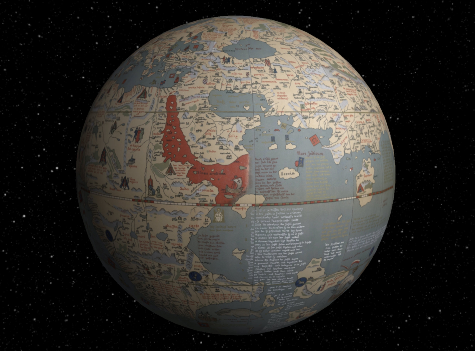 |
Martin Behaim, his Life and his Globe. By E.G. Ravenstein, F.R.G.S., First Victoria Gold Medallist of the Royal Geographical Society, with a Facsimile of the Globe Printed in Colours, Eleven Maps and Seventeen Illustrations. London, George Philip, Son & Nephew, Ltd., 45-51, South Castle Street, (1492) 1908. Martin Behaim's Erdapfel (earth apple) is the oldest surviving terrestrial globe. It exists in only one manuscript copy painted by Georg Glockendon, held Nuremberg, Germany. It shows the world according to Ptolemy and other sources, before the discovery of America by Columbus in the same year as the globe was made, 1492. Behaim's globe vividly shows the earth without America and illustrates why Columbus thought he could sail directly west from Europe and land in China and the East Indies. This facsimile of Behaim's globe gores and callots was made by E.G. Ravenstein in 1908 and is generally considered the best available facsimile. It is based on both the original globe and an earlier facsimile made in 1847 by E.F.Jomard, as well as other sources for the notes and place names. While it is by no means a completely faithful copy of the original, it does express the overall intent of Behaim's globe. We have georeferenced the 12 globe gores and 2 polar callots, allowing the reprojection of the 14 separate sections into continuous world maps on several different projections. We have also placed a virtual globe version in Google Earth. View Map |
  |
The world according to Ronald Reagan. Horsey. 1982 - Seattle Post-Intelligencer. 1982 AA Graphics, Inc., Seattle, Wash., USA. PC237 (with) The world according to Ronald Reagan. By David Horsey. 1987 AA Graphics, Inc., Seattle, Wash., USA. PC0288, Regan's world II. 1982. 1987. 2 Political satire maps, depicting the world as Ronald Reagan (US president 1980-1988) might have imagined it, showing various political humor. These are the first and second of Reagan's World maps, by David Horsey, published in 1982 and 1987. David Horsey was a Pulitzer-winning Seattle Post-Intelligencer cartoonist. View Maps |
   |
L'Atlas Curieux ou Le Monde Represente dans des Cartes Generales et Particulieres du Ciel et de la Terre Divise Tant en ses Quatre Principales Parties que par Etats et Provinces ... Par N. de Fer, Geografe de Monseigneur le Dauphin ... Dedie a Nosseigneurs les Enfans de France ... A Paris, chez l'Auteur dans l'Isle du Palais .... (The Atlas or The Curious World Represented by General and Particular Maps of Heaven and Earth Divided Both in Four Major Parts by States and Provinces ... By N. de Fer, Geographer to Monseigneur the Dauphin ... Dedicated to our Lords, the Children de France ... in Paris, at the House of the Author in Isle Palace ... 1700.) This is volume one of the normally two volume Atlas Curieux, here in the "Suite" edition. De Fer's Atlas Curieux is a fascinating mix of maps, views, and plans unlike any other during its time. Black and white, except title page. Relief shown in sketches. View Atlas |
  |
City Markets, A Study of Thirty-Five Cities. Advertising Department, The Curtis Publishing Company, Philadelphia, Penna. 1932. Maps are color keyed to show value of single family homes and corresponding rental rates, as well as the location of "Foreign or Colored" residents. Ostensibly for marketing purposes at the time, today the maps show vividly the segregation of 35 American cities by income levels in 1932. Refer to the text pages on how to interpret the maps. View Atlas |
  |
The Atlas of India, revised by J. Walker ... selected from the maps published under the superintendence of the Society for the Diffusion of Useful Knowledge, compiled from the latest and most authentic sources, including all the recent geographical discoveries. London: Edward Stanford, 6, Charing Cross. 1856. Revised edition of the Atlas of India, produced by Society for the Diffusion of Useful Knowledge to encourage broad use of maps in education. Date estimated. Includes 26 double page maps, including: 13 of India (an index map and 12 regional maps), 10 maps covering surrounding territories in the Middle East, South Asia and the Far East (including one showing Canton and Macao with an inset of Hong Kong), 1 map of the islands of the Pacific and a map of the world on Mercator's Projection in two sheets. Most sheets engraved by J. and C. Walker. Atlas is bound in half leather dark brown cloth covered boards with "Indian atlas" stamped in gold on the front cover. Maps are hand colored, showing political and administrative divisions, roads, railroads, major cities and towns, fortifications, rivers, canals and lakes. Relief shown by hachures, shading, and pictorially. View Atlas |
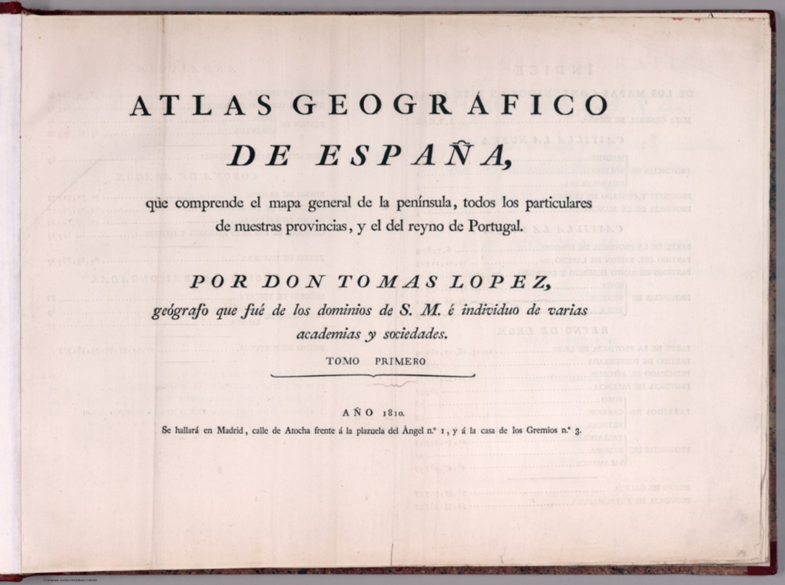  |
Atlas geografico de Espana : que comprende el mapa general de la peninsula, todos los particulares de nuestras provincias, y el del reyno de Portugal. por Don Tomas Lopez, geógrafo que fue de los dominios de S.M. e individuo de varias academias y sociedades. Tomo Primero. Ano 1810. Se hallara en Madrid, Calle de Atocha frente a la plazuela del Angel no. 1, y a la casa de los Gremios no. 3. 1810. Second edition of the geographic atlas of Spain, published in 1810, with half title page, 4 pages of index, contents and text. Comprising 38 maps on 98 sheets, Madrid (sheet 99) added later by owner, along with three other maps later removed. Some maps on multiple sheets. Maps dated 1765 - 1802. Contains the general map of the peninsula, all the provinces, and the kingdom of Portugal By Don Tomas Lopez. Maps are engraved outline hand colored, with decorative title cartouche, text and tables, showing administrative divisions, major cities, towns, villages, landmarks, public buildings, roads, rivers, canals and mountains. Bound in half leather marbled paper covers with title " Atlas geografico de Espana I” on spine in gilt. Relief shown pictorially. Don Tomas Lopez (1730-1802) a Spanish cartographer, began his studies at the Imperial College of the Spanish capital. In 1752 he went to continue his training in Paris to learn cartography with the great French mapmaker Jean Baptiste Bourguignon d'Anville (1697-1782). In Paris he was accompanied by, among others, Juan de la Cruz Cano y Olmedilla, Manuel Salvador Carmona and Alonso Cruzado. In 1804, Lopez published his “Atlas Geographic of Spain”, the first atlas of Spain that produced by a Spaniard. The children of Lopez reposted this work in a new edition in 1810 and again in 1830. View Atlas |
   |
Voyage de MM. Alexandre de Humboldt et Aime Bonpland. Atlas Geographique et Physique, pour Accompagner la Relation Historique. Sixieme livraison. Paris, J. Smith, Rue Montmorency, No. 16; Londres, Dulau et Compie., Soho-Square. 1831. Imprimerie de J. Smith. 1831. “This atlas was issued as part of Humboldt and Bonpland’s Voyage aux régions équinoxiales du Nouveau Continent fait en 1799, 1800, 1801, 1802, 1803 et 1804 (Paris, 1808-1834), which was published in over thirty volumes over several decades…This atlas is important for many reasons, and its illustrations showed Europe and the entire world new scientific information for the first time. Humboldt’s groundbreaking exploration of the Orinoco River, for example, is delineated on two maps, one of which was the first to establish the precise location of and to show the connection between Rio Orinoco and Rio Negro, a question that had baffled geographers for three centuries…The Orinoco river maps are supplemented by maps of other rivers, many accurately depicted for the first time. Also significant are the profiles and maps of mountain ranges, which are depicted with scientific precision showing new information in novel ways. Many of the profiles are dramatically hand colored… The dramatic volcano plates are supplemented by several large-scale maps, which are masterful depictions of land forms. These studies were crucial to Humboldt’s later conclusions about the origin and nature of these natural structures and constitute one of his major contributions to the field of geology. Humboldt mapped many areas in an accurate fashion for the first time. Because riverbeds and stream courses interested him immensely, those features are often shown in great detail on the maps, which also depict other natural and man-made features, such as mountains, missions, roads, and settlements. His map of the Isthmus of Tehuantepec, for example, was from the latest available surveys recently done by the Mexican government (Humboldt was for fifty years an advocate of an interoceanic connection between the Atlantic and Pacific). The Cuba map is also an updated version and reflects his recent explorations of the island. Despite a few secondary sources, most of the maps are based directly on his extensive travels and observations during the course of his explorations. Perhaps the most remarkable map in this atlas is the first printing of a manuscript map that harks back to the very earliest European cartographic representation of the New World. This is the manuscript world map made by Spanish conquistador, cartographer, and explorer Juan de la Cosa (ca. 1460-1509), who sailed with the first three voyages of Columbus and was the owner of the Santa María. This portolan world chart incorporates lands discovered in America up to 1500 during expeditions by Spanish, Portuguese, and English expeditions to America. Juan de la Cosa’s mappa mundi is painted in ink and colors on ox hide (93 x 183 cm) and richly decorated. His map is believed to be “the earliest extant map showing any part of the continent of North America” (Schwartz & Ehrenberg, The Mapping of America, Plate 1, pp. 18-19)… Finally, going back to the beginning, the emblematic frontispiece engraving Humanitas. Literæ. Fruges (after the art work of artist Barthélemy Joseph Fulcran Roger) is not just another pretty, classical picture, but rather an expression of Humboldt’s deep philosophical concept of America and Europe expressed in iconography.” (Dorothy Sloan, Auction 22, 2009). This copy is unbound in original paper covers with multiple title pages. See our “Atlas Geographique Et Physique Du Royaume De La Nouvelle-Espagne,” 1811 for the other atlas volume in this series, concerning Mexico. View Atlas |
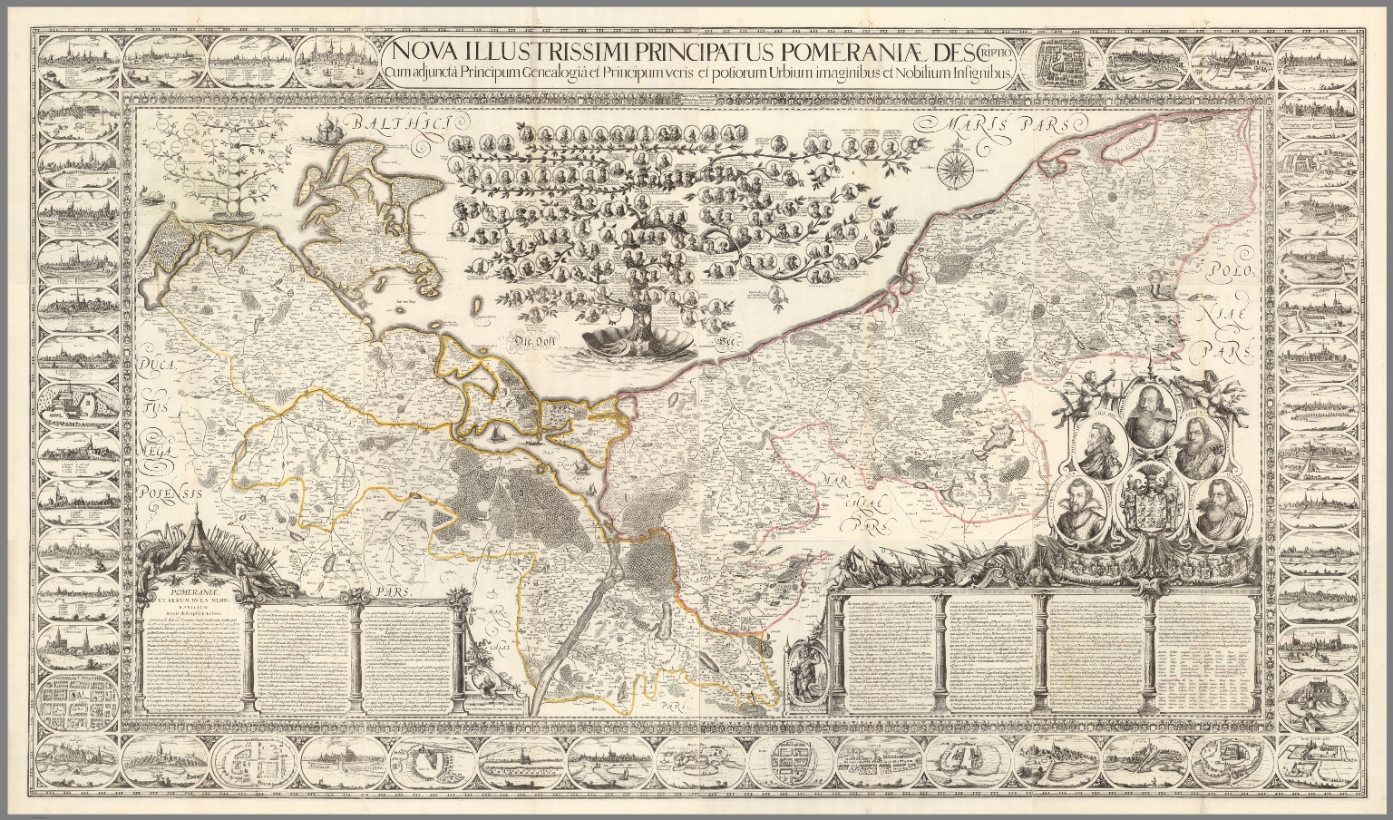  |
Nova illustrissimi principatus Pomeraniae descriptio cum adjuncta Principum genealogia et Principum veris et potiorum Urbium imaginibus et Nobilium insignibus. N. Geilkerckius sculpsit. [With] Pomeraniae et rerum in ea memorabilium brevis descriptio E. Lubini. 1618 (1758). Composite map of Pomerania, sheets 1-12. Large and impressive outline colored copperplate engraving map of Pomerania on 12 sheets, 42x54 or smaller, by Eilhard Lubin, Professor at the University of Rostock. In 1610 he was asked by Philipp II, the Duke of Pomerania to create a large scale map of the geography and history of the duchy. In 1612 map was completed, it was decorated with 49 town views, and coat of arms of the noble families. In 1618 the Dutch engraver Nicolas van Geelkercken, engraved the copperplates in Amsterdam, and a small number of sheets were printed. The plates disappeared in the thirty years war and were rediscovered by the historian Johann Carl Conard Oelrichs in 1758. The map shows 49 town views on the border, the family tree of the house of Griffins, dukes of Pomerania, with 157 names and small portraits, a small family tree of the house of Rugen, 5 large portraits of living dukes of different parts of Pomerania, and on the lower middle left sheet probably the portrait of Lubin himself. The map shows towns and villages, landmarks, churches, forest, rivers and mountains. Relief is shown pictorially. Lubin's Pomerania remained the most accurate map of the region from its inception in 1618 until the Prussian topographical survey of the eighteenth century. The map is extraordinary in the way that it combines the "mapping" of the history of the ruling families with the mapping of the topography of Pomerania. View Map |
 |
Shinkoku Taihei Take Mori Mata Akira. 1854. Wood block print, pictorial map of the coast defense of Tokyo Bay. Kawaraban Broadside Map depicting arrival of Perry's "Black Ships," describing the arrival of the American Commodore Matthew Perry to Edo Bay (Tokyo Bay) in 1854 (Kaei 6), after his earlier brief visit in 1853. The defensive ships identified by the warlord in charge and his armorial crest are around the bay to intimidate the invaders. Includes notes describing the troops and list of names of Samurais in charge of defense of Tokyo Bay. Includes an illustration in the upper right depicting an American soldier. Perry's ships were the first major western intrusion into Japan. “Perry, on behalf of the U.S. government, forced Japan to enter into trade with the United States and demanded a treaty permitting trade and the opening of Japanese ports to U.S. merchant ships. This was the era when all Western powers were seeking to open new markets for their manufactured goods abroad, as well as new countries to supply raw materials for industry. It was clear that Commodore Perry could impose his demands by force. The Japanese had no navy with which to defend themselves, and thus they had to agree to the demands… Upon seeing Perry's fleet sailing into their harbor, the Japanese called them the "black ships of evil mien (appearance)." Many leaders wanted the foreigners expelled from the country, but in 1854 a treaty was signed between the United States and Japan which allowed trade at two ports. In 1858 another treaty was signed which opened more ports and designated cities in which foreigners could reside. The trade brought much foreign currency into Japan disrupting the Japanese monetary system. Because the ruling shogun seemed unable to do anything about the problems brought by the foreign trade, some samurai leaders began to demand a change in leadership. The weakness of the Tokugawa shogunate before the Western demand for trade, and the disruption this trade brought, eventually led to the downfall of the Shogunate and the creation of a new centralized government with the emperor as its symbolic head.” Source: Asia for Educators, Columbia University. View Map |
   |
Handatlas der Allgemeinen Erdkunde, Laender- und Staatenkunde, In 80 Karten. Herausgegeben von L. Ewald ... Nebst einem Handbuch der allgemeinen Erdkunde. Laender- und Staatenkunde von Dr. E. Eder. Darmstadt, 1860. Verlag von Jonghaus & Venator's Kartogr[aphisch].-artist[ischen]. Anstalt. 1860. Looseleaf color atlas with accompanying text sheets, all in unbound original publisher's parts/sections. Relief depicted with hachures. Atlas was conceived of and initiated by Georg Leonhart Bauerkeller beginning in 1844 by subscription. From at least 1845, Ludwig Ewald was a primary author and was responsible for drafting the maps. Considered by authorities to be one of the most beautiful atlases of the 19th century, it is particularly noteworthy for its quality registration, sharp images, use of brown for relief and solid blue for water, multi-color lithography, and it's scope of content. Particularly noteworthy presentations being: map, diagrams and illustrations of glaciers in the Alps (No.14. Die Gletscher der Alpen - List No 12189.036); an elevation diagram of major mountains and sea depths (No.39. Hoehen und Tiefen - List No 12189.061); map of Switzerland with relief depicted with hachures and giving a shaded relief 3-D effect (No. 54. Die Schweiz - List No 12189.076). Most of the text planned to accompany the maps was never completed. The atlas was largely ignored by contemporary and subsequent scholars despite its high quality. This is Espenhorst version 19.1.0-19.1.1.3. It consists of the initial set of 80 maps plus two sets of supplemental maps totaling 12 sheets - mostly revisions of previous editions. This scanned set has most of the section title pages at the end because the 80 sheets were not originally issued in the table of contents order that we present. Bauerkeller was also known for his three dimensional maps of cities, see our copies of London, Paris, Hamburg, and others. View Atlas |
 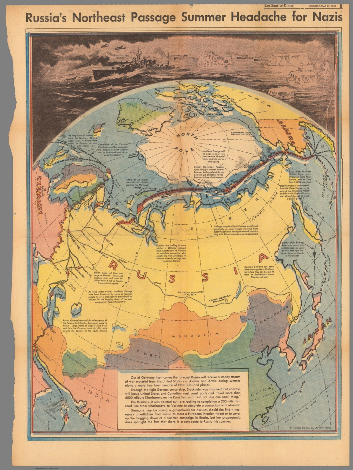 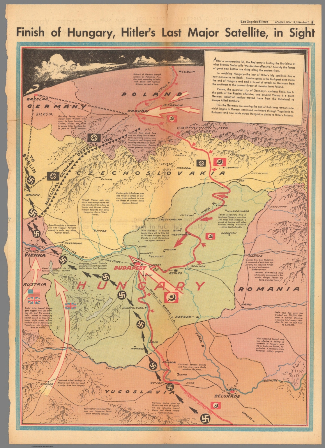 |
42 Los Angeles Times World War II Maps, 1942-1945. Group of pictorial newspaper maps issued during World War II by the Los Angeles Times. Many are by Charles Owens. A few of the maps are post war. View Maps |

Wow! What a superb collection with succinct annotations. I did experience one difficulty: I tried to find a way of enlarging a portion of a map but couldn't find how to do that. Can you give me any direction for zooming in? Thanks.